Landsat's Role in Responding to Disasters
In 2022, the Emergency Events Database (EM-DAT) reported 387 natural hazards and disasters worldwide, resulting in the loss of over 30,000 lives and affecting more than 185 million individuals. Economic losses totaled around US$223.8 billion. Fires, floods, heat waves, drought, hurricanes, tornadoes, and other natural disasters can be particularly tragic and costly when critical facilities such as power plants, airports, roads, and hospitals are threatened. When a disaster strikes, remote sensing is often the only way to get a big-picture view of what is happening on the ground. With its consistent, reliable, repeated observations of Earth’s changing surface, Landsat keeps a record of Earth’s land surfaces before and after disasters, serving as an essential tool for assessing risk, mapping the extent of damage, and planning post-disaster recovery. Landsat produces 185-kilometer-wide images with 30-meter resolution in visible and infrared wavelengths of light, making it possible to map impacts on the landscape in ways otherwise not visible to human sight. For example, Landsat sensors enable us to see the heat from fires both during and after the burns, and the lava flows from volcanic eruptions even when gaseous substances obscure the view to human eyes.
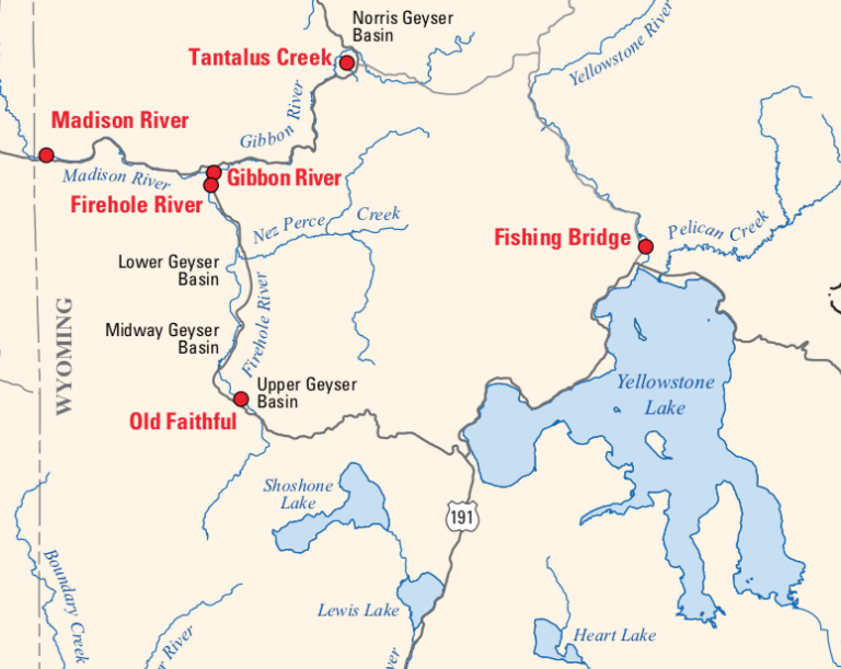
Tracking New Hydrothermal Activity in Yellowstone
Landsat is among the resources that scientists are using to assess hazards and track volcanic activity in Yellowstone.
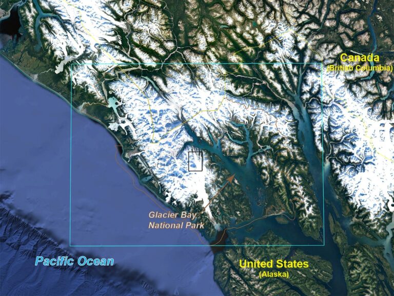
Watching Glacier Bay National Park Change
December 11, 2019 • Dr. Christopher Shuman is a glaciologist with NASA Goddard Space Flight Center and the University of Maryland at Baltimore County. Here is what Chris shared with us
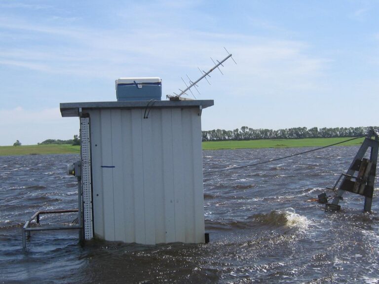
Mapping Past Floods to Help Predict Future Ones
Landsat has enabled a more thorough understanding of how the Central Valley landscape is impacted by floods.
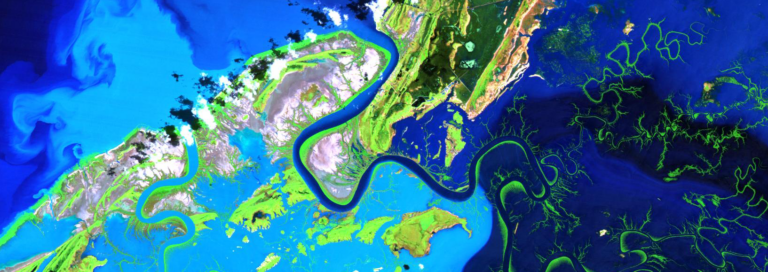
Mapping the Mighty Mangrove
A new longitudinal study from Australia has harnessed thirty years of NASA/USGS Landsat data to map the nationwide movement and migration of mangrove forests.
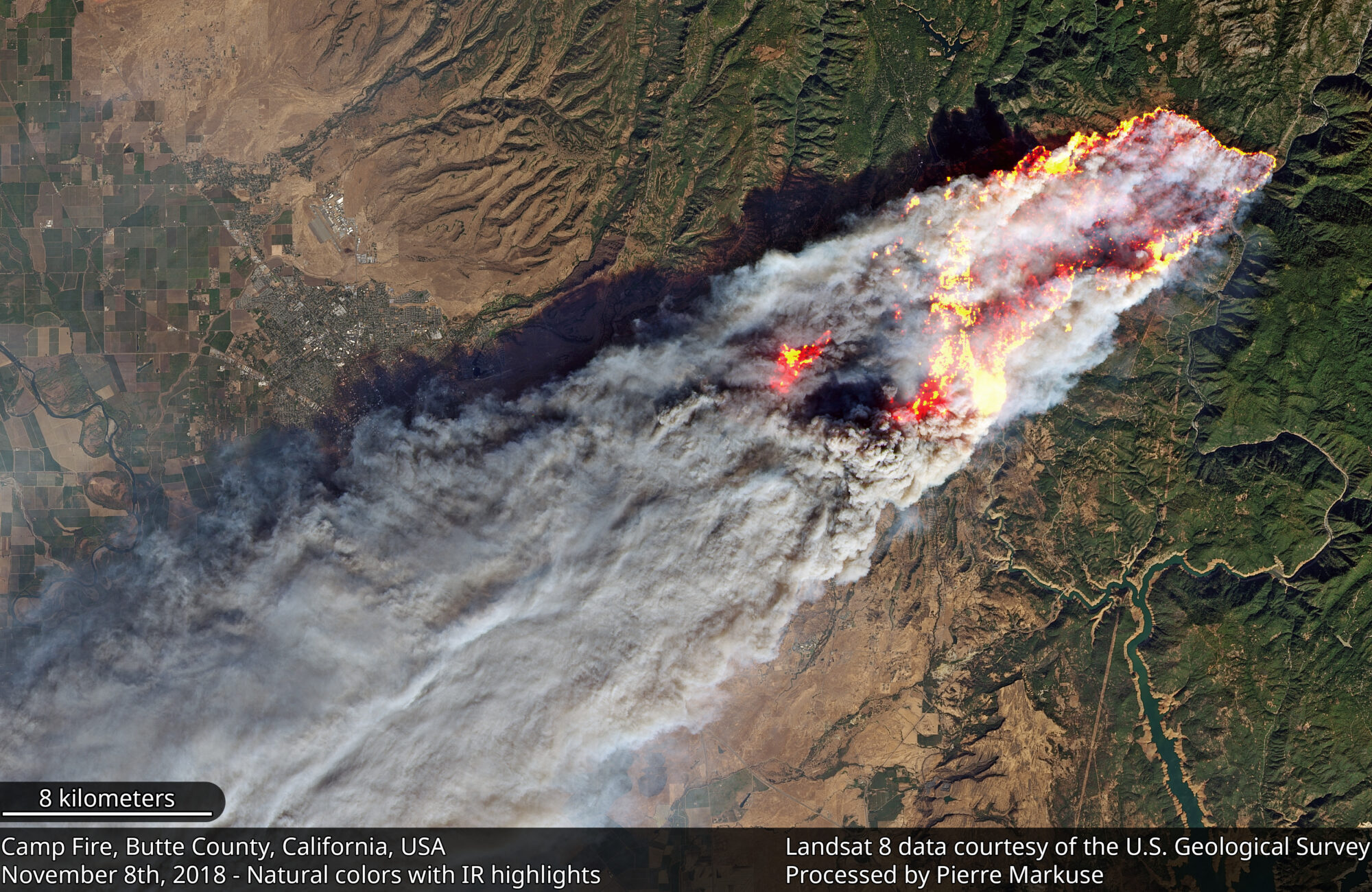
The Synoptic View of California’s Camp Fire: A Scorching Reality of Today’s Fires
Sprawling urban fires that once plagued civilization were thought to be a thing the past—the Camp Fire let us know they are back.
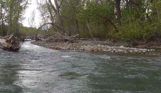
How Landsat Helps Alert Communities to Local Flood Hazards
For larger rivers, Landsat provides a rich dataset to define spatiotemporal patterns of channel shifting.