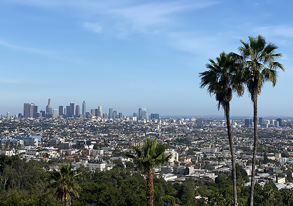
Landsat’s Role in Protecting Human Health
People have long recognized the connection between the environment and human health. Various animal and insect species from mice to mosquitoes serve as vectors that can transmit disease pathogens to people. Malaria is among the most deadly, preventable vector-borne diseases. About half of the world’s population (3.3 billion people) is at risk of contracting malaria from mosquitoes, according to the World Health Organization. Other human health problems such as cancer arise from exposure to pollutants in the environment. Finally, malnutrition can follow crop-destroying natural disasters such as drought or floods in poor regions. Landsat measurements can help decision makers pinpoint and minimize environmental health risks. With a spatial resolution of 30 meters, Landsat is well suited to mapping various components of changing landscapes, including agriculture and urbanization, that might pollute waterways. This level of detail can also show where water has accumulated in depressions to become breeding grounds for disease-carrying insect vectors. Landsat measures reflected light in both visible wavelengths and infrared wavelengths. This combination of measurements helps scientists gauge how healthy vegetation is, since growing plants generally absorb red light and reflect infrared light. Knowing the health of plants informs decision makers about cropland productivity and habitat conditions for disease-carrying insects and animals.
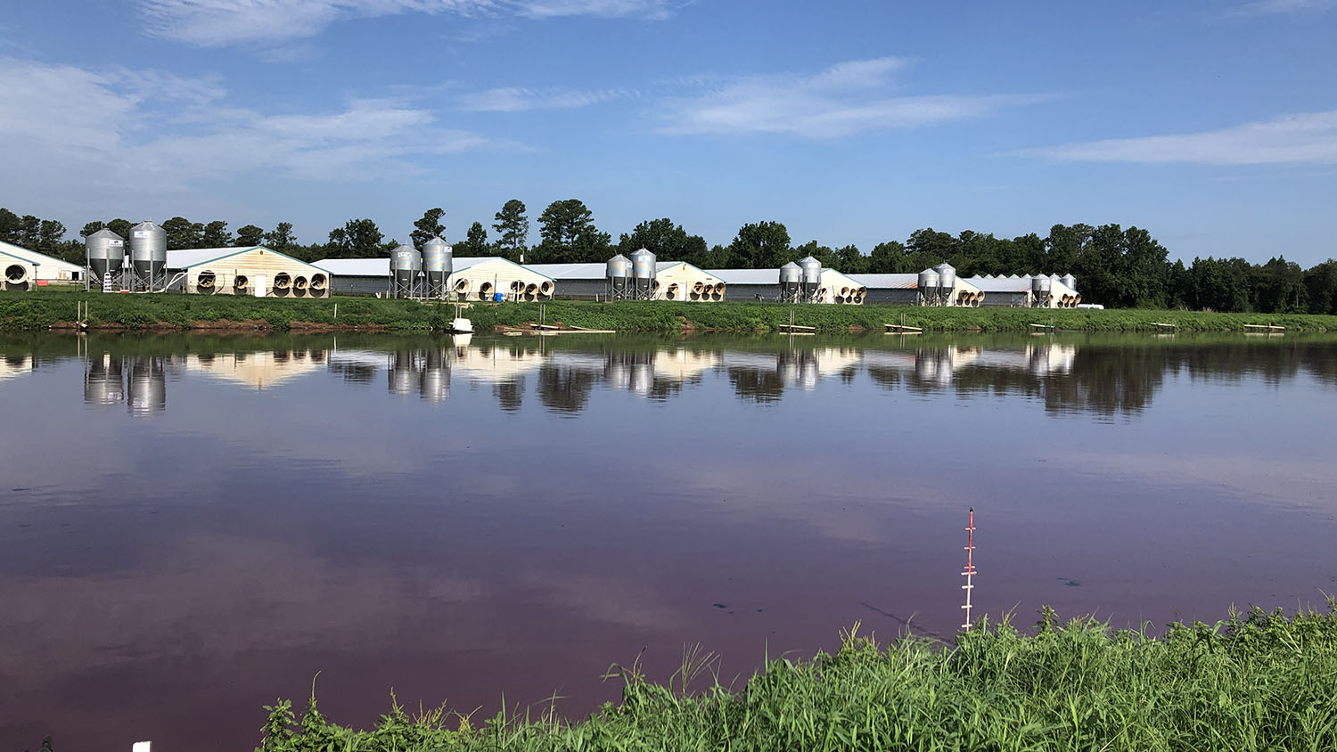
Tracking the Start of Swine Waste Lagoons with Landsat
Researchers at North Carolina State University have developed an automated technique that uses Landsat to determine when swine waste lagoons were constructed and how they may have affected environmental quality.
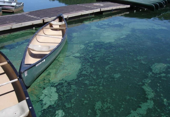
Downstream Consequences: How NASA Satellites Track Harmful Algal Blooms
Harmful algal blooms pose a health risk to fish and other wildlife as well as humans; satellites, including Landsat, are helping public health officials keep people safe.
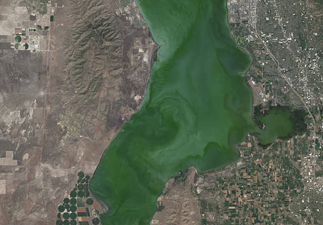
Landsat Satellite Data Warns of Harmful Algal Blooms
Landsat helps water resource managers know where to look for dangerous algal blooms in Utah lakes.
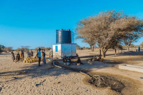
Keeping a Dry Eye on Drought in East Africa
The SERVIR team has developed models for groundwater demand based on Earth observations for parameters like rainfall and surface water from satellite missions.
AGU Panel Explores Environmental Impacts of the COVID-19 Pandemic, as Observed from Space
Landsat shows some of the ways in which COVID-19 is changing the environment.
Landsat Data Informs New Projects Exploring Connections Between the Environment and COVID-19
Satellite images are helping to reveal how COVID-19 lockdown measures are impacting food security, urban surface heat, water quality and aquatic ecosystems, and more in NASA-funded studies.