Landsat’s Role in Managing Water Resources
Water is essential for life. A third of Earth’s populace has unreliable access to clean water. With current population growth and environmental trends, the U.N. Environmental Program estimates that 1.8 billion people will face water scarcity by 2025. Water means survival for people and other species we rely upon to thrive, making proper stewardship of our water resources vital. Good decisions require good data. Since 1972 the Landsat series of satellites has been providing such data. Landsat-based decisions on how to manage limited water resources have impacted millions of people worldwide. From finding water for refugees in arid nations to reducing pollution in our national waterways, Landsat enables decisions that directly help people.
![A gage house](https://landsat.gsfc.nasa.gov/wp-content/uploads/2019/12/AGU19-USGSgagestation-westhopeND-768x576-1.jpg)
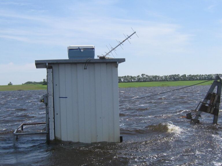
Mapping Past Floods to Help Predict Future Ones
Landsat has enabled a more thorough understanding of how the Central Valley landscape is impacted by floods.
![Arequipa](https://landsat.gsfc.nasa.gov/wp-content/uploads/2019/12/arequipa_3-1.jpg)
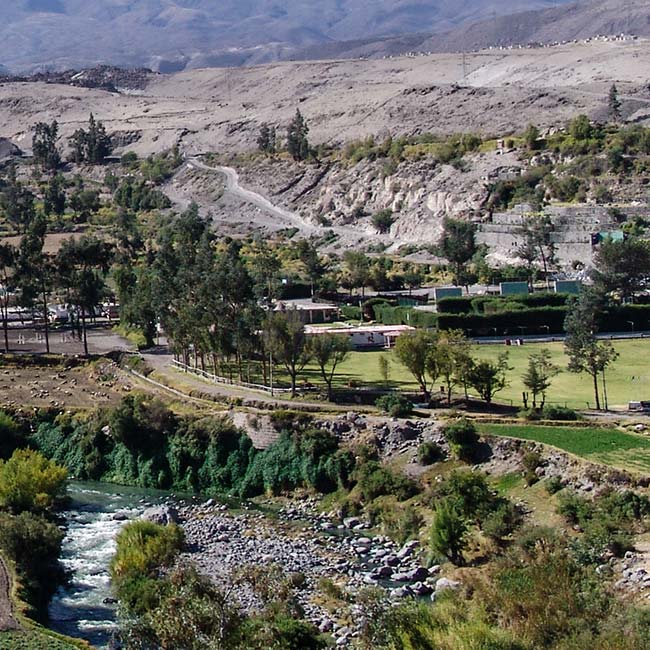
Arid-Region Agriculture in Arequipa, Peru
Landsat has helped map the expansion of intensive agriculture in arid Arequipa, Peru.
![Lago de Cahora Bassa in Mozambique](https://landsat.gsfc.nasa.gov/wp-content/uploads/2019/10/lagodecahorabassa_oli_2014208-1.jpg)
Lakes Worldwide Are Experiencing More-Severe Algal Blooms, 30-years of Landsat Data Shows
The intensity of summer algal blooms has increased over the past three decades, according to a first-ever global survey of dozens of large, freshwater lakes.
![Eastern Reef Egret](https://landsat.gsfc.nasa.gov/wp-content/uploads/2021/10/EasternReefEgretQueensland.png)
More than Naught: The “Z” of Where Land Meets Sea
Harnessing 30 years of Landsat data, a team of researchers from Australia has created the first 3D model of Australia’s entire coastline.
![Data from Landsat 8 can be used to detect high concentrations of chlorophyll-a](https://landsat.gsfc.nasa.gov/wp-content/uploads/2019/06/wis2-1.jpg)
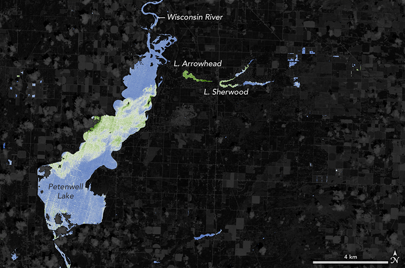
NASA Helps Warn of Harmful Algal Blooms in Lakes, Reservoirs
With limited resources to dedicate to monitoring for harmful algal blooms, water managers are looking to new technologies from NASA and its partners to detect and monitor potential hazards in lakes and reservoirs.
![A field photo showing mangrove roots](https://landsat.gsfc.nasa.gov/wp-content/uploads/2022/03/20190507_nu2.png)
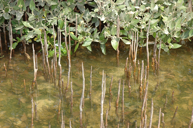
The Curious Case of Missing Mangroves in the Jubail Conservation
A group of researchers have used Landsat data to help solve a case of missing mangroves in Saudi Arabia’s Jubail Conservation.