Landsat’s Role in Managing Wildland Fires
Worldwide, fire plays a critical role in maintaining healthy forests, but fire can also be damaging. Homes are destroyed and the effects on air quality can be felt for miles. Forest fires are occurring more often and with greater intensity than in years past, and Landsat plays a critical role in understanding the impact. Landsat data enables land managers and scientists to assess the severity and extent of large fires as they plan recovery efforts; to improve safety and prevent damage to life, property and natural resources; to estimate how much pollution burning releases into the air; and to monitor the post-fire recovery of burned areas. Landsat satellites have been collecting information about forest fires since the 1970s. Landsat plays an important role in assessing the impact of fires on forest ecosystems and human society. Landsat satellites document the location and extent of burned areas, how severely fires burn, and the subsequent regrowth of the land after a forest fire. All this information helps land managers better manage our forests and other natural resources in the context of fire.
![Map of northern New Mexico showing a large burn scar.](https://landsat.gsfc.nasa.gov/wp-content/uploads/2023/04/TerraPulse_screenshot.jpg)
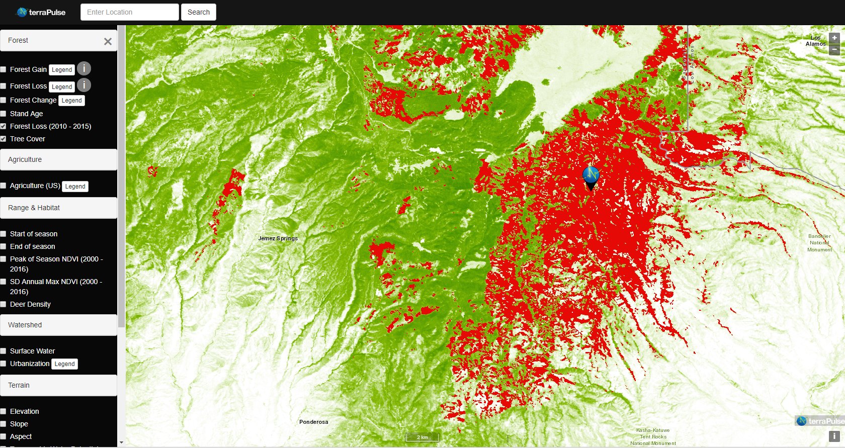
Taking the Pulse of Earth
Applying AI to Earth data—including Landsat—helps terraPulse reveal sustainable options for farming, reforestation, and land management.
![Meandering Lake Powell as seen by Landsat 8 in 2014. Dark blue deep waters change to green-grey shallow waters from image left (west) to right (east).](https://landsat.gsfc.nasa.gov/wp-content/uploads/2023/04/1-Lake_Powell.width-th.jpg)
NASA-Led Project Tracking Changes to Water, Ecosystems, Land Surface
Merging data from multiple satellites, OPERA can help government agencies, disaster responders, and the public access data about natural and human impacts to the land.
![Screenshot of the FIRMS interface](https://landsat.gsfc.nasa.gov/wp-content/uploads/2022/11/firms_landsat_double_creek_art.jpg)
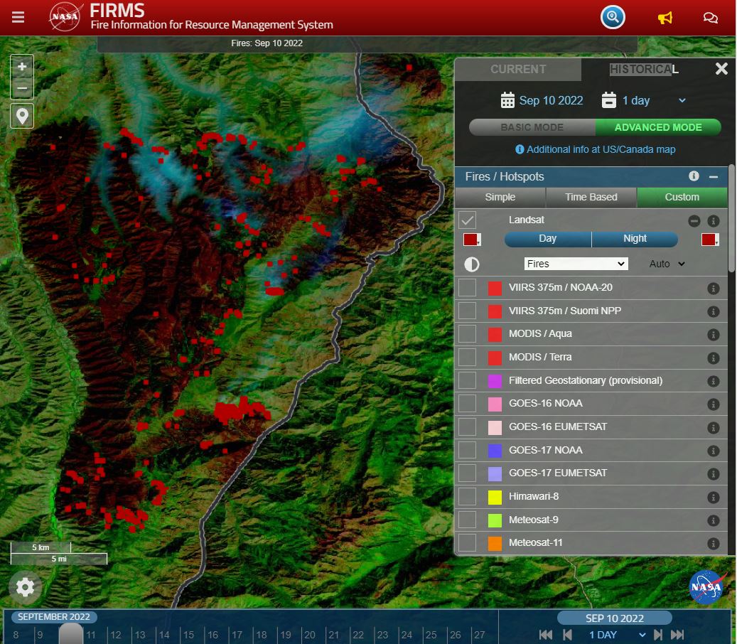
Landsat Fire and Thermal Anomaly Data Now Part of FIRMS
Thirty-meter Landsat 8 and 9 data have been added to NASA’s Fire Information for Resource Management System (FIRMS).
![Forests sit below Tahquitz Peak in Southern California’s San Jacinto mountain range.](https://landsat.gsfc.nasa.gov/wp-content/uploads/2022/07/TahquitzSanJacintoForest_lvwj_2021-2-768x432-1.jpg)
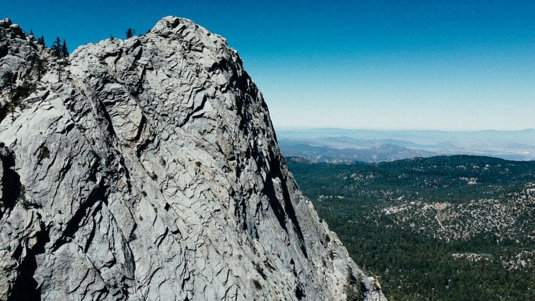
California’s Trees are Dying, and Might Not Be Coming Back
Landsat has shown that wildfires and climbing temperatures have caused a 6.7 percent decline in California tree cover since 1985.
![Big Creek Bridge](https://landsat.gsfc.nasa.gov/wp-content/uploads/2022/03/BigCreekBridge.jpg)
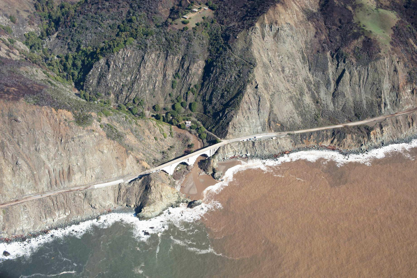
When Fire+Flood=Beach
A new study combines decades of Landsat and Sentinel-2 imagery with hydrologic and oceanographic data to look at how changes on land affect coastlines in Big Sur, California.
![Caldor Fire](https://landsat.gsfc.nasa.gov/wp-content/uploads/2021/12/CaldorFire_IW10SEP2021th.png)
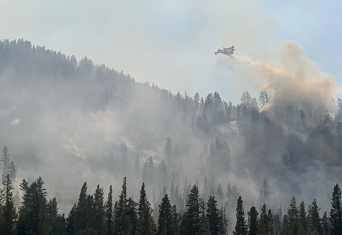
Climate Change Pushes Wildfires to New Heights
Wildfires in the western United States have been spreading to higher elevations over the past few decades due to warmer and drier conditions that are clearly linked to climate change.