Landsat’s Role in Managing Wildland Fires
Worldwide, fire plays a critical role in maintaining healthy forests, but fire can also be damaging. Homes are destroyed and the effects on air quality can be felt for miles. Forest fires are occurring more often and with greater intensity than in years past, and Landsat plays a critical role in understanding the impact. Landsat data enables land managers and scientists to assess the severity and extent of large fires as they plan recovery efforts; to improve safety and prevent damage to life, property and natural resources; to estimate how much pollution burning releases into the air; and to monitor the post-fire recovery of burned areas. Landsat satellites have been collecting information about forest fires since the 1970s. Landsat plays an important role in assessing the impact of fires on forest ecosystems and human society. Landsat satellites document the location and extent of burned areas, how severely fires burn, and the subsequent regrowth of the land after a forest fire. All this information helps land managers better manage our forests and other natural resources in the context of fire.
![A forest in Banff, Canada](https://landsat.gsfc.nasa.gov/wp-content/uploads/2020/09/Canada-Banff-KaiVogel.png)
The Stuff of Trees: Three-Decades of Forest Biomass Measured Across Canada
A new study reports a net increase of 5.38 petagrams of forest biomass between 1984 and 2016; carbon-wise, that is equivalent to a train of loaded coal cars long enough to wrap itself around Earth nearly 34 times.
![LANDFIRE Remap](https://landsat.gsfc.nasa.gov/wp-content/uploads/2020/07/LANDFIRE_remap.jpg)
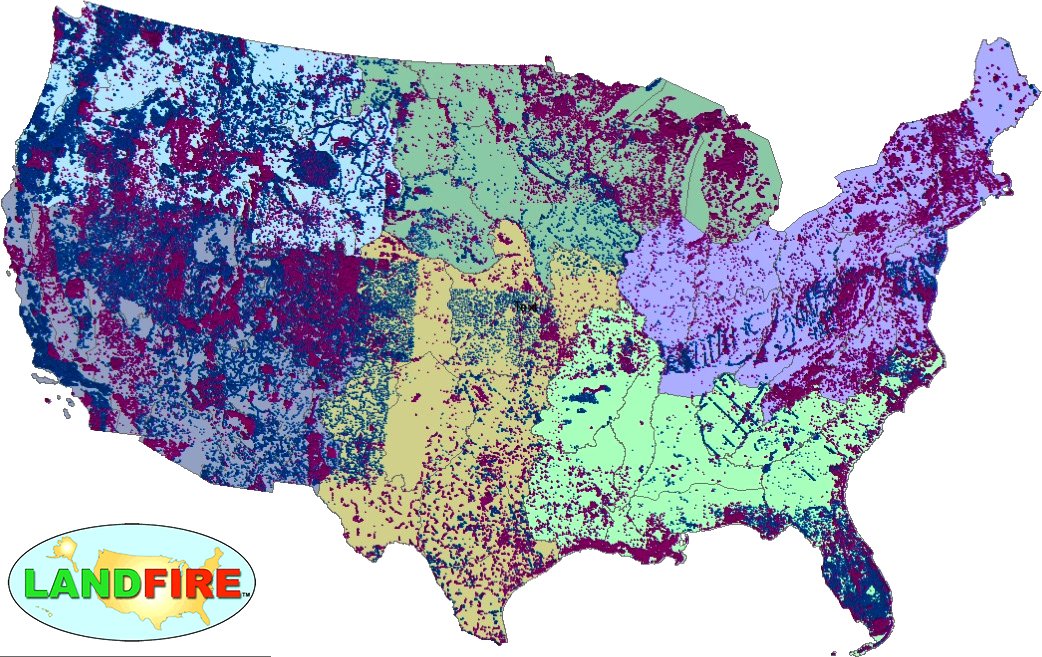
LANDFIRE Remap Is Here
LANDFIRE has released its Remap dataset; new techniques and new data provide significant improvement.
![The Eagle Creek fire at the edge of the Columbia River on Sept. 5, 2017](https://landsat.gsfc.nasa.gov/wp-content/uploads/2019/12/AGU19-JuliePadowski-EagleCreekFire2017-1.jpg)
Fire & Water: How Wildfires Can Impact Drinking Water
Fires in forested watersheds that support drinking water supplies can introduce contaminants that overwhelm current treatment capabilities. Earth observation data are helping.
![A beaver dam in Grand Teton National Park](https://landsat.gsfc.nasa.gov/wp-content/uploads/2021/12/grand-teton-national-park-sm.jpg)
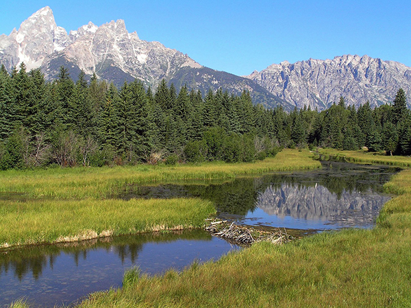
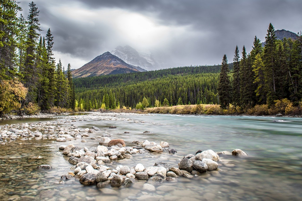
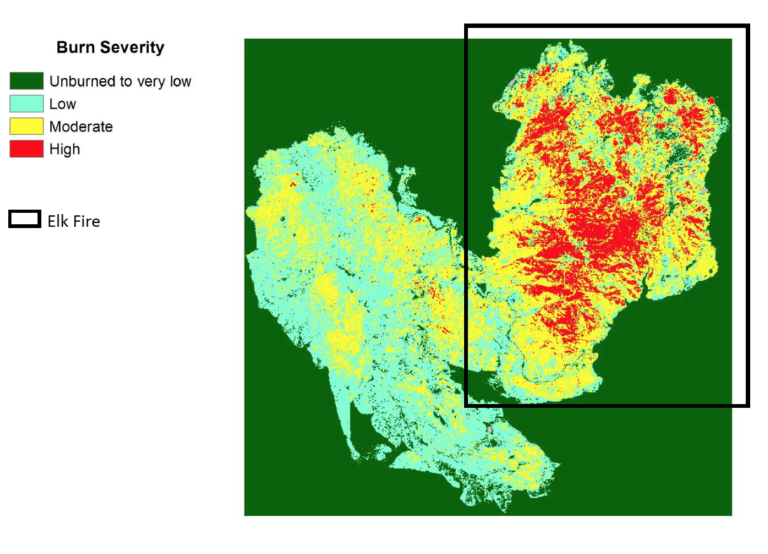
Smokey the Beaver? Beaver Dams and Wildfire
Landsat helped confirm and quantify what was only anecdotally known before: beaver dams make wetlands uniquely resistant to wildfires.
![August 2013 Elk Complex Fire](https://landsat.gsfc.nasa.gov/wp-content/uploads/2019/07/BAR_ElkComplex-768x554-1.png)
Landsat Can Save Federal Agencies up to $7.7 Million Annually in Post-Fire Costs
Using satellite imagery is a cost-effective way to assess burned areas and triage mitigation measures post-wildfire, study found. Federal agencies can save as much as $7.7 million annually in post-fire costs by using Landsat.
![Camp Fire](https://landsat.gsfc.nasa.gov/wp-content/uploads/2019/02/Camp_Fire_L8_MarkusePierre-1-2000x1300.jpg)
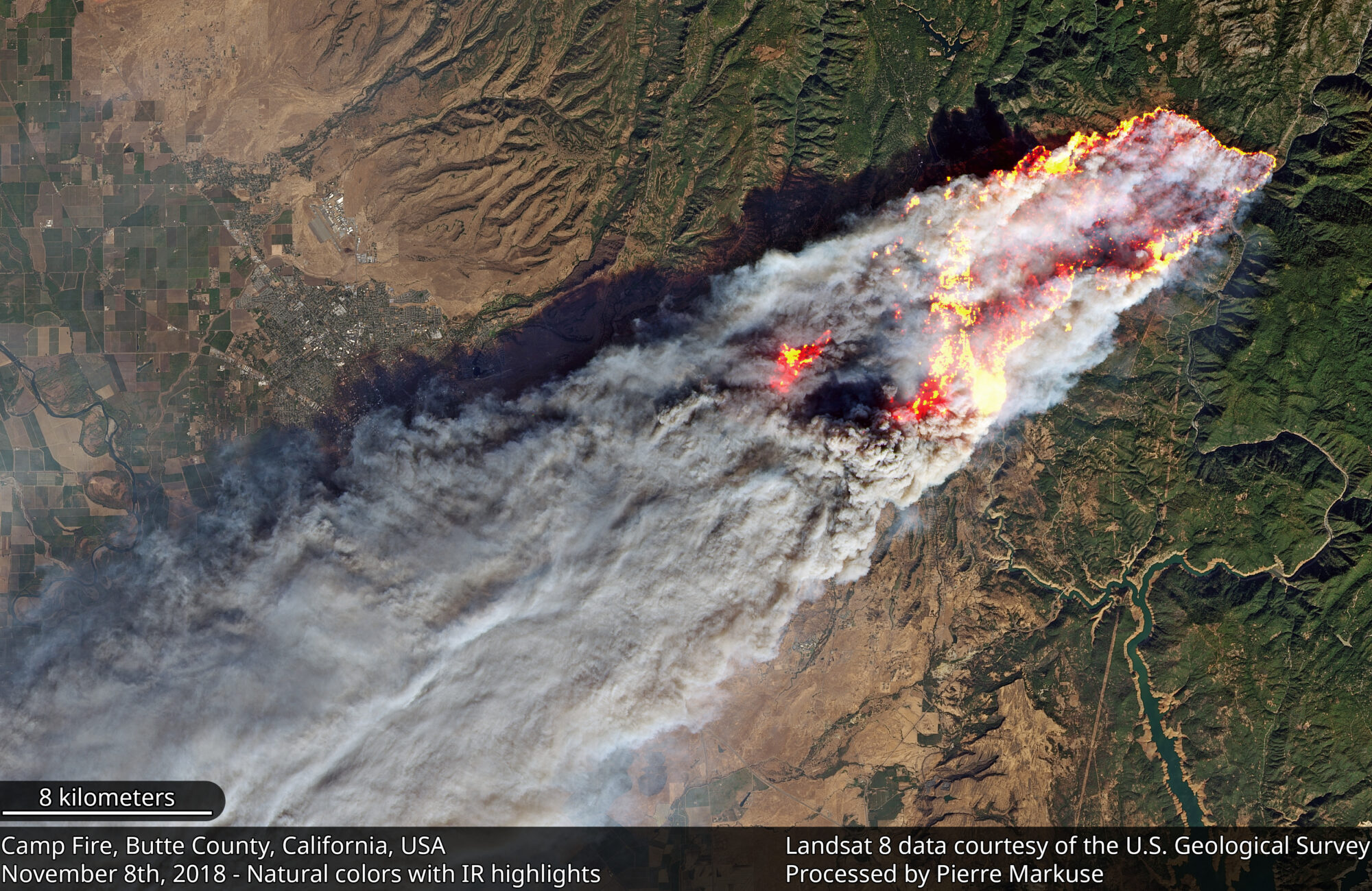
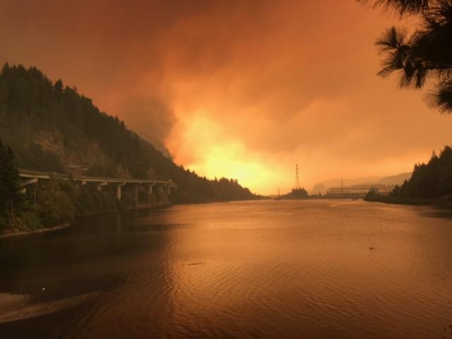
The Synoptic View of California’s Camp Fire: A Scorching Reality of Today’s Fires
Sprawling urban fires that once plagued civilization were thought to be a thing the past—the Camp Fire let us know they are back.