
December 13, 2019 • Dr. Julie Padowski is a Clinical Assistant Professor at the Washington State Water Research Center and the Assistant Director at the Center for Environmental Research, Education, and Outreach. Here is what Julie shared with us about the work she presented on Wednesday at #AGU19:
Identifying critical data and decision-support tools for municipal water quantity and quality planning to account for the impacts of wildfire in the Pacific Northwest, USA
You are helping to create a decision support tool for water managers in the Pacific Northwest who must consider fire-related impacts to drinking water. What type of information will this decision support tool provide?
Our project is a needs assessment designed to help modelers and researchers identify the key concerns and information gaps that face water managers as fire frequency and intensity increases throughout the Pacific Northwest (PNW).
A major part of this project is meeting and talking with water utility managers to understand what types of management and monitoring utilities are capable of implementing, and what information and data they would need to do this successfully. Through this assessment, we are learning about key questions they have about fire in their source watersheds, and the biophysical data and modeling needs of utility managers (e.g., soil moisture estimates, vegetative stress).
In time, this decision support tool will provide managers with a means to explore different burn scenarios under current conditions as a way of better anticipating the impacts these events have on vegetation survivability, soil stability, and water quality so they can plan and anticipate management responses efficiently.
Why is this information important for water managers?
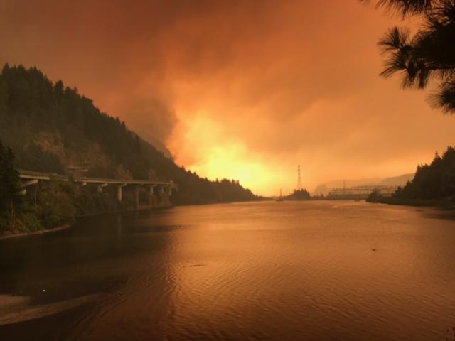
Fire disturbances are a major cause of increased erosion, runoff, suspended sediment, and debris flows in forested watersheds which can overwhelm water treatment plants or clog/block water supply infrastructure.
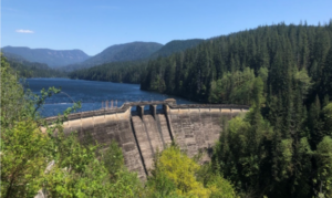
While fires in the Pacific Northwest were historically rare, recent wildfire events in the western Cascades, such as the 2017 Eagle Creek fire have fueled water utility concerns over drinking water quality and quantity.
Without a strong history of fire in the region, utilities find there is a lack of information on what to expect as fires become more common. They have expressed a need for tools and data that can help them predict how, when, and where fire will impact vegetation, soil and water in forested watersheds.
What information does NASA/USGS Landsat and SMAP contribute to the decision support tool (in context of post-wildfire decision making)?
Decision-support modeling tools that leverage updateable earth observation data could greatly aid water managers by integrating relatively static geographic characteristics (e.g., slope, soil type) readily available to water managers with remotely-sensed data that can provide new information on environmental conditions at temporal and spatial resolutions needed to make current decisions.
NASA and USGS data will be a critical part of this decision support tool, helping managers monitor and use vegetative load and plant and soil drought stress conditions to predict current areas of fire risk and identify potential responses.
The goal of this project is to identify how new tools could allow managers to input current fire risk conditions, and then explore different post-fire biophysical impacts (e.g., hydrologic response, sediment transport) and the effectiveness of different short-term (e.g., soil and slope stabilization activities) and long-term (e.g., tree planting, forest thinning, salvage logging) management actions that could help mitigate fire impacts to watershed function and water quality.
Co-author:
Amanda Hohner
Washington State University
Further Reading:
+ Landsat at the 2019 AGU Fall Meeting
Anyone can freely download Landsat data from the USGS EarthExplorer or the LandsatLook Viewer.


