

Intern with Our Outreach Team
Do you design interactive media? Consider interning with the Landsat outreach team.
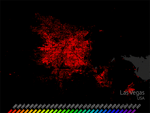
Mapping Our Human Footprint from Space
The World Settlement Footprint is the world’s most comprehensive dataset on human settlement.
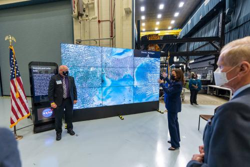
NASA, USGS Release First Landsat 9 Images
Landsat 9’s first light images provide a preview of how the mission will help people manage vital natural resources and understand the impacts of climate change.
Changes of Aapa Mires Can Be Detected from Landsat Satellite Data
The recent increase of Sphagnum mosses over portions of the northern peatlands known as wet aapa mires can be detected from Landsat satellite data.
OpenET: A Satellite-Based Water Data Resource
Data from Landsat powers OpenET, a new web-based platform that puts water use information for 17 western United States into the hands of farmers, water managers and conservation groups.

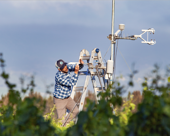
Bill Kustas: Advancing Water Research Drop by Drop
Kustas’ research informed the new OpenET app that uses Landsat thermal data as a key data input.
NASA Invites Media to Briefing on New Water Data Platform
NASA will hold a virtual media briefing at 1:30 p.m. EDT Thursday, Oct. 21, to share a powerful, new, web-based platform to help those who rely on water resources across the drought-stricken western U.S.
Finding “Cool Islands:” Landsat Used to Study Thermal Impact of Large Solar Parks
Using Landsat, scientists have discovered for the first time that large scale solar parks have a cooling effect on the land surrounding them.
NASA, USGS Release First Landsat 9 Images
Landsat 9’s first light images provide a preview of how the mission will help people manage vital natural resources and understand the impacts of climate change.
Changes of Aapa Mires Can Be Detected from Landsat Satellite Data
The recent increase of Sphagnum mosses over portions of the northern peatlands known as wet aapa mires can be detected from Landsat satellite data.
OpenET: A Satellite-Based Water Data Resource
Data from Landsat powers OpenET, a new web-based platform that puts water use information for 17 western United States into the hands of farmers, water managers and conservation groups.
Bill Kustas: Advancing Water Research Drop by Drop
Kustas’ research informed the new OpenET app that uses Landsat thermal data as a key data input.
NASA Invites Media to Briefing on New Water Data Platform
NASA will hold a virtual media briefing at 1:30 p.m. EDT Thursday, Oct. 21, to share a powerful, new, web-based platform to help those who rely on water resources across the drought-stricken western U.S.
Finding “Cool Islands:” Landsat Used to Study Thermal Impact of Large Solar Parks
Using Landsat, scientists have discovered for the first time that large scale solar parks have a cooling effect on the land surrounding them.
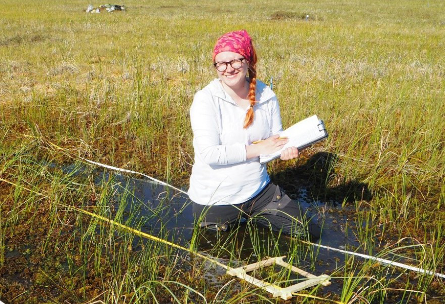
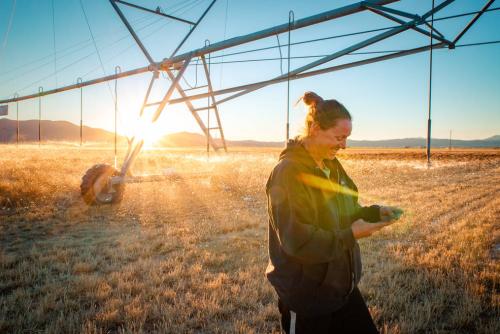
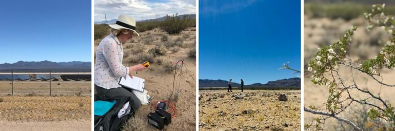
Landsat Pixel Walkers: Getting a Feel for Field Work
Field work conducted in northern Alaska is being used in concert with the Landsat satellite data record in an effort to better understand the impacts of climate change on the Arctic.
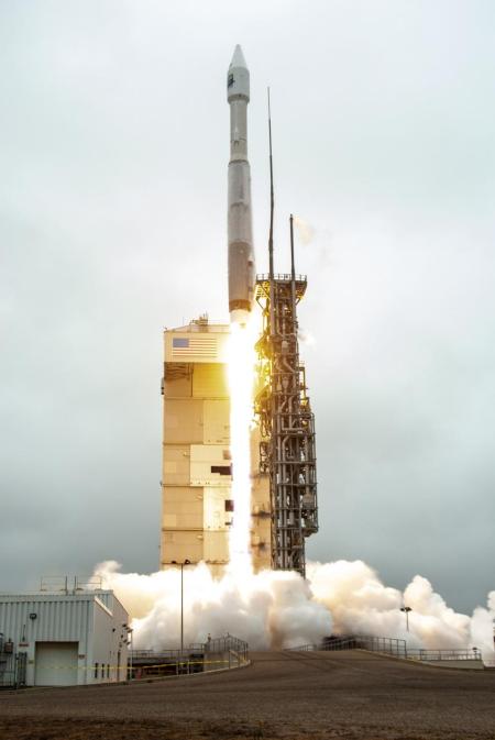
Landsat 9 Power-Positive and Proceeding Smoothly Through On-Orbit Checkout
Landsat 9 successfully launched on Monday, Sept 27, 2021 at 11:12 a.m. PDT and is now proceeding smoothly and accordingly through its scheduled on-orbit checkout period.
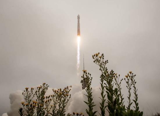
Newly Launched Landsat 9 Mission to Monitor Earth’s Landscapes
Landsat 9 successfully launched at 2:12 p.m. EDT Monday from Vandenberg Space Force Base in California.
NASA, USGS Release First Landsat 9 Images
Landsat 9’s first light images provide a preview of how the mission will help people manage vital natural resources and understand the impacts of climate change.
Changes of Aapa Mires Can Be Detected from Landsat Satellite Data
The recent increase of Sphagnum mosses over portions of the northern peatlands known as wet aapa mires can be detected from Landsat satellite data.
OpenET: A Satellite-Based Water Data Resource
Data from Landsat powers OpenET, a new web-based platform that puts water use information for 17 western United States into the hands of farmers, water managers and conservation groups.
Bill Kustas: Advancing Water Research Drop by Drop
Kustas’ research informed the new OpenET app that uses Landsat thermal data as a key data input.
NASA Invites Media to Briefing on New Water Data Platform
NASA will hold a virtual media briefing at 1:30 p.m. EDT Thursday, Oct. 21, to share a powerful, new, web-based platform to help those who rely on water resources across the drought-stricken western U.S.
Finding “Cool Islands:” Landsat Used to Study Thermal Impact of Large Solar Parks
Using Landsat, scientists have discovered for the first time that large scale solar parks have a cooling effect on the land surrounding them.
Landsat Pixel Walkers: Getting a Feel for Field Work
Field work conducted in northern Alaska is being used in concert with the Landsat satellite data record in an effort to better understand the impacts of climate change on the Arctic.
Landsat 9 Power-Positive and Proceeding Smoothly Through On-Orbit Checkout
Landsat 9 successfully launched on Monday, Sept 27, 2021 at 11:12 a.m. PDT and is now proceeding smoothly and accordingly through its scheduled on-orbit checkout period.
Newly Launched Landsat 9 Mission to Monitor Earth’s Landscapes
Landsat 9 successfully launched at 2:12 p.m. EDT Monday from Vandenberg Space Force Base in California.
