
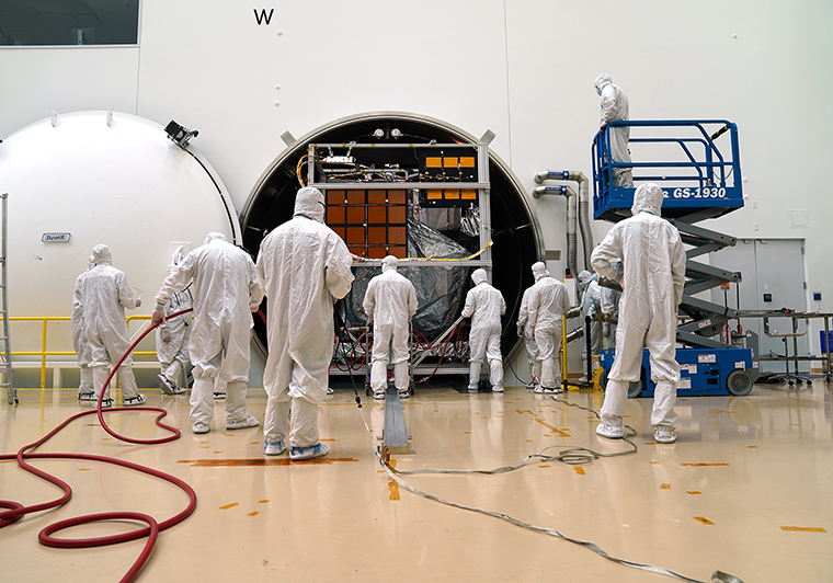
Landsat 9 Completes Test Simulating Harsh Space Environment
The Landsat 9 satellite has successfully completed its most strenuous environmental test leading up to launch.
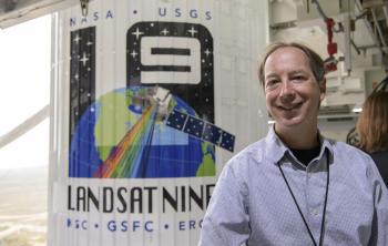
Data Chat with Dr. Jeffrey Masek
The Harmonized Landsat Sentinel-2 (HLS) project offers daily, 30-meter global land surface data products to facilitate a wide range of terrestrial Earth science research.
New USGS Case Studies Highlight Female Landsat Data Users
During the month of March, as we collectively celebrate Women History’s Month, we want to share a fantastic trio of user case study videos published by the U.S. Geological Survey.
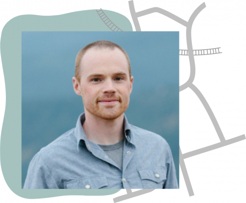
Justin Braaten has the Code
Justin Braaten is a code wizard, helping everyone from wildlife ecologists to machine learning experts more easily use Landsat.
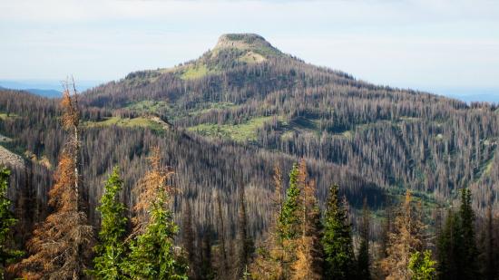
Twenty Years of Bark Beetle Activity Tracked Across Colorado Forests
More than two decades worth of Landsat satellite imagery was used to quantify how beetle outbreaks have impacted high-elevations forests in Colorado, southern Wyoming, and northern New Mexico.
Economics of Nature: Mapping Liberia’s Ecosystems to Understand Their Value
The Liberian government, with the help of NASA and Conservation International, is using Landsat and GEDI data to estimate the country’s natural capital.
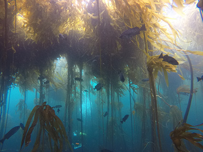
Landsat Shows the Collapse of Northern California Kelp Forests
Most of Northern California’s kelp forest ecosystem is gone, replaced by widespread ‘urchin barrens’ that may persist long into the future, according to a new study.
Landsat Assists ICESat-2 with First Global Survey of Freshwater Fluctuation
Lidar measurements of surface water level combined with Landsat-based surface water maps have enabled the first quantification of how humans impact the water cycle.
Economics of Nature: Mapping Liberia’s Ecosystems to Understand Their Value
The Liberian government, with the help of NASA and Conservation International, is using Landsat and GEDI data to estimate the country’s natural capital.
Landsat Shows the Collapse of Northern California Kelp Forests
Most of Northern California’s kelp forest ecosystem is gone, replaced by widespread ‘urchin barrens’ that may persist long into the future, according to a new study.
Landsat Assists ICESat-2 with First Global Survey of Freshwater Fluctuation
Lidar measurements of surface water level combined with Landsat-based surface water maps have enabled the first quantification of how humans impact the water cycle.
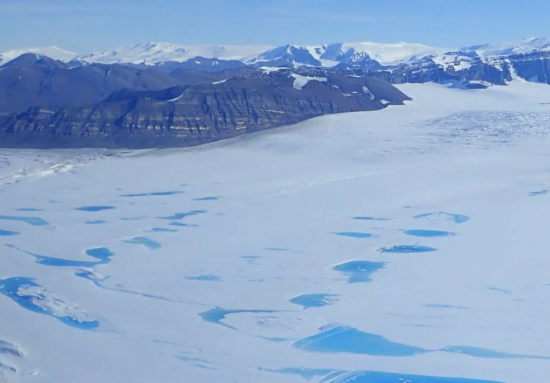
Extreme Melt on Antarctica’s George VI Ice Shelf
Antarctica’s George VI Ice Shelf experienced record melting during the 2019-2020 summer season.
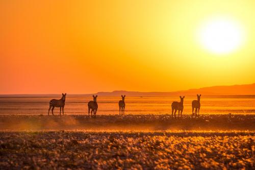
Landsat & Drones Used to Reconstruct Past Environmental Change
Vegetation cover along the Kuiseb River in the Namib Desert has increased over the last 35 years, Landsat has helped show.
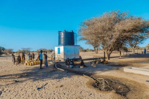
Keeping a Dry Eye on Drought in East Africa
The SERVIR team has developed models for groundwater demand based on Earth observations for parameters like rainfall and surface water from satellite missions.
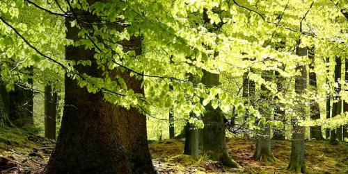
Quantifying Forests’ Impacts on Global Carbon Budget with Satellites
A new method, fusing data from many sources, has been developed for quantifying forests’ role as both carbon sink and carbon source.
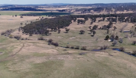
Protecting Water for Generations to Come in Australia
Australia’s natural resource regulator uses drones and satellite imagery to monitor water use and compliance with their water laws across New South Wales to ensure our water resources are protected for generations to come.
Mapping Landsat’s Long History
UtahView’s Ellie McGinty has created a Google Earth Web Map showcasing Landsat’s history.
Economics of Nature: Mapping Liberia’s Ecosystems to Understand Their Value
The Liberian government, with the help of NASA and Conservation International, is using Landsat and GEDI data to estimate the country’s natural capital.
Landsat Shows the Collapse of Northern California Kelp Forests
Most of Northern California’s kelp forest ecosystem is gone, replaced by widespread ‘urchin barrens’ that may persist long into the future, according to a new study.
Landsat Assists ICESat-2 with First Global Survey of Freshwater Fluctuation
Lidar measurements of surface water level combined with Landsat-based surface water maps have enabled the first quantification of how humans impact the water cycle.
Extreme Melt on Antarctica’s George VI Ice Shelf
Antarctica’s George VI Ice Shelf experienced record melting during the 2019-2020 summer season.
Landsat & Drones Used to Reconstruct Past Environmental Change
Vegetation cover along the Kuiseb River in the Namib Desert has increased over the last 35 years, Landsat has helped show.
Keeping a Dry Eye on Drought in East Africa
The SERVIR team has developed models for groundwater demand based on Earth observations for parameters like rainfall and surface water from satellite missions.
Quantifying Forests’ Impacts on Global Carbon Budget with Satellites
A new method, fusing data from many sources, has been developed for quantifying forests’ role as both carbon sink and carbon source.
Protecting Water for Generations to Come in Australia
Australia’s natural resource regulator uses drones and satellite imagery to monitor water use and compliance with their water laws across New South Wales to ensure our water resources are protected for generations to come.
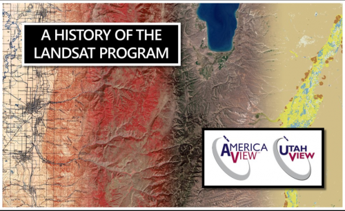
Mapping Landsat’s Long History
UtahView’s Ellie McGinty has created a Google Earth Web Map showcasing Landsat’s history.
