
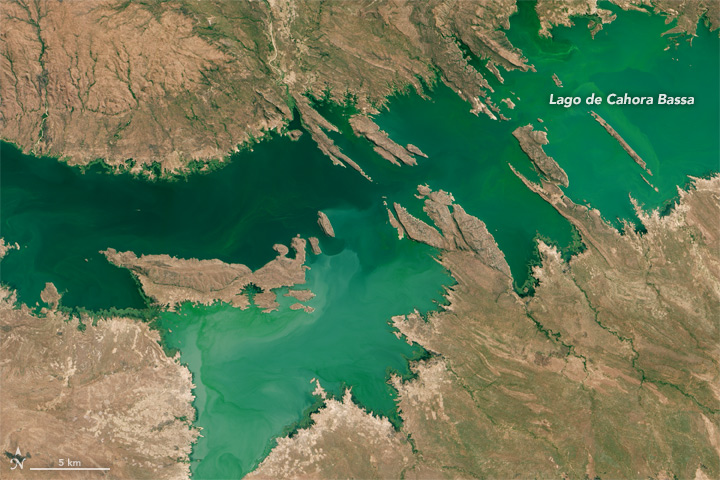
Lakes Worldwide Are Experiencing More-Severe Algal Blooms, 30-years of Landsat Data Shows
The intensity of summer algal blooms has increased over the past three decades, according to a first-ever global survey of dozens of large, freshwater lakes.

Pecora Award Honors Excellence in Earth Observation, Including Former Landsat Science Team Leader
The 2019 Pecora Award recipients include former Landsat Science Team leader Thomas R. Loveland and the Terra Science and Flight Operations Team.
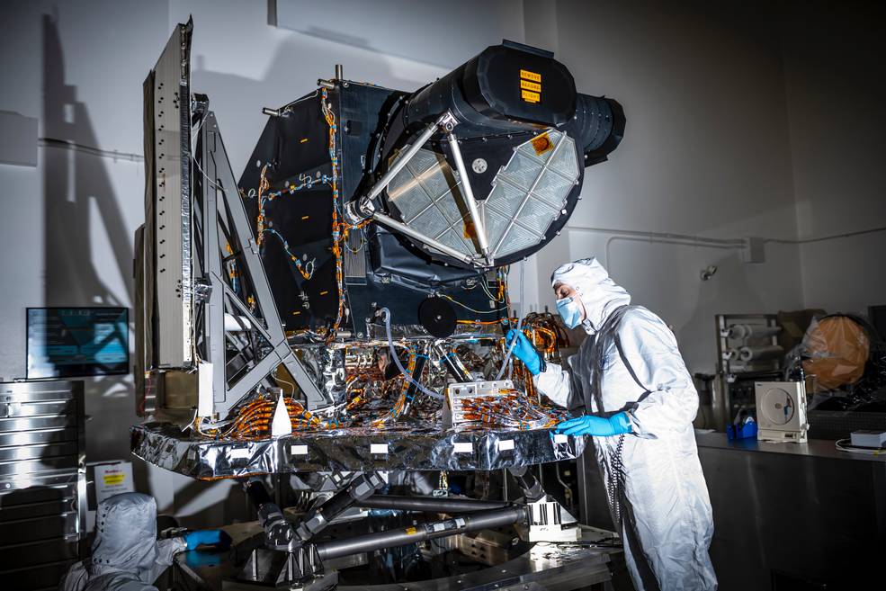
Landsat 9 Instrument Ready for Spacecraft Assembly
OLI-2 is now built, tested, and in place to be assembled onto the spacecraft.
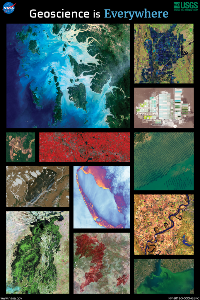
Geoscience is Everywhere: 2019 Earth Science Week Poster
The 2019 Earth Science Week Poster was created as a joint project between NASA and America View to show the wide scope of applications of geoscience.
Landsat Collection 2 Sample Products Now Available from USGS
Landsat Collection 2 will improve data quality and provide more accurate information for use in land change analysis, resulting in more informed decision-making.

Hot in the City, And Hotter Still in Low-Income Areas
A new investigative report published by NPR has found that it’s hotter in cities’ low income areas.
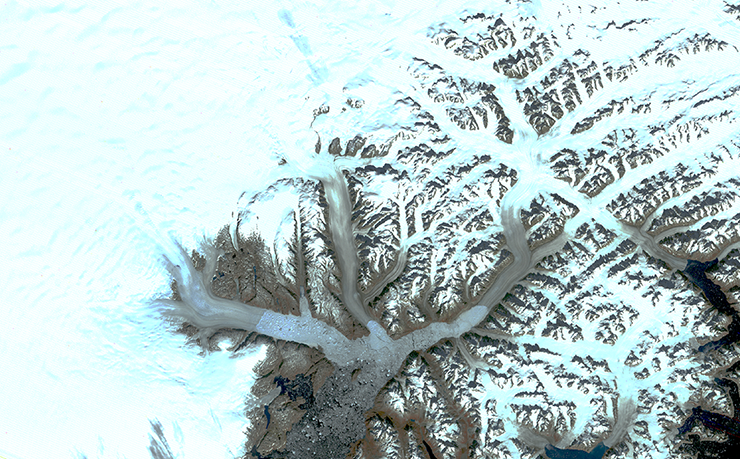
Landsat Illustrates Five Decades of Change to Greenland Glaciers
The branching network of glaciers that empty into Greenland’s Sermilik Fjord has changed significantly in the last half century.
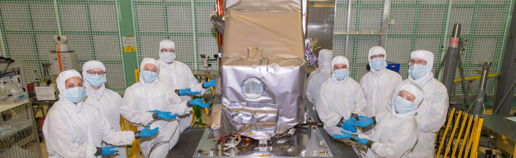
New Landsat Infrared Instrument Ships from NASA
This month, TIRS-2 successfully passed the stringent 12-week testing process at NASA’s Goddard Space Flight Center and was shipped to Northrop Grumman’s facility in Arizona.
Landsat 9 Instrument Ready for Spacecraft Assembly
OLI-2 is now built, tested, and in place to be assembled onto the spacecraft.
Geoscience is Everywhere: 2019 Earth Science Week Poster
The 2019 Earth Science Week Poster was created as a joint project between NASA and America View to show the wide scope of applications of geoscience.
Landsat Collection 2 Sample Products Now Available from USGS
Landsat Collection 2 will improve data quality and provide more accurate information for use in land change analysis, resulting in more informed decision-making.
Hot in the City, And Hotter Still in Low-Income Areas
A new investigative report published by NPR has found that it’s hotter in cities’ low income areas.
Landsat Illustrates Five Decades of Change to Greenland Glaciers
The branching network of glaciers that empty into Greenland’s Sermilik Fjord has changed significantly in the last half century.
New Landsat Infrared Instrument Ships from NASA
This month, TIRS-2 successfully passed the stringent 12-week testing process at NASA’s Goddard Space Flight Center and was shipped to Northrop Grumman’s facility in Arizona.
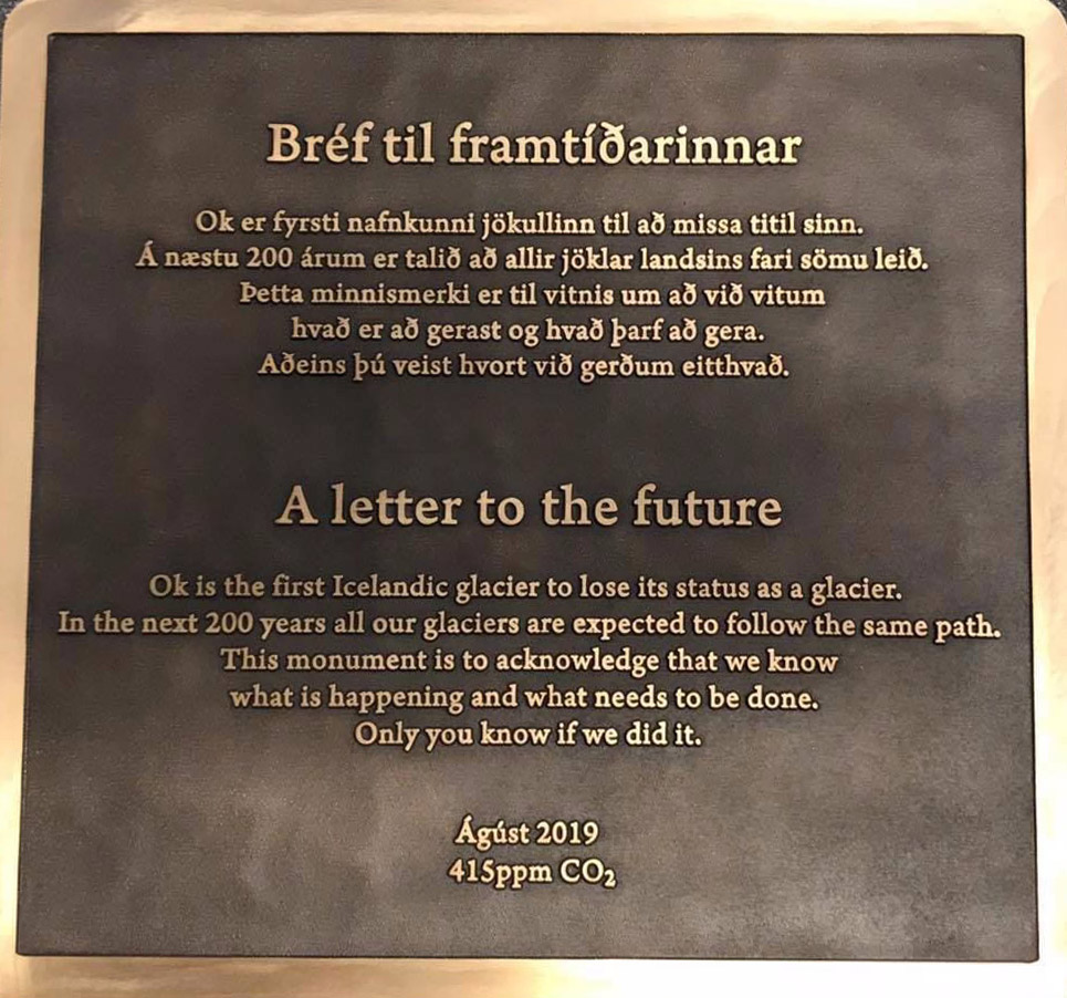
Tribute to a Glacier That Is No More
A memorial was placed on top of the volcano where Okjökull Glacier’s ice once flowed.
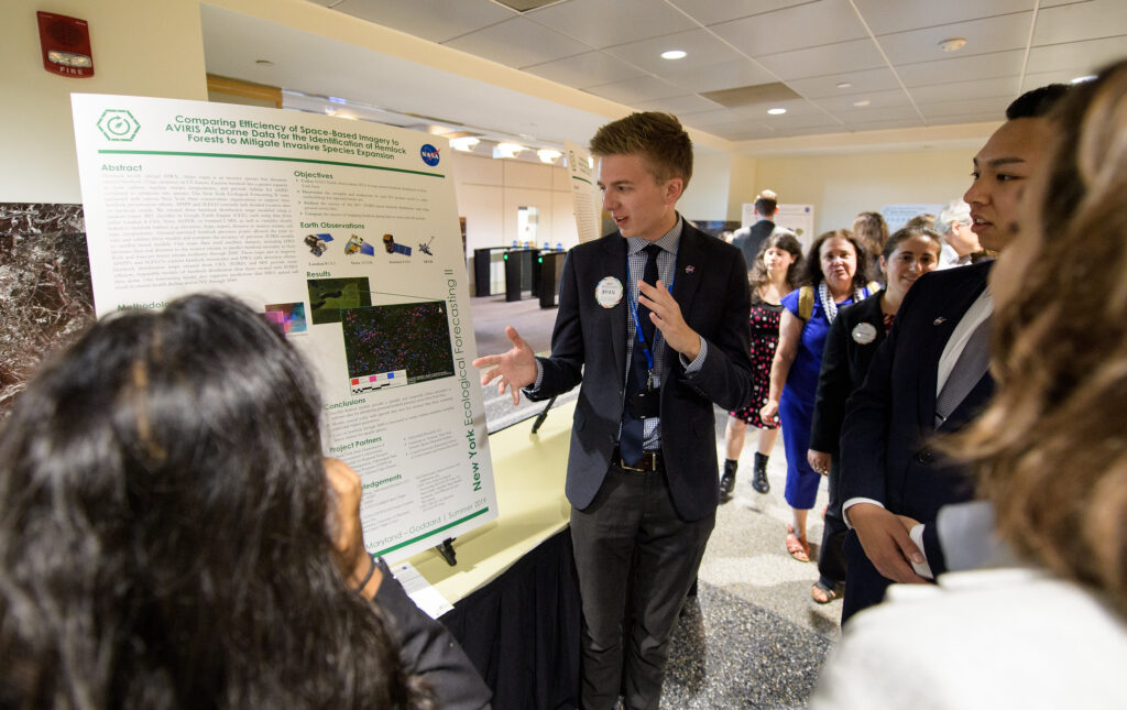
Applying Earth Observations to Real-World Concerns
Summer projects focused on using Earth science data for practical applications like agriculture and food security, disasters, ecological forecasting, energy, health and air quality, transportation and infrastructure, urban development and water resources.
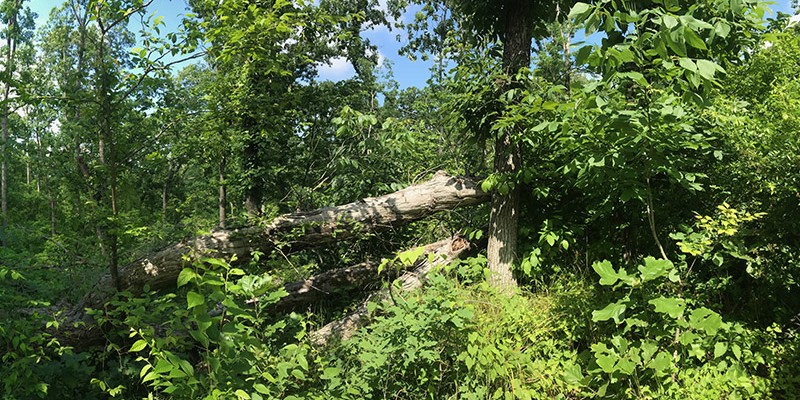
Tornadoes, Windstorms Pave Way for Lasting Plant Invasions
Landsat shows that large blowdown areas in southern Illinois forests are more heavily invaded by invasive species and slower to recover than smaller areas after a tornado.
Landsat 9 Instrument Ready for Spacecraft Assembly
OLI-2 is now built, tested, and in place to be assembled onto the spacecraft.
Geoscience is Everywhere: 2019 Earth Science Week Poster
The 2019 Earth Science Week Poster was created as a joint project between NASA and America View to show the wide scope of applications of geoscience.
Landsat Collection 2 Sample Products Now Available from USGS
Landsat Collection 2 will improve data quality and provide more accurate information for use in land change analysis, resulting in more informed decision-making.
Hot in the City, And Hotter Still in Low-Income Areas
A new investigative report published by NPR has found that it’s hotter in cities’ low income areas.
Landsat Illustrates Five Decades of Change to Greenland Glaciers
The branching network of glaciers that empty into Greenland’s Sermilik Fjord has changed significantly in the last half century.
New Landsat Infrared Instrument Ships from NASA
This month, TIRS-2 successfully passed the stringent 12-week testing process at NASA’s Goddard Space Flight Center and was shipped to Northrop Grumman’s facility in Arizona.
Tribute to a Glacier That Is No More
A memorial was placed on top of the volcano where Okjökull Glacier’s ice once flowed.
Applying Earth Observations to Real-World Concerns
Summer projects focused on using Earth science data for practical applications like agriculture and food security, disasters, ecological forecasting, energy, health and air quality, transportation and infrastructure, urban development and water resources.
Tornadoes, Windstorms Pave Way for Lasting Plant Invasions
Landsat shows that large blowdown areas in southern Illinois forests are more heavily invaded by invasive species and slower to recover than smaller areas after a tornado.
