
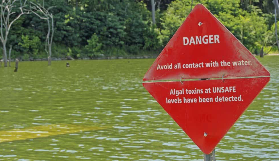
Satellites on Toxic Algae Patrol
Increasingly, water managers are turning to satellites like Landsat to monitor inland waters.
Landsat 9 Ground System Meets Design Criteria to Move Forward
Independent review panel unanimously agreed that the Landsat 9 Ground System Critical Design Review met all of the criteria for critical design.
Earth Images Enable Near-Perfect Crop Predictions
Boston-based startup TellusLabs uses Landsat and MODIS images to predict corn and soy yields with remarkable accuracy.
Landsat 9 Ground System Critical Design Review
The Landsat 9 Ground System Critical Design Review (GCDR) is taking place September 24 & 25th in Brandon, South Dakota.
Upcoming ARSET Webinar: Change Detection for Land Cover Mapping
NASA’s Applied Remote Sensing Training (ARSET) group will be hosting a two-day data training webinar.
Summer 2018 Landsat Science Team Presentations Available
Summer 2018 Landsat Science Team presentations have been made available by USGS.
Landsat Used To Predict Tree Species Distributions in Peruvian Lowland Amazonia
Researchers have succeeded in producing distribution maps for a selection of important tropical tree species in Peruvian lowland Amazonia.
Reading the Tides: Monitoring Estuarine Habitats in Northern Australia with Landsat
Australian researchers have used Landsat imagery to map coastal habitats critical to threatened and migratory species in northern Australia.
Landsat Adds Value, Reliability to Cubesat Imagery
Landsat is a gold standard for calibration that adds value and reliability to other satellite systems.
Seeing Hidden Worlds Under Melting Ice
Multi-year comparison of Landsat images can unmask previously unknown geography.
New Study: The Arctic Carbon Cycle is Speeding Up
Carbon in Alaska’s North Slope tundra ecosystems spends about 13 percent less time locked in frozen soil than it did 40 years ago.
USGS Landsat Archive Hits 8 Million
The USGS Landsat archive has reached eight million scenes.
App Helps Ecologists Map Vulnerable Ecosystems Within Minutes
A mapmaking app that can fast-track large-scale ecosystem analysis from months to minutes.
USGS Landsat Video: The Progress of Landsat Sensor Technology
Landsat sensor technology has come a long way since the days of the Return Beam Vidicon cameras on the first three Landsat satellites.
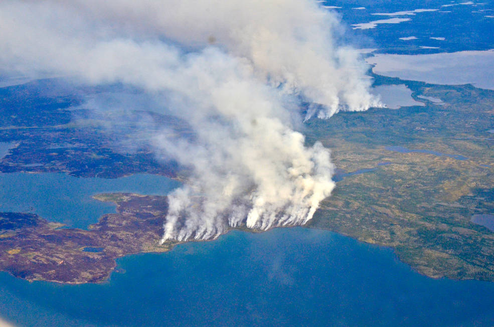
Fires, Floods and Satellite Views: Modeling the Boreal Forest’s Future
The 2014 megafires in Canada’s Northwest Territories burned 7 million acres of forest, making it one of the most severe fire events in Canadian history.
USGS, NASA Officials Cut Ribbon on New Landsat 7 Flight Operations Center
A ribbon-cutting ceremony for the new Landsat 7 Mission Operations Center (MOC) at the Goddard Space Flight Center was held this month.
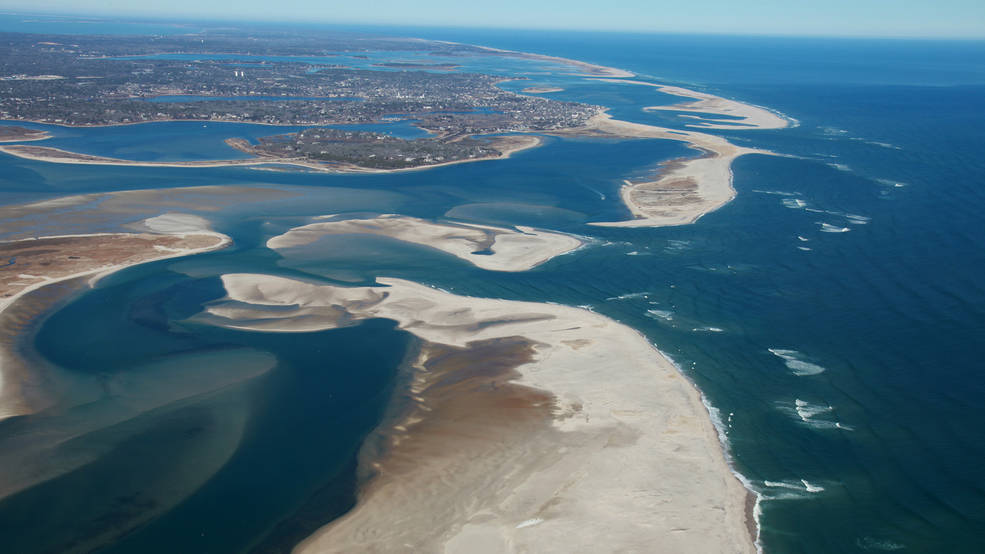
Landsat-based Global Study of World’s Beaches Shows Threat to Protected Areas
Using 30 years of Landsat data, a team of scientists and engineers from the Netherlands determined how Earth’s sandy beaches are changing.
Landsat Adds Value, Reliability to Cubesat Imagery
Landsat is a gold standard for calibration that adds value and reliability to other satellite systems.
Seeing Hidden Worlds Under Melting Ice
Multi-year comparison of Landsat images can unmask previously unknown geography.
New Study: The Arctic Carbon Cycle is Speeding Up
Carbon in Alaska’s North Slope tundra ecosystems spends about 13 percent less time locked in frozen soil than it did 40 years ago.
USGS Landsat Archive Hits 8 Million
The USGS Landsat archive has reached eight million scenes.
App Helps Ecologists Map Vulnerable Ecosystems Within Minutes
A mapmaking app that can fast-track large-scale ecosystem analysis from months to minutes.
USGS Landsat Video: The Progress of Landsat Sensor Technology
Landsat sensor technology has come a long way since the days of the Return Beam Vidicon cameras on the first three Landsat satellites.
Fires, Floods and Satellite Views: Modeling the Boreal Forest’s Future
The 2014 megafires in Canada’s Northwest Territories burned 7 million acres of forest, making it one of the most severe fire events in Canadian history.
USGS, NASA Officials Cut Ribbon on New Landsat 7 Flight Operations Center
A ribbon-cutting ceremony for the new Landsat 7 Mission Operations Center (MOC) at the Goddard Space Flight Center was held this month.
Landsat-based Global Study of World’s Beaches Shows Threat to Protected Areas
Using 30 years of Landsat data, a team of scientists and engineers from the Netherlands determined how Earth’s sandy beaches are changing.
