
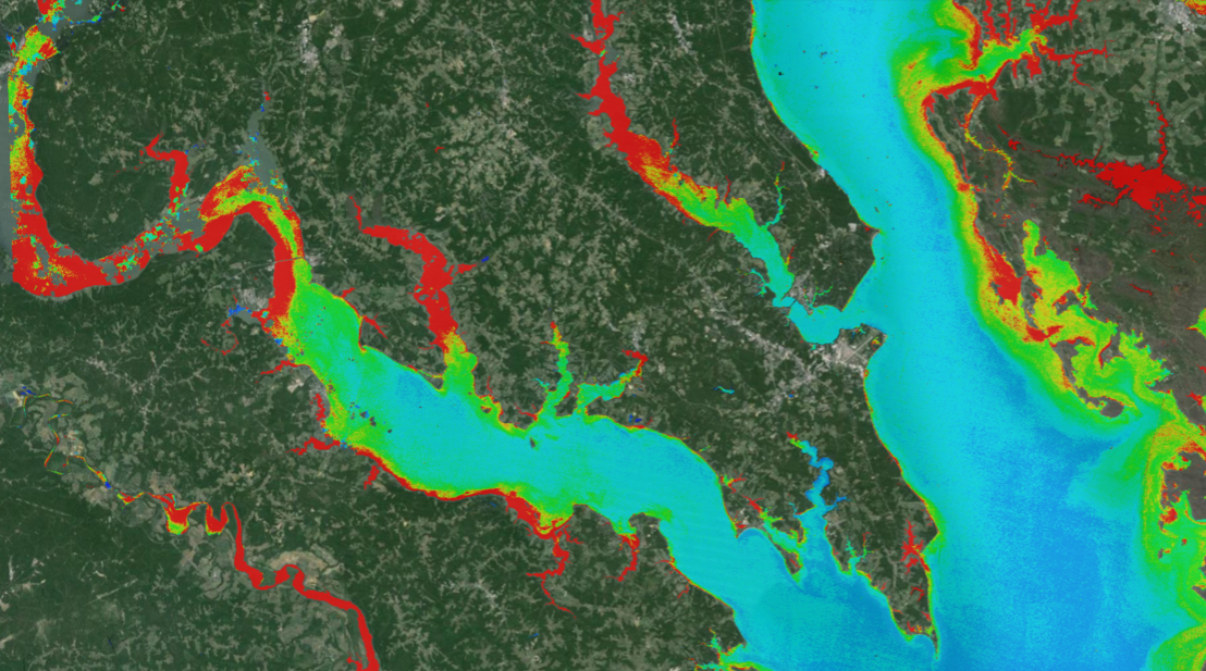
New Tool Provides Rapid Evaluation of Water Quality
A combination of Landsat and Sentinel-2 imagery, NASA near real-time data, and machine learning provides near real-time access to high-resolution water quality maps.
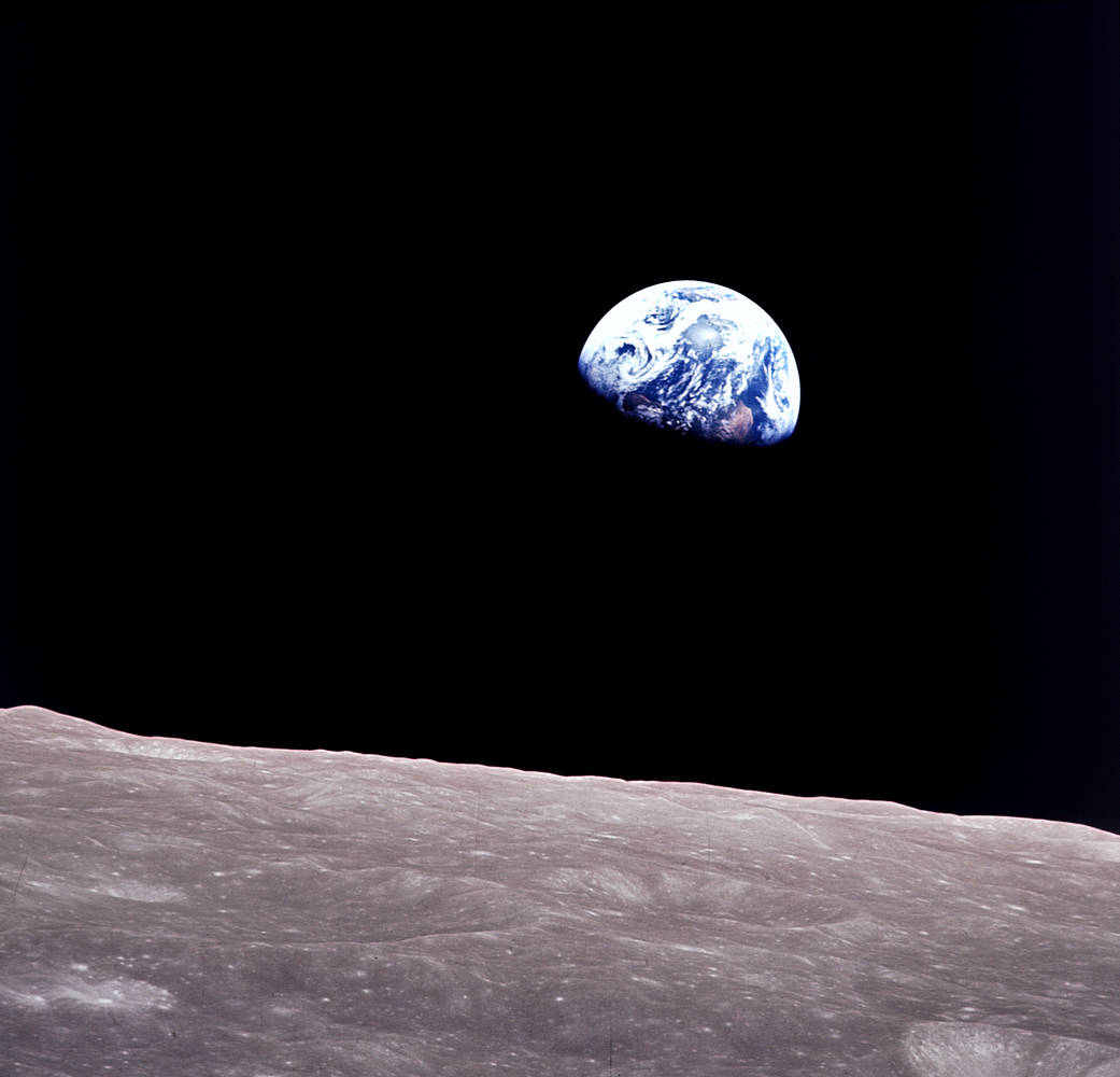
Remembering Bill Anders
Anders, 90, the astronaut who captured the iconic Earthrise photograph, died on June 7, 2024, when the plane he was piloting crashed into the San Juan Channel.

NASA Selects Raytheon Company to Build Landsat Next Instruments
NASA announced in a contract release that Raytheon Company will build the series of Landsat Next instruments. Landsat Next represents a quantum leap in measurement capabilities with improved temporal, spatial, and spectral resolutions.
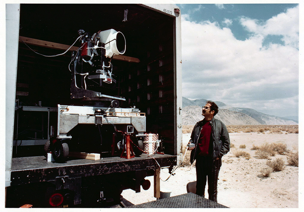
MSS You! Photos from a 1972 Road Trip
Two months before the launch of Landsat 1, the engineering model of the satellite’s multispectral scanner system went on a California road trip.

Landsat Observations Key Resource for Many Federal Agencies
In the FY23 Aeronautics and Space Report released on May 23, 2024, a multitude of Federal agencies report work informed by Landsat data.
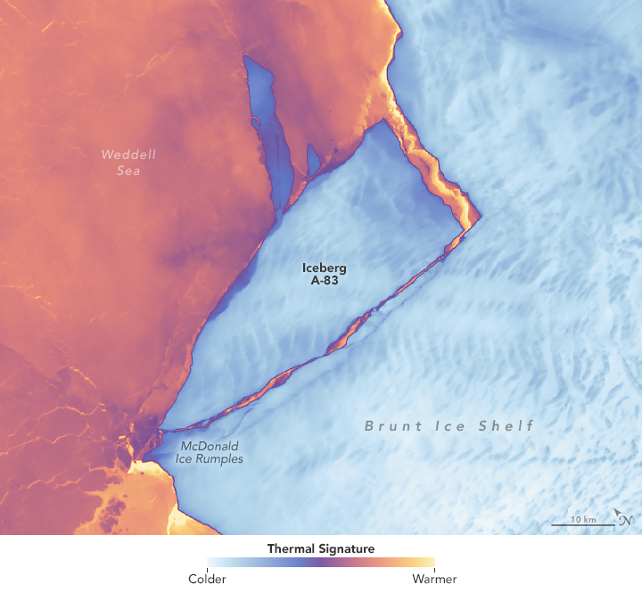
Antarctic Ice Shelf Spawns Iceberg A-83
The Brunt Ice Shelf lost a large wedge of floating ice, the third sizeable iceberg to calve from the shelf in recent years. The TIRS instrument on Landsat 9 captured false-color images of the calving.
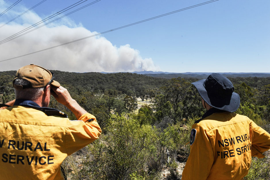
Spotted by Satellite: Situational Awareness in Fiery Times
The Australian company Indji Systems uses a variety of satellite data to provide real-time hazard monitoring and alerts to utility and renewable energy companies across Australia, North America and Europe.
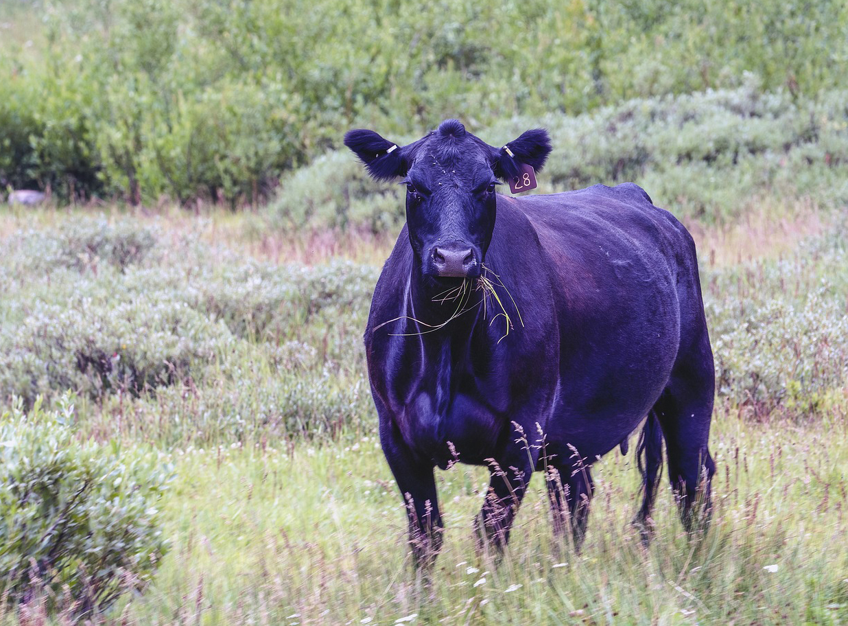
Meat of the Matter: Colorado River Over-Consumed
More water is taken from the Colorado River than it has to give. Better water use accounting made possible by Landsat provides needed guidance for difficult water use decisions.
NASA Selects Raytheon Company to Build Landsat Next Instruments
NASA announced in a contract release that Raytheon Company will build the series of Landsat Next instruments. Landsat Next represents a quantum leap in measurement capabilities with improved temporal, spatial, and spectral resolutions.
MSS You! Photos from a 1972 Road Trip
Two months before the launch of Landsat 1, the engineering model of the satellite’s multispectral scanner system went on a California road trip.
Landsat Observations Key Resource for Many Federal Agencies
In the FY23 Aeronautics and Space Report released on May 23, 2024, a multitude of Federal agencies report work informed by Landsat data.
Antarctic Ice Shelf Spawns Iceberg A-83
The Brunt Ice Shelf lost a large wedge of floating ice, the third sizeable iceberg to calve from the shelf in recent years. The TIRS instrument on Landsat 9 captured false-color images of the calving.
Spotted by Satellite: Situational Awareness in Fiery Times
The Australian company Indji Systems uses a variety of satellite data to provide real-time hazard monitoring and alerts to utility and renewable energy companies across Australia, North America and Europe.
Meat of the Matter: Colorado River Over-Consumed
More water is taken from the Colorado River than it has to give. Better water use accounting made possible by Landsat provides needed guidance for difficult water use decisions.
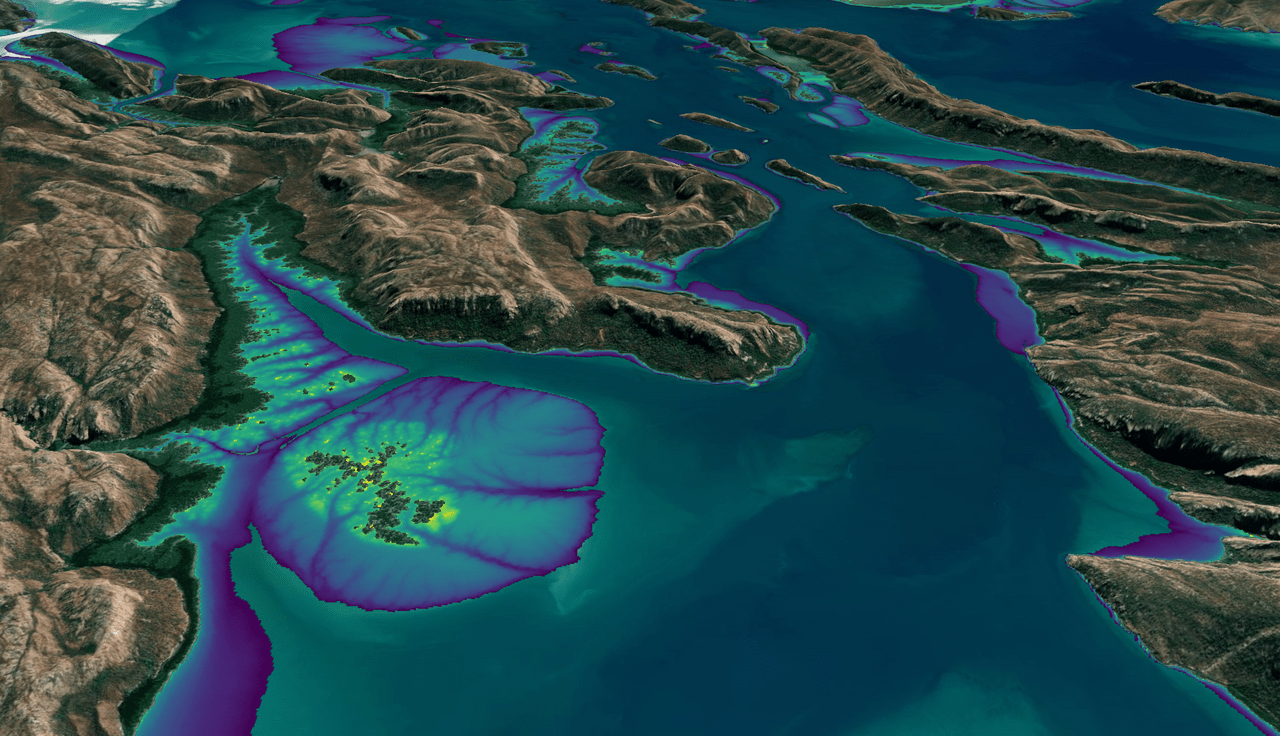
Australian Intertidal Zone Exposed: Landsat and Sentinel-2 Provide Information on Dynamic Region
This month, the Digital Earth Australia (DEA) team released a new Landsat and Sentinel-2 based intertidal data product. The new data set characterizes the tidal shoreline zone of Australia in more detail than ever before.
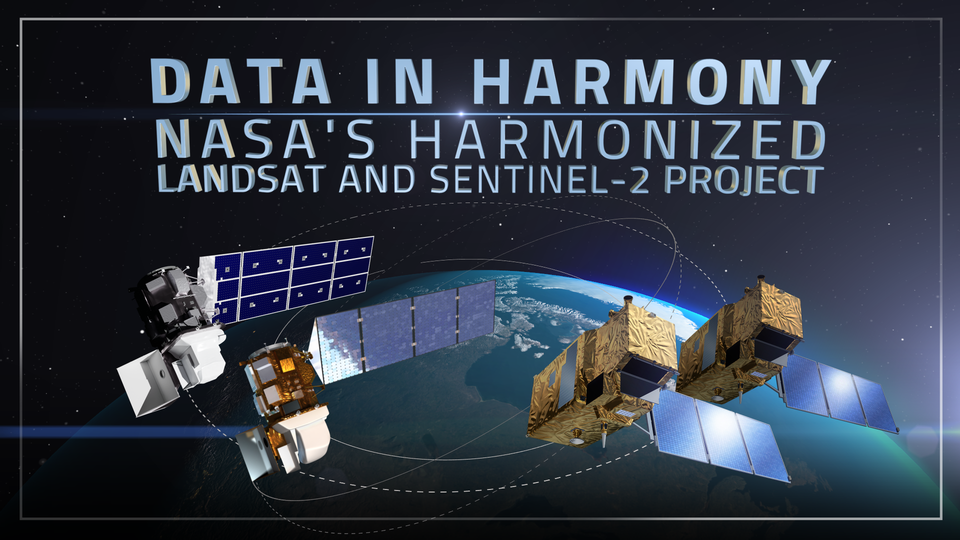
Data in Harmony: NASA’s Harmonized Landsat and Sentinel-2 Project
NASA’s Harmonized Landsat and Sentinel-2 (HLS) project is a groundbreaking initiative that combines data from Landsats 8 & 9 with the European Space Agency’s Sentinel-2A & 2B satellites.
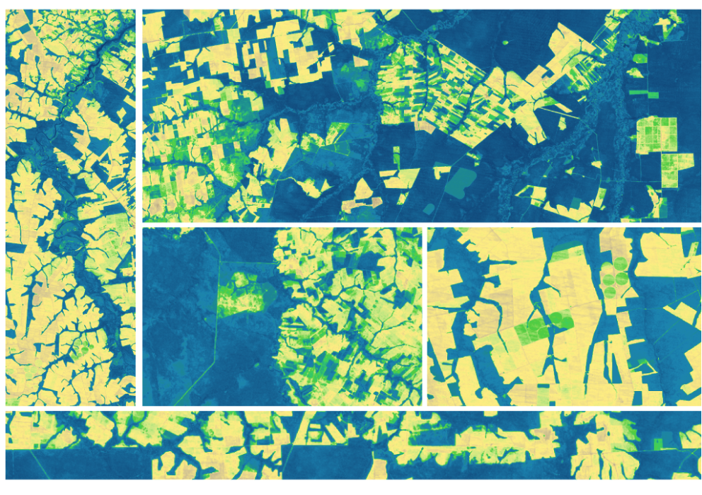
Expanding OpenET Across Amazon Basin
The research teams who help sustain the largest freshwater reserve in the world are developing a new tool to promote more resilient farming systems in Brazil. The goal is to help farmers better handle changes in the water cycle, deal with droughts, and adapt to a changing climate.
NASA Selects Raytheon Company to Build Landsat Next Instruments
NASA announced in a contract release that Raytheon Company will build the series of Landsat Next instruments. Landsat Next represents a quantum leap in measurement capabilities with improved temporal, spatial, and spectral resolutions.
MSS You! Photos from a 1972 Road Trip
Two months before the launch of Landsat 1, the engineering model of the satellite’s multispectral scanner system went on a California road trip.
Landsat Observations Key Resource for Many Federal Agencies
In the FY23 Aeronautics and Space Report released on May 23, 2024, a multitude of Federal agencies report work informed by Landsat data.
Antarctic Ice Shelf Spawns Iceberg A-83
The Brunt Ice Shelf lost a large wedge of floating ice, the third sizeable iceberg to calve from the shelf in recent years. The TIRS instrument on Landsat 9 captured false-color images of the calving.
Spotted by Satellite: Situational Awareness in Fiery Times
The Australian company Indji Systems uses a variety of satellite data to provide real-time hazard monitoring and alerts to utility and renewable energy companies across Australia, North America and Europe.
Meat of the Matter: Colorado River Over-Consumed
More water is taken from the Colorado River than it has to give. Better water use accounting made possible by Landsat provides needed guidance for difficult water use decisions.
Australian Intertidal Zone Exposed: Landsat and Sentinel-2 Provide Information on Dynamic Region
This month, the Digital Earth Australia (DEA) team released a new Landsat and Sentinel-2 based intertidal data product. The new data set characterizes the tidal shoreline zone of Australia in more detail than ever before.
Data in Harmony: NASA’s Harmonized Landsat and Sentinel-2 Project
NASA’s Harmonized Landsat and Sentinel-2 (HLS) project is a groundbreaking initiative that combines data from Landsats 8 & 9 with the European Space Agency’s Sentinel-2A & 2B satellites.
Expanding OpenET Across Amazon Basin
The research teams who help sustain the largest freshwater reserve in the world are developing a new tool to promote more resilient farming systems in Brazil. The goal is to help farmers better handle changes in the water cycle, deal with droughts, and adapt to a changing climate.
