
The Mechanics of Glacier Motion
Using Landsat 8 to document glacier velocity patterns on a mountain-range-wide scale.
How Louisiana's Coastal Marshes are Responding to Climate Change
Louisiana’s coastal marshes are responding to climate change.
Dust on a Glacier
The authors use Landsat imagery collected between 1996–2016 to analyze trends and variability in snow/ice albedo over the Himalayas.
The Eroding Hamlet of Paulatuk
The potential impacts of climate change on the Hamlet of Paulatuk in the Canadian Arctic are erosive.
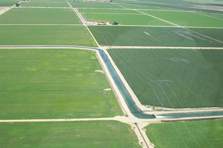
Watching Water Use in the Southwest
Water use trends observed in the Southwestern U.S. over three decades.
The Poleward March of Mangroves
Mangrove expansion has been observed in some subtropical locations around the world.
Reassessing Mass Balance in West Antarctica
Mr. Chuter presented a poster on new mass balance estimates and velocity changes for parts of West Antarctica.
Landsat Abounds at #AGU16
Over 375 presentations at this year’s AGU Fall feature Landsat.
Land Cover Matters: An Avian Flu Researcher Talks Landsat
We recently spoke with veterinary epidemiologist Todd Kelman from the University of Davis, California about his avian flu research. Todd has incorporated Landsat data into his research and we wanted to know more.
Landsat & Lasers: Your Job is to Monitor 860 Million Acres of Forest, Go!
Landsat Science Team member, Mike Wulder, spoke with the International Boreal Forest Research Association last year during their May 2015 conference in Rovaniemi, Finland.
14 Landsat Images Provided to International Charter, June 2016
These maps, provided to responders for free, often show where the damage is and where crisis victims are, allowing responders to plan and execute relief support.
Monitoring Coastline Change with Landsat
Q & A with John Trinder, a Professor Emeritus from the University of New South Wales, about using Landsat data to monitor coastal change.
A Cloud-Free Makeover of Google Maps Courtesy of Landsat 8
Google Maps Blog announced on June 26, 2016 that Google Maps and Google Earth have a new cloud-free mosaic based on Landsat 8 data.
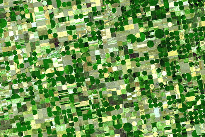
Agriculture: The View From Space
The Food and Agricultural Organization of the United Nations published an audio article about using geospatial data, including Landsat, to monitor would agriculture on soundcloud.
Restore-L Mission to Demonstrate Technology by Refueling Landsat 7
NASA moved forward with plans to execute the ambitious Restore-L mission, an endeavor to launch a robotic spacecraft in 2020 to refuel a live satellite. The current candidate client for this venture is USGS-operated Landsat 7.
Maker of a Miniature Landsat 8
We asked Mike what inspired him to create the miniature Landsat 8 and found out that making model spacecraft has been a lifetime hobby for him.
Flying High: Landsat 8 Sees the International Space Station
We are used to seeing photographs captured by the International Space Station, but on June 19, 2016 Landsat 8 caught a glimpse of the station itself.
Land Cover Matters: An Avian Flu Researcher Talks Landsat
We recently spoke with veterinary epidemiologist Todd Kelman from the University of Davis, California about his avian flu research. Todd has incorporated Landsat data into his research and we wanted to know more.
Landsat & Lasers: Your Job is to Monitor 860 Million Acres of Forest, Go!
Landsat Science Team member, Mike Wulder, spoke with the International Boreal Forest Research Association last year during their May 2015 conference in Rovaniemi, Finland.
14 Landsat Images Provided to International Charter, June 2016
These maps, provided to responders for free, often show where the damage is and where crisis victims are, allowing responders to plan and execute relief support.
Monitoring Coastline Change with Landsat
Q & A with John Trinder, a Professor Emeritus from the University of New South Wales, about using Landsat data to monitor coastal change.
A Cloud-Free Makeover of Google Maps Courtesy of Landsat 8
Google Maps Blog announced on June 26, 2016 that Google Maps and Google Earth have a new cloud-free mosaic based on Landsat 8 data.
Agriculture: The View From Space
The Food and Agricultural Organization of the United Nations published an audio article about using geospatial data, including Landsat, to monitor would agriculture on soundcloud.
Restore-L Mission to Demonstrate Technology by Refueling Landsat 7
NASA moved forward with plans to execute the ambitious Restore-L mission, an endeavor to launch a robotic spacecraft in 2020 to refuel a live satellite. The current candidate client for this venture is USGS-operated Landsat 7.
Maker of a Miniature Landsat 8
We asked Mike what inspired him to create the miniature Landsat 8 and found out that making model spacecraft has been a lifetime hobby for him.
Flying High: Landsat 8 Sees the International Space Station
We are used to seeing photographs captured by the International Space Station, but on June 19, 2016 Landsat 8 caught a glimpse of the station itself.
