Landsat 8 Satellite Begins Watch
NASA transferred operational control Thursday of the Landsat 8 satellite to the U.S. Geological Survey (USGS) in a ceremony in Sioux Falls, S.D.

NASA transferred operational control Thursday of the Landsat 8 satellite to the U.S. Geological Survey (USGS) in a ceremony in Sioux Falls, S.D.
From Russia to South Africa, Landsat observes land cover and land use change.
A new feature of the Landsat Data Continuity Mission will help ensure scientists get a cloud-free view of Earth from space.
Featured Landsat Videos + G2009-120_Landsat_Flyby_MASTER_ipod_lg – A short overview of how Landsat benefits people. + Landsat 8 Launch – Landsat 8 blasts off on an
+ Download Landsat eBook [46.8MB PDF] The Landsat Data Continuity Mission (LDCM), renamed Landsat 8 after launch, builds on a rich legacy of service to
Do you like exploring and viewing Earth from space? Do you like using satellite images, maps and other geospatial data? Do you like thinking in
NASA Wavelength is your pathway into a digital collection of Earth and space science resources for educators of all levels – from elementary to college,
Landsat has a long history of exploring Earth from Space. Use these resources to learn more about How Landsat Works, How Landsat Benefits Society, and
Thank you for choosing to host the NASA Landsat traveling exhibit! The documentation included below is designed to help ensure that your hosting experience is
Setting up is easy. Once Landsat: Seeing in a Different Light arrives, follow these steps to set up: Unscrew the four bolts using a
Hosting an exhibit can be a great way to bring current satellite science to your institution. See how Landsat has been observing our changing planet
Congratulations on being selected to host Landsat: Seeing in a Different Light! Soon you’ll be exploring Earth through Landsat satellite images with visitors from your
Landsat: Seeing in a Different Light Landsat: Seeing in a Different Light engages its audience through asking them to select different locations around the world,
Landsat is more than just a camera with a great zoom lens orbiting Earth. Landsat measures light reflected by Earth from the sun. The light
Surface reflectance is now available as a Landsat climate data record (CDR) product through EarthExplorer
The Thermal Infrared Sensor (TIRS) measures land surface temperature in two thermal bands with a new technology that applies quantum physics to detect heat. TIRS
The Operational Land Imager (OLI), built by the Ball Aerospace & Technologies Corporation, measures in the visible, near infrared, and short wave infrared portions of
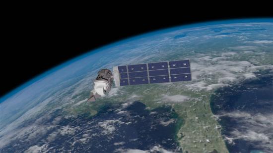
The Details Launch Date: February 11, 2013 Status: operational Sensors: OLI, TIRS Altitude: 705 km Inclination: 98.2° Orbit: polar, sun-synchronous Equatorial Crossing Time: nominally 10 AM (± 15 min.) local time (descending
Have you ever wondered what it might be like to watch the world fly by beneath you from space? That dream is elusive for most of us, but the Landsat Data Continuity Mission offers a vicarious flight with a crisper view than our eyes alone would be capable of if we were in space. That view is now available in a new NASA animation.
The Landsat Data Continuity Mission offers a look at Earth from space with a crisper view than our eyes alone would be capable of.
Google has compiled more than a quarter-century of images of Earth taken from space into an interactive time-lapse experience.
Within a week, hundreds of firefighters had contained the fire, limiting damage to just 16 buildings. That may seem like the end of the story, but for Burned Area Emergency Response (BAER) teams, the work just begins when the flames die down.
BAER t…
Images from Landsat satellites provided free to the public by the Department of the Interior’s U.S. Geological Survey were the starting points for “a new
On the beautifully clear Monday morning of Feb. 11, 2013, the Landsat Data Continuity Mission made its way from California’s Vandenberg Air Force Base to
As LDCM flew over Indonesia’s Flores Sea April 29, it captured an image of Paluweh volcano spewing ash into the air.
Source: NASA May 2, 2013 • All spacecraft and instrument systems continue to perform normally. LDCM continues to collect more than 400 scenes per day and the
Source: USGS Landsat May 1, 2013 • Since launch, the Landsat Data Continuity Mission (LDCM) has been gradually making its way to operational orbit (called WRS-2) at
Source: USGS Landsat May 1, 2013 • The workhorse of the Landsat 5 mission was the Thematic Mapper (TM) instrument. In November of 2011, the TM failed,
