
Presentation Title
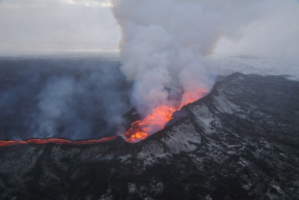
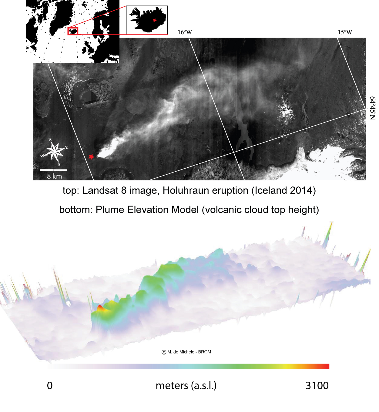
Extracting the Volcanic Ash Plume Elevation Model (PEM) from Landsat-8. Application to the 2014 Holuhraun (Iceland) Eruption
What are the major findings of this research?
For the first time, we present a method to extract a spatially detailed map of the height of the eruptive column from optical space-borne imagery. We called it “volcanic Plume Elevation Model” (PEM) in contrast to the well-known Digital Elevation Model (DEM) used for digital topographic height.
What are the implications of your findings? Why is it helpful to know volcanic plume heights?
There are many reasons why it is important to know precisely the volcanic plum heights. Among the others, the plume height controls the ashes injection into the atmosphere and consequently their dispersion around continents. Also, plume heights are controlled by the pressure in the magmatic chamber and other physical parameters that might be investigated indirectly using the PEM. Thirdly, I would add that PEMs can be extracted using archived satellite data—such as the Landsat legacy or the SPOT family (form the French Space Agency CNES); this would help in studying past eruptions such as the Pinatubo or Mount Saint Helene. Surely there are more reasons. More details can be found in our publication: de Michele et al., 2016.
What insight did you gain from Landsat 8 that would have been impossible to glean otherwise?
There are mainly two reasons. Firstly, we used Landsat 8 because at the time we developed the idea of the PEM, the Holuhraun (Iceland, 2014) eruption was going on and Landsat 8 captured it nicely. Secondly, the fact that Landsat data are freely available, helped us in speeding up the method development and assessment (for this, we are thankful to NASA/USGS).
In the future will using Landsat 8 data together with Sentinel-2a (and eventually 2b) be helpful to your research?
Definitely yes. The idea is to combine multiple sensors to improve observation frequency. Landsat OLI sensors arrangement in the focal plane is similar to Sentinel-2, which enable us to apply our methodology pretty straight forward to Sentinel 2. Moreover, Sentinel 2 has a repetition frequency improved with respect to Lansdat-8. Therefore, measurements can be done more often on a particular eruption. Besides, we have to say that the PEM extraction method can be applied to other push broom sensors such as SPOT-5 and Pleiades.
Co-authors:
Daniel Raucoules
French Geological Survey
Pordur Arason
Icelandic Meteorological Office
We are grateful to NASA/USGS for providing us with raw Landsat 8 images. The research leading to these results received funding from the European Commission Seventh Framework Program under the MED-SUV project.
Anyone can freely download Landsat data from the USGS EarthExplorer or LandsatLook.
Further Reading:
+ Landsat Abounds at #AGU16

Be Part of What’s Next: Emerging Applications of Landsat at AGU24
Anyone making innovative use of Landsat data to meet societal needs today and during coming decades is encouraged to submit and abstract for the upcoming “Emerging Science Applications of Landsat” session at AGU24.


