Source: British Antarctic Survey


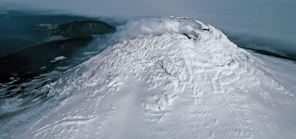
A team of scientists has discovered a rare lava lake on a remote and inaccessible sub-Antarctic island.
There are around 1500 land-based volcanoes on Earth, but despite the popular perception of steaming bubbling lava pools in their craters this volcano in the South Sandwich Islands is only the 8th to be identified worldwide to have a persistent lava lake.
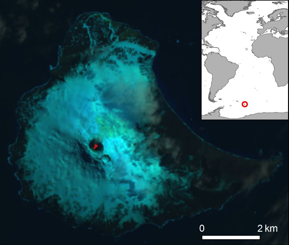
The discovery on Mount Michael on Saunders Island, reported this month (July 2019) in the journal Volcanology and Geothermal Research, was made using satellite images and is the first to be identified within the British overseas territory, South Georgia and the South Sandwich Islands.
In 2001, analysis of low-resolution satellite data revealed a geothermal anomaly but could not prove the existence of a lava lake. Now higher-resolution satellite images from 2003-2018 and advanced processing techniques have revealed a lake 90-215 meters in diameter with molten lava of 989-1279°C present throughout this period.
Author and geologist, Dr Alex Burton-Johnson from British Antarctic Survey, says:
“We are delighted to have discovered such a remarkable geological feature in the British Overseas Territory. Identifying the lava lake has improved our understanding of the volcanic activity and hazard on this remote island, and tells us more about these rare features, and finally, it has helped us develop techniques to monitor volcanoes from space.”
Lead author Danielle Gray from University College London says:
“Mount Michael is a volcano on a remote island in the Southern Ocean. It is extremely difficult to access, and without high-resolution satellite imagery it would have been very challenging to learn more about this amazing geological feature.”
The other seven lava lakes around the world are: Nyiragongo Volcano DR Congo; Erta Ale Volcano, Ethiopia; Mt Erebus, Antarctica; Mt Yasur Vanuatu; Kilauea, Hawaii and Ambrym, Vanuatu; Masaya, Nicaragua.
Reference:
Evidence for a lava lake on Mt. Michael volcano, Saunders Island (South Sandwich Islands) from Landsat, Sentinel-2 and ASTER satellite imagery by Gray, D.M., Burton-Johnson, A., Fretwell, P.T. is published in the Journal of Volcanology and Geothermal Research, 379, 60-71. DOI here: https://doi.org/10.1016/j.jvolgeores.2019.05.002
Related reading:
+ Rare Lava Lake Seen from Space, EarthSky


