Contributor: Laura E.P. Rocchio

The Prairie Pothole Region
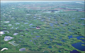
The Prairie Pothole Region (PPR) contains millions of these small depressional wetlands; together, they are considered North America’s most productive waterfowl breeding ground. Climate change and anthropogenic pressures (namely, coincident agriculture) affect water flow to this dynamic wetland system. These pressures threaten the existence of the pothole wetlands, and wetland losses could mean diminished down-stream water quality and significant waterfowl population losses. PPR wetland managers need long-term observational data to better understand these wetland stressors.
Landsat’s Forte
The massive size of the PPR and the small, dynamic nature of the potholes have made wetland monitoring challenging. While ground water records exist, surface water measurements have not been systematically made. Given Landsat’s relatively wide swath width (~182 km), moderate spatial resolution (30 m pixels), and long historic archive, researchers Ofer Beeri and Rebecca Phillips found Landsat data well suited for measuring the historical water surface area variations of prairie potholes.
Using a subset of the PPR as their study site, Beeri and Phillips came up with a method to accurately separate pothole wetlands from surrounding vegetation and to then measure the fluctuating size of those wetlands on a seasonal basis between 1997 and 2005. Their research found that over those years, pothole water surface area was reduced by 50%. They attribute this massive reduction to reduced snowfall and local agricultural water uses, among other factors. Landsat helped them to fill a gap in the knowledge about this dynamic landscape. They suggest that their Landsat-based monitoring approach can advance ongoing efforts to better understand how climate change and anthropogenic pressures are affecting this important ecosystem: and that’s what Landsat, prairie potholes, and climate change have in common!
References:
Beeri, O. and R. Phillips (2007). Tracking palustrine water seasonal and annual variability in agricultural wetland landscapes using Landsat from 1997 to 2005. Global Change Biology, vol. 13, pp: 897–912.
U.S. Global Change Research Program, Changes in Ecosystems; USGCRP Fiscal Year 2006 Accomplishments. Webpage accessed Sept. 30, 2008.

Be Part of What’s Next: Emerging Applications of Landsat at AGU24
Anyone making innovative use of Landsat data to meet societal needs today and during coming decades is encouraged to submit and abstract for the upcoming “Emerging Science Applications of Landsat” session at AGU24.


