
 Ellie Leydsman McGinty is a researcher in the Remote Sensing/GIS Laboratory of Utah State University in Logan, Utah.
She’s also the State Coordinator for UtahView, part of the USGS-funded AmericaViewprogram that helps member states use publicly available remote sensing resources—like NASA/USGS Landsat data—to meet environmental planning and management needs.
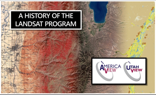
Recently, McGinty developed an interactive Google Earth Web Map of the Landsat Program’s long history.
We had the opportunity to talk with her about this project, read our interview here:
What inspired you to create the Google Earth Tour Map “A History of the Landsat Program”?
Through the AmericaView Program, each StateView is given an opportunity to apply for annual mini-grants that further the understanding of remote sensing and Earth observation. These mini-grants are often used to develop unique small projects that support the overall AmericaView mission, as well as the individual missions or objectives of the various StateViews.
One of the primary goals of UtahView is to develop educational materials that facilitate geospatial research and understanding at all levels. As the UtahView State Coordinator, I am generally responsible for developing these educational materials and setting up outreach events. As the AmericaView mini-grant program solicitation was announced, I began thinking of creative ways that I could use freely available online resources and Landsat material to further Earth observation education. One of my goals was to do this in an atypical manner that was captivating and interactive (i.e. not your typical academic setting or approach).
UtahView, as well as many other StateViews, use Google Earth Engine to develop educational materials and to analyze Landsat datasets. Google Earth Engine is just one of the Google Earth Outreach tools that has been developed to support and promote geospatial understanding. Google Earth Web and Google Tour Building are two Google Earth Outreach tools that support exploration, visualization, and storytelling.
I decided upon Google Earth Web because it allows users to turn the digital globe into a storytelling canvas that can be enhanced with rich contextual information, including images, text, links, and videos. As part of the mini-grant, I proposed to develop two tours. The concept for the first tour came to me straight away. As a cartographer and remote sensing scientist, I have always been fascinated with the USGS Earth As Art collections. Therefore, I decided to create an interactive tour of the Earth As Art 4 collection.

As I was brainstorming this first tour, I started thinking about the marvels of the Landsat Program. While I have worked with Landsat data since 2006, I realized that I knew very little about the history of the Landsat Program. I started wondering how such an amazing program was conceived. Since I am quite interested in history, I figured that this would be an interesting topic to cover using a creative and interactive platform.
After doing the historical research needed to build the Tour Map, what did you find most interesting about the Landsat program history?
As I mentioned, I knew very little about the history of the Landsat Program, with the exception of knowing about the different Landsat missions. Therefore, I found nearly everything that I researched and learned quite fascinating. With that said, the one theme that I found most interesting was the political and financial obstacles that the Landsat Program encountered throughout the years.
While I was developing the tour, I kept thinking to myself how often the Landsat Program could have failed or been terminated if it hadn’t been for the right set of circumstances. I kept asking myself questions about different scenarios. For instance, what would have happened if the MSS sensor hadn’t been developed by Virginia Norwood and associates? Well, if the MSS sensor hadn’t been developed, it may have been likely that the ERTS-1 mission would have been considered a failure because the RBV sensor failed within the first month of flight. Or, what if Dan Quayle was unable to procure emergency funding to sustain the program? Well, we know what would have happened there…NOAA ordered EOSAT to prepare the shutdown of Landsat 4 and Landsat 5.
After developing this tour, I have a much greater appreciation for and understanding of the Landsat Program. I hope this tour fosters that in others as well.
The Landsat Program is a truly remarkable program that has persisted because of influential and dedicated individuals and despite significant financial and legislative hurdles.
How would you describe the significance of Landsat in the world of remote sensing and Earth observation?
The Landsat Program continues to be one of the most valuable, respected, and referenced Earth observation programs in the world. While there are currently a number of other satellite-based Earth observation platforms, Landsat is the pioneer. When the EROS (Landsat) Program was announced in 1966, it was believed that satellite-based Earth observation systems could be used to support a wide range of natural resource and environmental applications and studies. While these assertions were somewhat speculative at the time, research throughout the years has proven that Landsat data have become an invaluable and fundamental resource for addressing scientific questions, monitoring the Earth over time, and supporting decision-making. Additionally, when the Landsat data archive became available for download at no charge, a new precedent was set that enabled users throughout the world to access an indispensable record.
+ Visit “A History of the Landsat Program”
And, if you like interactive map features, be sure to also check out the USGS Landsat 9 Road to Launch StoryMap!
Any use of trade, firm, or product names does not imply endorsement by the U.S. Government.


