
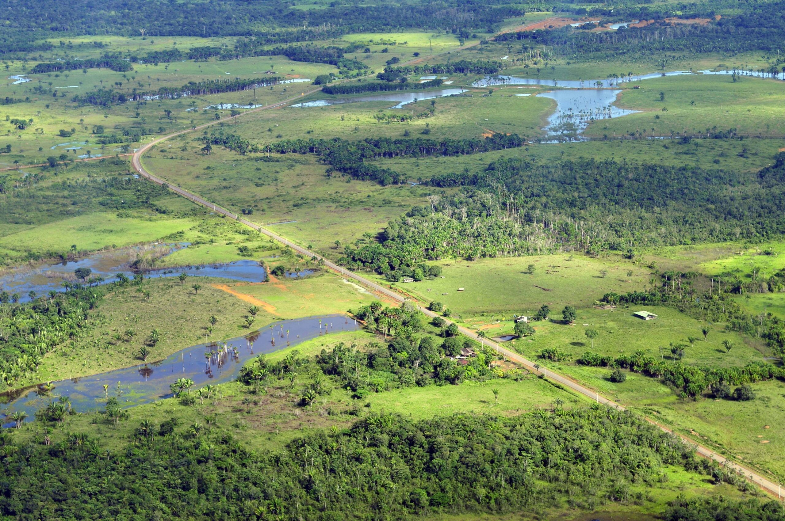
Reading the Landscape
More than 100 countries at the UN Climate Change Conference this past year made the bold commitment to halt and reverse deforestation by 2030.
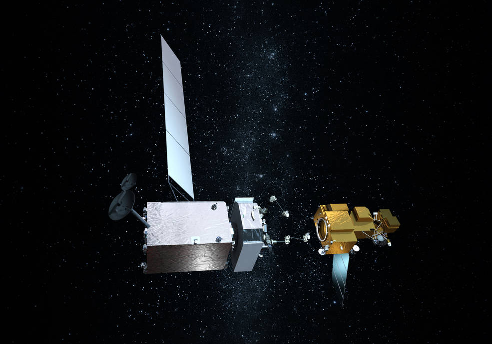
Technology Transfer: NASA Satellite Servicing Technologies
Northrop Grumman recently signed agreements to license three technologies from NASA related to satellite servicing.
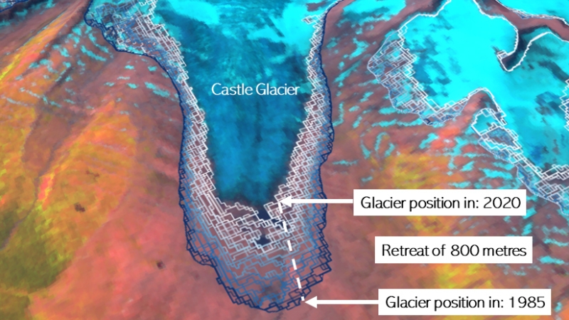
Landsat Shows Western Canada’s Glaciated Environments Rapidly Changing
A new mapping tool developed by UNBC researchers shows that western Canadian glaciers are shrinking at an increasing rate.
Pecora 22: Call for Abstracts
From October 23 – 28, 2022, Pecora 22 will focus on all aspects of Earth observation, spanning scientific discoveries to operational applications, and from sensors to decisions.
Landsat 9 to Provide a Wealth of Data to Landsat Archive
Launched September 27, Landsat 9 will provide a high-quality and reliable stream of land imaging data for the next 10-plus years.
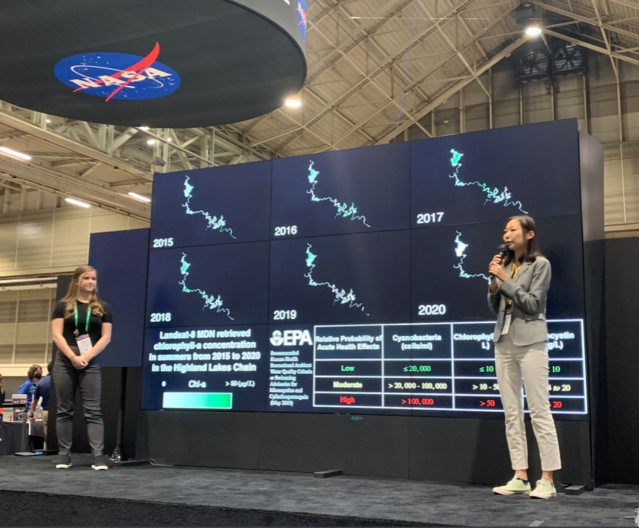
Landsat at #AGU21
This year at the Fall AGU conference, 409 Landsat-related presentations were given.
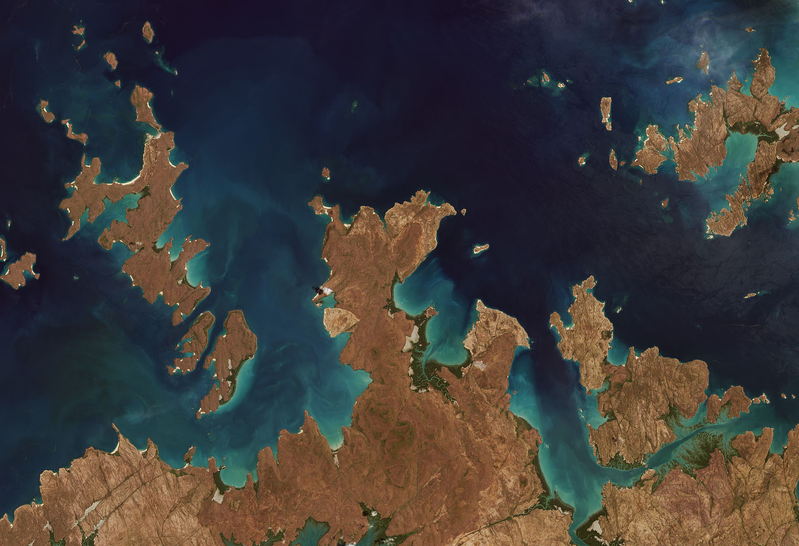
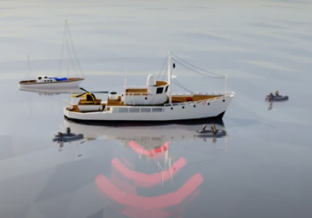
Shifting Shores of the Australian Continent Mapped with Landsat
Using decades of Landsat satellite imagery, scientists at Geoscience Australia have mapped annual shoreline locations for the entirety of Australia going back more than thirty years.
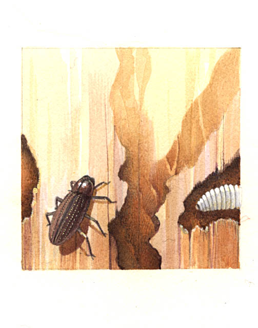
Diagnosis from the Sky: Catching Insect Infestations within Forests Before It’s Too Late
Fine-tuning remote sensing to protect forests from the spread of dangerous critters.
Reading the Landscape
More than 100 countries at the UN Climate Change Conference this past year made the bold commitment to halt and reverse deforestation by 2030.
Technology Transfer: NASA Satellite Servicing Technologies
Northrop Grumman recently signed agreements to license three technologies from NASA related to satellite servicing.
Landsat Shows Western Canada’s Glaciated Environments Rapidly Changing
A new mapping tool developed by UNBC researchers shows that western Canadian glaciers are shrinking at an increasing rate.
Pecora 22: Call for Abstracts
From October 23 – 28, 2022, Pecora 22 will focus on all aspects of Earth observation, spanning scientific discoveries to operational applications, and from sensors to decisions.
Landsat 9 to Provide a Wealth of Data to Landsat Archive
Launched September 27, Landsat 9 will provide a high-quality and reliable stream of land imaging data for the next 10-plus years.
Landsat at #AGU21
This year at the Fall AGU conference, 409 Landsat-related presentations were given.
Shifting Shores of the Australian Continent Mapped with Landsat
Using decades of Landsat satellite imagery, scientists at Geoscience Australia have mapped annual shoreline locations for the entirety of Australia going back more than thirty years.
Diagnosis from the Sky: Catching Insect Infestations within Forests Before It’s Too Late
Fine-tuning remote sensing to protect forests from the spread of dangerous critters.
Intern with Our Outreach Team
Do you design interactive media? Consider interning with the Landsat outreach team.
