
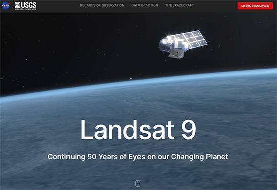
NASA Unveils New Interactive Website Ahead of Landsat 9 Launch
A new interactive Landsat 9 website has gone live.

Meet the Landsat 9 Team: Matt Johnson
This is the first in a series of five features introducing members of the Landsat 9 team.
Landsat 9 Passes Last Key Decision Point Before Launch
The Landsat 9 project has passed its final major lifecycle approval gateway.
Landsat Sees Dr. Beach’s Top 10 Beaches of 2021
For over 30 years, Dr. Beach, aka Dr. Stephen Leatherman, a professor and coast geomorphologist at Florida International University, has created a Top 10 Beach list based on criteria including water and sand quality, safety, and management. You can find his 2021 picks here and see how Landsat views them as well.
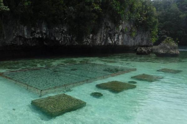
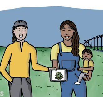
Planning the Future of Palau Fish Stocks with Satellites
In Micronesia, the nation of Palau is building sustainable aquaculture farms in the ocean with the help of satellites.
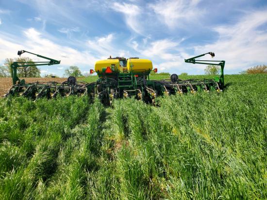
Shoring up the Corn Belt’s Soil Health
Soil is the foundation of our food systems, and sustainable farming depends upon healthy soil, which has impacts far beyond the field on air, water and climate.

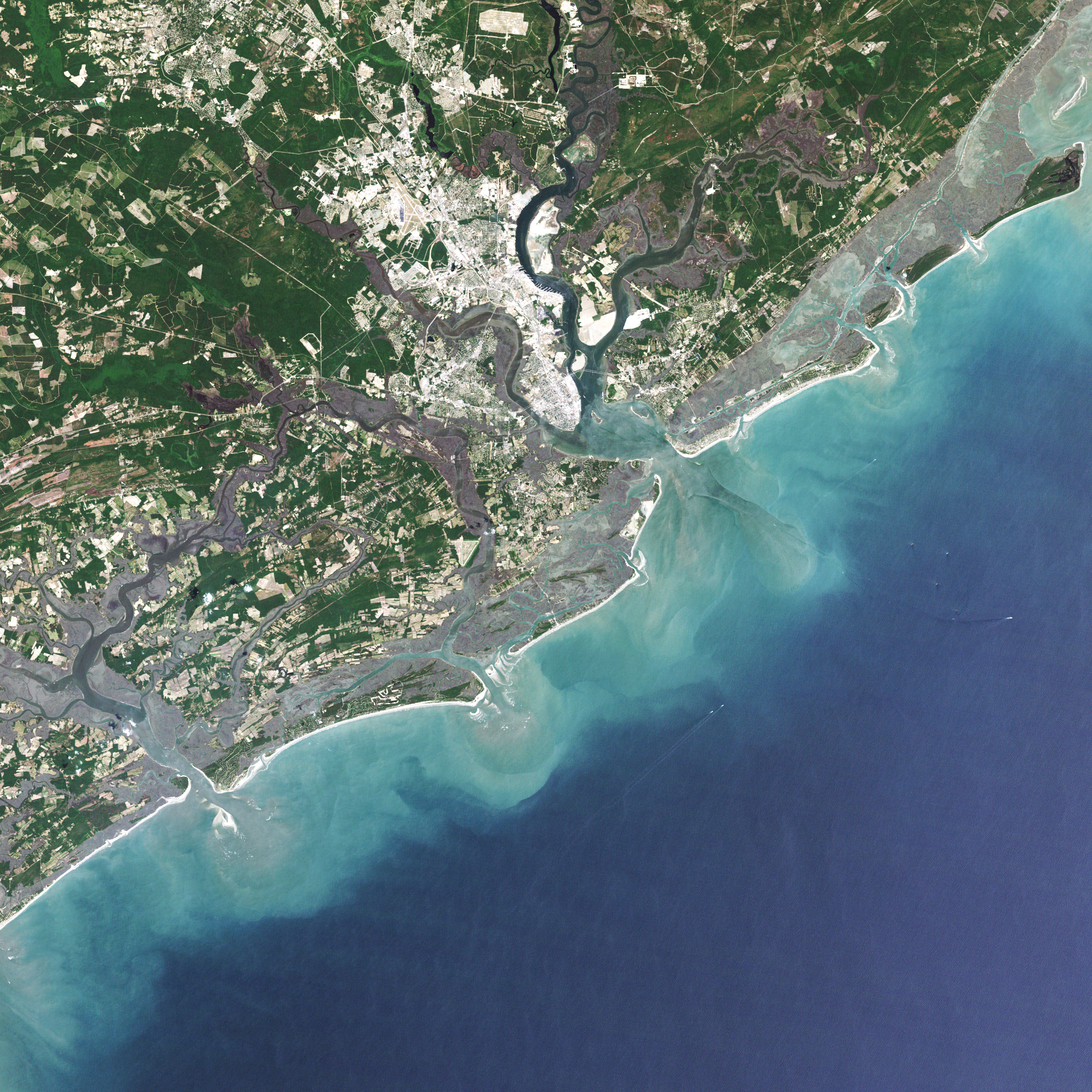
Landsat 9 at Work
For five decades, we have relied on Landsat’s high-quality, science-quality observations to understand and protect our home planet.
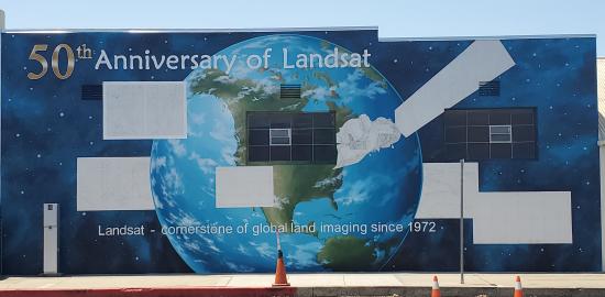
History within the Mural
A mural celebrating Landsat’s 50 year history is being painted in Lompoc, California.

Virginia T. Norwood, Engineer Responsible for First Landsat Multispectral Scanner, Receives 2021 ASPRS Lifetime Achievement Award
Top honors were bestowed upon Virginia Norwood in recognition of her far-reaching impact on the field of remote sensing.

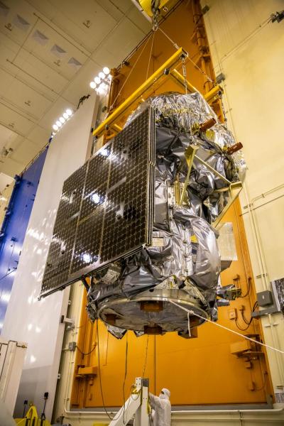
Landsat 9 Completes Test Simulating Harsh Space Environment
The Landsat 9 satellite has successfully completed its most strenuous environmental test leading up to launch.

Data Chat with Dr. Jeffrey Masek
The Harmonized Landsat Sentinel-2 (HLS) project offers daily, 30-meter global land surface data products to facilitate a wide range of terrestrial Earth science research.
New USGS Case Studies Highlight Female Landsat Data Users
During the month of March, as we collectively celebrate Women History’s Month, we want to share a fantastic trio of user case study videos published by the U.S. Geological Survey.

Justin Braaten has the Code
Justin Braaten is a code wizard, helping everyone from wildlife ecologists to machine learning experts more easily use Landsat.
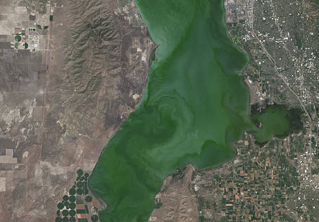
Landsat Satellite Data Warns of Harmful Algal Blooms
Landsat helps water resource managers know where to look for dangerous algal blooms in Utah lakes.
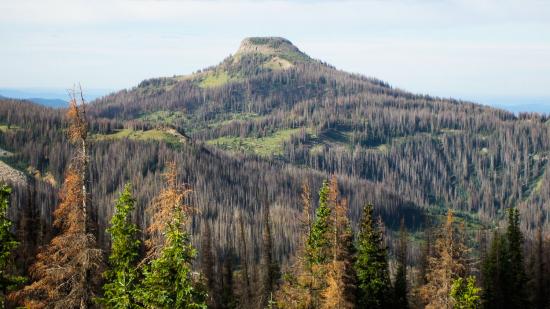
Twenty Years of Bark Beetle Activity Tracked Across Colorado Forests
More than two decades worth of Landsat satellite imagery was used to quantify how beetle outbreaks have impacted high-elevations forests in Colorado, southern Wyoming, and northern New Mexico.
Economics of Nature: Mapping Liberia’s Ecosystems to Understand Their Value
The Liberian government, with the help of NASA and Conservation International, is using Landsat and GEDI data to estimate the country’s natural capital.
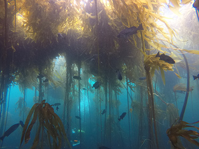
Landsat Shows the Collapse of Northern California Kelp Forests
Most of Northern California’s kelp forest ecosystem is gone, replaced by widespread ‘urchin barrens’ that may persist long into the future, according to a new study.
Virginia T. Norwood, Engineer Responsible for First Landsat Multispectral Scanner, Receives 2021 ASPRS Lifetime Achievement Award
Top honors were bestowed upon Virginia Norwood in recognition of her far-reaching impact on the field of remote sensing.
Landsat 9 Completes Test Simulating Harsh Space Environment
The Landsat 9 satellite has successfully completed its most strenuous environmental test leading up to launch.
Data Chat with Dr. Jeffrey Masek
The Harmonized Landsat Sentinel-2 (HLS) project offers daily, 30-meter global land surface data products to facilitate a wide range of terrestrial Earth science research.
New USGS Case Studies Highlight Female Landsat Data Users
During the month of March, as we collectively celebrate Women History’s Month, we want to share a fantastic trio of user case study videos published by the U.S. Geological Survey.
Justin Braaten has the Code
Justin Braaten is a code wizard, helping everyone from wildlife ecologists to machine learning experts more easily use Landsat.
Landsat Satellite Data Warns of Harmful Algal Blooms
Landsat helps water resource managers know where to look for dangerous algal blooms in Utah lakes.
Twenty Years of Bark Beetle Activity Tracked Across Colorado Forests
More than two decades worth of Landsat satellite imagery was used to quantify how beetle outbreaks have impacted high-elevations forests in Colorado, southern Wyoming, and northern New Mexico.
Economics of Nature: Mapping Liberia’s Ecosystems to Understand Their Value
The Liberian government, with the help of NASA and Conservation International, is using Landsat and GEDI data to estimate the country’s natural capital.
Landsat Shows the Collapse of Northern California Kelp Forests
Most of Northern California’s kelp forest ecosystem is gone, replaced by widespread ‘urchin barrens’ that may persist long into the future, according to a new study.
