
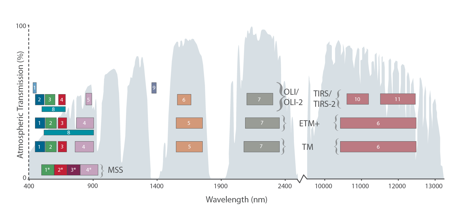
The Intervening Atmosphere: Tracing the Provenance of a Favorite Landsat Infographic
Learn more about the atmospheric transmission data used for our Landsat spectral band comparison graphic.
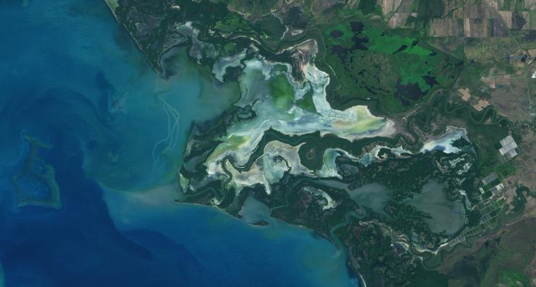
NASA Study Maps the Roots of Global Mangrove Loss
Using Landsat, researchers have created the first map of the causes of change in global mangrove habitats between 2000 and 2016—a valuable tool to aid conservation efforts for these vital coastline defenders.
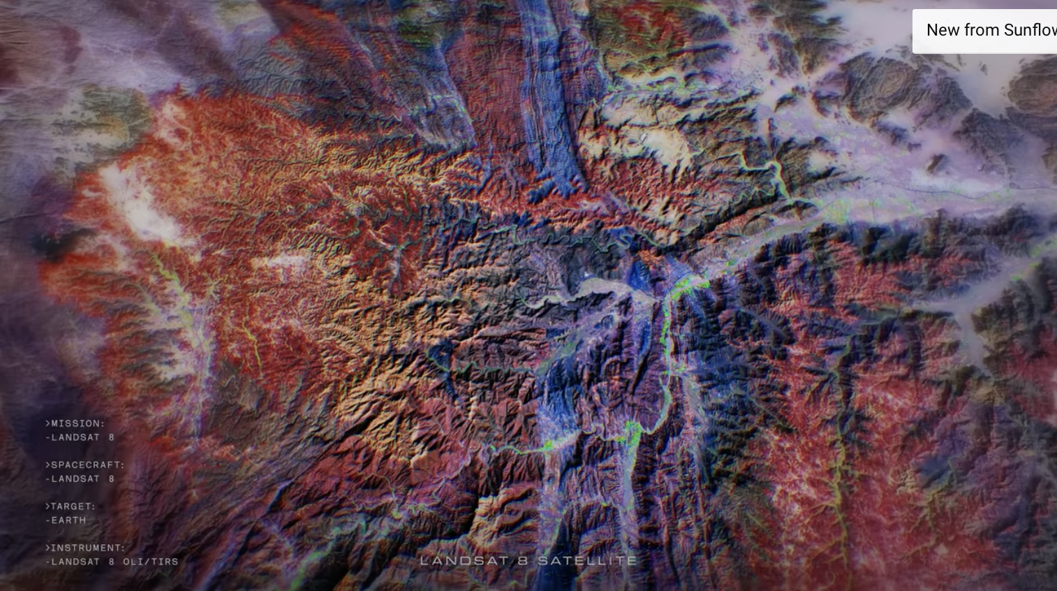
‘Hyperlife’ Video from Beck/NASA Collaboration Features Landsat 8
In Beck’s “Hyperlife” video, the abstract beauty of our planet morphs from geographic location-to-location with the flow of the etherial track.

Virginia T. Norwood: The Mother of Landsat
We have Virginia Norwood to thank for the design and engineering that made the Landsat program a success and set the path for modern Earth observation.

Student Liza Goldberg Uses National Geographic Young Explorers Grant to Bring Satellite Imagery into Classrooms
Goldberg will launch Cloud to Classroom, an innovative project that uses satellite imagery to help K-12 classrooms understand global environmental change through remote sensing.
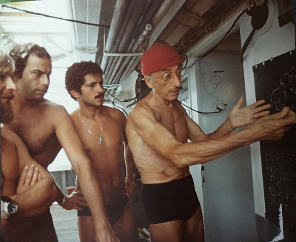
Chasing Satellites with Jacques Cousteau
In August 1975, Jacques Cousteau and his divers helped determine if Landsat could measure the depth of shallow ocean waters.
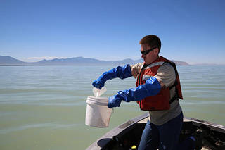
Early Detection of Algae ‘Blooms’ by Satellite Yields Healthcare Savings
The use of satellite data by environmental managers tracking harmful algal bloom outbreaks along lakefronts and coasts can result in earlier detections that yield significant savings on healthcare, lost work hours and other economic costs.
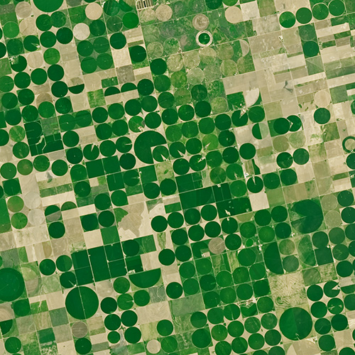
Agriculture: The View From Space
The Food and Agricultural Organization of the United Nations published an audio article about using geospatial data, including Landsat, to monitor would agriculture on soundcloud.
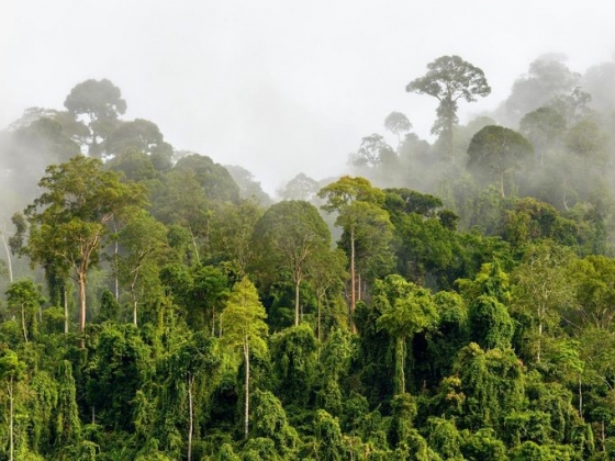
Pinpointing Tropical Forests with High Ecological ‘Quality’
Landsat and ICESat-2 satellite data have made it possible for scientists to develop maps showing the “quality” of tropical forests.
The Intervening Atmosphere: Tracing the Provenance of a Favorite Landsat Infographic
Learn more about the atmospheric transmission data used for our Landsat spectral band comparison graphic.
NASA Study Maps the Roots of Global Mangrove Loss
Using Landsat, researchers have created the first map of the causes of change in global mangrove habitats between 2000 and 2016—a valuable tool to aid conservation efforts for these vital coastline defenders.
‘Hyperlife’ Video from Beck/NASA Collaboration Features Landsat 8
In Beck’s “Hyperlife” video, the abstract beauty of our planet morphs from geographic location-to-location with the flow of the etherial track.
Virginia T. Norwood: The Mother of Landsat
We have Virginia Norwood to thank for the design and engineering that made the Landsat program a success and set the path for modern Earth observation.
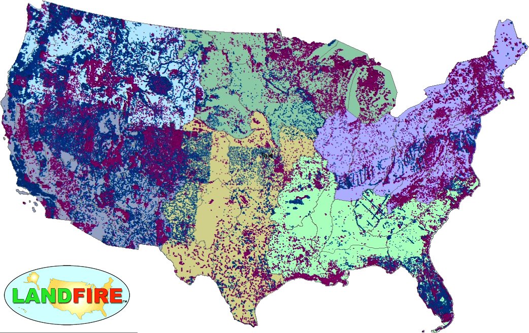
LANDFIRE Remap Is Here
LANDFIRE has released its Remap dataset; new techniques and new data provide significant improvement.
Student Liza Goldberg Uses National Geographic Young Explorers Grant to Bring Satellite Imagery into Classrooms
Goldberg will launch Cloud to Classroom, an innovative project that uses satellite imagery to help K-12 classrooms understand global environmental change through remote sensing.
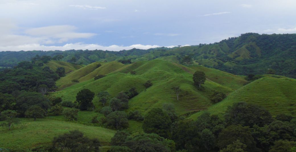
Using Landsat Data to Assess Regeneration in Tropical Forests
A team of Boise State researchers is helping forecast tropical forest recovery from deforestation using Landsat satellite data.
Chasing Satellites with Jacques Cousteau
In August 1975, Jacques Cousteau and his divers helped determine if Landsat could measure the depth of shallow ocean waters.
Pinpointing Tropical Forests with High Ecological ‘Quality’
Landsat and ICESat-2 satellite data have made it possible for scientists to develop maps showing the “quality” of tropical forests.
The Intervening Atmosphere: Tracing the Provenance of a Favorite Landsat Infographic
Learn more about the atmospheric transmission data used for our Landsat spectral band comparison graphic.
NASA Study Maps the Roots of Global Mangrove Loss
Using Landsat, researchers have created the first map of the causes of change in global mangrove habitats between 2000 and 2016—a valuable tool to aid conservation efforts for these vital coastline defenders.
‘Hyperlife’ Video from Beck/NASA Collaboration Features Landsat 8
In Beck’s “Hyperlife” video, the abstract beauty of our planet morphs from geographic location-to-location with the flow of the etherial track.
Virginia T. Norwood: The Mother of Landsat
We have Virginia Norwood to thank for the design and engineering that made the Landsat program a success and set the path for modern Earth observation.
LANDFIRE Remap Is Here
LANDFIRE has released its Remap dataset; new techniques and new data provide significant improvement.
Student Liza Goldberg Uses National Geographic Young Explorers Grant to Bring Satellite Imagery into Classrooms
Goldberg will launch Cloud to Classroom, an innovative project that uses satellite imagery to help K-12 classrooms understand global environmental change through remote sensing.
Using Landsat Data to Assess Regeneration in Tropical Forests
A team of Boise State researchers is helping forecast tropical forest recovery from deforestation using Landsat satellite data.
Chasing Satellites with Jacques Cousteau
In August 1975, Jacques Cousteau and his divers helped determine if Landsat could measure the depth of shallow ocean waters.
