
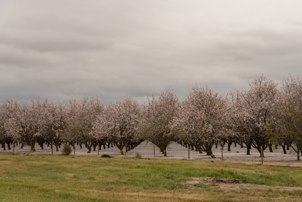
Towards Agricultural Sustainability of Fruit and Nut Trees in California’s Central Valley
A robust detection method to track crop cover dynamics and identify the planting year through Landsat time series data.
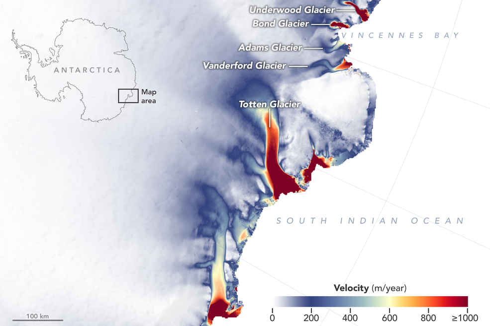
More Glaciers in East Antarctica Are Waking Up
New detailed NASA maps of ice velocity and elevation show that a group of glaciers spanning one-eighth of East Antarctica’s coast have begun to lose ice over the past decade, hinting at widespread changes in the ocean.

Mapping Circulation Patterns of Icy Fjords
“Great insight comes from thinking in multi-sensor and using several constellations together.”

Landsat at #AGU18
Learn what scientists, researchers, and students are doing with Landsat data this year at AGU 2018.
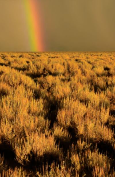
Post-fire Sagebrush Recovery Looks to Landsat Time Series Data for Solutions
USGS scientists are working with the Landsat-based NLCD shrubland dataset to help land managers restore native sagebrush landscapes.

Stanford Researchers Find That a Drying Canadian Delta has Driven Muskrat Population Decline
Stanford research shows the drying trend in Canada’s Peace-Athabasca Delta is linked to the long-term decline in populations of the semi-aquatic muskrat.
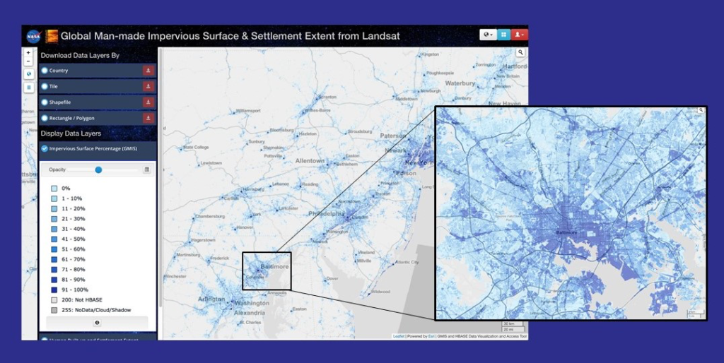
NASA Webinar on Mapping Global Urbanization with Landsat and High-Resolution Reference Data Held Nov. 14
Webinar described the production of the Global Man-made Impervious Surface dataset and its companion urban extent dataset called Human Built-up And Settlement Extent.
Poster Featuring Landsat-based Research Wins 2018 NRCan Map Contest
Access to image data collected by the Landsat series of satellites has improved Canada’s ability to observe, track and study forest disturbances.
"Landsat 10-Era" Concepts Wanted
NASA and USGS are seeking information on system concepts and innovative approaches for its second Sustainable Land Imaging Architecture Study.
Q&A with Tim Newman: A USGS Look at Landsat's Potential Future
Source: USGS EROS When it comes to the business of acquiring remotely sensed data, of preserving that data and providing a portal to it, National Land Imaging Program Coordinator Tim
AmericaView Secures 5-Year USGS National Land Imaging Grant
A five-year, $6.25 million dollar grant to support nationwide remote sensing education, outreach, and research has been granted to AmericaView.
Review Panels Ensure USGS, NASA Don’t Pay ‘the Price of Failure’ with Landsat 9
Agencies like NASA and the U.S. Geological Survey (USGS) that commit multiple millions of dollars to put Landsat satellites into space need to know that the spacecraft, the sensors onboard, the ground system operating the satellite, and the launch vehicle are all designed and built the right way.
The Lewis and Clark Trail from Space
Explore the Lewis and Clark National Historic Trail with an interactive storymap.

Satellites on Toxic Algae Patrol
Increasingly, water managers are turning to satellites like Landsat to monitor inland waters.
Landsat 9 Ground System Meets Design Criteria to Move Forward
Independent review panel unanimously agreed that the Landsat 9 Ground System Critical Design Review met all of the criteria for critical design.

Earth Images Enable Near-Perfect Crop Predictions
Boston-based startup TellusLabs uses Landsat and MODIS images to predict corn and soy yields with remarkable accuracy.
Landsat 9 Ground System Critical Design Review
The Landsat 9 Ground System Critical Design Review (GCDR) is taking place September 24 & 25th in Brandon, South Dakota.
"Landsat 10-Era" Concepts Wanted
NASA and USGS are seeking information on system concepts and innovative approaches for its second Sustainable Land Imaging Architecture Study.
Q&A with Tim Newman: A USGS Look at Landsat's Potential Future
Source: USGS EROS When it comes to the business of acquiring remotely sensed data, of preserving that data and providing a portal to it, National Land Imaging Program Coordinator Tim
AmericaView Secures 5-Year USGS National Land Imaging Grant
A five-year, $6.25 million dollar grant to support nationwide remote sensing education, outreach, and research has been granted to AmericaView.
Review Panels Ensure USGS, NASA Don’t Pay ‘the Price of Failure’ with Landsat 9
Agencies like NASA and the U.S. Geological Survey (USGS) that commit multiple millions of dollars to put Landsat satellites into space need to know that the spacecraft, the sensors onboard, the ground system operating the satellite, and the launch vehicle are all designed and built the right way.
The Lewis and Clark Trail from Space
Explore the Lewis and Clark National Historic Trail with an interactive storymap.
Satellites on Toxic Algae Patrol
Increasingly, water managers are turning to satellites like Landsat to monitor inland waters.
Landsat 9 Ground System Meets Design Criteria to Move Forward
Independent review panel unanimously agreed that the Landsat 9 Ground System Critical Design Review met all of the criteria for critical design.
Earth Images Enable Near-Perfect Crop Predictions
Boston-based startup TellusLabs uses Landsat and MODIS images to predict corn and soy yields with remarkable accuracy.
Landsat 9 Ground System Critical Design Review
The Landsat 9 Ground System Critical Design Review (GCDR) is taking place September 24 & 25th in Brandon, South Dakota.
