News Archives
What Lies Beneath: Mapping Benthic Habitats with Landsat
A method for mapping coral reefs or other benthic habitats over time.
![mapping wetlands with Landsat](https://landsat.gsfc.nasa.gov/wp-content/uploads/2017/12/20171213_agu1-1.png)
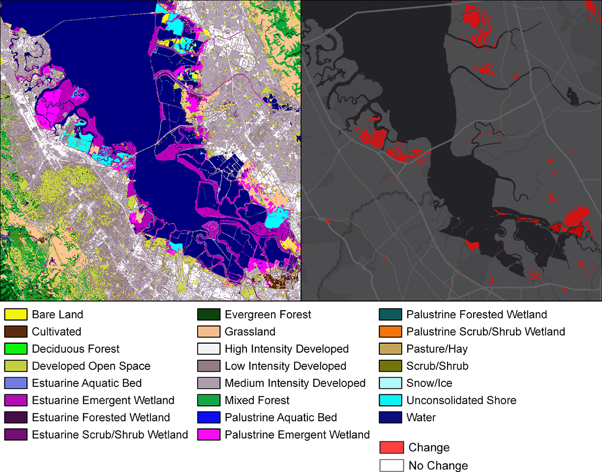
How Much Swamp Are We Talking Here? Towards Better Mapping of Coastal Wetlands
Ways to better estimate the greenhouse gas contributions of wetlands.
Graphing a Path to Survival: Habitat Connectivity in Australia's Murray-Darling Basin
Quantifying the impact of historic land-use and hydroclimatic variability on landscape connectivity dynamics across Australia’s breadbasket.
How Scientists Watched the Larsen C Ice Shelf Give Birth to an Iceberg in the Polar Night
Using Landsat 8’s thermal data to monitor calving events in Antarctica.
How Do Coastal Marshes Respond to Climate Change?
Using Landsat data from 1984-2014 to investigate the blue carbon change in Louisiana’s coastal marshes.
Near Real Time Monitoring of Volcanic Eruptions
Using Earth Observation data to monitor volcanic eruptions.
Using Landsat and Sentinel-2 Data in Harmony
HLS offers a seamless data set of surface reflectance observations.
Water in Flux—Monitoring Shifting Water Body Sizes in Canada
Monitoring surface water trends in North Western Canada.
News Archives
NASA Awards Launch Services Contract for Landsat 9 Mission
NASA has selected United Launch Services LLC (ULS) of Centennial, Colorado, to provide launch services for the Landsat 9 mission.
USGS Video: Landsat in Action—Interview with Alan Belward
Alan Belward from the European Union’s Joint Research Center discusses how Landsat helps his team promote sustainable development.
USGS Video: Landsat In Action—Interview with Ted Scambos
Ted Scambos, Lead Scientist at the National Snow & Ice Data Center, talks about the roll of Landsat in his research studying polar regions.
Madcap Recap: Landsat in the News
Very brief summaries and links to some of the more fascinating Landsat news and blog posts out there.
GEO Announces Major Milestone Reached in Forest Monitoring from Space
Thanks to a major effort to ensure full satellite coverage of the world’s forests, all countries now have the necessary data for annual forest monitoring for the first time ever.
Landsat 9's OLI-2 Instrument Takes Shape
OLI-2 is being built by Ball Aerospace in Boulder, Colorado.
Mapping the World's Most Precious Resource: Landsat Science Team Member Gives Surface Water TEDx Talk
This TEDx talk explains Belward’s work which utilizes the Landsat data archive to map surface water movement around the globe.
Puerto Rico Landscape Ravaged by Hurricane Maria
Hurricane Maria tore across Puerto Rico on September 20, 2017, ravaging both urban and rural areas with category 4 winds and intense rainfall for several days.
Landsat Analysis Ready Data Coming Soon
A fundamental goal for Landsat ARD is to significantly reduce the magnitude of data processing for application scientists.