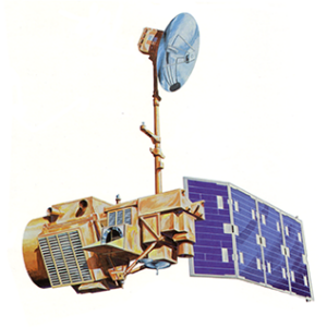
Year: 2013

News Archive
San Francisco map 1894

Northern San Francisco Bay, 1894

Maps often convey our relationship to the world. In this map of the northern San Francisco Bay and surrounding environs, the early development of the region is recorded in detail. The full and arduous title of this map is “Map showing portions of Alameda and Contra Costa counties, city and county of San Francisco, California, carefully compiled from official and private maps, surveys and data.”

Read More »

Using Landsat to Detect Human Rights Violations

Over 2500 villages were destroyed during six years of conflict in Darfur between 2002 and 2008. Dr. Andrew Marx, a 2013 fellow at the Center for the Prevention of Genocide at the U.S. Holocaust Memorial Museum, has found that this type of destruction—associated with human rights violations—can be detected using freely available Landsat data.

Read More »

Surveying Ice and Fire: The First Map of All of Iceland’s Glaciers and Subglacier Volcanic Calderas Released

For the first time, all of Iceland’s glaciers are shown on a single map, produced by the Icelandic Meteorological Office (IMO), in collaboration with the U. S. Geological Survey (USGS) and Iceland Geosurvey. The map is the first to incorporate historical data and coverage from aerial photographs and remote sensing satellites, such as Landsat and SPOT, to show the change in the areal extent of glaciers during the past century.

Read More »

Mapping the World with Landsat

Speeding around the Earth at 16,800 mph (27,000 kph), two Landsat satellites are quietly, expertly watching and recording changes in Earth’s lands from space. They are gathering data for people to make maps–all kinds of wonderful maps–of our cities growing, rivers flooding, lava flowing from volcanic eruptions, forests expanding or shrinking, crops greening through the growing season, and even of evidence of pollution.

Read More »

Vast Water Reserves Found in Drought-Prone Northern Kenya

Large underground water reserves have been found in Turkana, one of Kenya’s driest and poorest regions. The discoveries were made by the natural resources exploration firm, Radar Technologies International, during the course of a survey of groundwater conducted for the Kenyan Government on behalf of the UN. The aquifers were detected with the WATEX System, RTI’s state-of-the-art, space-based exploration technology.

Read More »

Landsat Impedes Crop Insurance Fraud

With unbiased Landsat imagery as evidence, the U.S. Court of Appeals for the 9th Circuit affirmed an earlier jury-conviction of a northern California farmer found guilty on 16 counts of filing false federal crop insurance claims—scheming the government out of $410, 372.

Read More »

Meet Mauri Pelto, Glaciologist

At a small college in Dudley, Mass., a professor of Environmental Science is doing big things. Glaciologist Mauri Pelto is using Landsat imagery to monitor glaciers around the world from his office at Nichols College.

Read More »

NRC Report "Landsat and Beyond" Available

In 1972 NASA launched the Earth Resources Technology Satellite (ETRS), now known as Landsat 1, and on February 11, 2013 launched Landsat 8. Currently the United States has collected 40 continuous years of satellite records of land remote sensing data from satellites similar to these. Even though this data is valuable to improving many different aspects of the country such as agriculture, homeland security, and disaster mitigation; the availability of this data for planning our nation’s future is at risk.

Read More »

Historic Landsat 5 Mission Ends

When the Landsat 5 satellite launched on March 1, 1984, it was expected to last at least three years. More than 29 years and 2.5 million images later, the U.S. Geological Survey issued the final command to the aged satellite on June 5, 2013, and officially decommissioned it on June 19.

Read More »

Meet Jeanine Murphy-Morris

Aerospace engineer Jeanine Murphy-Morris has always been interested in flight, and that interest propelled her into a career building Earth-observing satellites. As a college student,

Read More »

Contact Us

Communications and Public Engagement Team Contacts Ginger Butcher Landsat Communications and Public Engagement Lead NASA Goddard Space Flight Center c/o Science Systems and Applications, Inc.

Read More »

Landsat Applications

  Agriculture, Forestry and Range Resources Land Use and Mapping Geology Hydrology Coastal Resources Environmental Monitoring Discriminating vegetative, crop and timber types Classifying land uses

Read More »