Search
Close this search box.

Category: Water

News Archive
Longwall mining machinery in a Colorado coal mine

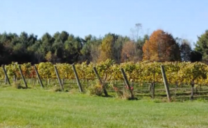
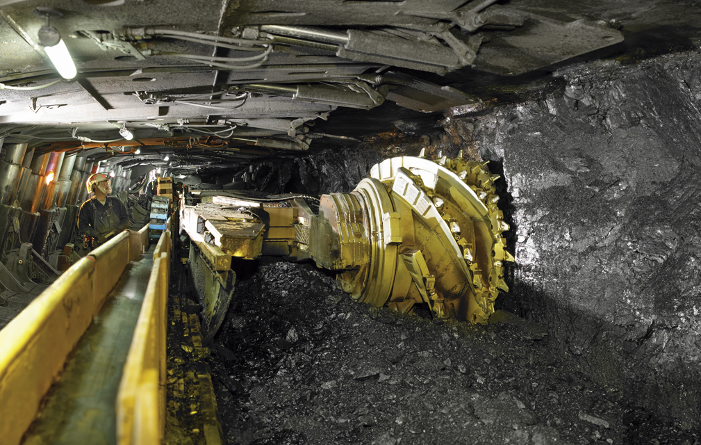
Assessing Longwall Mining Impacts on the Forests Above

Erin Pfeil-McCullough, a graduate student at the University of Pittsburgh, gave a talk at #AGU15 on insights that she has gained from her research to determine what impacts longwall mining has on forest canopies above as the ground subsides and local hydrology is altered.

Read More »

Landsat Helps Inform Restoration Decisions in the Great Lakes

Charles Perry, a Research Soil Scientist with the USDA’s Forest Inventory and Analysis group, gave a talk about his research that uses Landsat to monitor land use and land cover change in watersheds surrounding the Great Lakes at #AGU15. He is able to link the land use and land cover change information with other ancillary data to predict water quality, such as the amount of phosphorus (which feeds algae) in the lakes.

Read More »

Despite Warming, Landsat Reveals Decadal Slowdowns on Greenland Ice Sheet

Ice sheets are in perpetual motion, making their way downslope like a river. If the amount of snow that an ice sheet accumulates does not keep pace with its loss to the sea, sea level will rise. As temperatures have climbed, positive feedback loops have led to an accelerated loss of ice sheet sections that touch the sea, but in an unexpected twist to the global warming saga, scientists have just discovered a negative feedback loop that is slowing down the Greenland Ice Sheet sections that end on land—a sliver of good news for sea-level rise.

Read More »
An enhanced vegetation index from Landsat imagery

Tracking Agricultural Water Use on a Smartphone

This fall scientists at the University of Nebraska, with partners at Google Inc., the University of Idaho and the Desert Research Institute, introduced the latest evolution of METRIC technology—an application called EEFLUX, which will allow anyone in the world to produce field-scale maps of water consumption.

Read More »

Landsat Images Advance Watershed Restoration in Western Tanzania

For those who live along its shores, Lake Tanganyika in east Africa is the backbone of local transportation and serves as an essential source of household water and protein. Every night, fishers lure nocturnal, sardine-like fish called dagaa with compression lamps that are strung between their boats. From the shore, the lake sparkles with the lights of miniature moons as people gather the treasured catch.

Read More »
migrating birds

Landsat Helps Feed the Birds

The BirdReturns program, created by The Nature Conservancy of California, is an effort to provide “pop-up habitats” for some of the millions of shorebirds, such as sandpipers and plovers, that migrate each year from their summer breeding grounds in Alaska and Canada to their winter habitats in California, Mexico, Central and South America.

Read More »

Lakes On A Glacier

How deep is that icy blue water on Greenland’s ice sheet? Dr. Allen Pope, of the National Snow and Ice Data Center, is using data from the NASA/USGS Landsat 8 satellite to find out. In this video, Dr. Pope shares what he sees when he looks at a Landsat image of the Greenland ice sheet just south of the Jakobshavn Glacier.

Read More »

Avoiding Rock Bottom: How Landsat Aids Nautical Charting

On the most recent nautical chart of the Beaufort Sea where the long narrow Tapkaluk Islands of Alaska’s North Slope separate the sea from the shallow Elson Lagoon (Nautical Chart 16081) a massive shoal is immediately noticeable just west of the entrance to the lagoon. On the chart it looks like a massive blue thumb jutting out into the sea. The National Oceanographic and Atmospheric Administration (NOAA) identified this prodigious, 6-nautical mile-long, 2-nm-wide shoal using Landsat satellite data.

Read More »

A Satellite View of River Width

Hydrologists from the University of North Carolina have come up with an innovative way to estimate the size of rivers via satellite images. Combing through data acquired by Landsat satellites, George Allen and Tamlin Pavelsky have compiled a new database of river widths for North America.

Read More »

Vanishing Lake Urmia

Iran’s Lake Urmia is one of the largest saltwater lakes in the world. With eight times as much salt as seawater, it’s the globe’s largest habitat for brine shrimp, which attract flamingos, egrets and other birds as they migrate across Asia. But the lake is disappearing. Using images captured by USGS-NASA Landsat satellites, researchers determined that its area has decreased by 88 percent since the 1970s. Many blamed severe drought, but climate data from satellites and other sources demonstrated that the lake is shrinking even in wet years.

Read More »

Water Mapping Technology Rebuilds Lives in Arid Regions

Turkana County in northwest Kenya has been reeling from several years of crippling drought. As a consequence, the nomadic peoples in the region have suffered. Livestock such as goats and cattle, the sole source of income for these pastoralists, have perished by the droves from starvation, and the resulting economic hardship has left many children malnourished. Many have also died from violent clashes over increasingly scarce resources.

Read More »

Landsat Satellite Sees Green-up Along Colorado River's Delta After Experimental Flow

A pulse of water released down the lower reaches of the Colorado River last spring resulted in more than a 40 percent increase in green vegetation where the water flowed, as seen by the Landsat 8 satellite. The March 2014 release of water – an experimental flow implemented under a U.S.-Mexico agreement called “Minute 319” – reversed a 13-year decline in the greenness along the delta.

Read More »

From the River to the Sea

A pulse of water released down the lower reaches of the Colorado River last spring resulted in more than a 40 percent increase in green vegetation where the water flowed, as seen by the Landsat 8 satellite. The March 2014 release of water – an experimental flow implemented under a U.S.-Mexico agreement called “Minute 319” – reversed a 12-year decline in the greenness along the delta.

Read More »

Bringing Climate Change Tools to Lower Mekong Region

NASA and the U.S. Agency for International Development (USAID) announced a five-year project that will promote the use of satellite imagery to help Asia’s Lower Mekong region better predict and cope with floods and other natural disasters and increase resilience to the negative effects of climate change.

Read More »

Taking Landsat 8 to the Beach

Some things go perfectly with a summer trip to the coast: sunscreen, mystery novels, cold beverages, and sand castles. Other things—like algae blooms or polluted runoff—are a lot less appealing. The newest generation of Landsat satellite is helping researchers identify and study potential problem areas from space.

Read More »

Landsat and Water: Using Space to Advance Resource Solutions

A recent White House-led assessment found that Landsat is among the Nation’s most critical Earth observing systems, second only to GPS and weather. A new USGS study, Landsat and Water — Case Studies of the Uses and Benefits of Landsat Imagery in Water Resources, provides examples of why Landsat is so valuable.

Read More »

Landsat Aids Forest Service Research

Ensuring the health and sustainability of the nation’s forests requires scientifically credible and timely information about the extent, location, health, and ownership of these forests and the possible effects of global climate change. Forest managers and policy makers need detailed data to assess sustainability, to make important business decisions, to evaluate wildlife habitat, and for many other things. The Northern Research Station’s Forest Inventory and Analysis (FIA) team provides information on northeastern, midwestern, and Great Plains forests.

Read More »

Tracking Giant Kelp From Space

Citizen scientists worldwide are invited to take part in marine ecology research, and they won’t have to get their feet wet to do it. The Floating Forests project, an initiative spearheaded by scientists at UC Santa Barbara and UCLA, is calling on would-be researchers to examine 30 years of satellite photographs of coastal kelp-dominated areas around the globe to help identify their various sizes and locations.

Read More »

Landsat's Role in Water Resource Management

Water availability and allocation are issues gaining a great deal of attention, particularly in arid climates. Increases in population growth and recent droughts bring urgency to measuring and monitoring water use in areas such as the western United States, where the majority of the water has already been allocated.

Read More »

At the Beach with Landsat 8

Scientists with the Michigan Tech Research Institute are tracking the spread of Chladophora, a hair-fine algae that attaches to shallow water rocks, or the shells of dead invasive zebra and quagga mussels. Occasionally, due to storms in the Great Lakes, the algae slough off the rocks, and cover the beach in a green decaying mess.

Read More »

Landsat and Water—Case Studies of the Uses and Benefits of Landsat Imagery in Water Resources

The Landsat program has been collecting and archiving moderate resolution earth imagery since 1972. The number of Landsat users and uses has increased exponentially since the enactment of a free and open data policy in 2008, which made data available free of charge to all users. Benefits from the information Landsat data provides vary from improving environmental quality to protecting public health and safety and informing decision makers such as consumers and producers, government officials and the public at large. Although some studies have been conducted, little is known about the total benefit provided by open access Landsat imagery.

Read More »