Landsat 9 to Provide a Wealth of Data to Landsat Archive
Launched September 27, Landsat 9 will provide a high-quality and reliable stream of land imaging data for the next 10-plus years.

Launched September 27, Landsat 9 will provide a high-quality and reliable stream of land imaging data for the next 10-plus years.
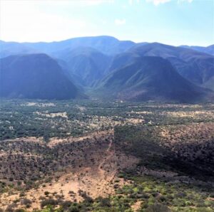
Using decades of Landsat satellite imagery, scientists at Geoscience Australia have mapped annual shoreline locations for the entirety of Australia going back more than thirty years.

Fine-tuning remote sensing to protect forests from the spread of dangerous critters.
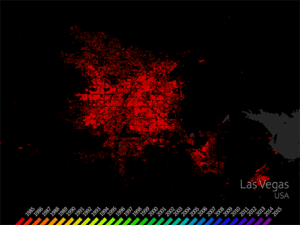
The World Settlement Footprint is the world’s most comprehensive dataset on human settlement.
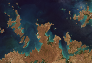
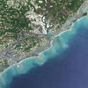
Landsat 9’s first light images provide a preview of how the mission will help people manage vital natural resources and understand the impacts of climate change.
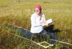
The recent increase of Sphagnum mosses over portions of the northern peatlands known as wet aapa mires can be detected from Landsat satellite data.
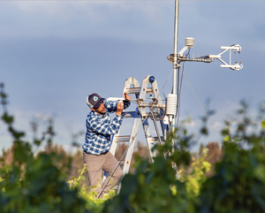
Data from Landsat powers OpenET, a new web-based platform that puts water use information for 17 western United States into the hands of farmers, water managers and conservation groups.

Kustas’ research informed the new OpenET app that uses Landsat thermal data as a key data input.
Using Landsat, scientists have discovered for the first time that large scale solar parks have a cooling effect on the land surrounding them.
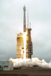
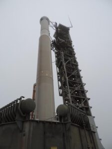
Landsat 9 successfully launched on Monday, Sept 27, 2021 at 11:12 a.m. PDT and is now proceeding smoothly and accordingly through its scheduled on-orbit checkout period.
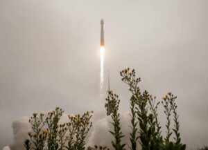
Landsat 9 successfully launched at 2:12 p.m. EDT Monday from Vandenberg Space Force Base in California.
by Jason Costa, Kennedy Space Center, Launch Services Program September 27, 2021 • After a United Launch Alliance Atlas V rocket successfully carried the Landsat 9 spacecraft into orbit from

Starting on Sunday, Sept. 19, 2021, a number of local Landsat-focused events will be taking place. From geocaching to family fun nights, from science cafe talks to women in STEM socials, there’s something for you to do during launch week.

by Jim Cawley, NASA’s Kennedy Space Center September 22, 2021 • Landsat 9 is targeted for launch no earlier than Sept. 27, 2021, on a United Launch Alliance Atlas V
Adventurers, explorers, and satellite lovers alike descended on Lompoc, California, Sunday, Sept. 19 to kick-off Southern California’s first GeoTour: The History of Landsat in Lompoc.
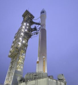
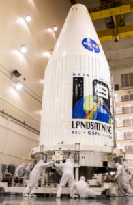
Landsat 9, now scheduled for launch on Monday, Sept. 27, is safely encapsulated in its fairing and mated to the launch vehicle in preparation for launch.
The Landsat 9 launch is now scheduled for no earlier than Monday, Sept. 27, 2021.
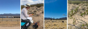
Remote sensing measurements using Landsat can help assess the effectiveness of various restoration interventions.
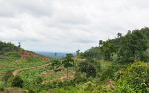
A new analysis of protected forests worldwide finds that protected forests are unlikely to be cut down when they are surrounded by intact forests.
The Wet Dress Rehearsal enabled engineers to evaluate how the Landsat 9 rocket and ground systems behave prior to launch.
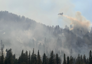
Wildfires in the western United States have been spreading to higher elevations over the past few decades due to warmer and drier conditions that are clearly linked to climate change.

Come along on a “roadtrip” through the decades to see how the technology on Landsat has evolved with the times to provide an unbroken data record.
Current pandemic demands for medical liquid oxygen have caused delivery delays of needed liquid nitrogen to Vandenberg, impacting the Landsat 9 launch date.

This video takes you to the summer of 1975 when Jacques Cousteau and his divers helped NASA determine if Landsat could measure the depth of shallow ocean waters.
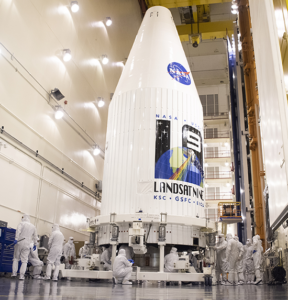
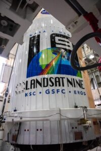
In preparation for launch, the Landsat 9 observatory has been encapsulated in the fairing of the Atlas V 401 rocket that will deliver it into orbit this September.

This is the second in a series of five features introducing members of the Landsat 9 team.

This is the first in a series of five features introducing members of the Landsat 9 team.
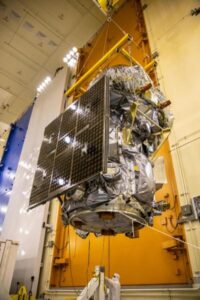
The Landsat 9 project has passed its final major lifecycle approval gateway.
For over 30 years, Dr. Beach, aka Dr. Stephen Leatherman, a professor and coast geomorphologist at Florida International University, has created a Top 10 Beach list based on criteria including water and sand quality, safety, and management. You can find his 2021 picks here and see how Landsat views them as well.
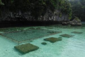
In Micronesia, the nation of Palau is building sustainable aquaculture farms in the ocean with the help of satellites.
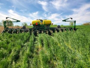
Soil is the foundation of our food systems, and sustainable farming depends upon healthy soil, which has impacts far beyond the field on air, water and climate.

For five decades, we have relied on Landsat’s high-quality, science-quality observations to understand and protect our home planet.
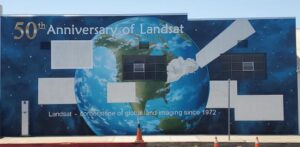
A mural celebrating Landsat’s 50 year history is being painted in Lompoc, California.
