
Virginia Norwood: Engineer Extraordinaire
Virginia Norwood was awarded the USGS John Wesley Powell Award for her contributions to USGS—most notably the long-running Landsat program.

Virginia Norwood was awarded the USGS John Wesley Powell Award for her contributions to USGS—most notably the long-running Landsat program.

Rooftop gardens and greenery can help ease some of the severe heat in cities, according to research from climate scientists at NASA’s Goddard Institute for Space Studies (GISS) in New York.
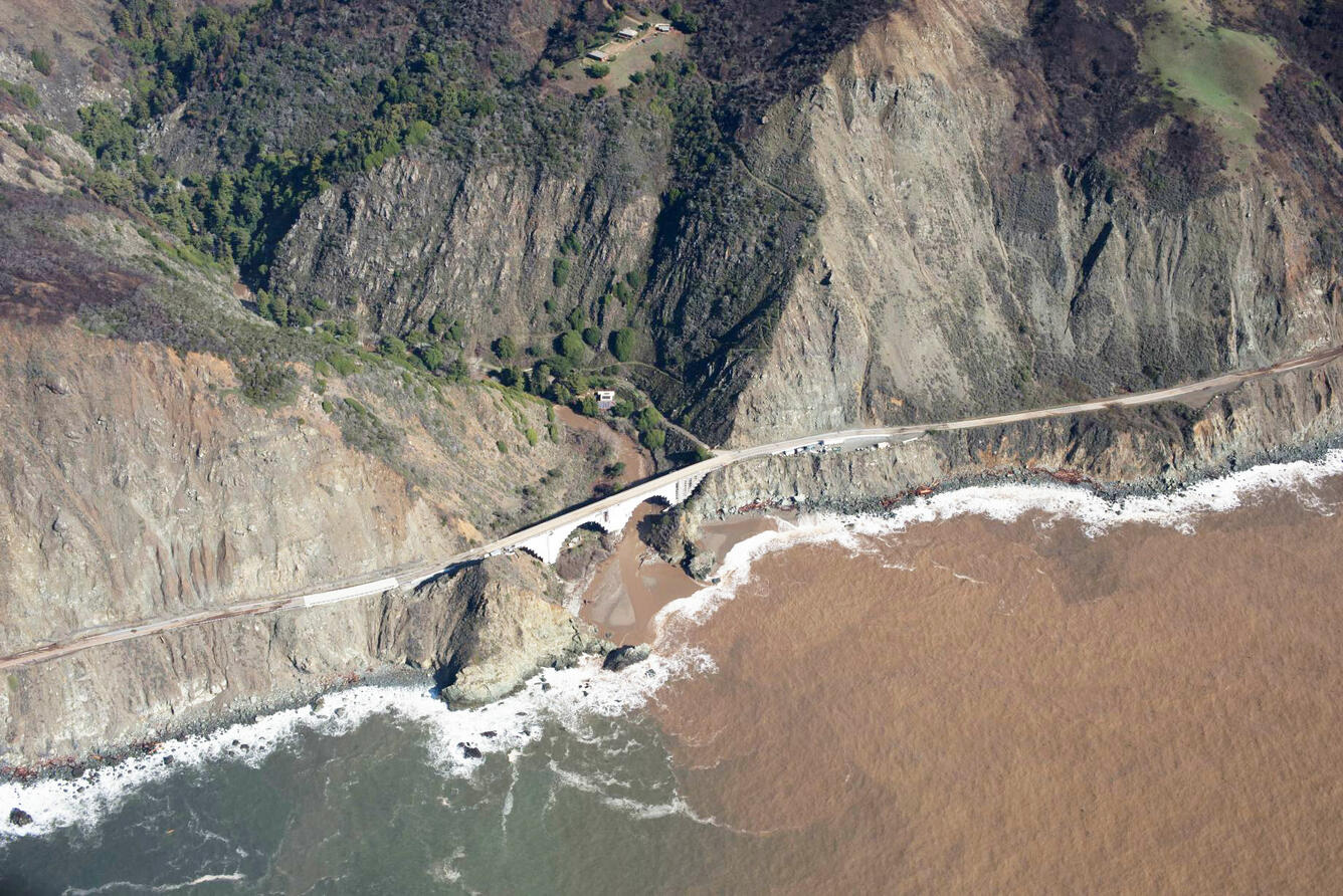
A new study combines decades of Landsat and Sentinel-2 imagery with hydrologic and oceanographic data to look at how changes on land affect coastlines in Big Sur, California.

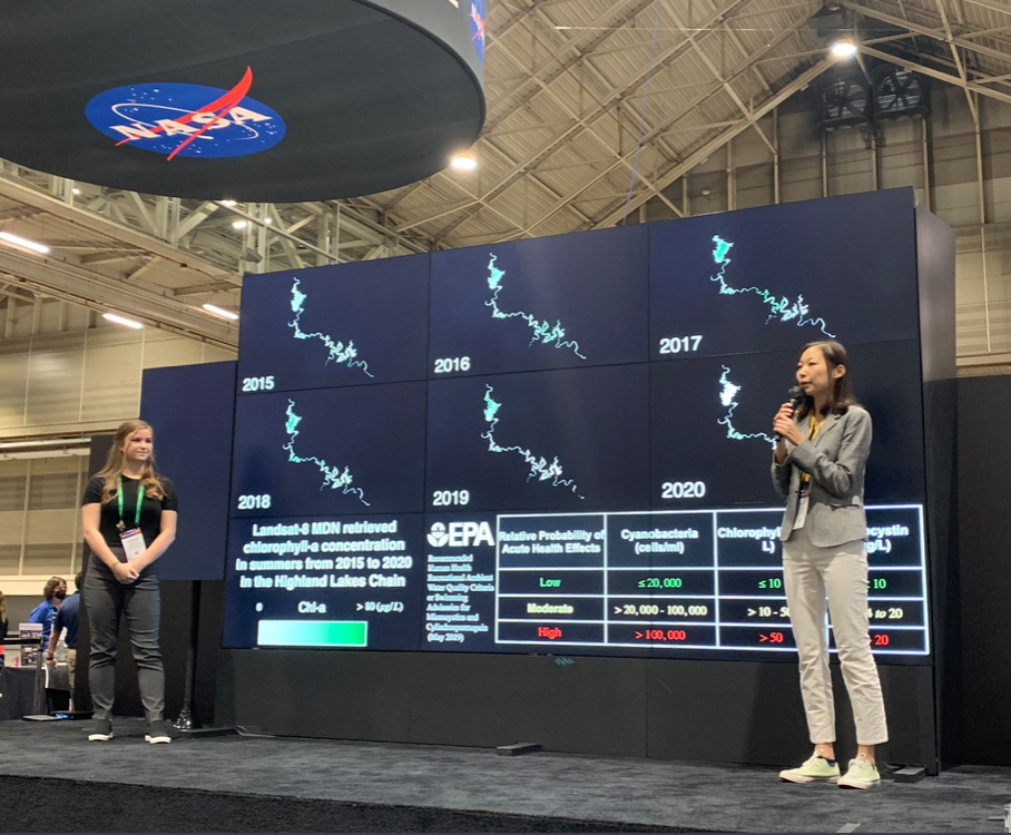
Wu wants anyone to be able to derive meaningful information from geospatial data like Landsat.

The U.S. Geological Survey has made all Landsat 9 data available from its Landsat archive.
Landsat 9, a joint mission of NASA and the U.S. Geological Survey (USGS), passed its post-launch assessment review and is now in its operational phase.
From record-breaking heatwaves to pandemic-related events, the images in this list showcase some of the beautiful and complex events that occurred on our planet in the past year.
More than 100 countries at the UN Climate Change Conference this past year made the bold commitment to halt and reverse deforestation by 2030.
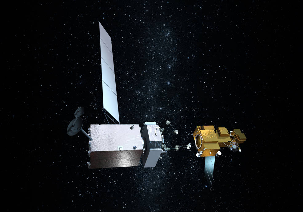
Northrop Grumman recently signed agreements to license three technologies from NASA related to satellite servicing.
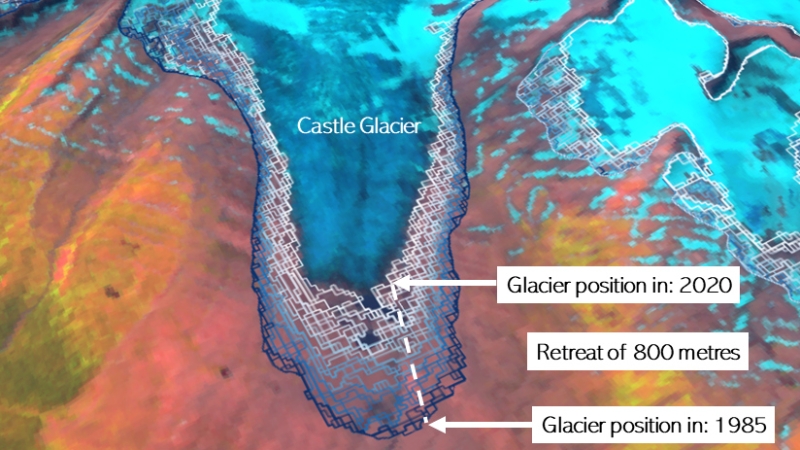
A new mapping tool developed by UNBC researchers shows that western Canadian glaciers are shrinking at an increasing rate.
From October 23 – 28, 2022, Pecora 22 will focus on all aspects of Earth observation, spanning scientific discoveries to operational applications, and from sensors to decisions.
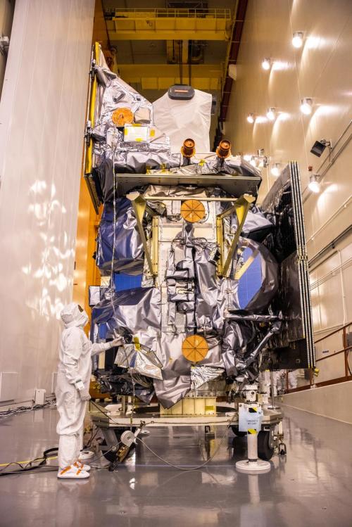
Launched September 27, Landsat 9 will provide a high-quality and reliable stream of land imaging data for the next 10-plus years.
This year at the Fall AGU conference, 409 Landsat-related presentations were given.

Using decades of Landsat satellite imagery, scientists at Geoscience Australia have mapped annual shoreline locations for the entirety of Australia going back more than thirty years.

Fine-tuning remote sensing to protect forests from the spread of dangerous critters.

Do you design interactive media? Consider interning with the Landsat outreach team.
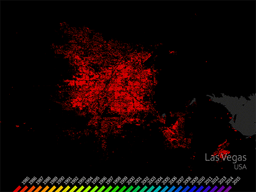
The World Settlement Footprint is the world’s most comprehensive dataset on human settlement.
Landsat 9’s first light images provide a preview of how the mission will help people manage vital natural resources and understand the impacts of climate change.
The recent increase of Sphagnum mosses over portions of the northern peatlands known as wet aapa mires can be detected from Landsat satellite data.
Data from Landsat powers OpenET, a new web-based platform that puts water use information for 17 western United States into the hands of farmers, water managers and conservation groups.

Kustas’ research informed the new OpenET app that uses Landsat thermal data as a key data input.
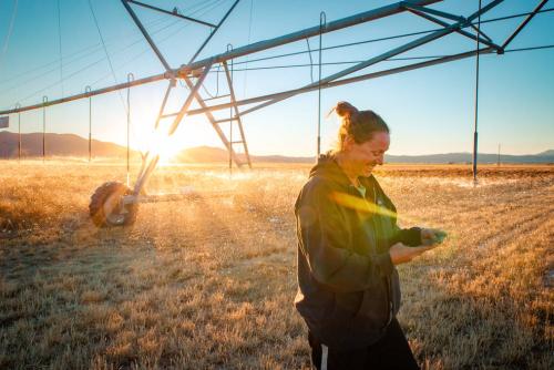
NASA will hold a virtual media briefing at 1:30 p.m. EDT Thursday, Oct. 21, to share a powerful, new, web-based platform to help those who rely on water resources across the drought-stricken western U.S.
Using Landsat, scientists have discovered for the first time that large scale solar parks have a cooling effect on the land surrounding them.
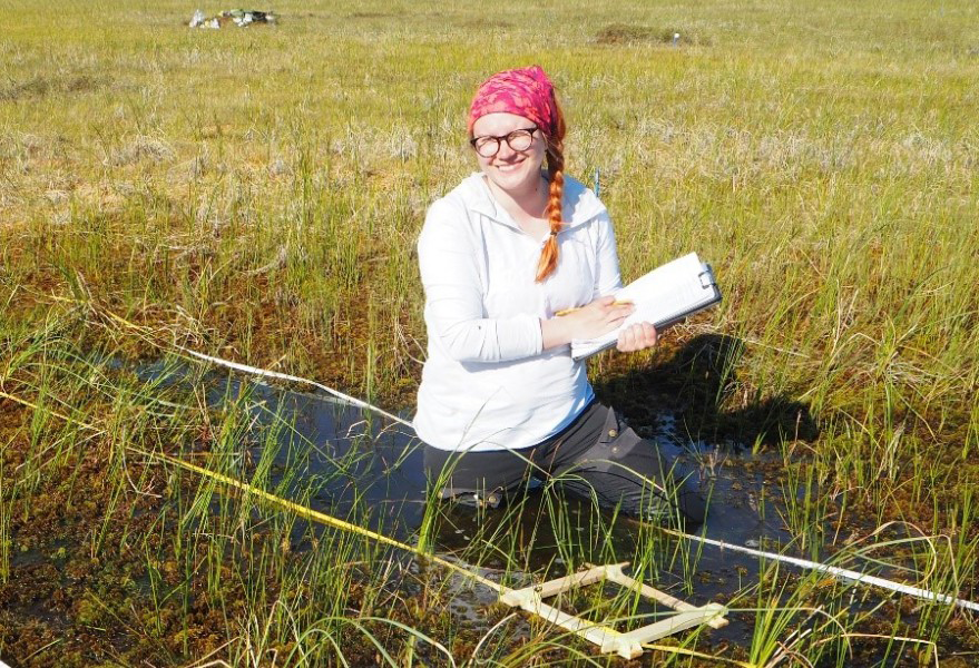
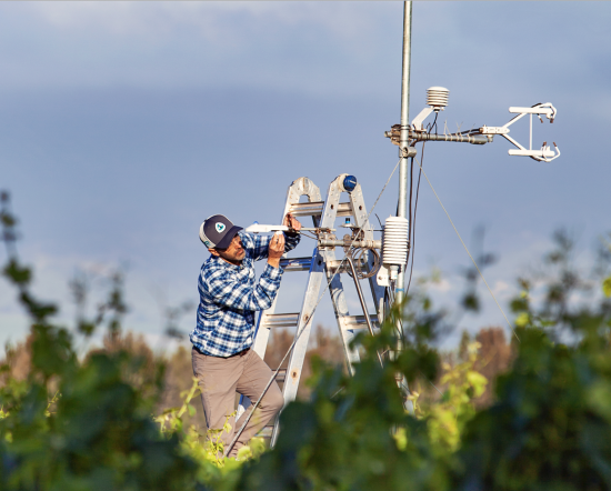
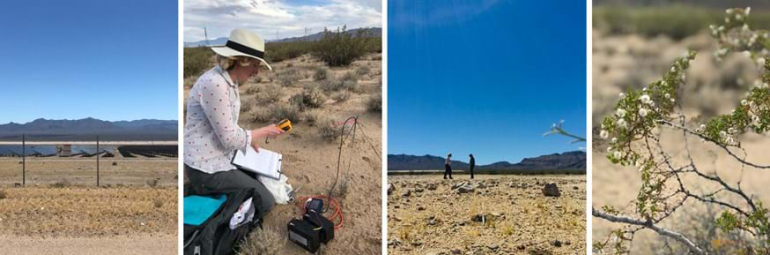
Field work conducted in northern Alaska is being used in concert with the Landsat satellite data record in an effort to better understand the impacts of climate change on the Arctic.
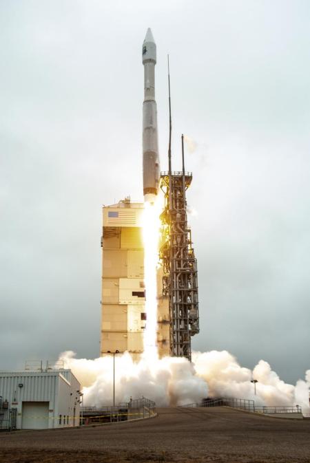
Landsat 9 successfully launched on Monday, Sept 27, 2021 at 11:12 a.m. PDT and is now proceeding smoothly and accordingly through its scheduled on-orbit checkout period.
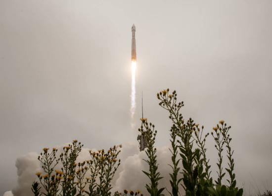
Landsat 9 successfully launched at 2:12 p.m. EDT Monday from Vandenberg Space Force Base in California.
by Jason Costa, Kennedy Space Center, Launch Services Program September 27, 2021 • After a United Launch Alliance Atlas V rocket successfully carried the Landsat 9 spacecraft into orbit from

Starting on Sunday, Sept. 19, 2021, a number of local Landsat-focused events will be taking place. From geocaching to family fun nights, from science cafe talks to women in STEM socials, there’s something for you to do during launch week.

by Jim Cawley, NASA’s Kennedy Space Center September 22, 2021 • Landsat 9 is targeted for launch no earlier than Sept. 27, 2021, on a United Launch Alliance Atlas V
Adventurers, explorers, and satellite lovers alike descended on Lompoc, California, Sunday, Sept. 19 to kick-off Southern California’s first GeoTour: The History of Landsat in Lompoc.
NASA will provide coverage of the upcoming prelaunch and launch activities for the NASA/USGS Landsat 9 satellite.
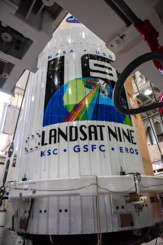
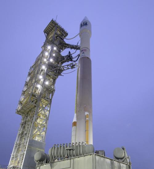
Landsat 9, now scheduled for launch on Monday, Sept. 27, is safely encapsulated in its fairing and mated to the launch vehicle in preparation for launch.
The Landsat 9 launch is now scheduled for no earlier than Monday, Sept. 27, 2021.
