Landsat’s Role in Managing Forests
People and economies around the world rely on forests for timber, carbon storage, flood control, biological diversity, recreation, and more. Forest managers face many challenges. In the last few years, forest fires have become more intense and more frequent; North American forests have experienced widespread infestations by pests such as the pine bark beetle; and tropical deforestation continues. Our changing climate adds complexity to government and commercial decisions about how to manage, protect, and sustain our forest resources. Landsat satellites provide key data for forest monitoring and management across the globe. Landsat gives us consistent views of the health, composition, and extent of forest ecosystems as they change over time. Curtis Woodcock, Professor, Boston University and specialist in remote sensing, has said, “I would argue that the Landsat data archive may be the most valuable environmental data record we have.” Designed, built, and launched by NASA, Landsat satellites have recorded global forest conditions every year since the 1970’s, and they have observed all U.S. forests once a season throughout those years. The U.S. Geological Survey provides this valuable data to the public at no cost. Landsat observations will continue into the future with Landsat 8.

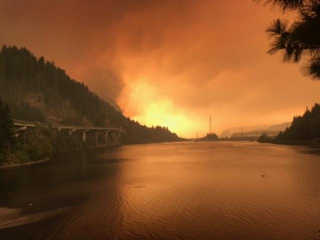
Fire & Water: How Wildfires Can Impact Drinking Water
Fires in forested watersheds that support drinking water supplies can introduce contaminants that overwhelm current treatment capabilities. Earth observation data are helping.

Neotropical Cloud Forests to Lose What Most Defines Them: Clouds
If greenhouse gas emissions continue increasing as they have been, 90% of Western Hemisphere cloud forests would be affected as early as 2060.

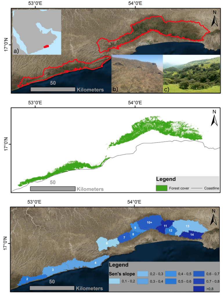
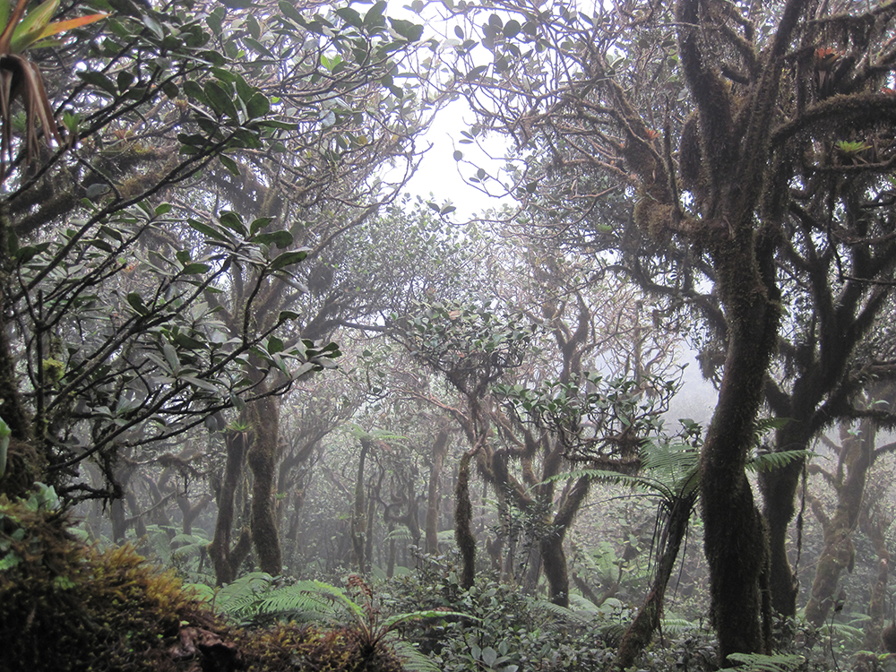
Getting to Know the Dhofar Cloud Forest
Learn more about this rather unusual seasonal and semi-arid cloud forest.

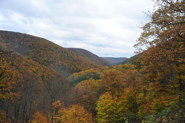
Monitoring Forest Health Amid Oil and Gas Extraction
Following changes in long-term forest health around oil and gas wells in the Pennsylvania State Forest.

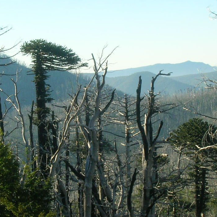
Looking at Burn Severity and Post-Fire Forest Regeneration in Chile’s Andean Cordillera, Home to the Monkey Puzzle Tree
The first study that connects field-measured data with satellite-derived burn severity in this corner of the world.

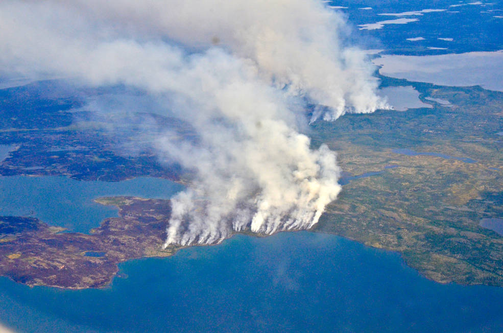
Fires, Floods and Satellite Views: Modeling the Boreal Forest’s Future
The 2014 megafires in Canada’s Northwest Territories burned 7 million acres of forest, making it one of the most severe fire events in Canadian history.