
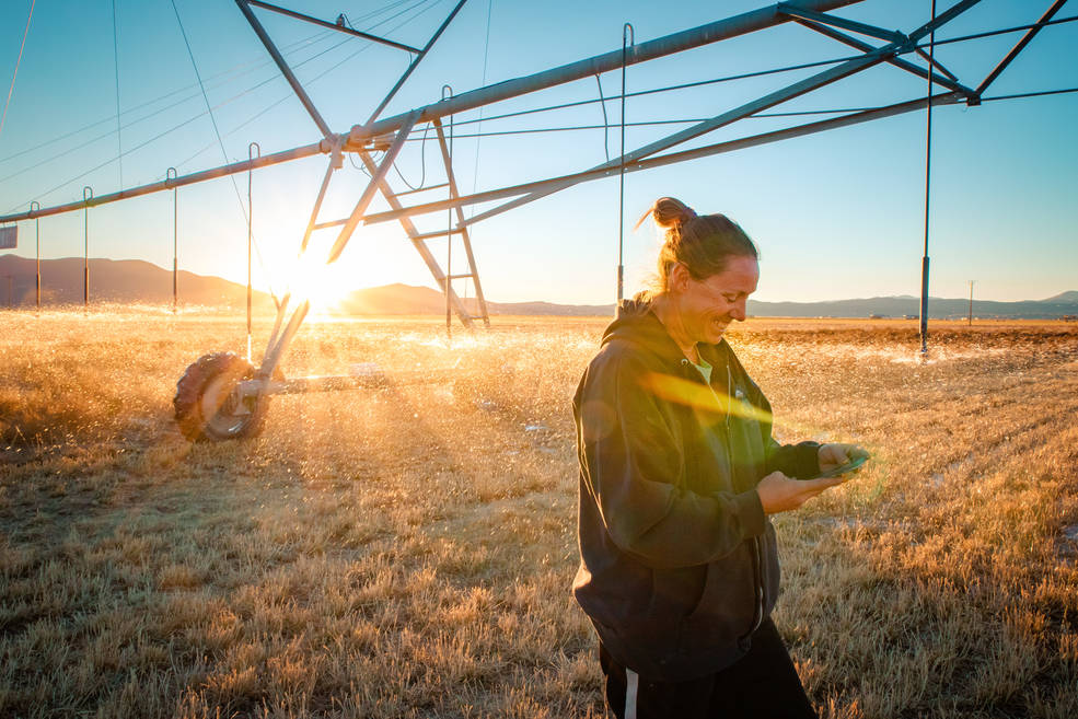
Transforming Water Management in the U.S. West with Satellite Data
A new web-based platform called OpenET will soon be putting satellite data in the hands of farmers, water managers and conservation groups to accelerate improvements and innovations in water management.
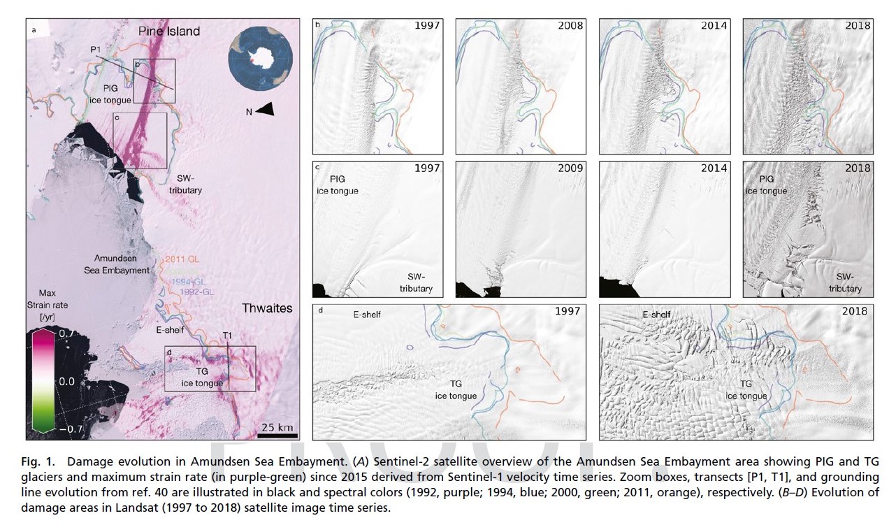
Antarctica: Cracks in the Ice
Combined satellite imagery have afforded researchers a new, accurate picture of the rapid development of damage in the shear zones on the ice shelves of Pine Island and Thwaites.
The Stuff of Trees: Three-Decades of Forest Biomass Measured Across Canada
A new study reports a net increase of 5.38 petagrams of forest biomass between 1984 and 2016; carbon-wise, that is equivalent to a train of loaded coal cars long enough to wrap itself around Earth nearly 34 times.
Landsat Data Informs New Projects Exploring Connections Between the Environment and COVID-19
Satellite images are helping to reveal how COVID-19 lockdown measures are impacting food security, urban surface heat, water quality and aquatic ecosystems, and more in NASA-funded studies.

Global Survey Using Landsat Shows Dramatic Growth of Glacial Lakes
Using 30 years of Landsat data, researchers have found that the volume of glacial lakes worldwide has increased by about 50% since 1990.
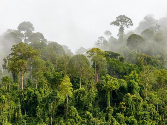
Pinpointing Tropical Forests with High Ecological ‘Quality’
Landsat and ICESat-2 satellite data have made it possible for scientists to develop maps showing the “quality” of tropical forests.
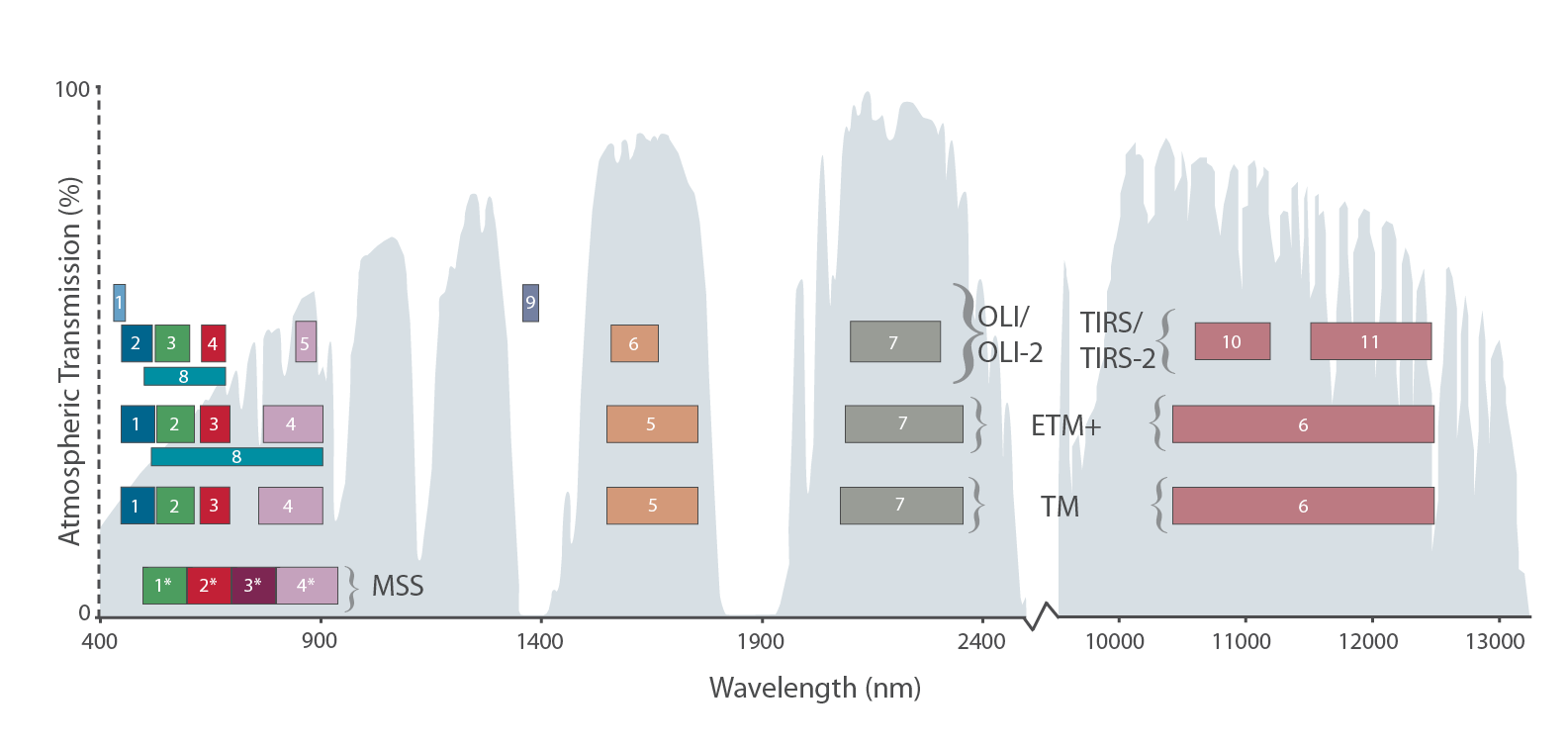
The Intervening Atmosphere: Tracing the Provenance of a Favorite Landsat Infographic
Learn more about the atmospheric transmission data used for our Landsat spectral band comparison graphic.
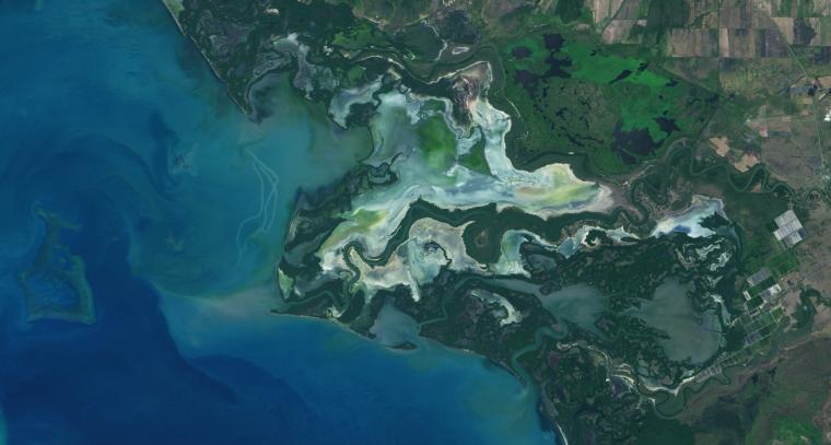
NASA Study Maps the Roots of Global Mangrove Loss
Using Landsat, researchers have created the first map of the causes of change in global mangrove habitats between 2000 and 2016—a valuable tool to aid conservation efforts for these vital coastline defenders.
NASA Is Where the Wild Things Are
Researchers and conservationists around the world are using data and images from NASA satellite instruments to manage and track living creatures of all kinds.
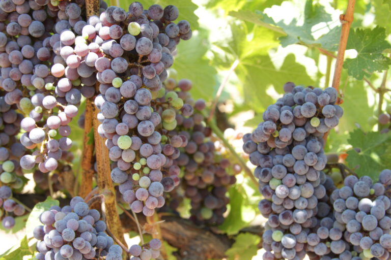
Raising a Glass in Wine Country to Better Water Management
Grape growers like Gallo are using data from Earth-observing satellites to better track soil and vine moisture levels, understand vine water use and plan grapevine irrigation.
Landsat 9 Ground System and Mission Operation Plans Well on Track for Launch
Landsat 9 has successfully passed its Mission Operations Review.
New Life for ESA’s Landsat Historical Data
ESA has processed its historical collection of Landsat MSS data (collected by ESA ground stations) so that it can be easily compared to later Landsat data sets and Sentinel-2 data.

William T. Pecora Award Nominations Now Being Accepted
Nominations for the 2020 William T. Pecora Award are now being accepted through May 1, 2020.

New Satellite-Based Algorithm Pinpoints Crop Water Use
A new satellite-driven biophysical model can make accurate forecasts of crop water use that are critical for farmland water management and sustainability.
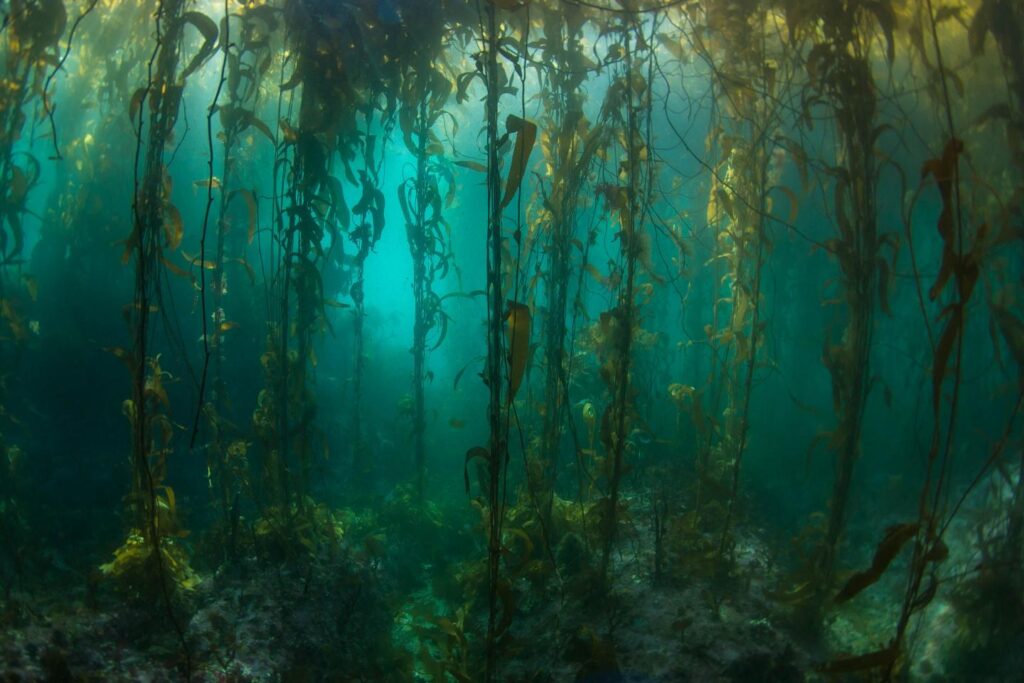
Kelp Forests at the End of the Earth
Kelp forest cover near Tierra del Fuego appeared to follow approximately four-year cycles that mirror sea surface temperature and El Niño-Southern Oscillation rainfall patterns.
Landsat Gives Epidemiologists Key Insights
How the fields of epidemiology and remote sensing intersect to help the public.

Landsat Boosts Understanding of Climate Change’s Impact on Kelp
Landsat imagery shows that bull kelp canopy area can vary dramatically from year to year, and that long-term population trends vary from reef to reef.
NASA Is Where the Wild Things Are
Researchers and conservationists around the world are using data and images from NASA satellite instruments to manage and track living creatures of all kinds.
Raising a Glass in Wine Country to Better Water Management
Grape growers like Gallo are using data from Earth-observing satellites to better track soil and vine moisture levels, understand vine water use and plan grapevine irrigation.
Landsat 9 Ground System and Mission Operation Plans Well on Track for Launch
Landsat 9 has successfully passed its Mission Operations Review.
New Life for ESA’s Landsat Historical Data
ESA has processed its historical collection of Landsat MSS data (collected by ESA ground stations) so that it can be easily compared to later Landsat data sets and Sentinel-2 data.
William T. Pecora Award Nominations Now Being Accepted
Nominations for the 2020 William T. Pecora Award are now being accepted through May 1, 2020.
New Satellite-Based Algorithm Pinpoints Crop Water Use
A new satellite-driven biophysical model can make accurate forecasts of crop water use that are critical for farmland water management and sustainability.
Kelp Forests at the End of the Earth
Kelp forest cover near Tierra del Fuego appeared to follow approximately four-year cycles that mirror sea surface temperature and El Niño-Southern Oscillation rainfall patterns.
Landsat Gives Epidemiologists Key Insights
How the fields of epidemiology and remote sensing intersect to help the public.
Landsat Boosts Understanding of Climate Change’s Impact on Kelp
Landsat imagery shows that bull kelp canopy area can vary dramatically from year to year, and that long-term population trends vary from reef to reef.
