
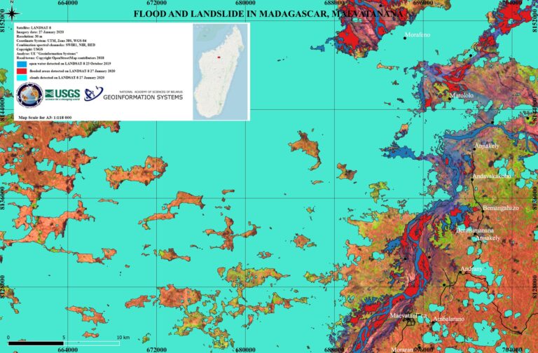
Mapping it Out: Flooding & Landslides in Madagascar
Landsat continues to support the International Disaster Charter.
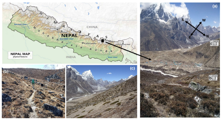
Landsat Reveals Expanding Plant Life in the Everest Region
Plant life is expanding in the area around Mount Everest, and across the Himalayan region, new research shows.
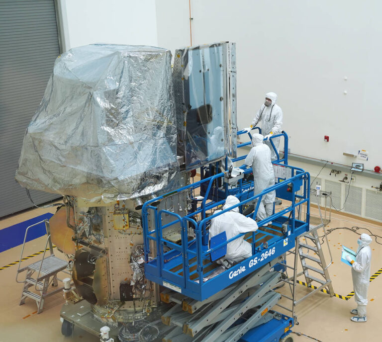
Landsat 9: The Pieces Come Together
Landsat 9’s two science instruments are now attached to the spacecraft.
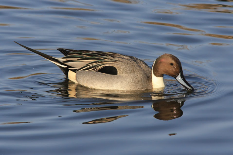
Predicting Waterbird Habitat in California
Ecologists are using Landsat to locate waterbird habitat that may be vulnerable in dry years.

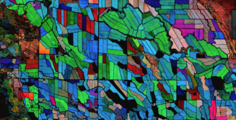
Understanding the Ecological and Environmental Impacts of Urbanization
Landsat-based urban extent and phenology indicators provide new information about urban environments.
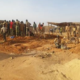
Assessing the Environmental Impacts of Artisanal Gold Mining
Landsat helps monitor changes in artisanal gold mining areas, enabling land managers to prevent and remedy environmental impacts.
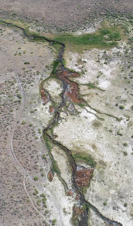
When a River Runs Through Drylands
There is a dance between the vegetation that thrives along a river’s edge and the availability of water; with Landsat, that relationship is now being understood in ways not previously possible.
Using NASA’s Harmonized Landsat Sentinel-2 Product to Give Farmers Real-Time Crop Health Information
IndigoAg is using HLS data to help fulfill its mission of making farms more profitable and sustainable.
Mapping it Out: Flooding & Landslides in Madagascar
Landsat continues to support the International Disaster Charter.
Landsat Reveals Expanding Plant Life in the Everest Region
Plant life is expanding in the area around Mount Everest, and across the Himalayan region, new research shows.
Landsat 9: The Pieces Come Together
Landsat 9’s two science instruments are now attached to the spacecraft.
Predicting Waterbird Habitat in California
Ecologists are using Landsat to locate waterbird habitat that may be vulnerable in dry years.
Understanding the Ecological and Environmental Impacts of Urbanization
Landsat-based urban extent and phenology indicators provide new information about urban environments.
Assessing the Environmental Impacts of Artisanal Gold Mining
Landsat helps monitor changes in artisanal gold mining areas, enabling land managers to prevent and remedy environmental impacts.
When a River Runs Through Drylands
There is a dance between the vegetation that thrives along a river’s edge and the availability of water; with Landsat, that relationship is now being understood in ways not previously possible.
Using NASA’s Harmonized Landsat Sentinel-2 Product to Give Farmers Real-Time Crop Health Information
IndigoAg is using HLS data to help fulfill its mission of making farms more profitable and sustainable.
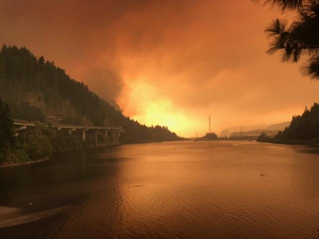
Fire & Water: How Wildfires Can Impact Drinking Water
Fires in forested watersheds that support drinking water supplies can introduce contaminants that overwhelm current treatment capabilities. Earth observation data are helping.
Mapping it Out: Flooding & Landslides in Madagascar
Landsat continues to support the International Disaster Charter.
Landsat Reveals Expanding Plant Life in the Everest Region
Plant life is expanding in the area around Mount Everest, and across the Himalayan region, new research shows.
Landsat 9: The Pieces Come Together
Landsat 9’s two science instruments are now attached to the spacecraft.
Predicting Waterbird Habitat in California
Ecologists are using Landsat to locate waterbird habitat that may be vulnerable in dry years.
Understanding the Ecological and Environmental Impacts of Urbanization
Landsat-based urban extent and phenology indicators provide new information about urban environments.
Assessing the Environmental Impacts of Artisanal Gold Mining
Landsat helps monitor changes in artisanal gold mining areas, enabling land managers to prevent and remedy environmental impacts.
When a River Runs Through Drylands
There is a dance between the vegetation that thrives along a river’s edge and the availability of water; with Landsat, that relationship is now being understood in ways not previously possible.
Using NASA’s Harmonized Landsat Sentinel-2 Product to Give Farmers Real-Time Crop Health Information
IndigoAg is using HLS data to help fulfill its mission of making farms more profitable and sustainable.
Fire & Water: How Wildfires Can Impact Drinking Water
Fires in forested watersheds that support drinking water supplies can introduce contaminants that overwhelm current treatment capabilities. Earth observation data are helping.
