
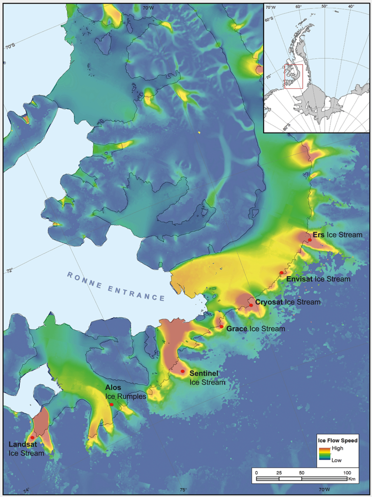
Introducing Landsat Ice Stream
Seven ice features in western Antarctica have been named for Earth-observation satellites, including one named for Landsat.
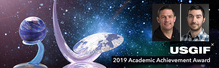
RIT Scientists Recognized for Solving Issue with Landsat 8 TIRS Instrument
Aaron Gerace and Matthew Montanaro earned the 2019 USGIF Academic Achievement Award for their work on the Landsat 8 TIRS stray-light issue.

Landsat Science Team Member Feng Gao Wins 2018 Arthur S. Flemming Award
Dr. Gao has been awarded in recognition of his original research in the application of remote sensing for crop and vegetation monitoring.
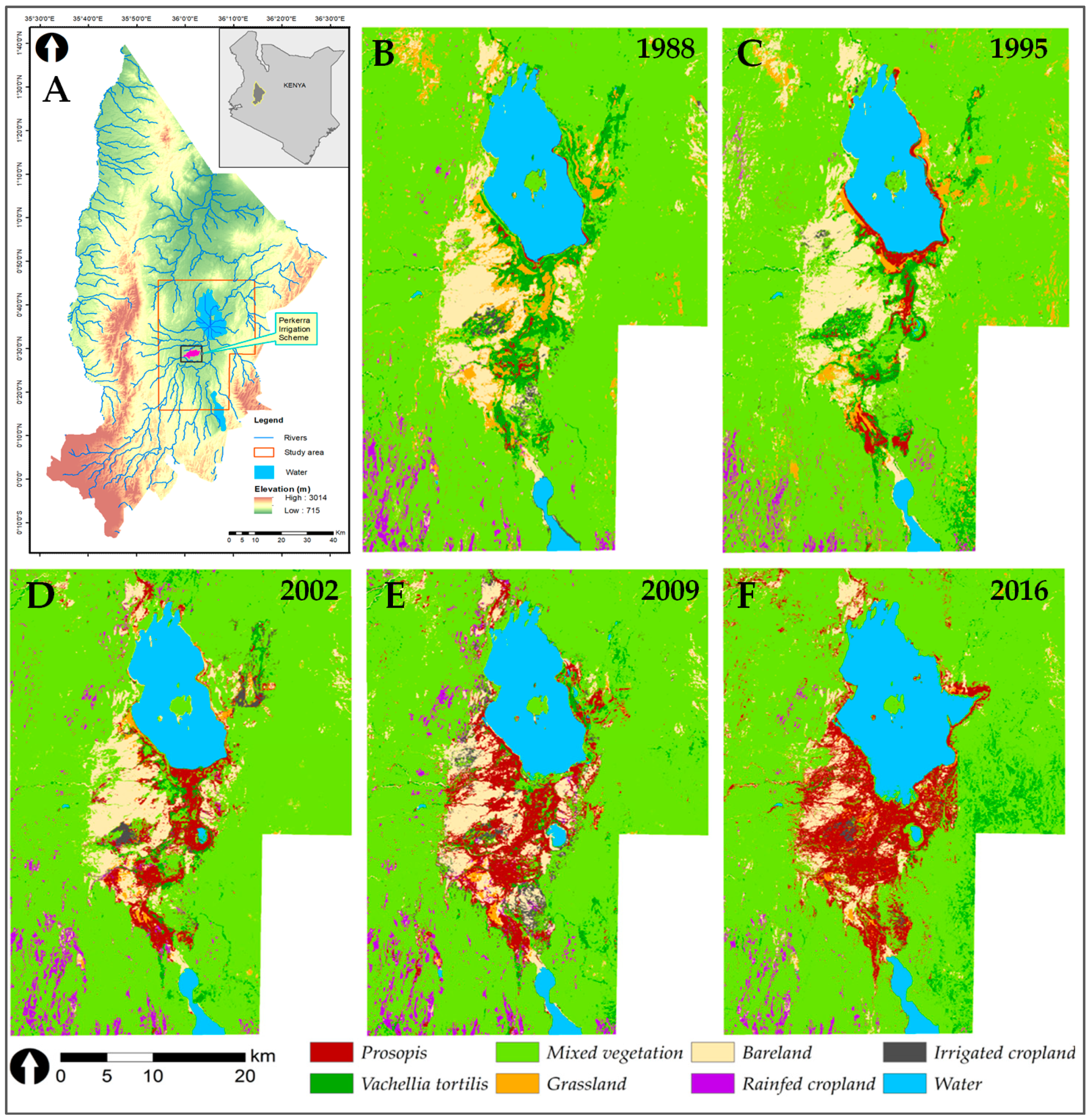
Containing a Woody Weed in Kenya
Prosopis was introduced to Kenya in the 1980s to provide fuelwood; it has since turned into an environmental scourge. Landsat has tracked its fast-paced spread.
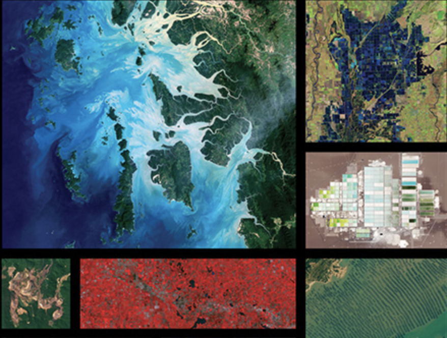
Geoscience is Everywhere: 2019 Earth Science Week Poster
NASA and AmericaView again joined forces to create this year’s 2019 Earth Science Week Poster. The poster features a wide array of remote sensing and geoscience applications.

Green Space is Good for Mental Health, Landsat Helps Establish
The prolonged presence of green space is intrinsic for a healthy society a new nationwide Danish study finds.
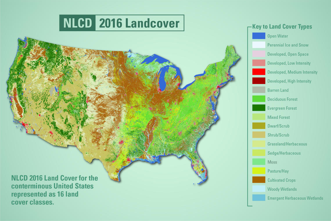
New Land Cover Maps Depict 15 Years of Change Across America
USGS released the latest edition of the National Land Cover Database (NLCD) for the U.S.—the most comprehensive land cover database that the USGS has ever produced.
Landsat Collection 2 Summary and Sample Metadata Now Available
The USGS is currently finalizing the Landsat Collection 2 product definition structure, production timeline and public availability.
Geoscience is Everywhere: 2019 Earth Science Week Poster
NASA and AmericaView again joined forces to create this year’s 2019 Earth Science Week Poster. The poster features a wide array of remote sensing and geoscience applications.
Green Space is Good for Mental Health, Landsat Helps Establish
The prolonged presence of green space is intrinsic for a healthy society a new nationwide Danish study finds.
New Land Cover Maps Depict 15 Years of Change Across America
USGS released the latest edition of the National Land Cover Database (NLCD) for the U.S.—the most comprehensive land cover database that the USGS has ever produced.
Landsat Collection 2 Summary and Sample Metadata Now Available
The USGS is currently finalizing the Landsat Collection 2 product definition structure, production timeline and public availability.
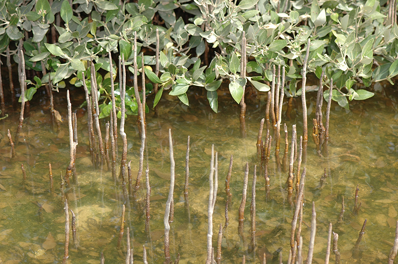
The Curious Case of Missing Mangroves in the Jubail Conservation
A group of researchers have used Landsat data to help solve a case of missing mangroves in Saudi Arabia’s Jubail Conservation.
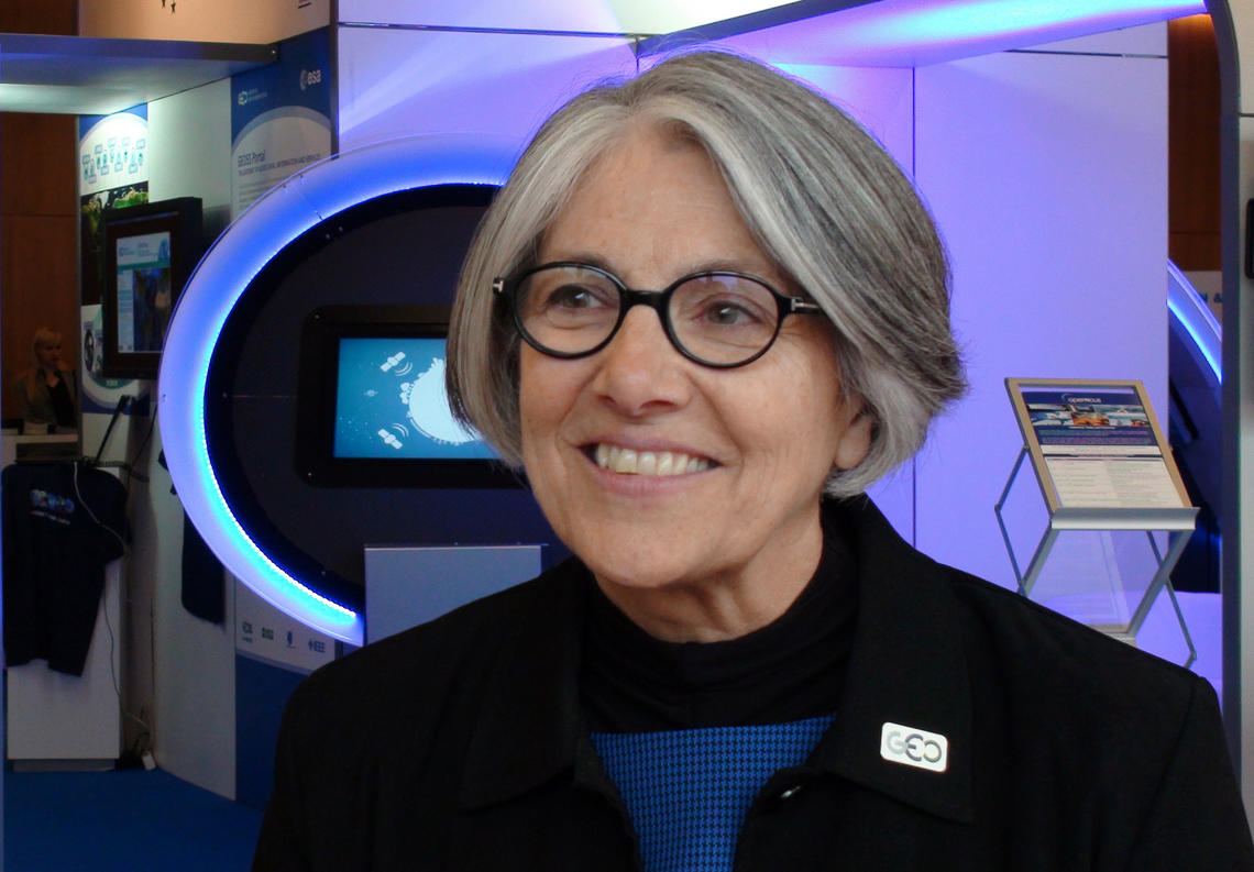
Barbara Ryan Wins 2018 Pecora Award
Barb Ryan was recognized with the individual Pecora award for her outstanding contributions as a scientist and visionary leader for advancing the global use of remote sensing through championing data democratization.
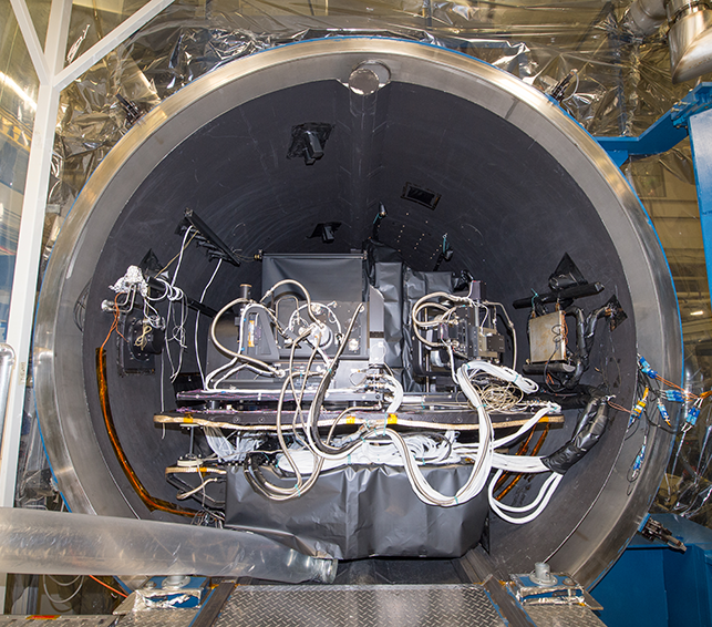
TIRS-2 Completes Baseline Thermal Vac Test
The completion of this test represents a major milestone for the TIRS-2 project, demonstrating that the team has built a well working instrument to meet the requirements of Landsat 9.
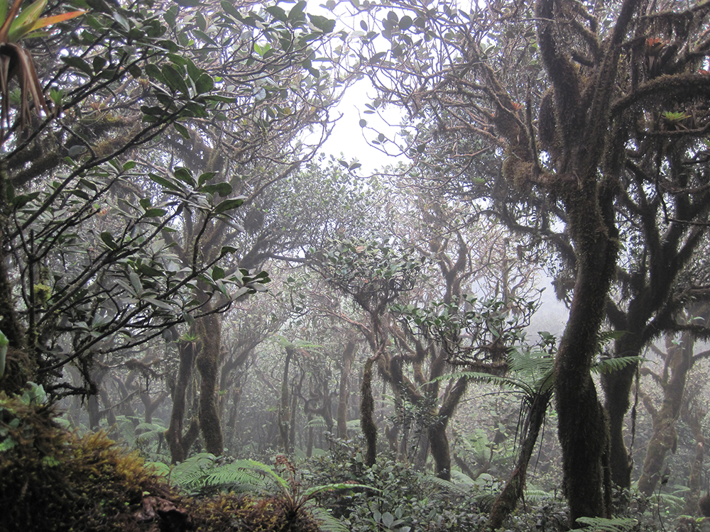
Neotropical Cloud Forests to Lose What Most Defines Them: Clouds
If greenhouse gas emissions continue increasing as they have been, 90% of Western Hemisphere cloud forests would be affected as early as 2060.
Twenty Years with Landsat 7
In the long and winding history of the Landsat Program, April 15, 1999 was an important day.
Geoscience is Everywhere: 2019 Earth Science Week Poster
NASA and AmericaView again joined forces to create this year’s 2019 Earth Science Week Poster. The poster features a wide array of remote sensing and geoscience applications.
Green Space is Good for Mental Health, Landsat Helps Establish
The prolonged presence of green space is intrinsic for a healthy society a new nationwide Danish study finds.
New Land Cover Maps Depict 15 Years of Change Across America
USGS released the latest edition of the National Land Cover Database (NLCD) for the U.S.—the most comprehensive land cover database that the USGS has ever produced.
Landsat Collection 2 Summary and Sample Metadata Now Available
The USGS is currently finalizing the Landsat Collection 2 product definition structure, production timeline and public availability.
The Curious Case of Missing Mangroves in the Jubail Conservation
A group of researchers have used Landsat data to help solve a case of missing mangroves in Saudi Arabia’s Jubail Conservation.
Barbara Ryan Wins 2018 Pecora Award
Barb Ryan was recognized with the individual Pecora award for her outstanding contributions as a scientist and visionary leader for advancing the global use of remote sensing through championing data democratization.
TIRS-2 Completes Baseline Thermal Vac Test
The completion of this test represents a major milestone for the TIRS-2 project, demonstrating that the team has built a well working instrument to meet the requirements of Landsat 9.
Neotropical Cloud Forests to Lose What Most Defines Them: Clouds
If greenhouse gas emissions continue increasing as they have been, 90% of Western Hemisphere cloud forests would be affected as early as 2060.
Twenty Years with Landsat 7
In the long and winding history of the Landsat Program, April 15, 1999 was an important day.
