
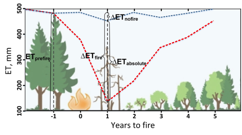
Understanding How Fire Alters the Water Use of Sierra Nevada Forests
Fires play an important role in regulating forest density, vegetation water use, and runoff.
Watching River Islands Grow on the Brahmaputra
Stable river islands locally known as ‘chars’ are increasing in the Brahmaputra river.
Monitoring Forest Health Amid Oil and Gas Extraction
Following changes in long-term forest health around oil and gas wells in the Pennsylvania State Forest.
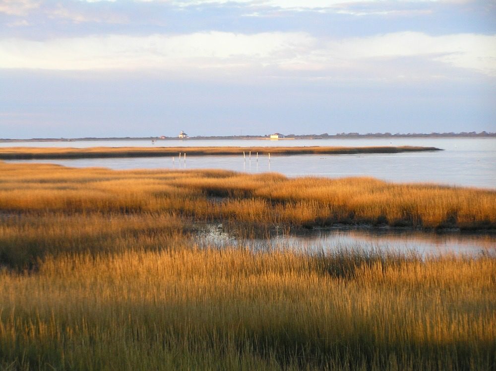
Mapping Long-term Salt Marsh Change with Landsat
This research identified the Delmarva as an area of significant salt marsh loss over the last three decades.
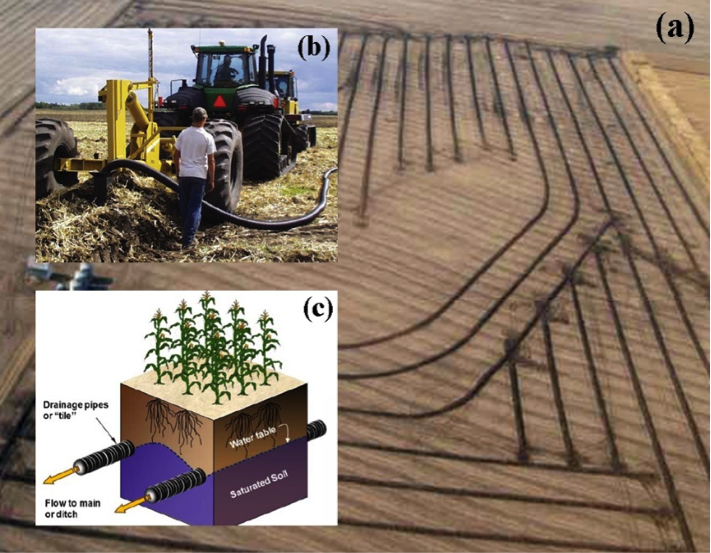
Improving Water Resource Management in the Great Plains
Making annual high-resolution agricultural subsurface drainage maps for the Northern Great Plains regions using multiple satellite and model datasets with Google Earth Engine.
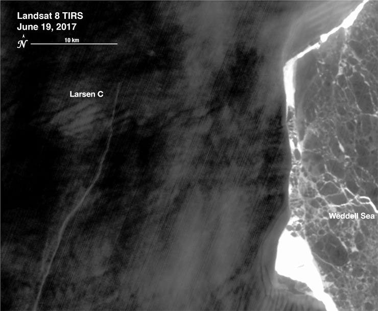
The Dynamic Nature of a Large Iceberg Calving Event
Iceberg A-68 calved from the Larsen C during a period of larger then average tidal cycles.
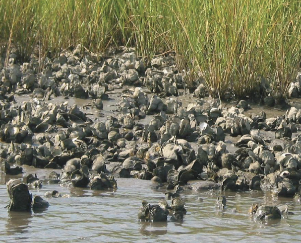
Investigating the Ecosystem Services Provided by Oysters
There is evidence of oyster reefs driving estuary-scale detention of freshwater in the Suwannee Sound.
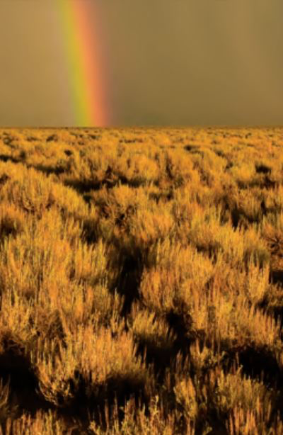
Shrub and Grass Vegetation Declining Across Great Basin
Across the Great Basin from 1984-2016, shrub and grass vegetation are declining.

Mapping Circulation Patterns of Icy Fjords
“Great insight comes from thinking in multi-sensor and using several constellations together.”

Landsat at #AGU18
Learn what scientists, researchers, and students are doing with Landsat data this year at AGU 2018.
Post-fire Sagebrush Recovery Looks to Landsat Time Series Data for Solutions
USGS scientists are working with the Landsat-based NLCD shrubland dataset to help land managers restore native sagebrush landscapes.

Stanford Researchers Find That a Drying Canadian Delta has Driven Muskrat Population Decline
Stanford research shows the drying trend in Canada’s Peace-Athabasca Delta is linked to the long-term decline in populations of the semi-aquatic muskrat.
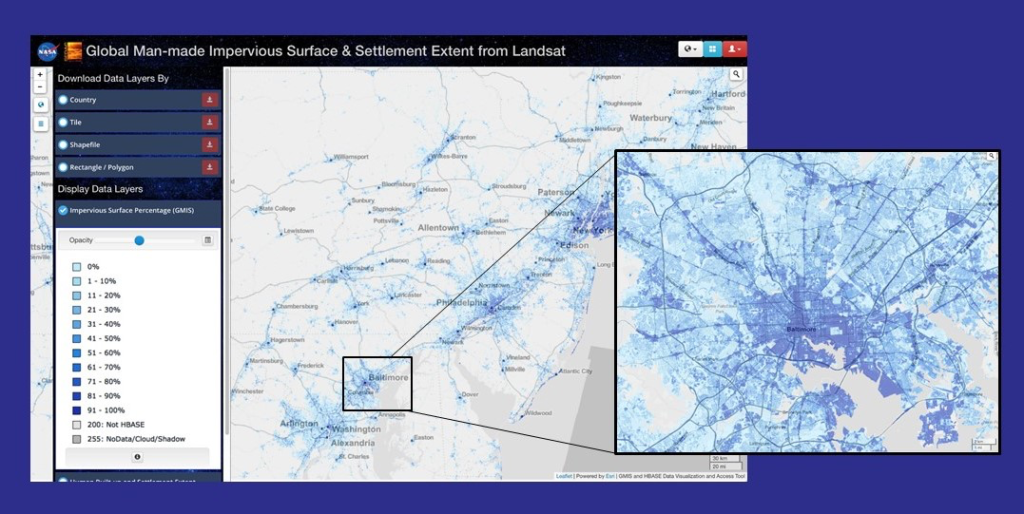
NASA Webinar on Mapping Global Urbanization with Landsat and High-Resolution Reference Data Held Nov. 14
Webinar described the production of the Global Man-made Impervious Surface dataset and its companion urban extent dataset called Human Built-up And Settlement Extent.
Poster Featuring Landsat-based Research Wins 2018 NRCan Map Contest
Access to image data collected by the Landsat series of satellites has improved Canada’s ability to observe, track and study forest disturbances.
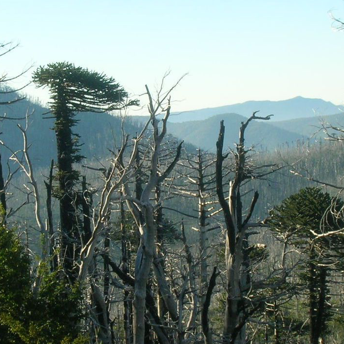
Looking at Burn Severity and Post-Fire Forest Regeneration in Chile’s Andean Cordillera, Home to the Monkey Puzzle Tree
The first study that connects field-measured data with satellite-derived burn severity in this corner of the world.
USGS Burned Area Products Group in Denver Touts Value of Landsat ARD
A new Burned Area algorithm has been developed by USGS to identify burned areas in images across the Landsat archive.
Despite Recovery, Widespread Evidence of Deforestation Remains a Half-Century Later
The patterns of large-scale tropical deforestation endure across landscapes, even after more than a half-century of tropical rainforest expansion and growth.
Mapping Circulation Patterns of Icy Fjords
“Great insight comes from thinking in multi-sensor and using several constellations together.”
Landsat at #AGU18
Learn what scientists, researchers, and students are doing with Landsat data this year at AGU 2018.
Post-fire Sagebrush Recovery Looks to Landsat Time Series Data for Solutions
USGS scientists are working with the Landsat-based NLCD shrubland dataset to help land managers restore native sagebrush landscapes.
Stanford Researchers Find That a Drying Canadian Delta has Driven Muskrat Population Decline
Stanford research shows the drying trend in Canada’s Peace-Athabasca Delta is linked to the long-term decline in populations of the semi-aquatic muskrat.
NASA Webinar on Mapping Global Urbanization with Landsat and High-Resolution Reference Data Held Nov. 14
Webinar described the production of the Global Man-made Impervious Surface dataset and its companion urban extent dataset called Human Built-up And Settlement Extent.
Poster Featuring Landsat-based Research Wins 2018 NRCan Map Contest
Access to image data collected by the Landsat series of satellites has improved Canada’s ability to observe, track and study forest disturbances.
Looking at Burn Severity and Post-Fire Forest Regeneration in Chile’s Andean Cordillera, Home to the Monkey Puzzle Tree
The first study that connects field-measured data with satellite-derived burn severity in this corner of the world.
USGS Burned Area Products Group in Denver Touts Value of Landsat ARD
A new Burned Area algorithm has been developed by USGS to identify burned areas in images across the Landsat archive.
Despite Recovery, Widespread Evidence of Deforestation Remains a Half-Century Later
The patterns of large-scale tropical deforestation endure across landscapes, even after more than a half-century of tropical rainforest expansion and growth.
