
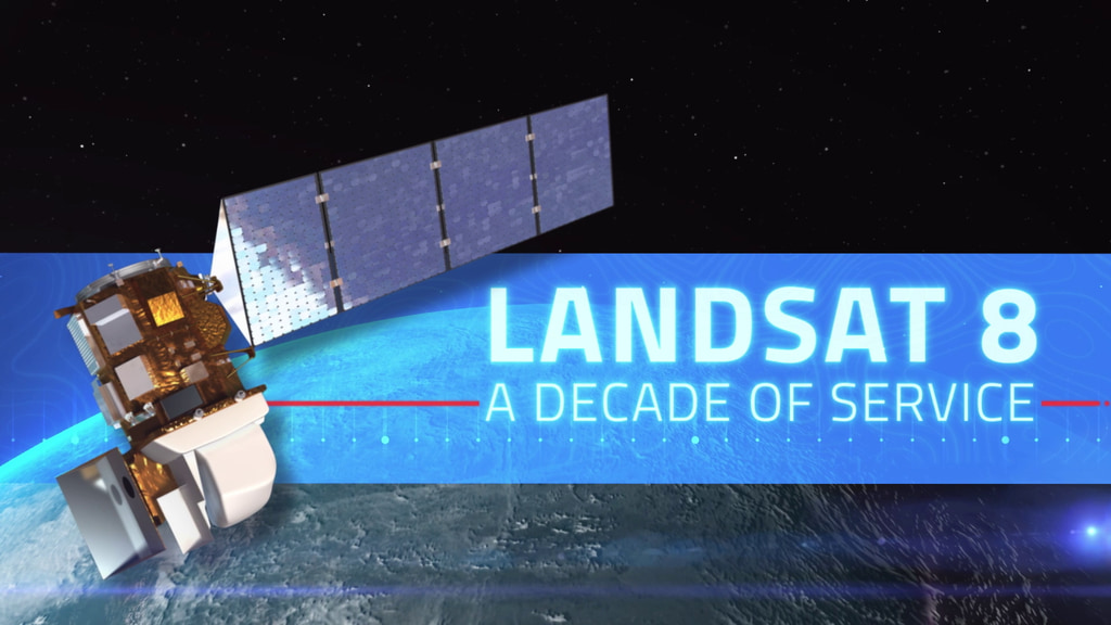
Landsat 8 – A Decade of Service
This February marks the 10th anniversary of the launch of Landsat 8, launched by NASA in 2013 and operated by the US Geological Survey.
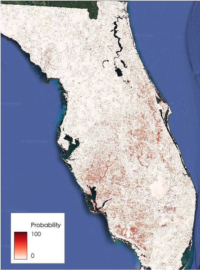
NASA and IBM Collaborate to Apply AI to Earth Science Data
The collaboration between NASA and IBM is a unique application of artificial intelligence (AI) foundation model technology to NASA Earth observation data.
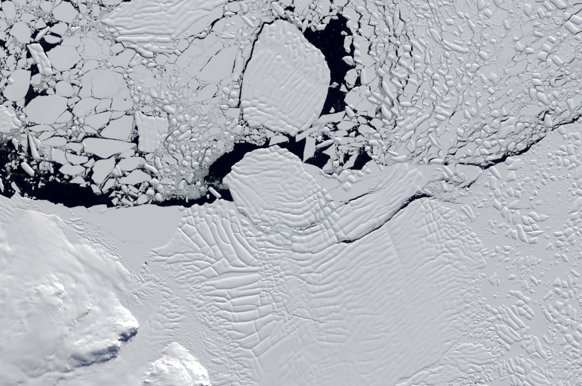
Influencing Factors: Satellites Help Decipher the Fate of West Antartica
An international team of researchers has combined satellite imagery and climate and ocean records to obtain the most detailed understanding yet of how the West Antarctic Ice Sheet – which contains enough ice to raise global sea level by 3.3 metres – is responding to climate change.
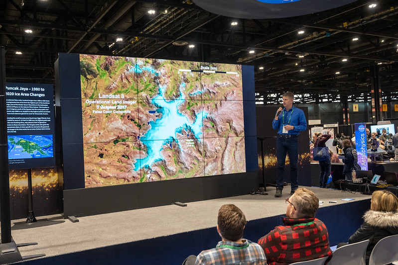
Landsat at #AGU22
Landsat was part of over 400 presentations at the AGU 2022 Fall Meeting this year in Chicago.

2022 AGS Awards Highlight Landsat’s Impact on the Field of Geography
Virginia Norwood was recognized by AGS for her development of the first Landsat sensor and Karen Seto was recognized for her urban growth research which often relies on the long Landsat data archive.
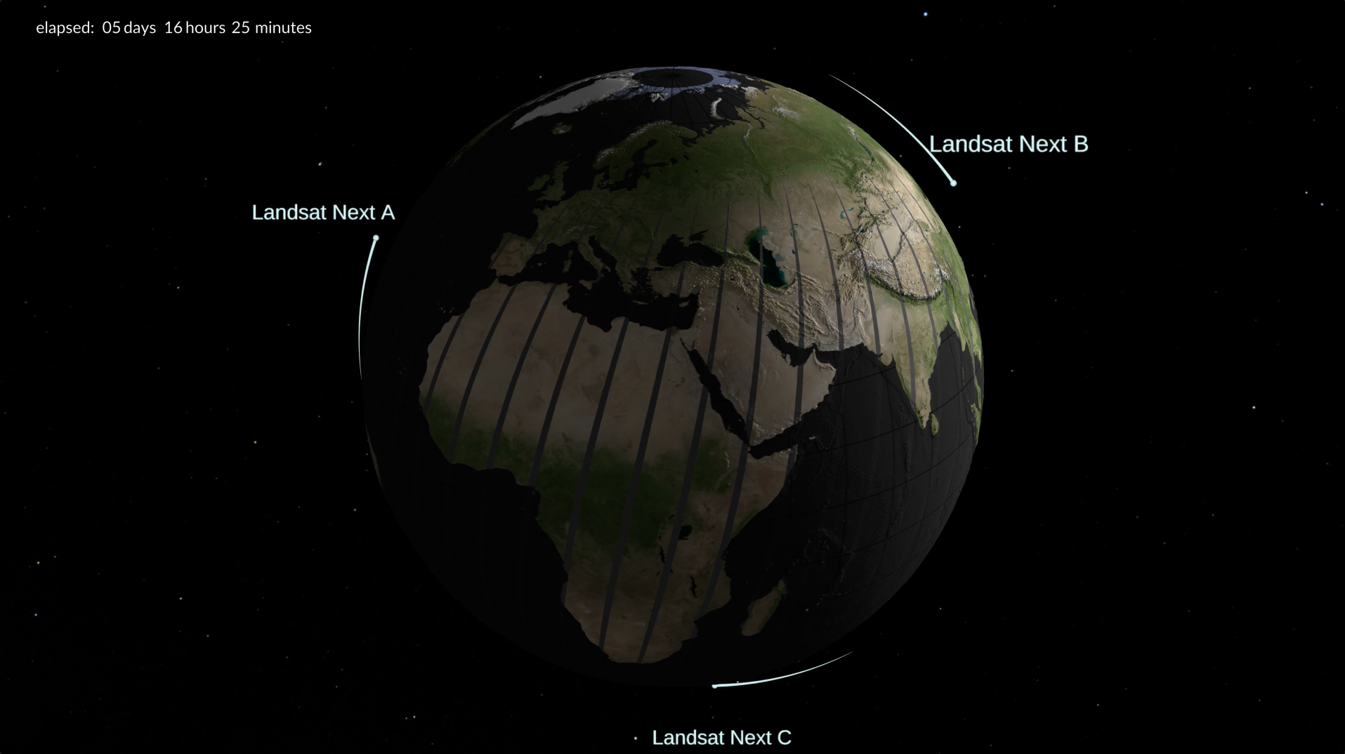
Next up to Continue NASA/USGS’s Landsat Legacy
With a trio of smaller satellites that can each detect 26 wavelengths of light and thermal energy, the Landsat Next mission is expected to look very different from its predecessors that have been observing Earth for 50 years.
NASA Harvest Video Celebrates 50 Years of Landsat
NASA Harvest gathered agricultural remote sensing experts to discuss how Landsat fundamentally transformed agricultural monitoring over the last half century.
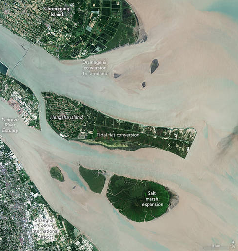
NASA Scientists Map Global Salt Marsh Losses and Their Carbon Impact
The world has lost 561 square miles (1,453 square kilometers) of salt marshes over the past 20 years.
NASA Scientists Map Global Salt Marsh Losses and Their Carbon Impact
The world has lost 561 square miles (1,453 square kilometers) of salt marshes over the past 20 years.
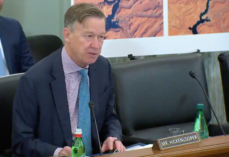
Hearing: Landsat at 50 & the Future of U.S. Satellite-Based Earth Observation
A U.S. Senate subcommittee hearing titled “Landsat at 50 & the Future of U.S. Satellite-based Earth Observation: took place on Thursday, Dec. 1, 2022.
Space for Ag: How Satellites Aid Water and Food Security
Satellites offer a wealth of information pertinent for water and food security. Landsat has long been a foundational piece of the “Space for Ag” initiative.
Landsat Helps Scientists Track Dramatic Wetlands Loss in Louisiana
New research uses Landsat observations and advanced computing to chronicle wetlands lost (and found) around the globe.
Landsat Fire and Thermal Anomaly Data Now Part of FIRMS
Thirty-meter Landsat 8 and 9 data have been added to NASA’s Fire Information for Resource Management System (FIRMS).
Celebrating 50 Years of Earth Observation with the Landsat Chamber Orchestra
On Saturday, October 15, the Visitors Center at NASA’s Goddard Space Flight center presented an audio/visual event in celebration of Landsat’s 50th anniversary.

The Satellite Stewards of Glacier Bay
Nestled in the science-based information that park rangers share with visitors to Glacier Bay National Park and Preserve are insights from Landsat satellites and NASA climate scientists.
Quickly Assessing the Aftermath of Hurricane Ian with Satellites
UCONN remote sensing experts used Harmonized Landsat Sentinel-2 imagery to quickly assess damage caused by the storm’s aftermath, providing spatially-relevant situational awareness that could aid rescue efforts.

Eyes on the Snow as Water Supplies Dwindle
Airborne Snow Observatories, Inc. uses higher-resolution snow cover data from Landsat to update their model snow cover.
NASA Scientists Map Global Salt Marsh Losses and Their Carbon Impact
The world has lost 561 square miles (1,453 square kilometers) of salt marshes over the past 20 years.
Hearing: Landsat at 50 & the Future of U.S. Satellite-Based Earth Observation
A U.S. Senate subcommittee hearing titled “Landsat at 50 & the Future of U.S. Satellite-based Earth Observation: took place on Thursday, Dec. 1, 2022.
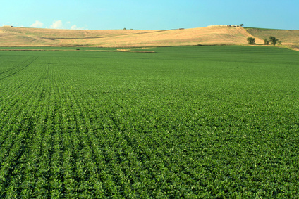
Space for Ag: How Satellites Aid Water and Food Security
Satellites offer a wealth of information pertinent for water and food security. Landsat has long been a foundational piece of the “Space for Ag” initiative.
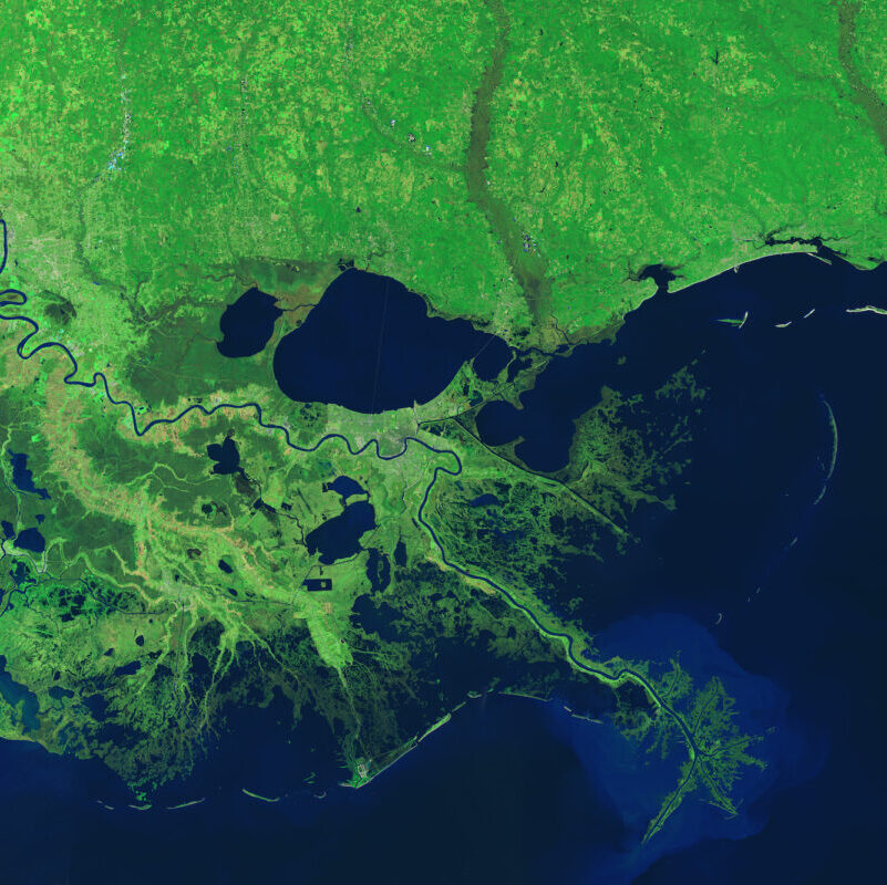
Landsat Helps Scientists Track Dramatic Wetlands Loss in Louisiana
New research uses Landsat observations and advanced computing to chronicle wetlands lost (and found) around the globe.
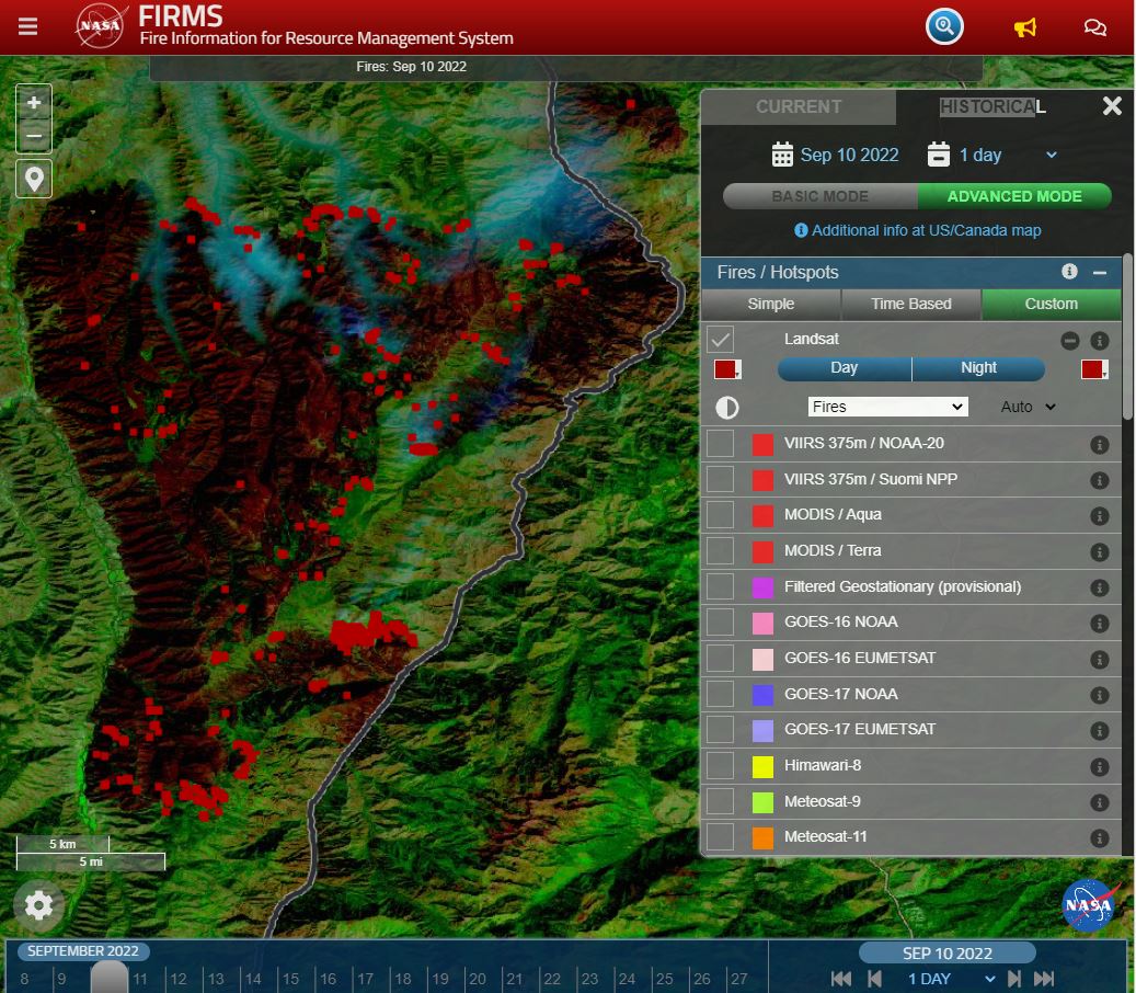
Landsat Fire and Thermal Anomaly Data Now Part of FIRMS
Thirty-meter Landsat 8 and 9 data have been added to NASA’s Fire Information for Resource Management System (FIRMS).
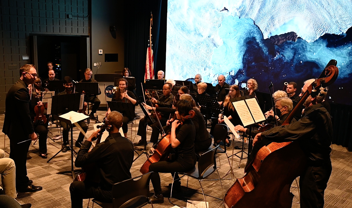
Celebrating 50 Years of Earth Observation with the Landsat Chamber Orchestra
On Saturday, October 15, the Visitors Center at NASA’s Goddard Space Flight center presented an audio/visual event in celebration of Landsat’s 50th anniversary.
The Satellite Stewards of Glacier Bay
Nestled in the science-based information that park rangers share with visitors to Glacier Bay National Park and Preserve are insights from Landsat satellites and NASA climate scientists.
Quickly Assessing the Aftermath of Hurricane Ian with Satellites
UCONN remote sensing experts used Harmonized Landsat Sentinel-2 imagery to quickly assess damage caused by the storm’s aftermath, providing spatially-relevant situational awareness that could aid rescue efforts.
Eyes on the Snow as Water Supplies Dwindle
Airborne Snow Observatories, Inc. uses higher-resolution snow cover data from Landsat to update their model snow cover.
