
A Rendezvous with Landsat
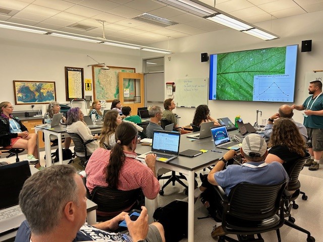
NASA outreach specialists led educators through a workshop on accessing and utilizing Landsat data at the annual Earth Educators’ Rendezvous.
Be Part of What’s Next: Emerging Applications of Landsat at AGU24
Anyone making innovative use of Landsat data to meet societal needs today and during coming decades is encouraged to submit and abstract for the upcoming "Emerging Science Applications of Landsat" session at AGU24.
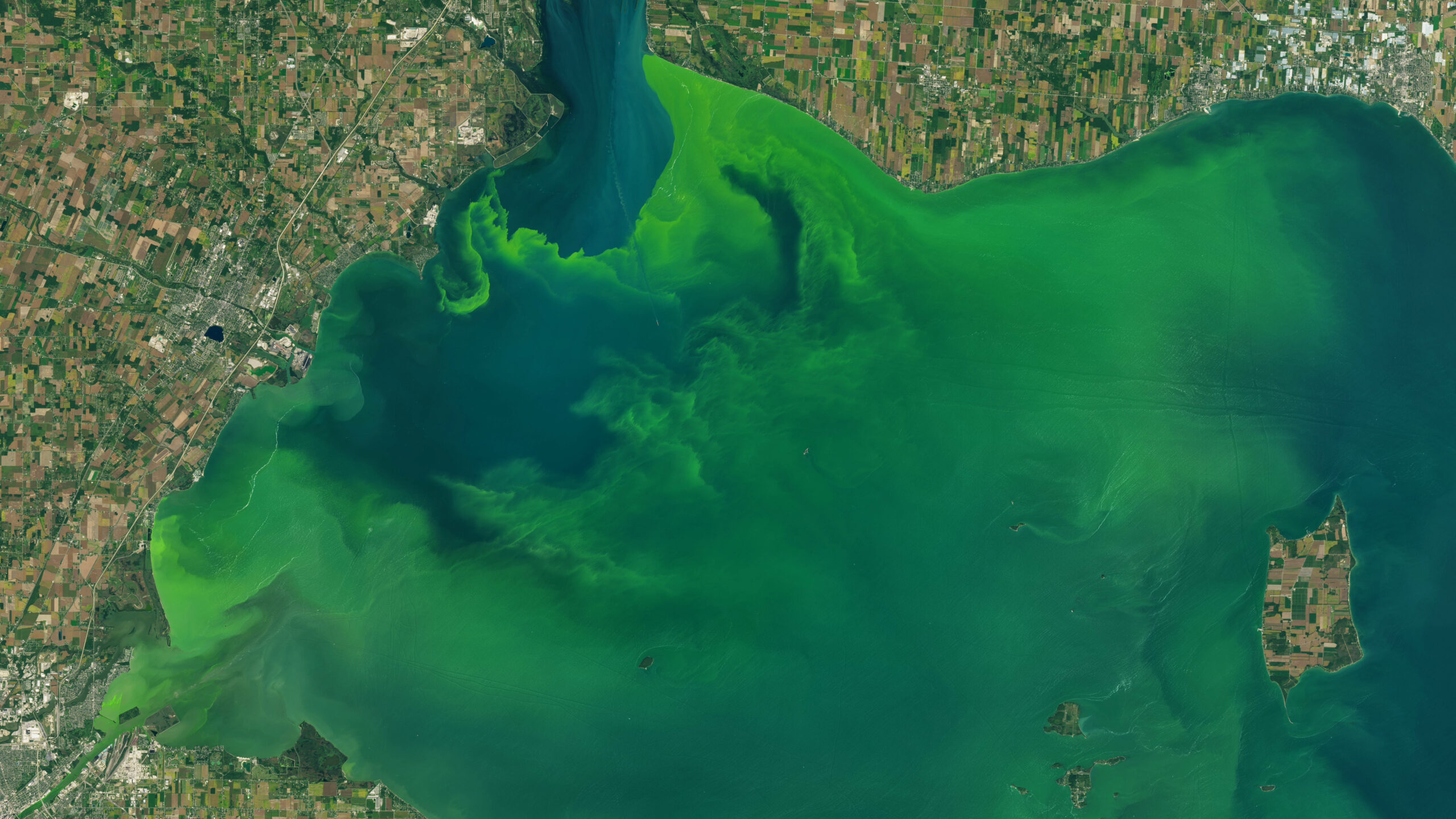
New Tool Provides Rapid Evaluation of Water Quality
A combination of Landsat and Sentinel-2 imagery, NASA near real-time data, and machine learning provides near real-time access to high-resolution water quality maps.
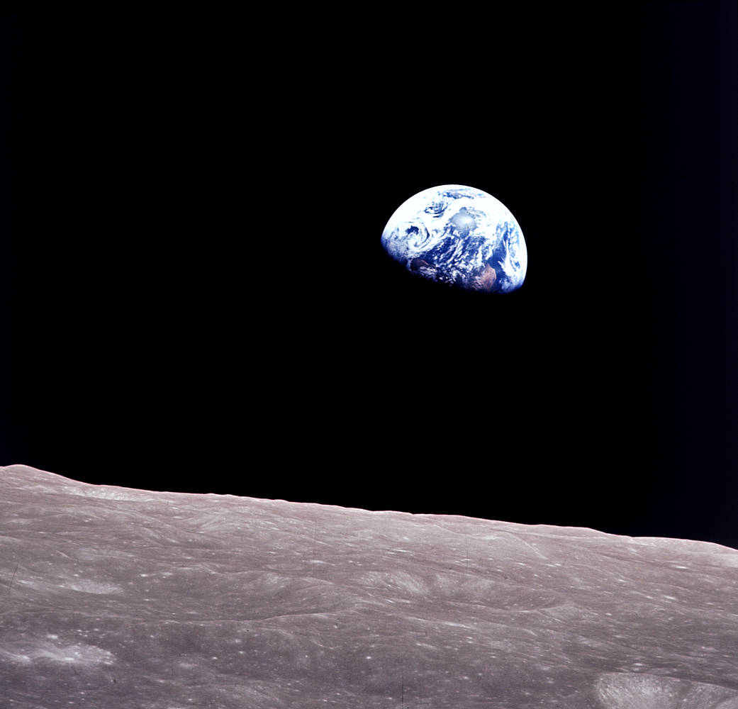
Remembering Bill Anders
Anders, 90, the astronaut who captured the iconic Earthrise photograph, died on June 7, 2024, when the plane he was piloting crashed into the San Juan Channel.

NASA Selects Raytheon Company to Build Landsat Next Instruments
NASA announced in a contract release that Raytheon Company will build the series of Landsat Next instruments. Landsat Next represents a quantum leap in measurement capabilities with improved temporal, spatial, and spectral resolutions.
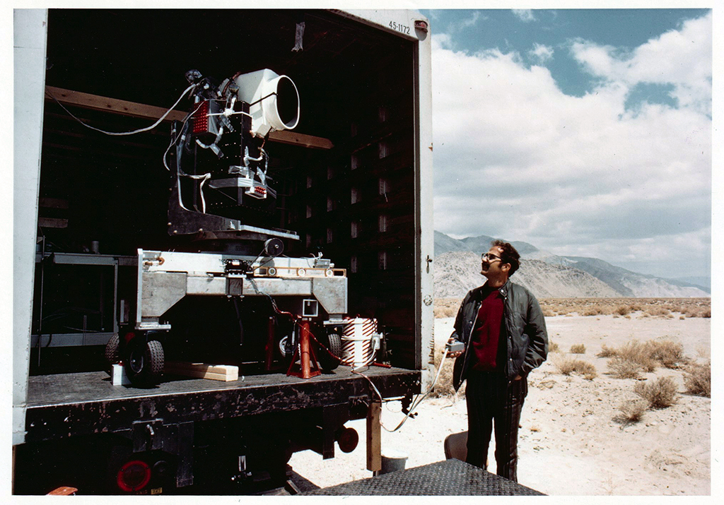
MSS You! Photos from a 1972 Road Trip
Two months before the launch of Landsat 1, the engineering model of the satellite's multispectral scanner system went on a California road trip.

Satellites to Seeds: NASA Ag Day on the Hill
The Landsat Communications and Public Engagement team supported the Satellites to Seeds event on the Hill in Washington, D.C.

Landsat at Odyssey of the Mind
From May 21-25, the Landsat Outreach team supported Odyssey of the Mind World Finals at Iowa State University in Ames, Iowa.

Landsat Observations Key Resource for Many Federal Agencies
In the FY23 Aeronautics and Space Report released on May 23, 2024, a multitude of Federal agencies report work informed by Landsat data.
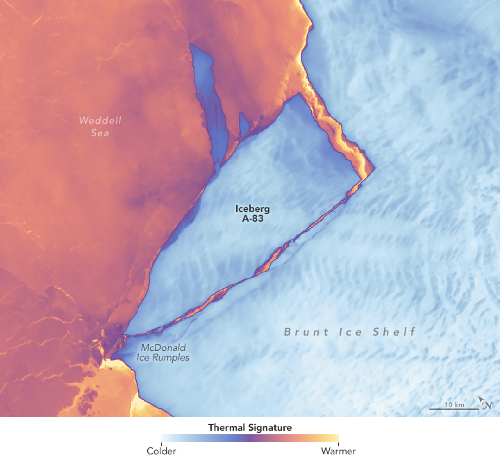
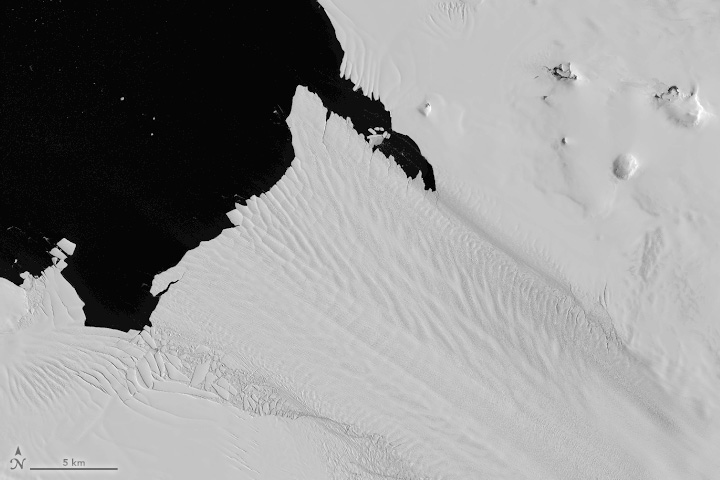
Antarctic Ice Shelf Spawns Iceberg A-83
The Brunt Ice Shelf lost a large wedge of floating ice, the third sizeable iceberg to calve from the shelf in recent years. The TIRS instrument on Landsat 9 captured false-color images of the calving.
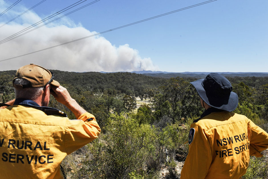
Spotted by Satellite: Situational Awareness in Fiery Times
The Australian company Indji Systems uses a variety of satellite data to provide real-time hazard monitoring and alerts to utility and renewable energy companies across Australia, North America and Europe.
Exploring Earth from Above: Landsat Outreach at Maryland Day
The Landsat Communications and Public Engagement team supported Maryland Day, hosted by the University of Maryland (UMD), College Park on Saturday, April 27, 2024.
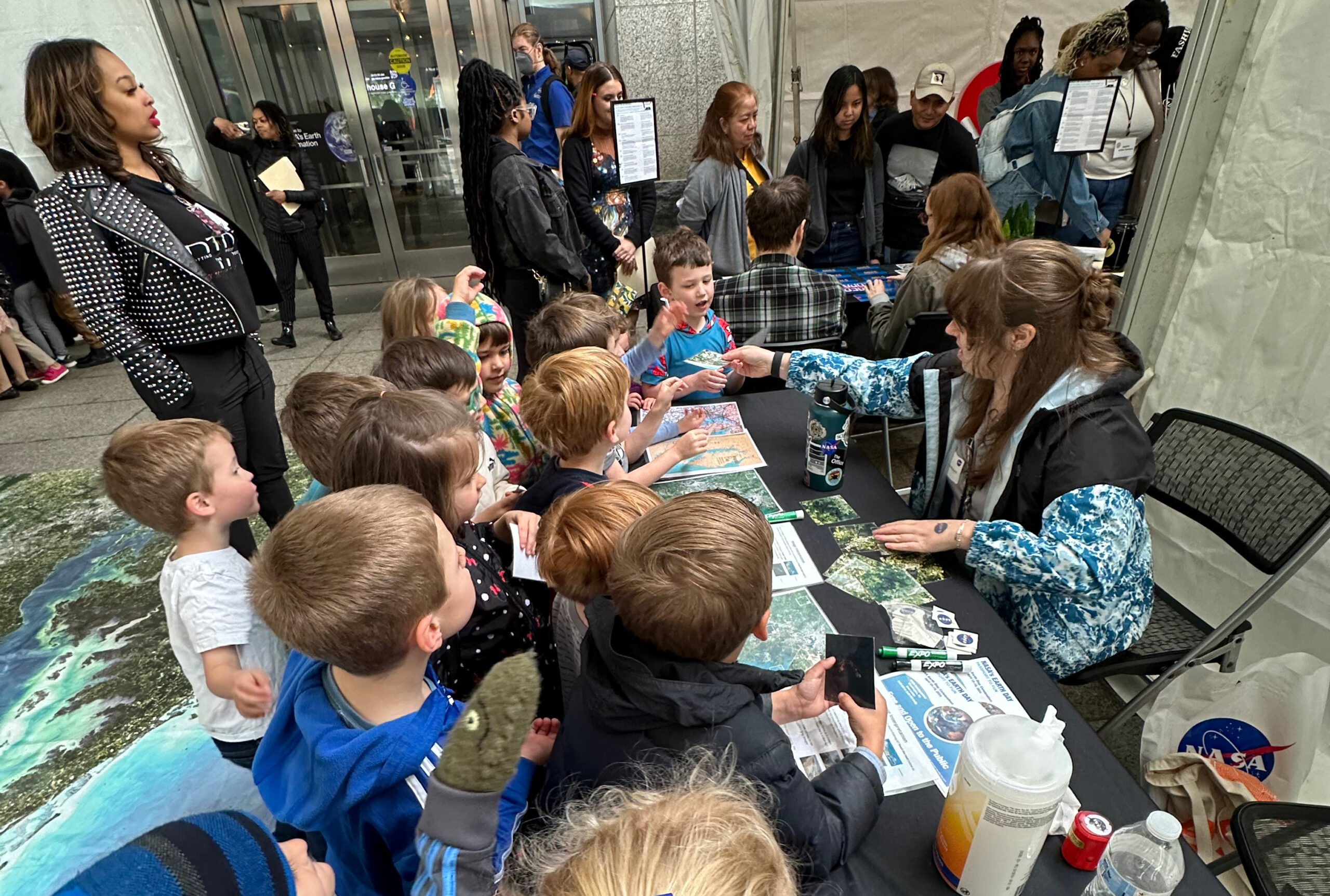
Landsat Outreach: Celebrating Earth Day 2024
On April 18 and 19, Landsat outreach coordinators Ross Walter, Allison Nussbaum, and Michael Taylor supported the Earth Day event at NASA Headquarters in Washington D.C.
Meat of the Matter: Colorado River Over-Consumed
More water is taken from the Colorado River than it has to give. Better water use accounting made possible by Landsat provides needed guidance for difficult water use decisions.
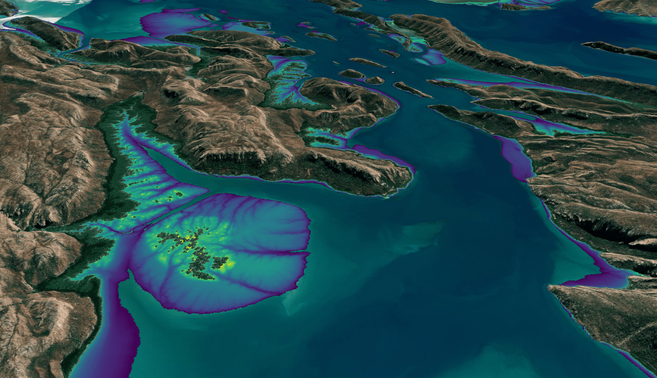
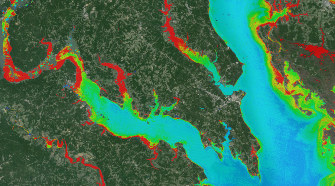
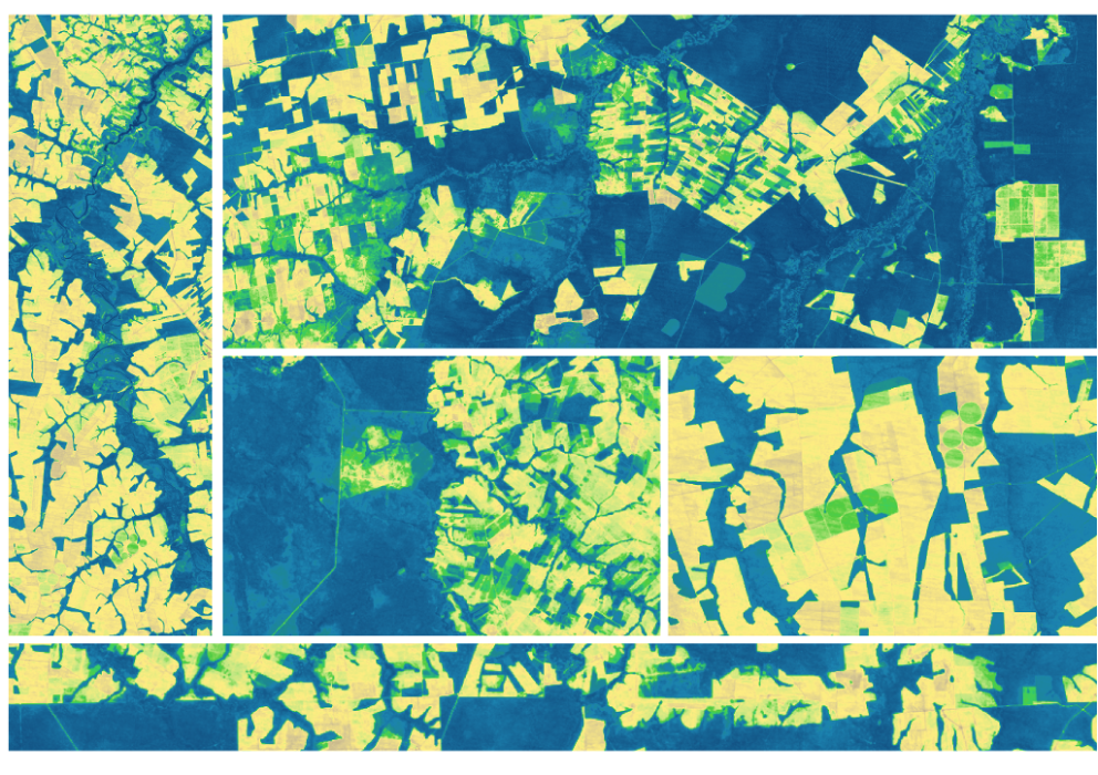
Australian Intertidal Zone Exposed: Landsat and Sentinel-2 Provide Information on Dynamic Region
This month, the Digital Earth Australia (DEA) team released a new Landsat and Sentinel-2 based intertidal data product. The new data set characterizes the tidal shoreline zone of Australia in more detail than ever before.
Landsat & LCLUC: Science Meeting Highlights
Outreach specialists from the Landsat Communications and Public Engagement team participated in community engagement efforts at the joint NASA and University of Maryland Land Cover Land Use Change (LCLUC) meeting.
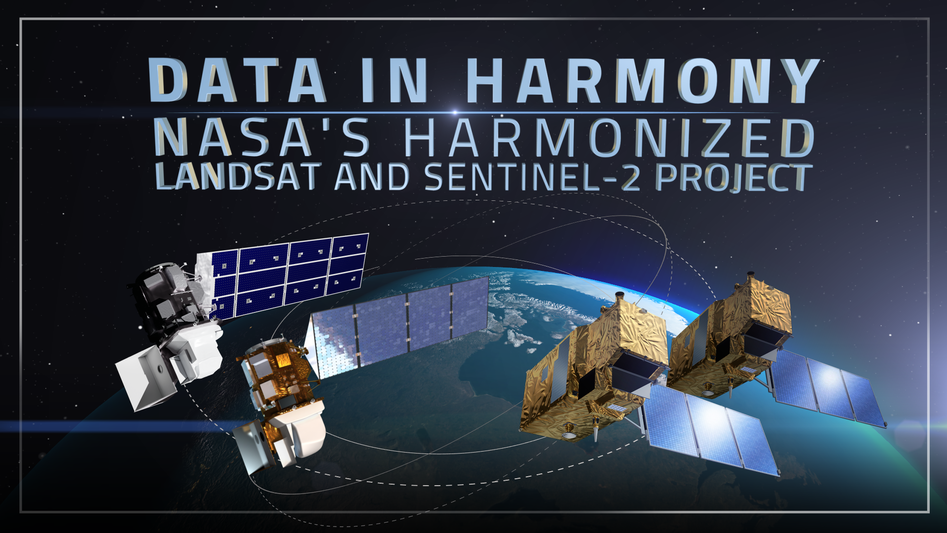
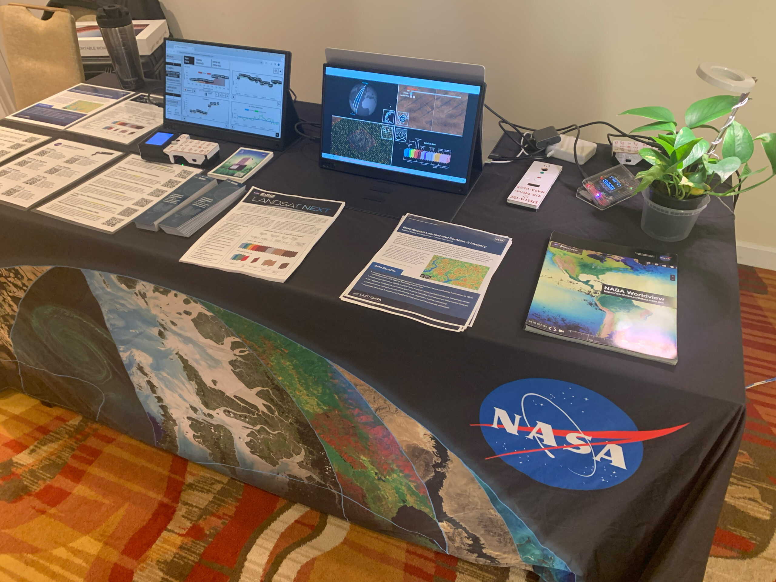
Data in Harmony: NASA’s Harmonized Landsat and Sentinel-2 Project
NASA's Harmonized Landsat and Sentinel-2 (HLS) project is a groundbreaking initiative that combines data from Landsats 8 & 9 with the European Space Agency's Sentinel-2A & 2B satellites.
Expanding OpenET Across Amazon Basin
The research teams who help sustain the largest freshwater reserve in the world are developing a new tool to promote more resilient farming systems in Brazil. The goal is to help farmers better handle changes in the water cycle, deal with droughts, and adapt to a changing climate.

Scenes from the Polar Night
Landsat satellites have begun regularly acquiring images of ice at the poles during the winter, with enlightening results.
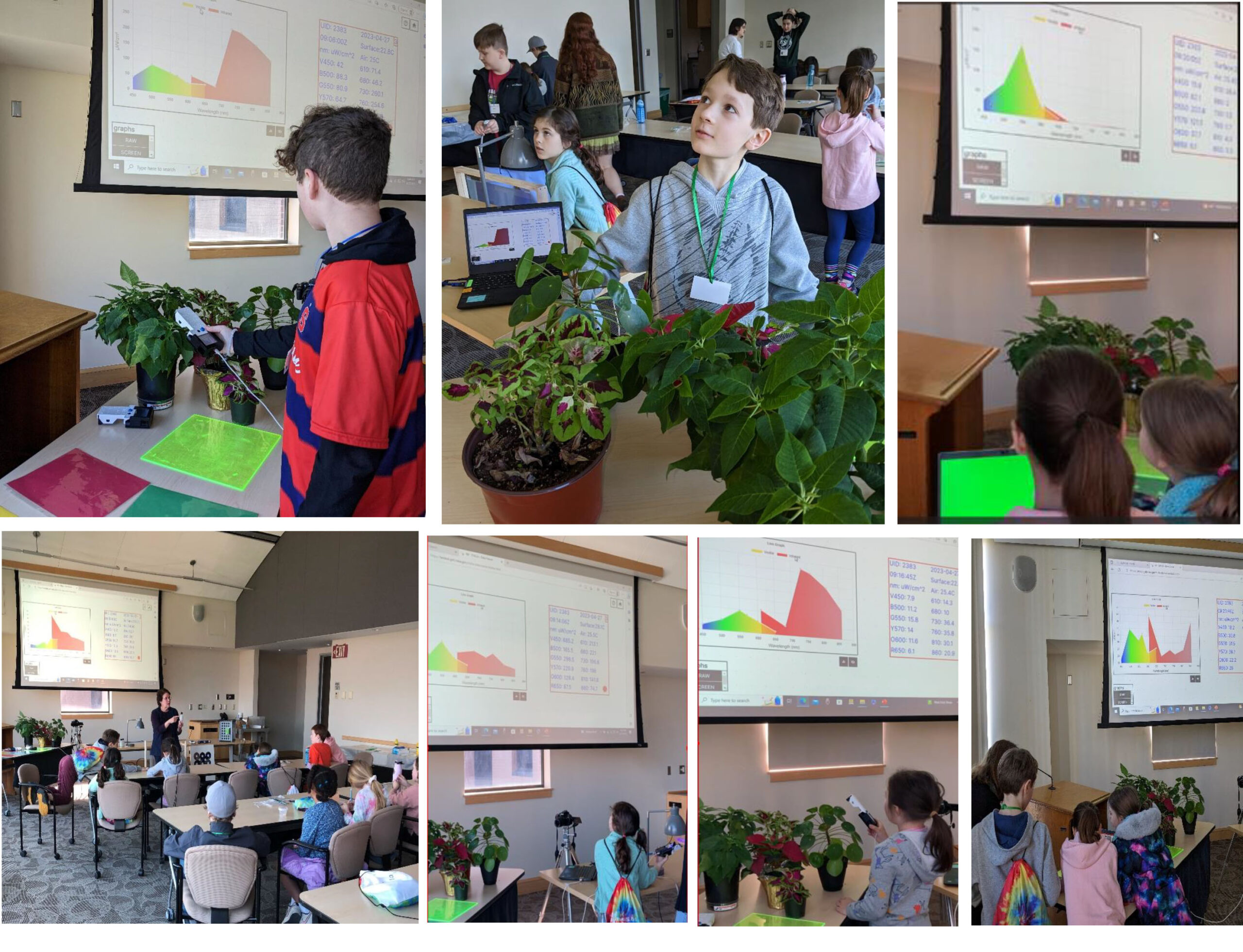
STELLA Spring Webinar: April 15, 2024
STELLA users will talk about their experiences using the DIY spectrometer during this webinar. Panelists include Bianca Cilento (RIT), Karen Karker (SUNY), and Peder Nelson (OSU and NASA GLOBE Observer).

Landsat 9’s Operational Land Imager 2: A Well-Known Instrument
Landsat 9's OLI-2 instrument was characterized in unprecedented detail using a new laser-based method of in-band spectral response testing. A continuous relative spectral response dataset and pre-launch testing details have been published in a recent paper.

Bringing Earth Observations into Science Classrooms
Landsat outreach supported the NASA booth at the National Science Teacher's Association annual meeting in Denver.
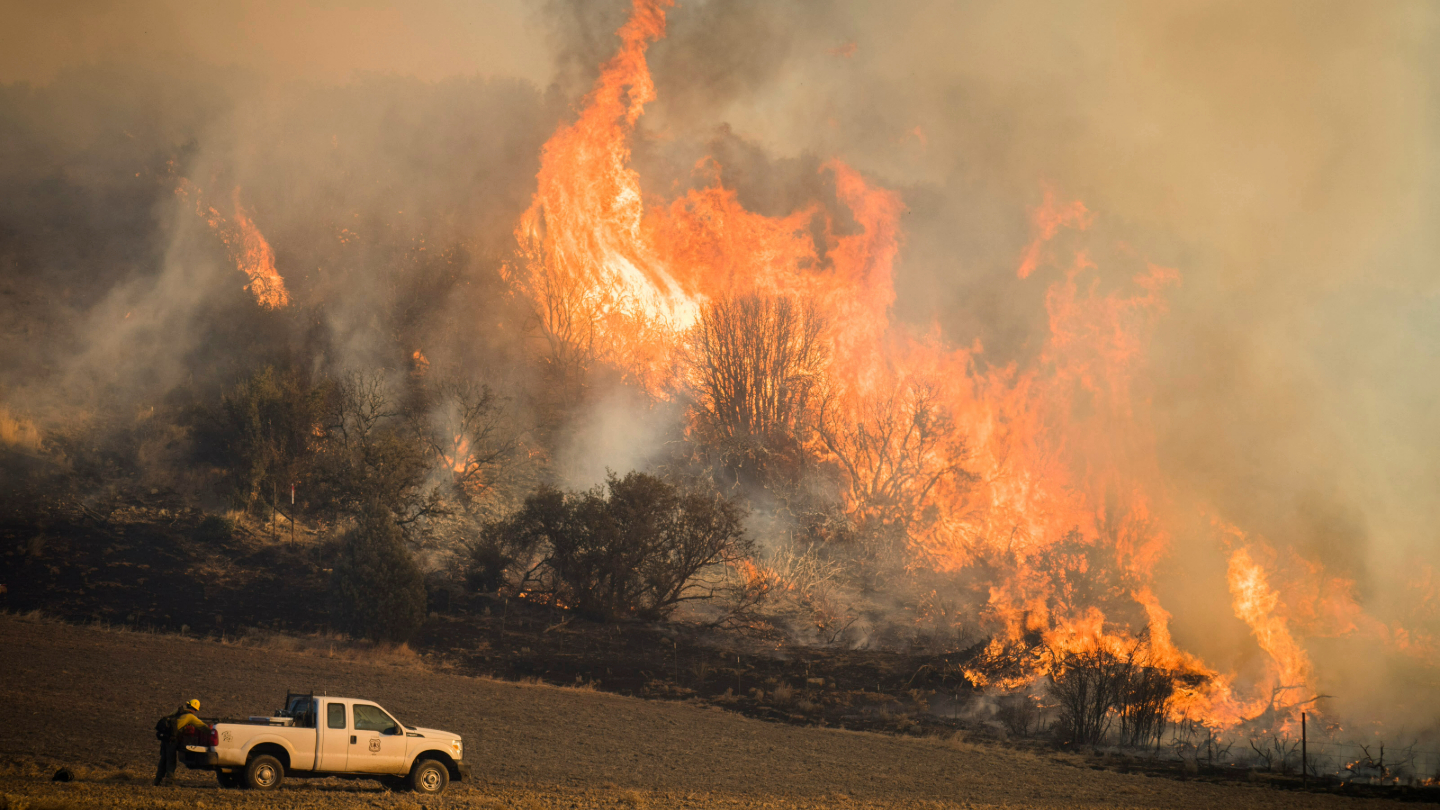
Satellites Show How Drought Changes Wildfire Recovery in the West
A new study using NASA satellite data reveals how drought affects the recovery of western ecosystems from fire, a result that could provide meaningful information for conservation efforts.

Commodity Classic: Landsat Supports Farmers and Food Production
Landsat was part of the NASA Earth Science presence at the 2024 Commodity Classic in Houston this year.
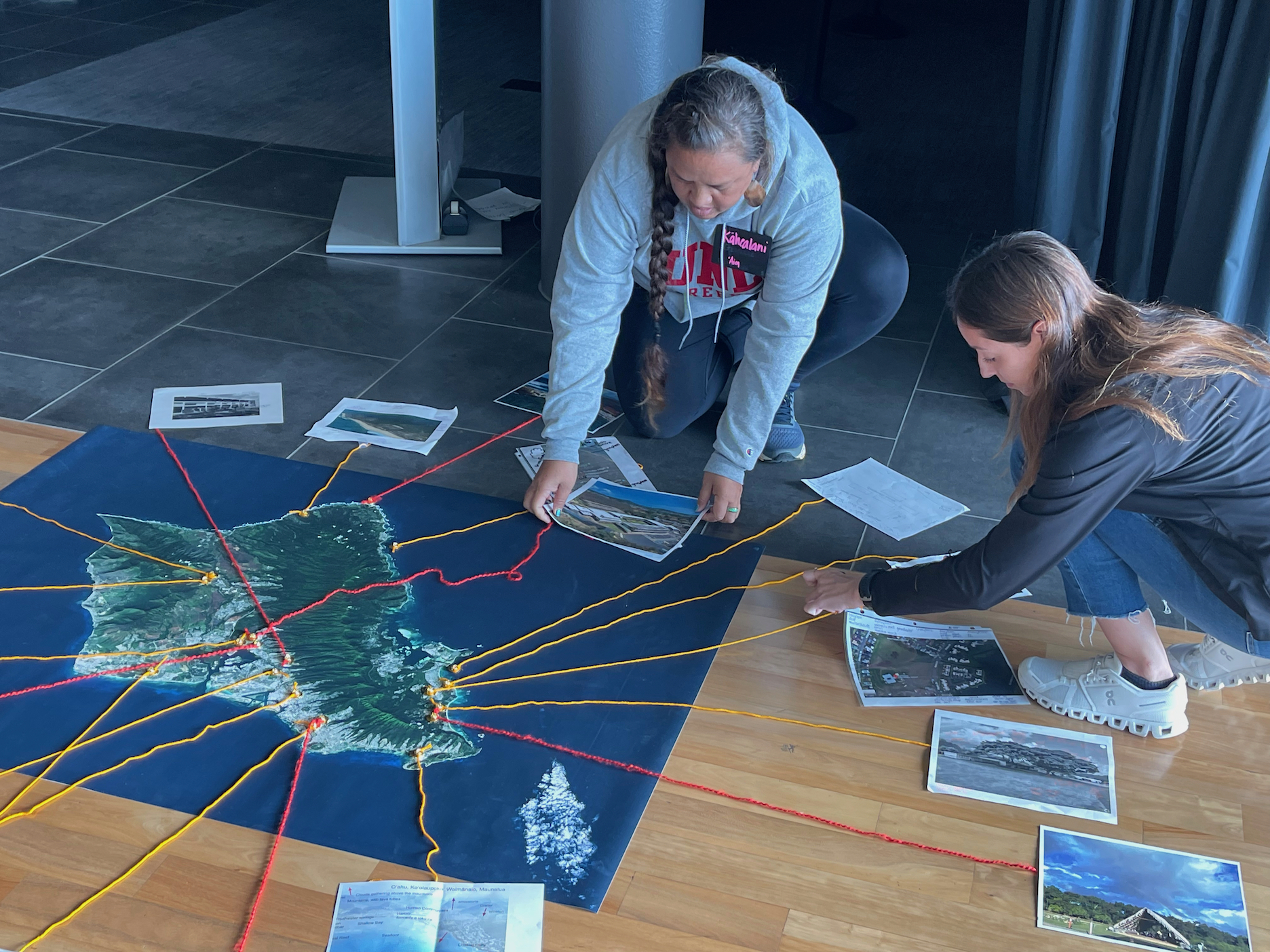
Landsat Goes to Hawaiʻi to Help Inspire Climate Change Connections
During two recent Earth to Sky Climate Science Education workshops, participants learned how Landsat imagery helps us assess changes in land cover and land use.
Antarctic History Revealed by Landsat
New research shows that while some Antarctic ice shelves have been thinning since at least the 1970s, widespread thinning accelerated in the 1990s.
Landsat Outreach: Denver Edition
The Landsat outreach team participated in AAAS and Geo Week events this month to highlight the benefits of the Landsat program and how the NASA/USGS partnership facilitates the invaluable, ongoing Landsat record.
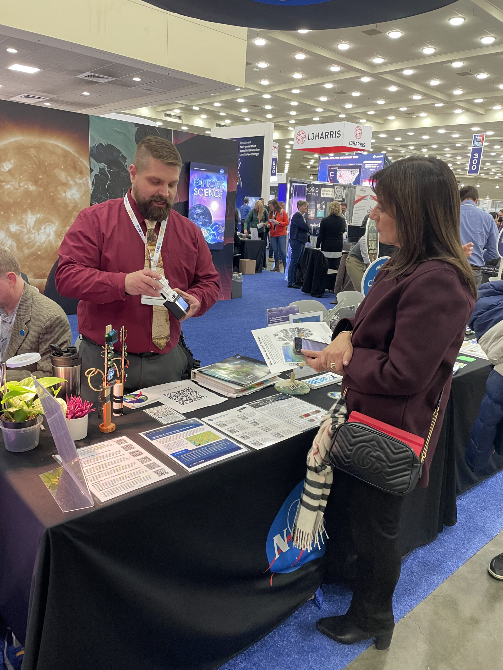
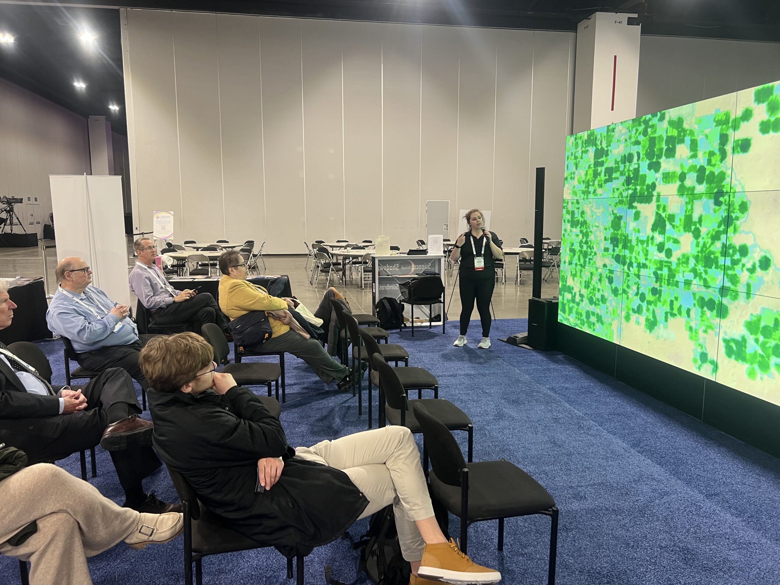
Landsat Outreach at the 2024 American Meteorological Society Meeting
This year, AMS meeting-goers had an opportunity to learn more about Landsat, its data, and its applications at the NASA Exhibit Booth.
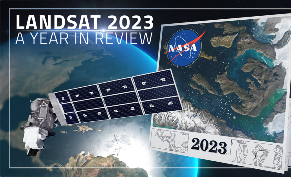
Landsat 2023 – A Year in Review
A delve into Landsat-based studies revealing the environmental impact of river mining, the decline in global lake water levels, and the risks of rising sea levels on coastal habitats. Plus, a sneak peek at what the future of the Landsat program holds with the introduction of Landsat Next.
Leveraging the Synergistic Power of Landsat and GEDI Data to Support Sustainable Forest Management
By fusing multispectral Landsat data with forest structure products from the GEDI mission, researchers and scientists have unlocked a deeper understanding of complex forest processes and dynamics and empowered land managers and policymakers to manage forests with greater effectiveness and sustainability.
OpenET Study Helps Water Managers and Farmers Put Landsat to Work
As the world looks for sustainable solutions, a system tapping into Landsat data for water management has passed a critical test.
