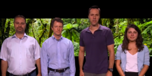
This free, self-paced course teaches prospective, non-commercial users how to use the CLASlite forest monitoring software, developed by Greg Asner and his research group, and provides licenses to the free software to students who pass.
CLASlite uses a suite of algorithms to generate, through a simple user-interface that ingests raw satellite imagery, maps of deforestation and disturbance in areas as small as 0.1 hectare (0.25 acre). This degree of precision enables scientists and non-experts alike to monitor forest change over time, leading to more informed conservation responses.
“CLASlite represents for our country an improvement in the capacity of over 400 professionals who were trained in the software between 2010 and 2013,” said Peruvian Minister of Environment Manuel Pulgar-Vidal. “With it, we are generating information about the state of the forest that supports the development of public policy for conservation and sustainable use of our Amazonia.”
The course will be a replica of the English version, launched on December 17, 2013, but with fully translated content including subtitles for video lessons, evaluations and explanations in Spanish, and a license to the Spanish version of the software.
“Given that Latin America is home to the majority of the world’s tropical forests and a locus of the deforestation problem, we hope that this new Spanish version of the course will increase its accessibility to many more people who seek to manage forest change throughout the region,” said Asner.
CLASlite is made possible by support from the Gordon and Betty Moore Foundation, the John D. and Catherine T. MacArthur Foundation, and the endowment of the Carnegie Institution for Science.
Further Information:
+ Spanish-language version of CLASlite Classroom
+ Forest Monitoring: Bringing the Power to the People

Be Part of What’s Next: Emerging Applications of Landsat at AGU24
Anyone making innovative use of Landsat data to meet societal needs today and during coming decades is encouraged to submit and abstract for the upcoming “Emerging Science Applications of Landsat” session at AGU24.


