
The View from Space Keeps Getting Better
After 50 years of Landsat, discovery of new commercial and scientific uses is only accelerating.
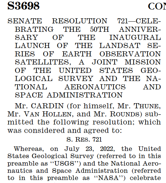
July 23, 2022 Designated Landsaturday
July 23, 2022, was designated as Landsaturday by the U.S. Senate in recognition of the 50th anniversary of the Landsat Program.

Virginia Norwood & the Little Scanner that Could
Virginia T. Norwood, known as the person who could solve impossible problems, played a crucial role in the development of the first space-based multispectral scanner instrument that flew on Landsat 1 and made the mission a success.

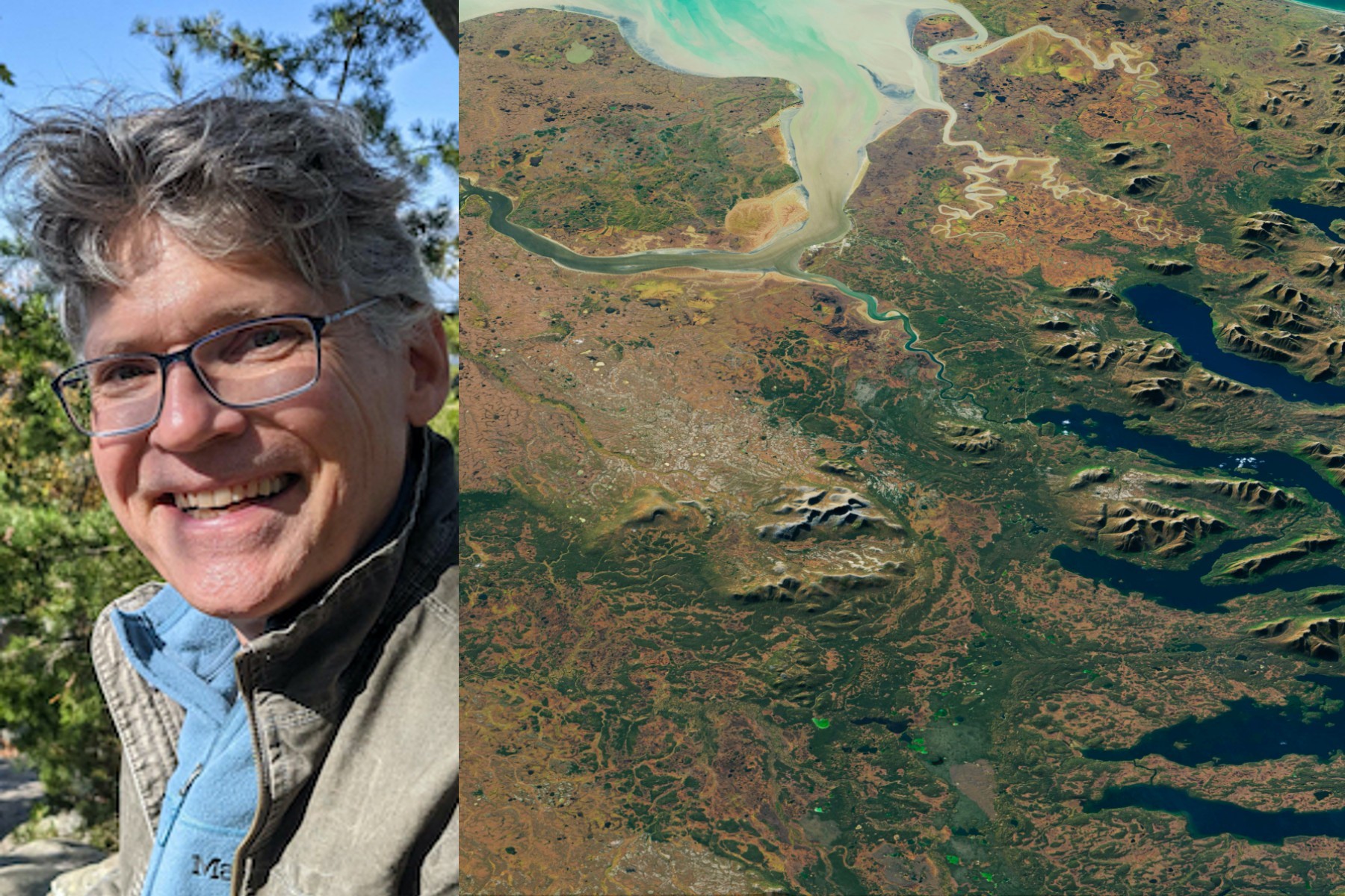
50 Years, 50 Stories: Kate Fickas
I use Landsat to explore wetland and aquatic ecosystem dynamics over time, studying how they may vary in a changing climate. Biotic and abiotic, everything on Earth has its own connection.
50 Years, 50 Stories: Bruce Cook
I use Landsat data as part of a joint U.S. Department of Agriculture/NASA effort to inventory all forest lands in interior Alaska.
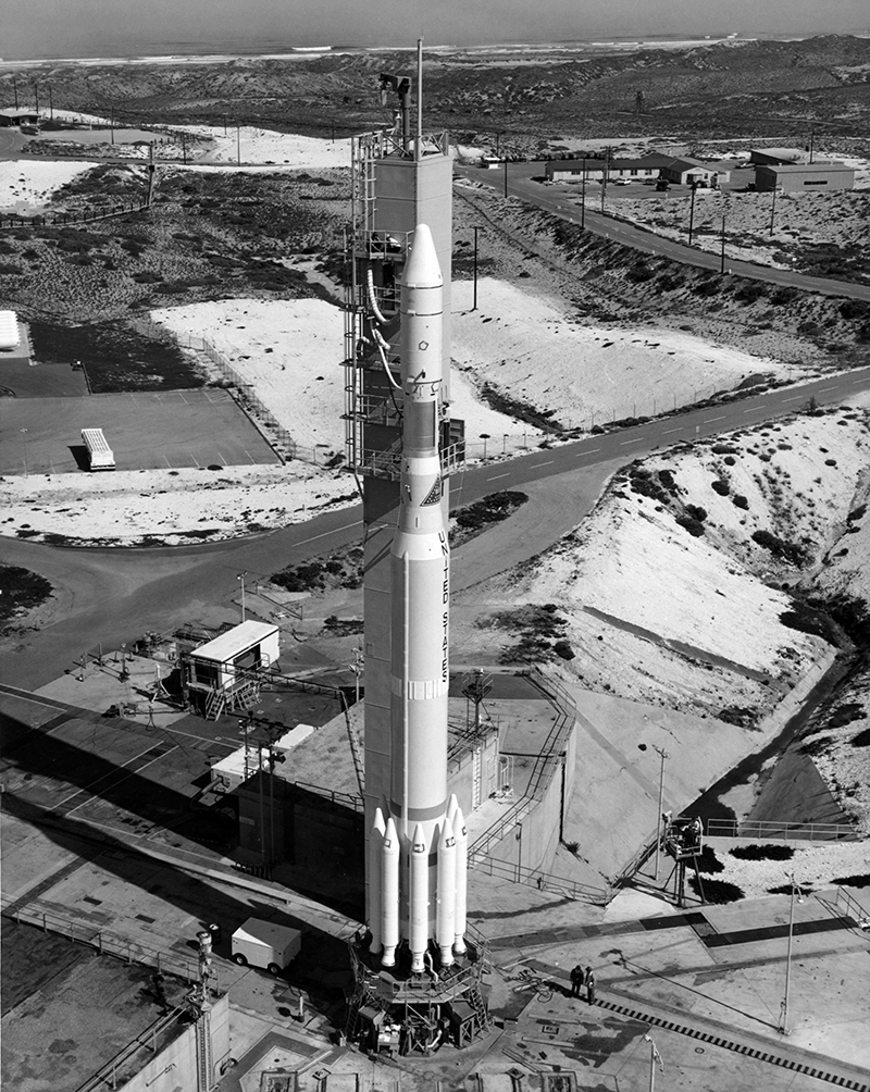
Landsat Legacy: NASA-USGS Program Observing Earth from Space Turns 50
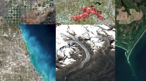
Since its debut, Landsat has amassed over 10 million images. These images, also called scenes, show current snapshots of land and coasts, but pair with images of years past and they also reveal changes through time – glaciers slowly disappearing, or urban spaces sprawling across the landscape.
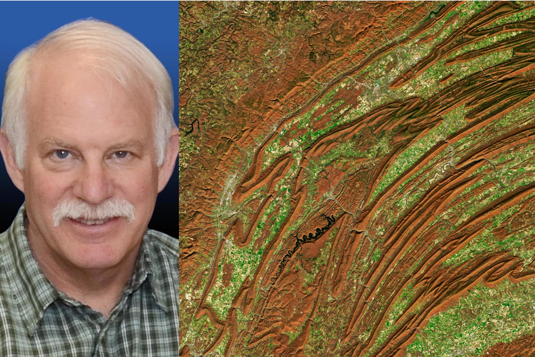
50 Years, 50 Stories: Jim Irons
I worked at Goddard Space Flight Center for 43 years. A great deal of my career was spent engaged in the Landsat program.
A Planetary Sage: Landsat at 50
Landsat satellites have been reliably returning images of Earth’s land surface for fifty years, providing novel insights about the planet we call home.
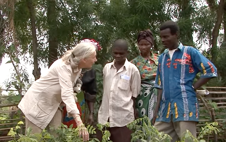
Satellite Data Helps Jane Goodall Protect Chimpanzee Habitats (Video Trailer)
The Jane Goodall Institute (JGI) uses satellite observations, including data from the NASA and USGS Landsat satellite series, in their efforts to work in partnership with local residents to understand and protect chimpanzee habitats.
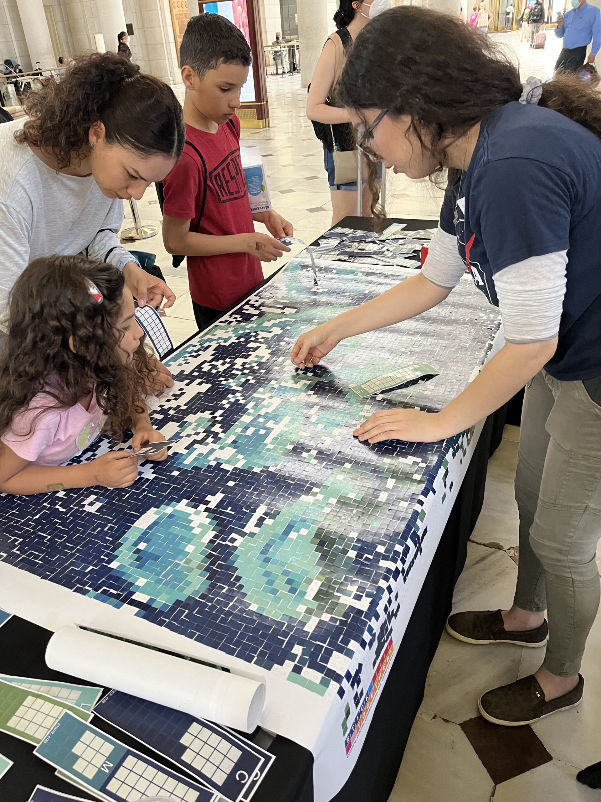
Landsat Goes to the Library
Landsat made a solid showing at the annual ALA conference (considered “the world’s biggest library event”) in Washington, D.C. this month.
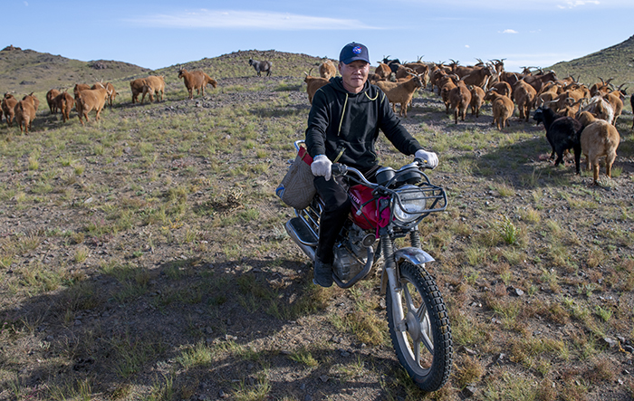
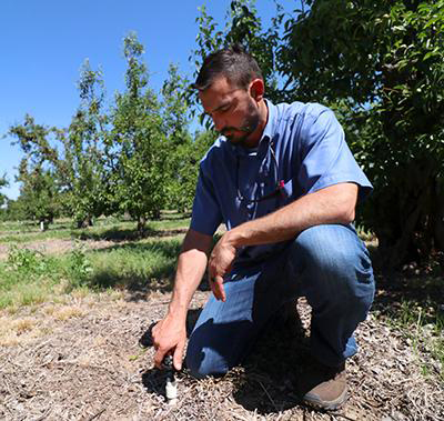
NASA “Steppes” onto the Runway to Make Mongolian Cashmere Sustainable
Landsat allows herders to monitor vast expanses of desert in a way traditional field monitoring can’t support.
Webinar Recording Available: Advancing Science Capabilities with Data Harmonization & NASA’s Harmonized Landsat Sentinel-2 (HLS) Products
This webinar provides an introduction to HLS data, services, and tools and shows you how to find resources to work with the data; visualize, search for, and access the data through NASA Worldview and Earthdata Search; it also demonstrates how to use the Fire Information for Resource Management System (FIRMS) tool to visualize HLS data to monitor fires and floods.
Sharing Landsat Science on Earth Day and Everyday
Communicating the technology and science of Landsat has always been a facet of the mission.

Study Finds Increased Urban Greenery Could Save Lives
A new analysis found that between 34,000-38,000 could have been reduced with local increases in green vegetation in US metropolitan areas from 2000-2019.
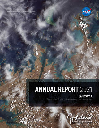
Landsat 9 in the 2021 Goddard Annual Report
Landsat 9’s first light image was featured on the cover of the 2021 Goddard Annual Report.
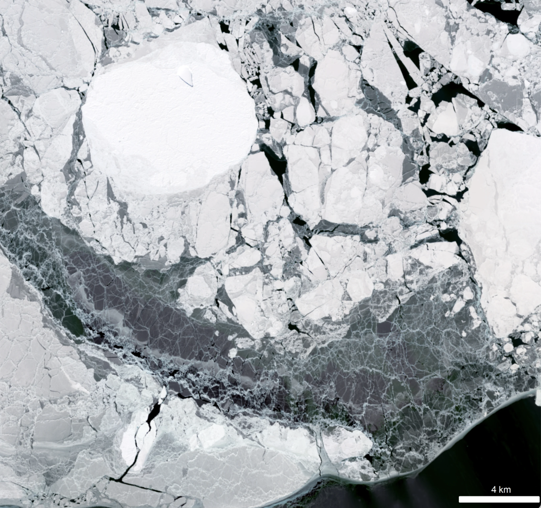
New Research Finds Sea Ice Can Control Antarctic Ice Sheet Stability
Despite the rapid melting of ice in many parts of Antarctica during the second half of the 20th century, researchers have found that the floating ice shelves which skirt the eastern Antarctic Peninsula have undergone sustained advance over the past 20 years.

Landsat Reveals Dramatic Loss of Global Wetlands Over Past Two Decades
An analysis of over a million Landsat images has revealed that 4,000 square kilometres of tidal wetlands have been lost globally over twenty years.
Satellite Data Helps Jane Goodall Protect Chimpanzee Habitats (Video Trailer)
The Jane Goodall Institute (JGI) uses satellite observations, including data from the NASA and USGS Landsat satellite series, in their efforts to work in partnership with local residents to understand and protect chimpanzee habitats.
Landsat Goes to the Library
Landsat made a solid showing at the annual ALA conference (considered “the world’s biggest library event”) in Washington, D.C. this month.
NASA “Steppes” onto the Runway to Make Mongolian Cashmere Sustainable
Landsat allows herders to monitor vast expanses of desert in a way traditional field monitoring can’t support.
Webinar Recording Available: Advancing Science Capabilities with Data Harmonization & NASA’s Harmonized Landsat Sentinel-2 (HLS) Products
This webinar provides an introduction to HLS data, services, and tools and shows you how to find resources to work with the data; visualize, search for, and access the data through NASA Worldview and Earthdata Search; it also demonstrates how to use the Fire Information for Resource Management System (FIRMS) tool to visualize HLS data to monitor fires and floods.
Sharing Landsat Science on Earth Day and Everyday
Communicating the technology and science of Landsat has always been a facet of the mission.
Study Finds Increased Urban Greenery Could Save Lives
A new analysis found that between 34,000-38,000 could have been reduced with local increases in green vegetation in US metropolitan areas from 2000-2019.
Landsat 9 in the 2021 Goddard Annual Report
Landsat 9’s first light image was featured on the cover of the 2021 Goddard Annual Report.
New Research Finds Sea Ice Can Control Antarctic Ice Sheet Stability
Despite the rapid melting of ice in many parts of Antarctica during the second half of the 20th century, researchers have found that the floating ice shelves which skirt the eastern Antarctic Peninsula have undergone sustained advance over the past 20 years.
Landsat Reveals Dramatic Loss of Global Wetlands Over Past Two Decades
An analysis of over a million Landsat images has revealed that 4,000 square kilometres of tidal wetlands have been lost globally over twenty years.
