
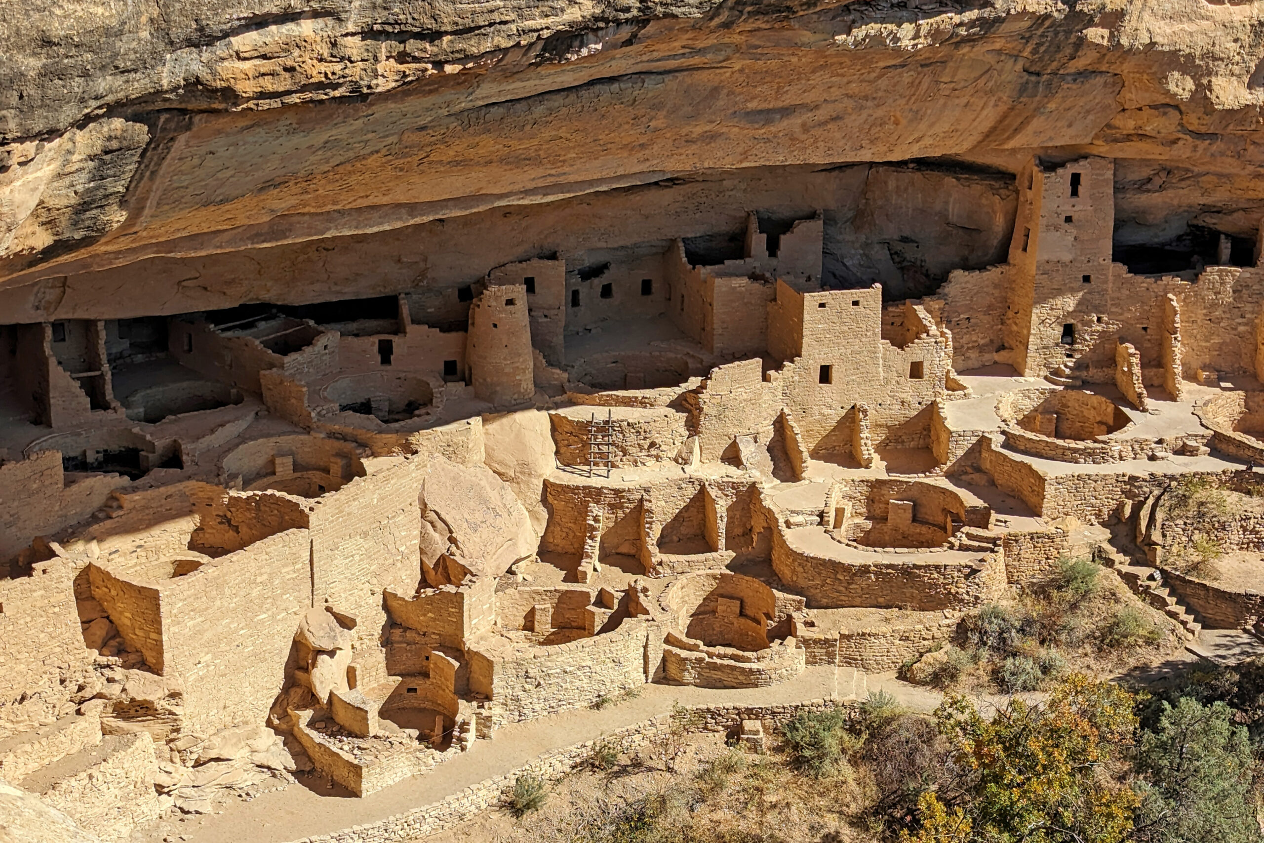
Shining a Light on Mesa Verde National Park: NASA Outreach During the “Ring of Fire” Solar Eclipse
On Saturday, October 14, 2023, regions of North, Central, and South America experienced an annular solar eclipse. Through the Earth to Sky Partnership, NASA coordinated with Mesa Verde National Park to host a series of outreach events.
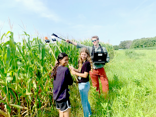
Landsat In Your Hands: STEM Adventures with a DIY Instrument
One way to better understand the science and technology behind Landsat’s spectral measurements is to build a spectrometer. This past summer, two local high school students did just that.
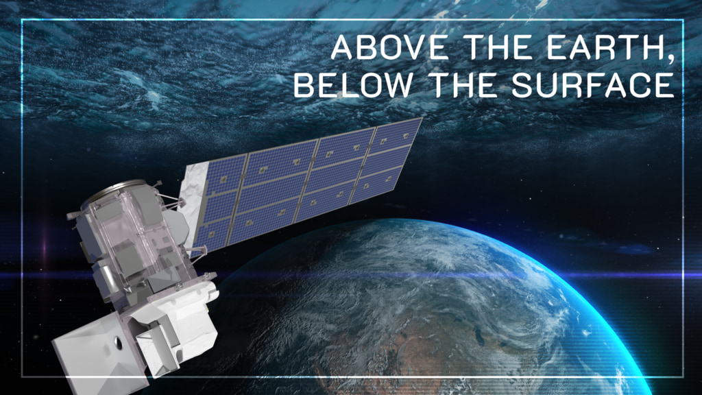
Above the Earth, Below the Surface: Landsat’s Role in Monitoring Water Quality
Safeguarding freshwater resources is crucial, and while scientists use a variety of ground-based techniques to gauge water quality, the Landsat program has provided water quality data from orbit for decades.
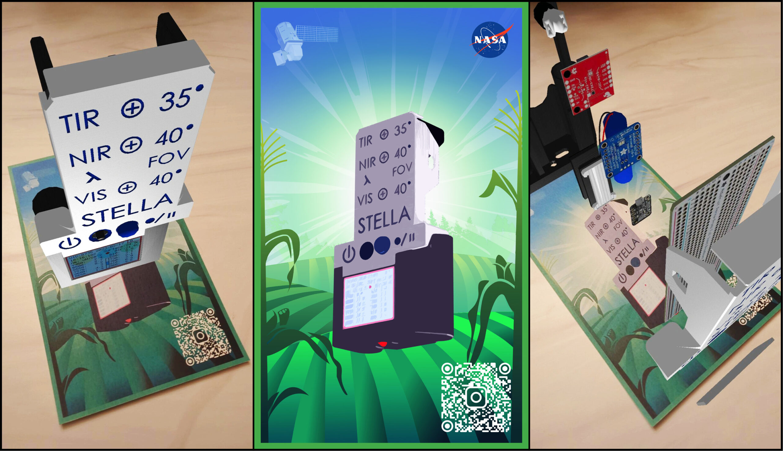
Webinar: STELLA, the DIY-Handheld Spectrometer
Join the STELLA team on September 19, 2023, to hear the the latest and greatest about the STELLA handheld spectrometer, a DIY instrument that helps you understand how Landsat works.
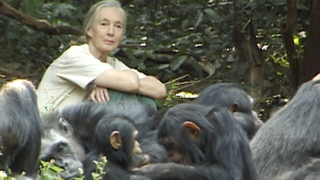
Joining Jane Goodall in Conserving Chimpanzee Habitats
The Jane Goodall Institute has been working with NASA and using Earth science satellite imagery and data—including Landsat (NASA/USGS)—in its chimpanzee and forest conservation efforts in Africa, particularly the Gombe region.
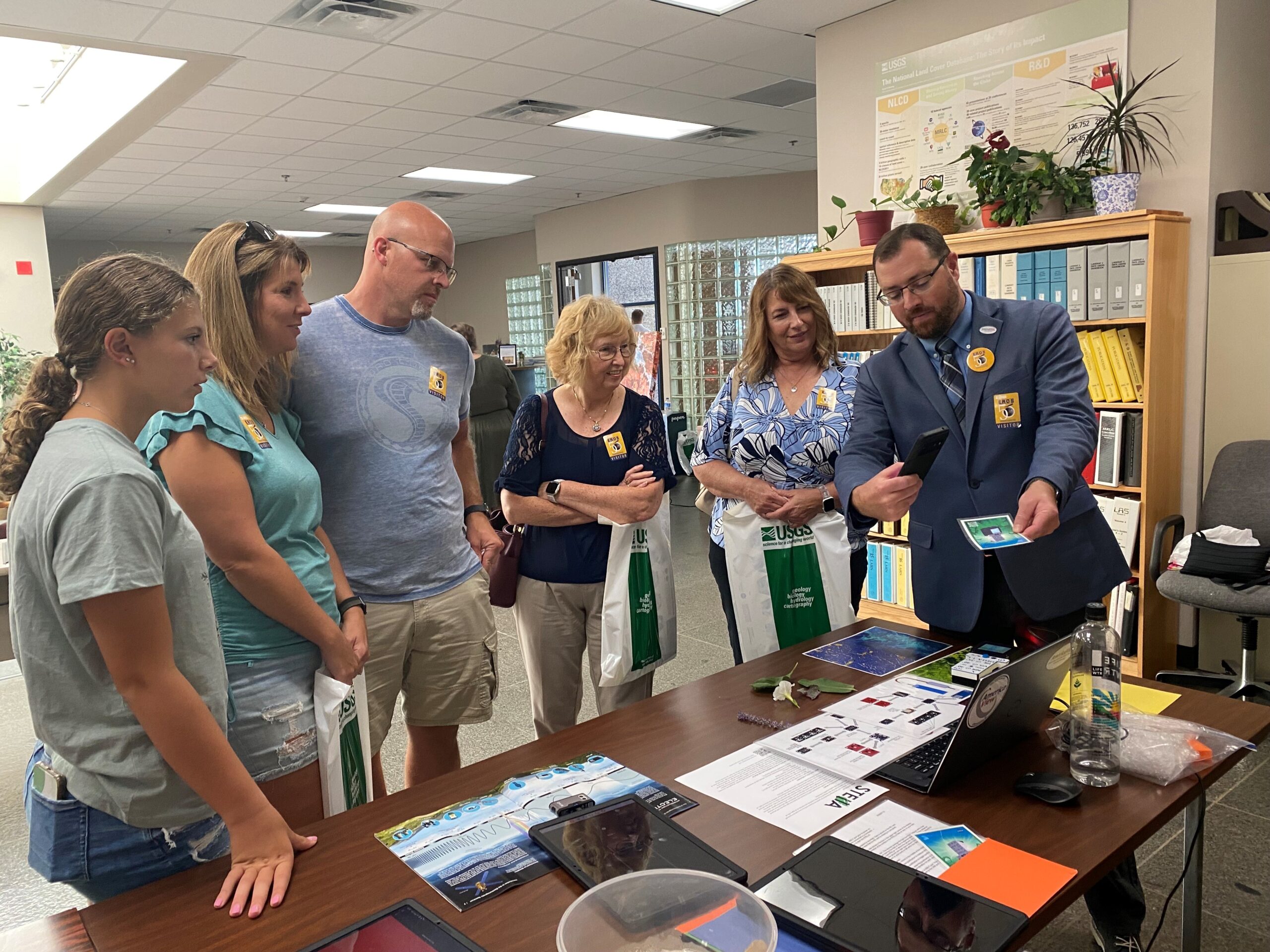
The 50th Anniversary of the EROS Center: Honoring Five Decades of Innovation Through STEM Outreach Activities
The Earth Resources Observation and Science (EROS) Center celebrated its 50th anniversary in August. Learn more about the EROS Center, the anniversary celebration, and the Landsat-related outreach activities at the event—with a spotlight on STELLA, a DIY spectrometer.
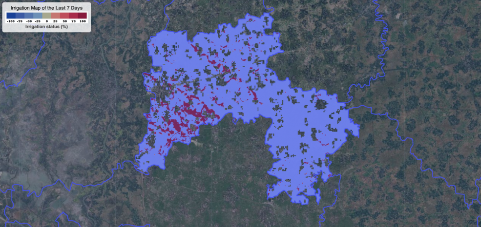
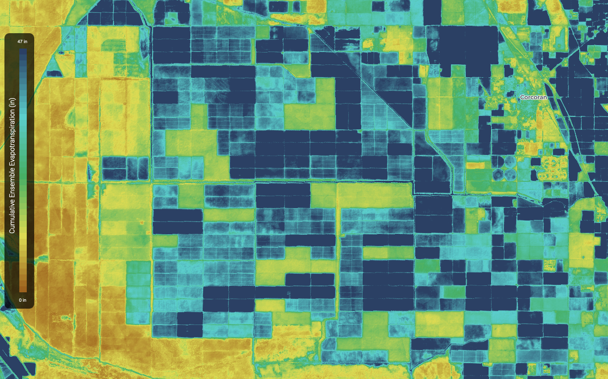
Satellite Data Helps Bangladeshi Farmers Save Water, Money, Energy
Satellite data are providing information to Bangladeshi farmers about how much water they are using, how much they have, and how much their crops need.

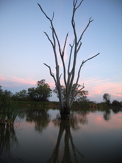
Bex Dunn: Landsat Data User + Wetland Explorer
Bex Dunn is an Earth Observation Scientist at Geoscience Australia where she uses Landsat data to better understand wetlands.
Webinar: STELLA, the DIY-Handheld Spectrometer
Join the STELLA team on September 19, 2023, to hear the the latest and greatest about the STELLA handheld spectrometer, a DIY instrument that helps you understand how Landsat works.
Joining Jane Goodall in Conserving Chimpanzee Habitats
The Jane Goodall Institute has been working with NASA and using Earth science satellite imagery and data—including Landsat (NASA/USGS)—in its chimpanzee and forest conservation efforts in Africa, particularly the Gombe region.
The 50th Anniversary of the EROS Center: Honoring Five Decades of Innovation Through STEM Outreach Activities
The Earth Resources Observation and Science (EROS) Center celebrated its 50th anniversary in August. Learn more about the EROS Center, the anniversary celebration, and the Landsat-related outreach activities at the event—with a spotlight on STELLA, a DIY spectrometer.
Satellite Data Helps Bangladeshi Farmers Save Water, Money, Energy
Satellite data are providing information to Bangladeshi farmers about how much water they are using, how much they have, and how much their crops need.
Bex Dunn: Landsat Data User + Wetland Explorer
Bex Dunn is an Earth Observation Scientist at Geoscience Australia where she uses Landsat data to better understand wetlands.
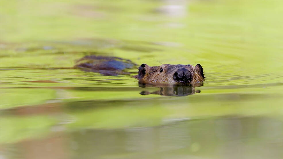
Researchers Become “Beaver Believers” After Measuring the Impacts of Rewilding
Satellites like Landsat are quantifying how beavers can have an outsized and positive impact on local ecosystems.
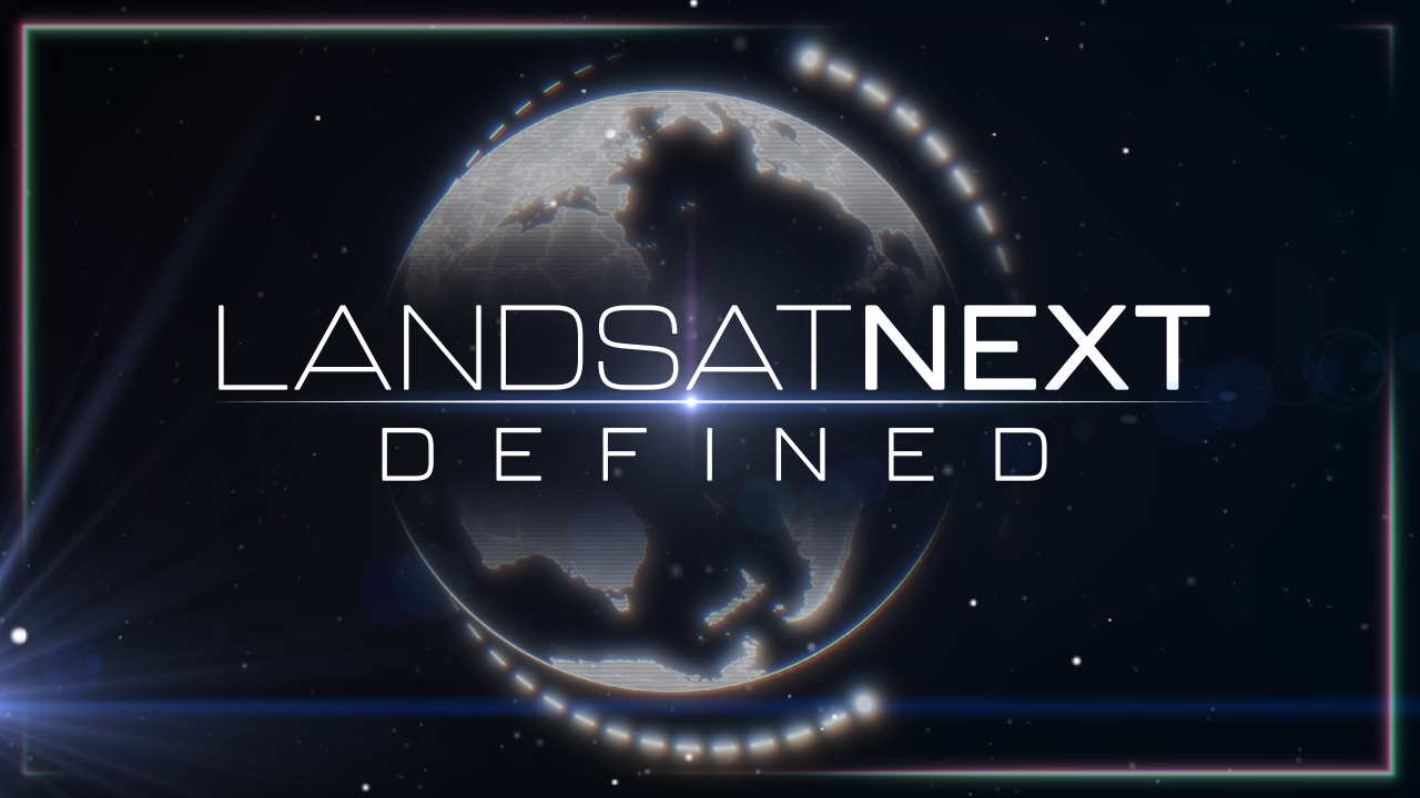
Landsat Next Defined
Landsat Next is on the horizon—the new mission will not only ensure continuity of the longest space-based record of Earth’s land surface, it will fundamentally transform the breadth and depth of actionable information freely available to end users. Take a look at the new capabilities that will define the next Landsat mission.
Landsat Insights: Wetland History in Your Hand
Practitioners managing the wellbeing of wetlands have a new tool at their disposal. The Wetland Insight Tool, developed by Geoscience Australia, provides a visual summary of 35+ years of wetland dynamics.
Ten Years of TIRS: Data for a Thirsty World
Landsat 8 very nearly flew without a thermal infrared sensor. This is the backstory of how TIRS made it onto Landsat 8.
Webinar: STELLA, the DIY-Handheld Spectrometer
Join the STELLA team on September 19, 2023, to hear the the latest and greatest about the STELLA handheld spectrometer, a DIY instrument that helps you understand how Landsat works.
Joining Jane Goodall in Conserving Chimpanzee Habitats
The Jane Goodall Institute has been working with NASA and using Earth science satellite imagery and data—including Landsat (NASA/USGS)—in its chimpanzee and forest conservation efforts in Africa, particularly the Gombe region.
The 50th Anniversary of the EROS Center: Honoring Five Decades of Innovation Through STEM Outreach Activities
The Earth Resources Observation and Science (EROS) Center celebrated its 50th anniversary in August. Learn more about the EROS Center, the anniversary celebration, and the Landsat-related outreach activities at the event—with a spotlight on STELLA, a DIY spectrometer.
Satellite Data Helps Bangladeshi Farmers Save Water, Money, Energy
Satellite data are providing information to Bangladeshi farmers about how much water they are using, how much they have, and how much their crops need.
Bex Dunn: Landsat Data User + Wetland Explorer
Bex Dunn is an Earth Observation Scientist at Geoscience Australia where she uses Landsat data to better understand wetlands.
Researchers Become “Beaver Believers” After Measuring the Impacts of Rewilding
Satellites like Landsat are quantifying how beavers can have an outsized and positive impact on local ecosystems.
Landsat Next Defined
Landsat Next is on the horizon—the new mission will not only ensure continuity of the longest space-based record of Earth’s land surface, it will fundamentally transform the breadth and depth of actionable information freely available to end users. Take a look at the new capabilities that will define the next Landsat mission.
Landsat Insights: Wetland History in Your Hand
Practitioners managing the wellbeing of wetlands have a new tool at their disposal. The Wetland Insight Tool, developed by Geoscience Australia, provides a visual summary of 35+ years of wetland dynamics.
Ten Years of TIRS: Data for a Thirsty World
Landsat 8 very nearly flew without a thermal infrared sensor. This is the backstory of how TIRS made it onto Landsat 8.
