Landsat Images Provided to the International Charter in May 2015
The International Charter is a system that supplies free satellite imagery to emergency responders anywhere in the world.

The International Charter is a system that supplies free satellite imagery to emergency responders anywhere in the world.
The Chongsecun landslide was found by a Canadian government scientist (Ministry of Forests, Lands and Natural Resource Operations Canada) scrutinizing post- and pre-quake Landsat 8 images.
The April 25, 2015, magnitude 7.8 Gorkha earthquake in Nepal triggered devastating landslides in Langtang Valley. Ice, snow and debris avalanches, rockfalls and landslides also occurred widely in other areas of the Nepal Himalaya. Landsat 8 satellite imagery shows that a landslide is also damming a river and resulting in the formation of a lake in the Manaslu trekking region of Nepal.
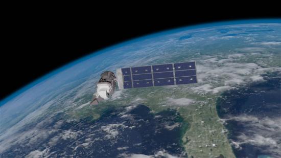
The magnitude 7.8 Gorkha earthquake that struck Nepal on April 25, 2015, caused extensive damage in Kathmandu Valley and severely affected Nepal’s rural areas. Space agencies around the world are providing extensive resources in a huge international effort. They are tasking their satellites to observe the areas hit by the earthquake. This effort began immediately after the disaster.
This month, 53 Landsat scenes were ingested by the USGS Hazard Data Distribution System to provide data for Charter activations.
On April 9, 2015, severe thunderstorms produced several reports of damaging wind, hail, and tornadoes — including one particularly strong (EF-4) long-track tornado across north-central Illinois.
The International Charter is a system that supplies free satellite imagery to emergency responders anywhere in the world.
Turkana County in northwest Kenya has been reeling from several years of crippling drought. As a consequence, the nomadic peoples in the region have suffered. Livestock such as goats and cattle, the sole source of income for these pastoralists, have perished by the droves from starvation, and the resulting economic hardship has left many children malnourished. Many have also died from violent clashes over increasingly scarce resources.
Mapbox is a cloud-based map platform startup that creates custom maps with open source tools. The team at Mapbox consists of over fifty cartographers, data analysts and software engineers, located in Washington, D.C. and San Francisco, California. One of the open-source tools used by Mapbox is Landsat imagery. The company has a satellite team consisting of five employees dedicated to projects that use Landsat imagery to develop new products and enhance existing imagery.
The International Charter is a system that supplies free satellite imagery to emergency responders anywhere in the world.
NASA and the U.S. Agency for International Development (USAID) announced a five-year project that will promote the use of satellite imagery to help Asia’s Lower Mekong region better predict and cope with floods and other natural disasters and increase resilience to the negative effects of climate change.
Year after year, somewhere on Earth, natural or manmade disasters cause loss of life and widespread destruction, frequently spawning refugee situations. Though the risk of a disaster is low in any one particular place, earthquakes, volcanoes, floods, fires, landslides, oil spills, and hurricanes—when considered together on a global scale—regularly menace people, property, and natural resources.
As part of the International Charter—Space and Major Disasters, a number of satellite-derived maps showing the extent of flooding across the UK have been released, including the above Landsat 8-derived map of flooding along the River Thames near Oxford.
Although dousing the flames was foremost in people’s minds during the recent Rim Fire in Stanislaus National Forest and Yosemite National Park, U.S. Geological Survey scientific work continues well after the fire is out. USGS scientists are continuing their critical research characterizing the hidden dangers faced after large wildfires.
Two recent images from the Landsat 8 satellite compare land conditions in the vicinity of Yosemite National Park before and during the Rim Fire. The images, from August 15 before the fire began and from August 31, can be contrasted and downloaded from the USGS Earth Resources Observation and Science (EROS) Center.
The Wallow Fire burned over 500,000 acres, making it the largest fire in Arizona history, to date. It is one of many large fires that fire managers and researchers have seen scorch forests nationwide since the early 2000s.
While the 138,000-acre Silver Fire still smoldered, forest restoration specialists were on the job. They analyzed maps created using Landsat satellite data to determine where the burn destroyed vegetation and exposed soil—and where to focus emergency restoration efforts.
The Black Forest wildfire this June was one of the most destructive in Colorado history, in terms of homes lost. It started close to houses and quickly spread through the ponderosa pine canopies on the rolling hills near Colorado Springs. The wildfire destroyed 500 homes in the first 48 hours and killed two people.
WNYC’s Leonard Lopate talks with SkyTruth president, John Amos, about using public domain satellite imagery, such as Landsat, to monitor the environment. SkyTruth uses all types of satellite imagery to monitor environmental changes and disasters; Landsat is prominently mentioned among them.
In June, air pollution over Singapore and Malaysia spiked as forests in neighboring Sumatra (Indonesia) burned. Using NASA’s daily fire alerts and official national maps, the fires were located in the vicinity of oil palm and acacia tree plantations. However, the coarse resolution of the fire alerts coupled with outdated national maps, made it hard to establish culpability.
Images from Landsat satellites provided free to the public by the Department of the Interior’s U.S. Geological Survey were the starting points for “a new
The presence of birds near an aircraft runway is a constant concern. Although deadly crashes are rare, a bird strike to the windshield can cause
A combination of lightning, drought and human activity caused fires to scorch more than one-third of Yellowstone National Park in the summer of 1988. Within
• Floods are considered the number one natural hazard, causing more deaths and damage year after year. The National Science Foundation (NSF) provided funding to
• UNESCO began mapping groundwater this January in the drought-stricken Horn of Africa, in order to bring the population a sustainable water supply. Drought has
Remnants of Hurricane Irene caused heavy flooding, as shown in thisAugust 31 Landsat 5 image, in the hamlet of Pine Island in the town of
Contributor: Melissa Quijada, NASA Goddard Space Flight Center NASA satellite images regularly map active fires around the world. Once a fire is out, satellite data and
Flooding along the Missouri River continues as shown in recent Landsat satellite images of the Nebraska and Iowa border. Heavy rains and snowmelt have caused
Landsat 5 captured an image of flooding occurring along the Iowa/Nebraska border on June 30, 2011. Flooding is still occurring on July 6, and Flood
Heavy rains in Canada caused historic flooding in Minot, N.D. Landsat satellite images taken before and during the flooding reveal the water’s extent. The Souris
Contributor: Rob Gutro, NASA Goddard Space Flight Center The largest fire in the history of the state of Arizona continues to burn and emergency managers
In a Landsat 5 satellite image captured June 11, 2011, flooding is still evident both east and west of the Mississippi River near Vicksburg, Miss.
Source: Jan Nelson, USGS / Rob Gutro, NASA Goddard Space Flight Center The second largest fire in Arizona history, the Wallow Fire is graphically depicted
