
Celebrating 53 Years Since Landsat 1’s Launch
When the first Landsat satellite launched in 1972, it posed the following question: could we manage our natural resources using remotely–sensed data? The answer, 53 years on, is a resounding “yes.”

When the first Landsat satellite launched in 1972, it posed the following question: could we manage our natural resources using remotely–sensed data? The answer, 53 years on, is a resounding “yes.”
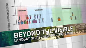
With Landsat Next’s 26 new spectral bands, we’ll be able to see our planet like never before. Landsat Next’s enhanced capabilities will provide scientists, farmers, and decision-makers with critical data to tackle global challenges.

Landsat Next is on the horizon—the new mission will not only ensure continuity of the longest space-based record of Earth’s land surface, it will fundamentally transform the breadth and depth of actionable information freely available to end users. Take a look at the new capabilities that will define the next Landsat mission.
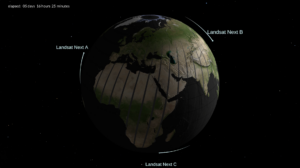
With a trio of smaller satellites that can each detect 26 wavelengths of light and thermal energy, the Landsat Next mission is expected to look very different from its predecessors that have been observing Earth for 50 years.
Nestled in the science-based information that park rangers share with visitors to Glacier Bay National Park and Preserve are insights from Landsat satellites and NASA climate scientists.
After 50 years of Landsat, discovery of new commercial and scientific uses is only accelerating.
Landsat satellites have been reliably returning images of Earth’s land surface for fifty years, providing novel insights about the planet we call home.
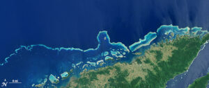
An analysis of over a million Landsat images has revealed that 4,000 square kilometres of tidal wetlands have been lost globally over twenty years.
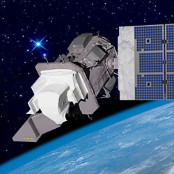
Landsat 9, a joint mission of NASA and the U.S. Geological Survey (USGS), passed its post-launch assessment review and is now in its operational phase.
Landsat 9’s first light images provide a preview of how the mission will help people manage vital natural resources and understand the impacts of climate change.
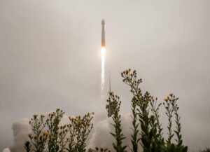
Landsat 9 successfully launched at 2:12 p.m. EDT Monday from Vandenberg Space Force Base in California.

Come along on a “roadtrip” through the decades to see how the technology on Landsat has evolved with the times to provide an unbroken data record.
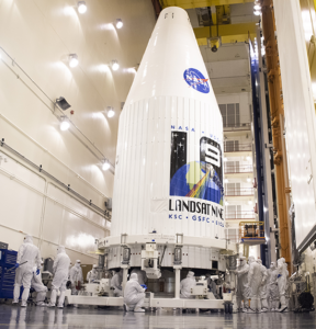
In preparation for launch, the Landsat 9 observatory has been encapsulated in the fairing of the Atlas V 401 rocket that will deliver it into orbit this September.
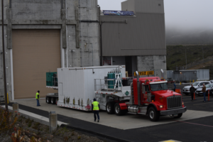
The Landsat 9 satellite has arrived at the VSFB on the central coast of California.
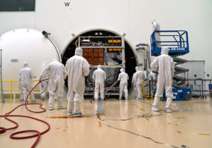
The Landsat 9 satellite has successfully completed its most strenuous environmental test leading up to launch.
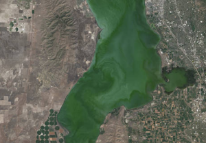
Landsat helps water resource managers know where to look for dangerous algal blooms in Utah lakes.

A new method, fusing data from many sources, has been developed for quantifying forests’ role as both carbon sink and carbon source.
This new four-part video series shares the history of Landsat, how Landsat 9 works, how Landsat data gets from the satellite to the ground, and how Landsat data can be used with other data to support a wide range of research and applications. Enjoy!

We have Virginia Norwood to thank for the design and engineering that made the Landsat program a success and set the path for modern Earth observation.
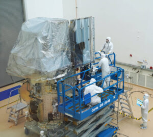
Landsat 9’s two science instruments are now attached to the spacecraft.
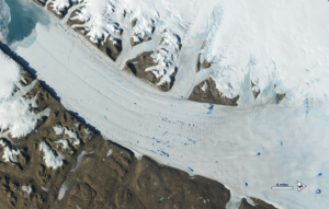
New time-lapse videos of Earth’s glaciers and ice sheets as seen from space are providing scientists with new insights into how the planet’s frozen regions are changing.
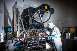
OLI-2 is now built, tested, and in place to be assembled onto the spacecraft.

This month, TIRS-2 successfully passed the stringent 12-week testing process at NASA’s Goddard Space Flight Center and was shipped to Northrop Grumman’s facility in Arizona.

The prolonged presence of green space is intrinsic for a healthy society a new nationwide Danish study finds.
In the long and winding history of the Landsat Program, April 15, 1999 was an important day.
Evolving technology, free data and robust calibration have helped make Landsat the cornerstone of global land imaging.
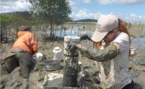
The study used machine-learning to analyze more than 700,000 Landsat images to map changing global distribution of intertidal areas over a 30-year period.

Learn what scientists, researchers, and students are doing with Landsat data this year at AGU 2018.
Review board gives high praise to Landsat 9 project for its mission status.
In the decades since the Mount St. Helens eruption, scientists have studied the recovery of the ecosystem around the mountain using the Landsat series of satellites.
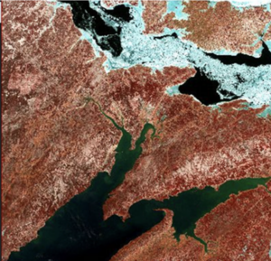
Quantifying changes in global surface waters over the past 32 years.