Landsat at #AGU17

Landsat at #AGU17

By Laura E.P. Rocchio

At the 2017 AGU Fall Meeting, over 400 presentations will feature research conducted with the aid of Landsat data. The gamut of focus areas where you can find Landsat-related papers and posters attests to the wide scope and interdisciplinary nature of Landsat data—from cryosphere to biogeoscience to hydrology to global environmental change to natural hazards to informatics.

This year we had the opportunity to speak with a number of scientists, researchers, and students using Landsat in their studies, the resulting Q&A’s will be posted here throughout the week.

A number of scientists will also be sharing their research on the NASA Hyperwall located in the NASA Booth in the exhibitor’s hall (#1645). For details on these presentations, download the NASA Booth Schedule of Events PDF.

Traveling Back in Time to Follow Glacier Trends with IceTrendr
Fox glacier Taking Inventory of New Zealand’s Glaciers
clearcut mangrove in Tanzania Global Mangrove Mapping with Landsat
River Findhorn Measuring the Wide World of Rivers
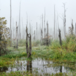
tidal marshes Calculating Carbon: Tidal Marsh Contributions
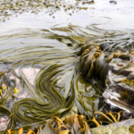
kelp on Falkland Islands Floating Forests: Citizen Scientists are Mapping Giant Kelp with Landsat
clear water in Florida Keys What Lies Beneath: Mapping Benthic Habitats with Landsat
wetlands in Baylands Nature Preserve How Much Swamp Are We Talking Here? Towards Better Mapping of Coastal Wetlands
Murray River Graphing a Path to Survival: Habitat Connectivity in Australia’s Murray-Darling Basin
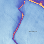
birth of iceberg A-68 How Scientists Watched the Larsen C Ice Shelf Give Birth to an Iceberg in the Polar Night
marsh How Do Coastal Marshes Respond to Climate Change?
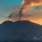
Mt. Etna Near Real Time Monitoring of Volcanic Eruptions
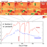
An example HLS product Using Landsat and Sentinel-2 Data in Harmony
Nunavut, Canada Water in Flux—Monitoring Shifting Water Body Sizes in Canada
Palo Verde diversion dam Farm Crops for City Drops—Assessing Water Right Transfers with Landsat
Sarasota Bridge Shedding Light on Watershed Management Priorites

Visit the 2017 AGU Fall Meeting website for more details, including the scientific program and virtual options.

Further Information:
+ NASA at AGU 2017
+ USGS Landsat Update—The AGU Edition

Anyone can freely download Landsat data from the USGS EarthExplorer or LandsatLook.

Post Last Updated on April 9, 2025
On Key

Recent Posts

A headshot of Brian Markham. Tree branches can be seen in the background; Brian is smiling.

Data as Good as it Gets:
A Discussion with Brian Markham

Why do we calibrate Landsat data? We spoke with Brian Markham, a key figure of Landsat calibration science for four decades. He said that it all comes down to this: “If we’re using a system to quantify changes on the Earth, we must make sure the system we’re using is not changing.”

Read More »
On Key

Related Posts