
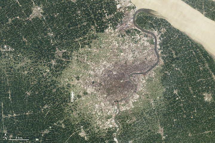
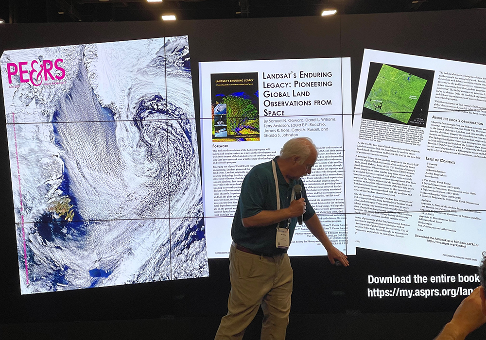
A Planetary Sage: Landsat at 50
Landsat satellites have been reliably returning images of Earth’s land surface for fifty years, providing novel insights about the planet we call home.
California’s Trees are Dying, and Might Not Be Coming Back
Landsat has shown that wildfires and climbing temperatures have caused a 6.7 percent decline in California tree cover since 1985.
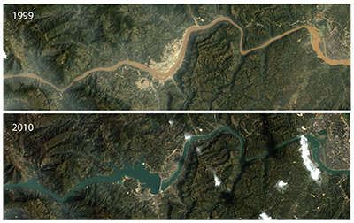
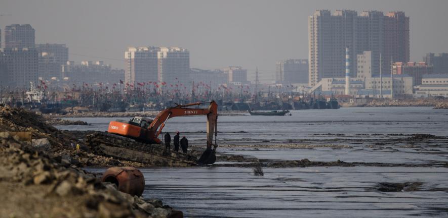
Landsat-Based Study Shows ‘Unprecedented’ Changes to World’s Rivers
Using 40 years of Landsat data, Dartmouth researchers show how dams and land use are altering flows of sediment.
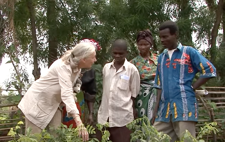
Satellite Data Helps Jane Goodall Protect Chimpanzee Habitats (Video Trailer)
The Jane Goodall Institute (JGI) uses satellite observations, including data from the NASA and USGS Landsat satellite series, in their efforts to work in partnership with local residents to understand and protect chimpanzee habitats.
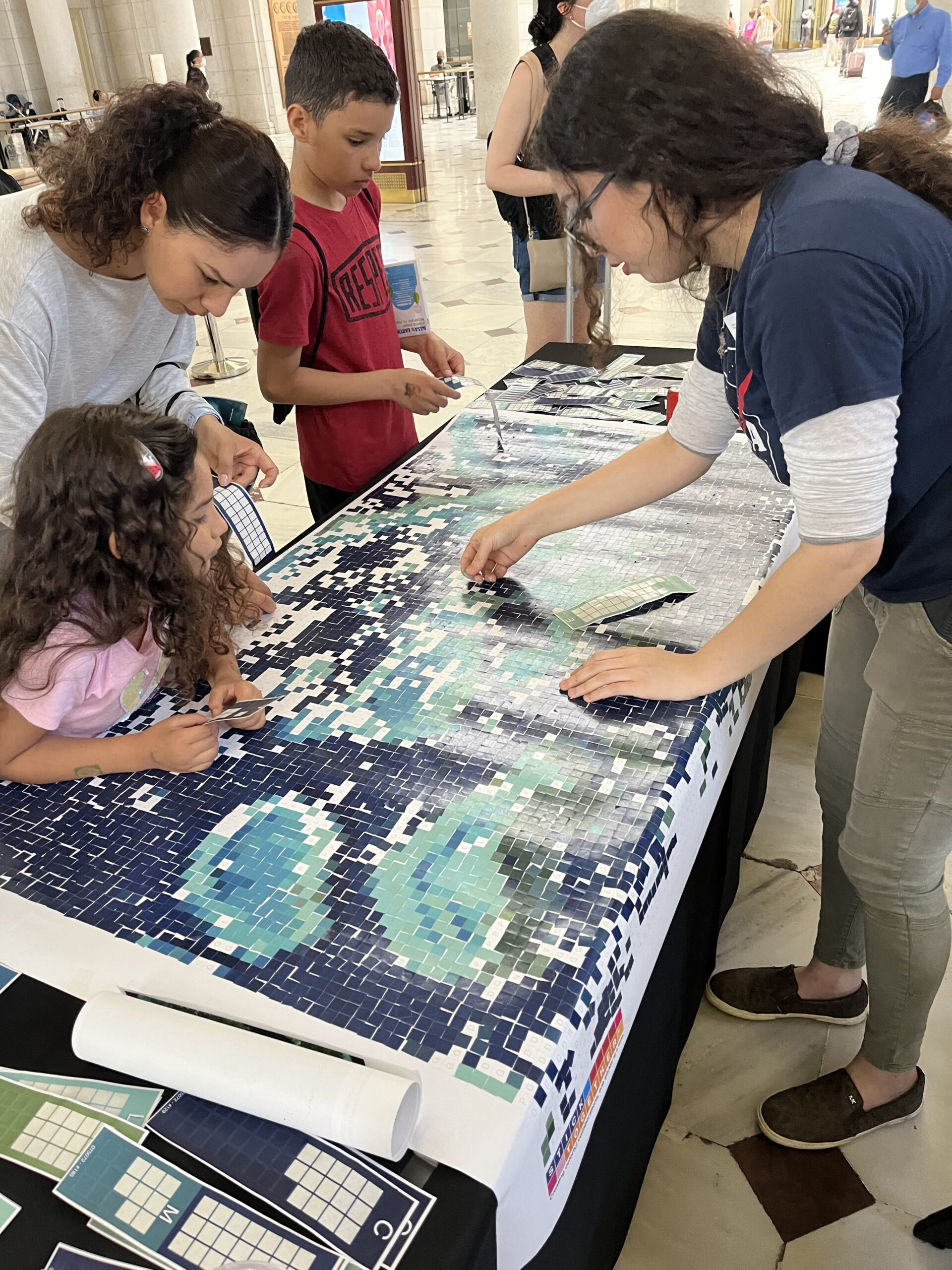
Landsat Goes to the Library
Landsat made a solid showing at the annual ALA conference (considered “the world’s biggest library event”) in Washington, D.C. this month.
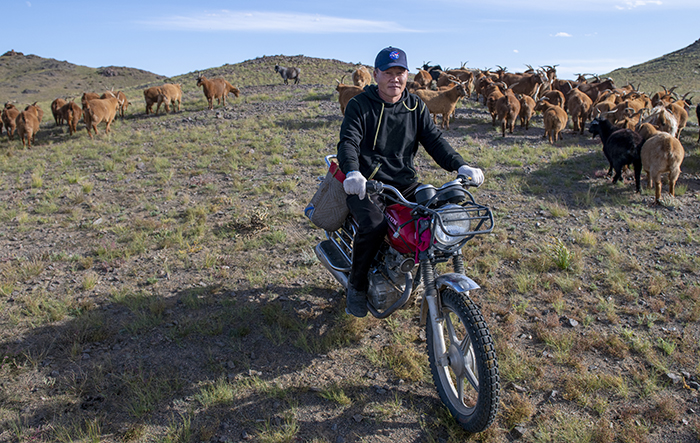
NASA “Steppes” onto the Runway to Make Mongolian Cashmere Sustainable
Landsat allows herders to monitor vast expanses of desert in a way traditional field monitoring can’t support.
Webinar Recording Available: Advancing Science Capabilities with Data Harmonization & NASA’s Harmonized Landsat Sentinel-2 (HLS) Products
This webinar provides an introduction to HLS data, services, and tools and shows you how to find resources to work with the data; visualize, search for, and access the data through NASA Worldview and Earthdata Search; it also demonstrates how to use the Fire Information for Resource Management System (FIRMS) tool to visualize HLS data to monitor fires and floods.
Sharing Landsat Science on Earth Day and Everyday
Communicating the technology and science of Landsat has always been a facet of the mission.
Landsat Reveals Dramatic Loss of Global Wetlands Over Past Two Decades
An analysis of over a million Landsat images has revealed that 4,000 square kilometres of tidal wetlands have been lost globally over twenty years.

Landsat Interns Observing Earth in Innovative and Creative Ways
In recognition of Earth Day, NASA is highlighting two interns advancing the well-being of our planet through their work with the Landsat team.
Faces of NASA: Emil Cherrington
Get to know Emil Cherrington, a scientist and Landsat data user.

Faces of NASA: Nikki Tulley
Get to know Nikki Tulley, an Assistant Research Scientist at NASA’s Ames Research Center and Landsat data user.
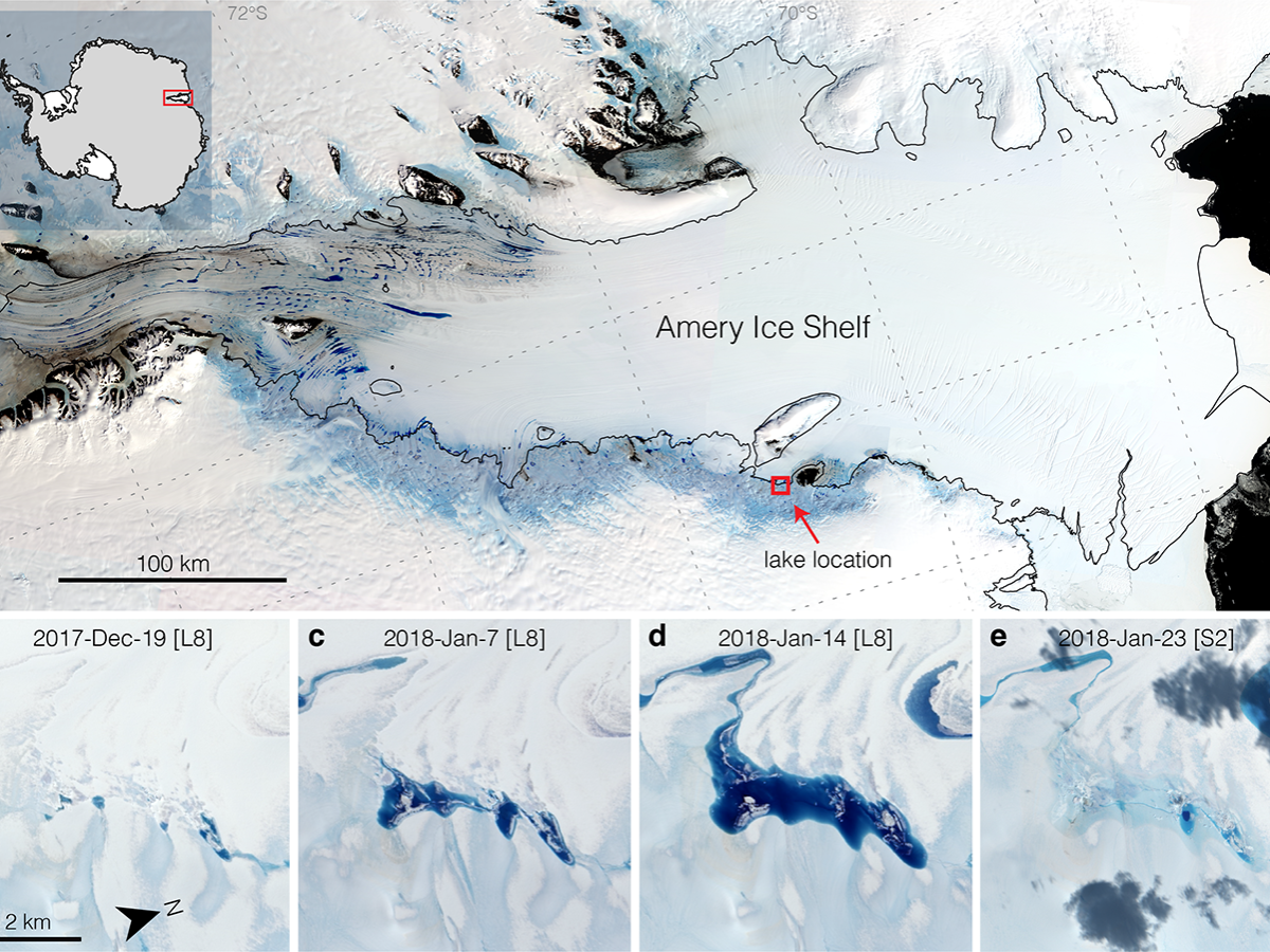
Strong Tides, Vanishing Lakes May Prove Beneficial to Antarctic Ice Shelf
Satellites have helped show that strong tidal activity may facilitate water-induced fracturing, or hydrofracturing, where land ice transitions to floating ice shelf and cause the meltwater lake to drain quickly, often in as little as several days.
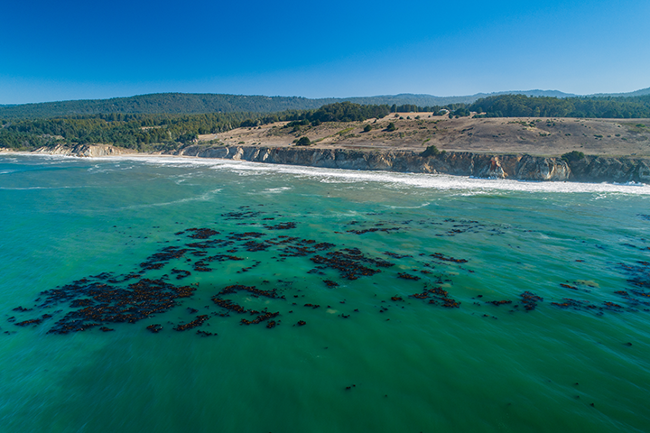
World’s Largest Dynamic Kelp Map Launched
The Landsat-informed kelpwatch.org hosts the world’s largest open-source dynamic map of kelp forest canopy.
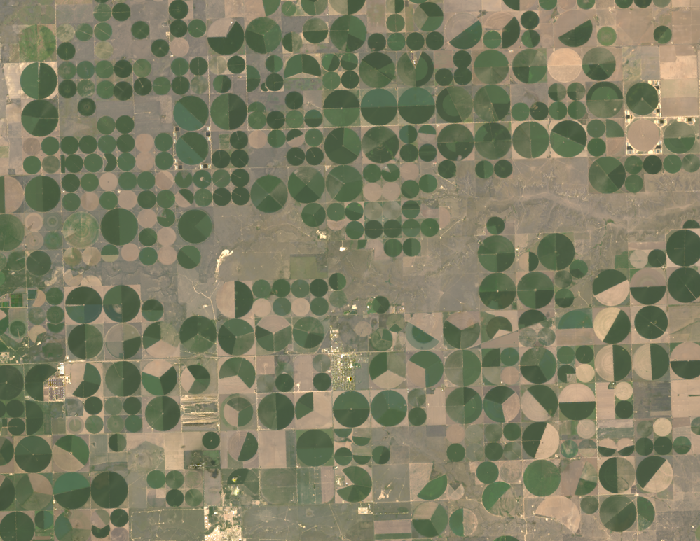
Food Documentary Explores Satellites and the Future of Farming
BBC’s Follow the Food documentary series has reported on Earth observations supporting food production, market stability and on-farm decisions.

From Seeds to Satellites
NASA is partnering with farmers to deliver new technology, new tools and new data to help producers make decisions at every level, from the farm field to the state to the nation to the world.
Improving Crop Yield Predictions with Satellite Assist
New Michigan State University research found that incorporating in-season water deficit information into remote sensing-based crop models significantly improves corn yield predictions.
Landsat Reveals Dramatic Loss of Global Wetlands Over Past Two Decades
An analysis of over a million Landsat images has revealed that 4,000 square kilometres of tidal wetlands have been lost globally over twenty years.
Landsat Interns Observing Earth in Innovative and Creative Ways
In recognition of Earth Day, NASA is highlighting two interns advancing the well-being of our planet through their work with the Landsat team.
Faces of NASA: Emil Cherrington
Get to know Emil Cherrington, a scientist and Landsat data user.
Faces of NASA: Nikki Tulley
Get to know Nikki Tulley, an Assistant Research Scientist at NASA’s Ames Research Center and Landsat data user.
Strong Tides, Vanishing Lakes May Prove Beneficial to Antarctic Ice Shelf
Satellites have helped show that strong tidal activity may facilitate water-induced fracturing, or hydrofracturing, where land ice transitions to floating ice shelf and cause the meltwater lake to drain quickly, often in as little as several days.
World’s Largest Dynamic Kelp Map Launched
The Landsat-informed kelpwatch.org hosts the world’s largest open-source dynamic map of kelp forest canopy.
Food Documentary Explores Satellites and the Future of Farming
BBC’s Follow the Food documentary series has reported on Earth observations supporting food production, market stability and on-farm decisions.
From Seeds to Satellites
NASA is partnering with farmers to deliver new technology, new tools and new data to help producers make decisions at every level, from the farm field to the state to the nation to the world.
Improving Crop Yield Predictions with Satellite Assist
New Michigan State University research found that incorporating in-season water deficit information into remote sensing-based crop models significantly improves corn yield predictions.
