
ExtraDimensional—The Fusion of Landsat & GEDI
When Landsat’s vast decades-long archive is combined with data from other instruments it can provide amazing insight into how our world is evolving with us and around us. Here are some of the ways Landsat and GEDI data are being harnessed to help us better understand the complex relationship between humanity and nature.

Join the Pale Blue Dot Visualization Challenge and Be Part of a Brighter Future
The Pale Blue Dot Visualization Challenge—aimed at making Earth observation data accessible to everyone—has officially kicked off.

Landsat & Tackling Climate Crisis Through Collaborative Science-Based Partnerships
At a recent Group on Earth Observations Ministerial Summit, DOI Assistant Secretary Cantor and USGS Director Applegate highlighted the Landsat program.
Researchers Caution Use of Landsat’s Land-Specific Surface Reflectance Products for Long-Term Water Quality Studies
While floating algae, emergent aquatic vegetation, and historic surface scum can be tracked throughout the Landsat record, researchers warn data users that older Landsat sensors lack the precision needed to be used for water-column studies.
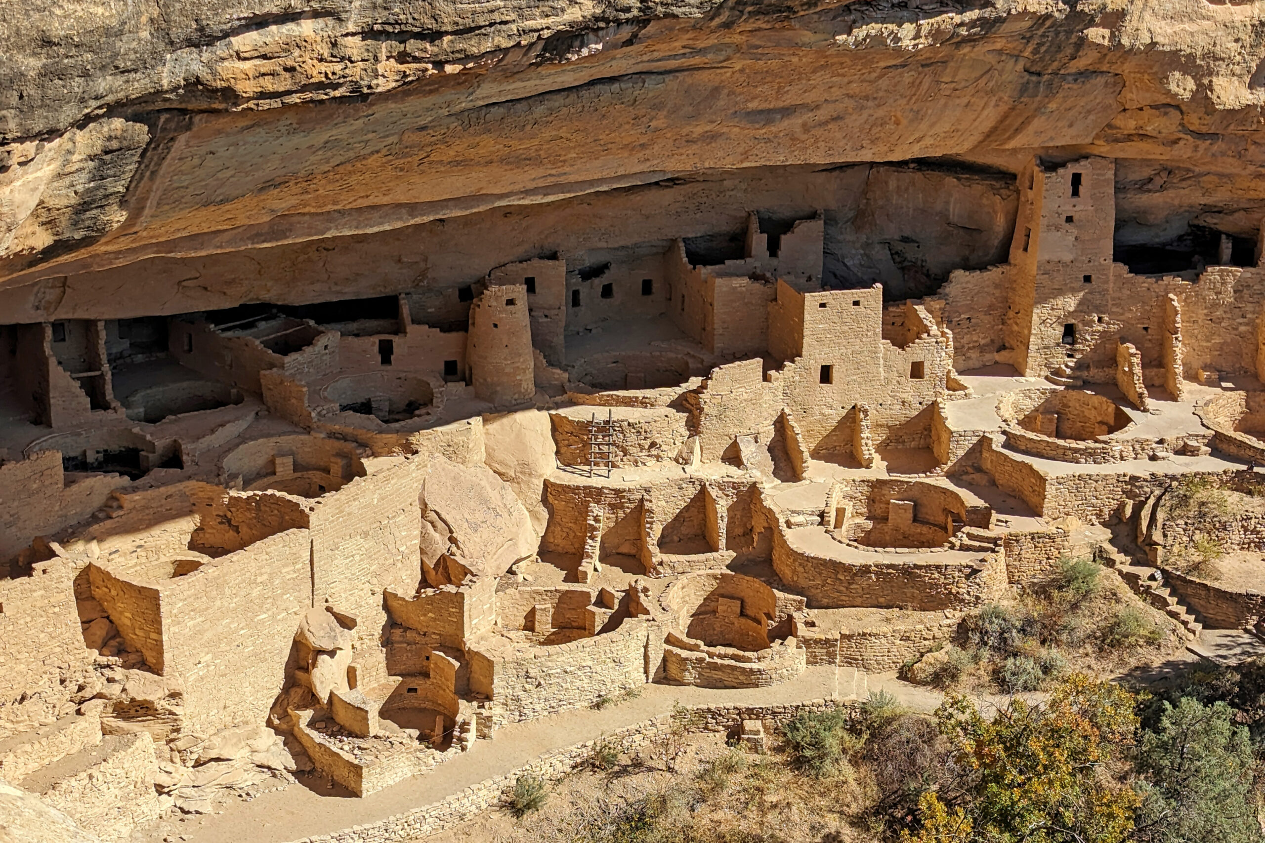
Shining a Light on Mesa Verde National Park: NASA Outreach During the “Ring of Fire” Solar Eclipse
On Saturday, October 14, 2023, regions of North, Central, and South America experienced an annular solar eclipse. Through the Earth to Sky Partnership, NASA coordinated with Mesa Verde National Park to host a series of outreach events.
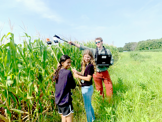
Landsat In Your Hands: STEM Adventures with a DIY Instrument
One way to better understand the science and technology behind Landsat’s spectral measurements is to build a spectrometer. This past summer, two local high school students did just that.
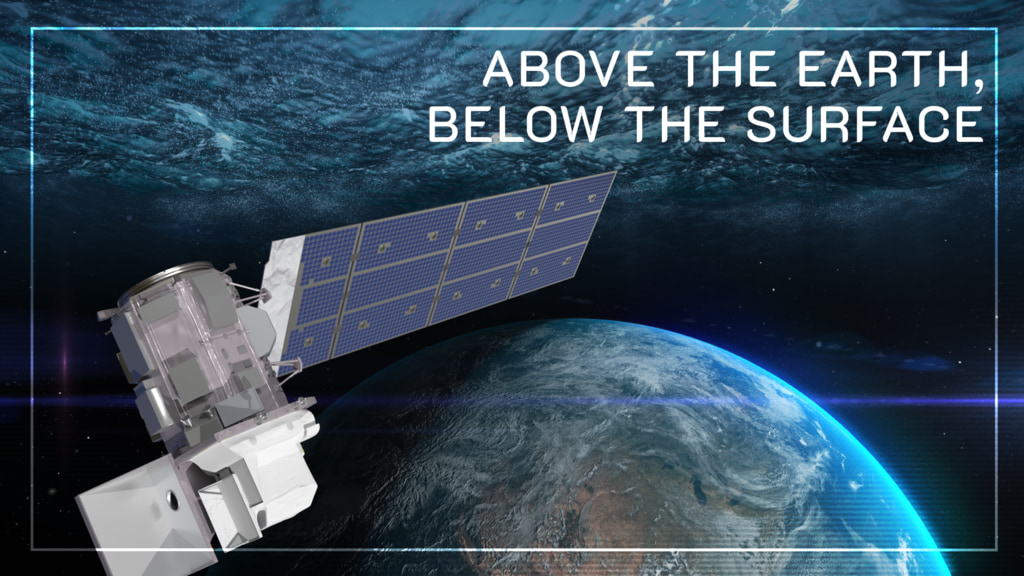
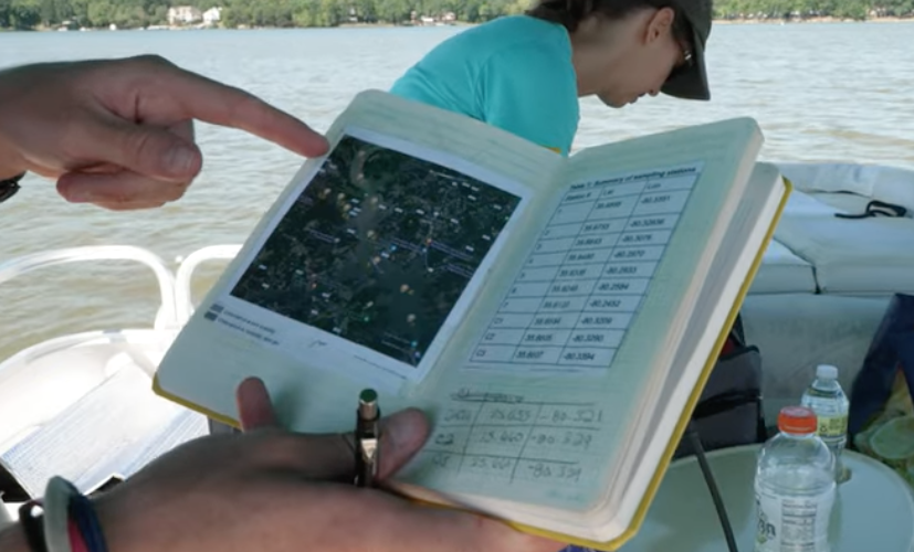
Above the Earth, Below the Surface: Landsat’s Role in Monitoring Water Quality
Safeguarding freshwater resources is crucial, and while scientists use a variety of ground-based techniques to gauge water quality, the Landsat program has provided water quality data from orbit for decades.
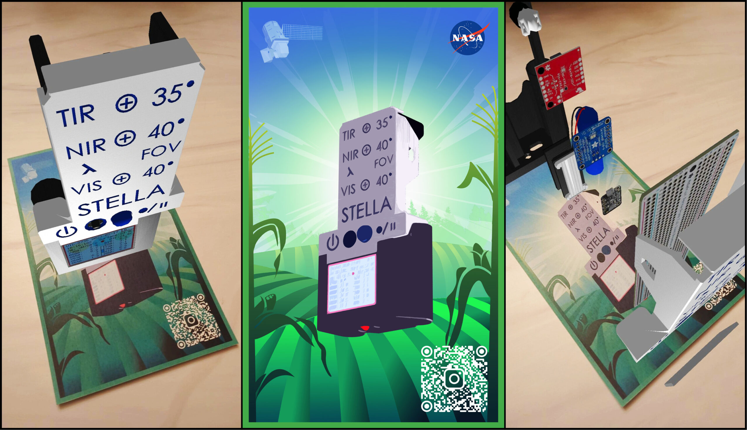
Webinar: STELLA, the DIY-Handheld Spectrometer
Join the STELLA team on September 19, 2023, to hear the the latest and greatest about the STELLA handheld spectrometer, a DIY instrument that helps you understand how Landsat works.
Researchers Caution Use of Landsat’s Land-Specific Surface Reflectance Products for Long-Term Water Quality Studies
While floating algae, emergent aquatic vegetation, and historic surface scum can be tracked throughout the Landsat record, researchers warn data users that older Landsat sensors lack the precision needed to be used for water-column studies.
Shining a Light on Mesa Verde National Park: NASA Outreach During the “Ring of Fire” Solar Eclipse
On Saturday, October 14, 2023, regions of North, Central, and South America experienced an annular solar eclipse. Through the Earth to Sky Partnership, NASA coordinated with Mesa Verde National Park to host a series of outreach events.
Landsat In Your Hands: STEM Adventures with a DIY Instrument
One way to better understand the science and technology behind Landsat’s spectral measurements is to build a spectrometer. This past summer, two local high school students did just that.
Above the Earth, Below the Surface: Landsat’s Role in Monitoring Water Quality
Safeguarding freshwater resources is crucial, and while scientists use a variety of ground-based techniques to gauge water quality, the Landsat program has provided water quality data from orbit for decades.
Webinar: STELLA, the DIY-Handheld Spectrometer
Join the STELLA team on September 19, 2023, to hear the the latest and greatest about the STELLA handheld spectrometer, a DIY instrument that helps you understand how Landsat works.

Joining Jane Goodall in Conserving Chimpanzee Habitats
The Jane Goodall Institute has been working with NASA and using Earth science satellite imagery and data—including Landsat (NASA/USGS)—in its chimpanzee and forest conservation efforts in Africa, particularly the Gombe region.
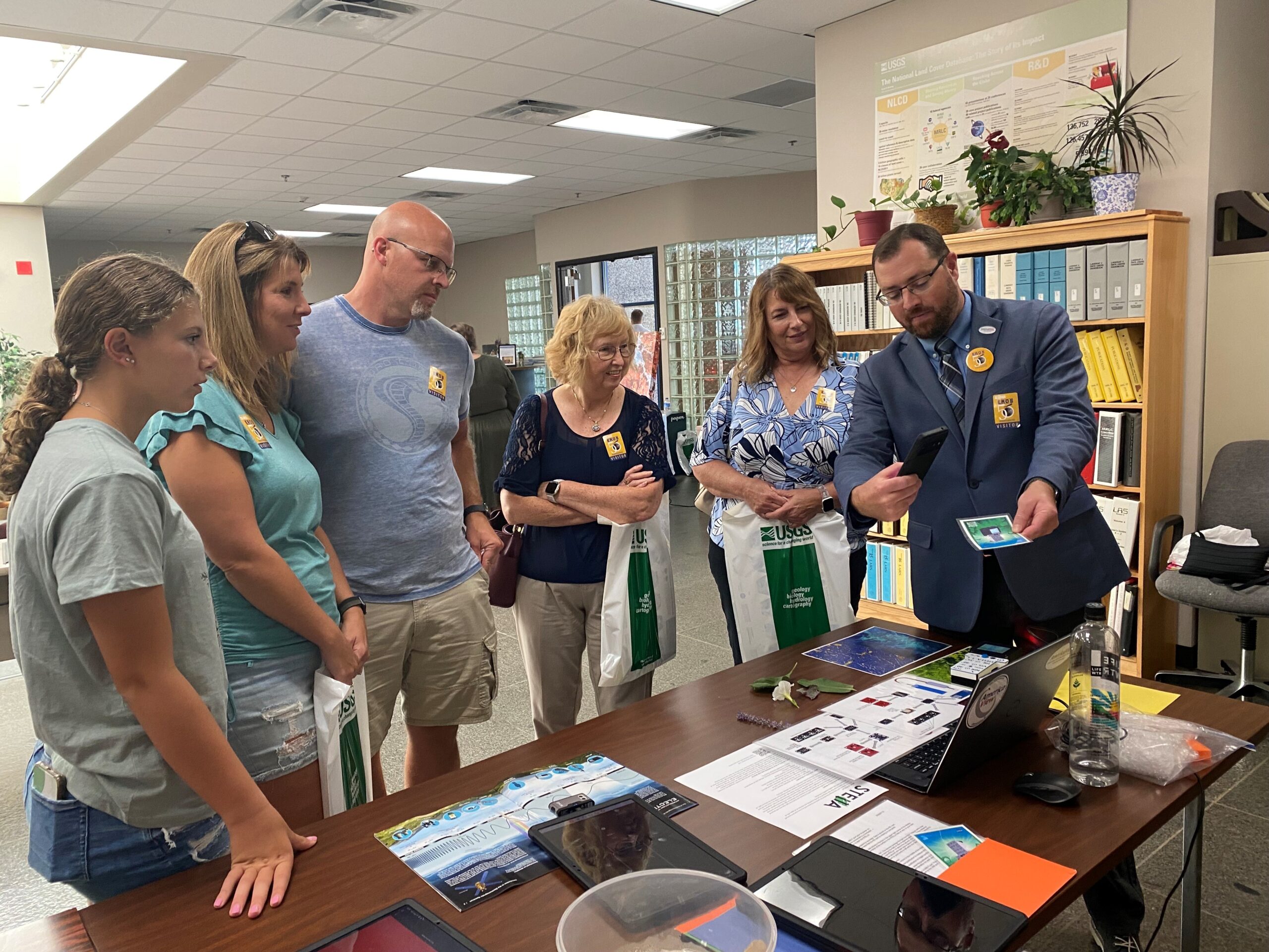
The 50th Anniversary of the EROS Center: Honoring Five Decades of Innovation Through STEM Outreach Activities
The Earth Resources Observation and Science (EROS) Center celebrated its 50th anniversary in August. Learn more about the EROS Center, the anniversary celebration, and the Landsat-related outreach activities at the event—with a spotlight on STELLA, a DIY spectrometer.
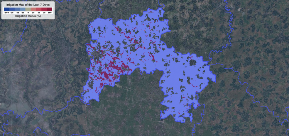
Satellite Data Helps Bangladeshi Farmers Save Water, Money, Energy
Satellite data are providing information to Bangladeshi farmers about how much water they are using, how much they have, and how much their crops need.

Bex Dunn: Landsat Data User + Wetland Explorer
Bex Dunn is an Earth Observation Scientist at Geoscience Australia where she uses Landsat data to better understand wetlands.
Researchers Caution Use of Landsat’s Land-Specific Surface Reflectance Products for Long-Term Water Quality Studies
While floating algae, emergent aquatic vegetation, and historic surface scum can be tracked throughout the Landsat record, researchers warn data users that older Landsat sensors lack the precision needed to be used for water-column studies.
Shining a Light on Mesa Verde National Park: NASA Outreach During the “Ring of Fire” Solar Eclipse
On Saturday, October 14, 2023, regions of North, Central, and South America experienced an annular solar eclipse. Through the Earth to Sky Partnership, NASA coordinated with Mesa Verde National Park to host a series of outreach events.
Landsat In Your Hands: STEM Adventures with a DIY Instrument
One way to better understand the science and technology behind Landsat’s spectral measurements is to build a spectrometer. This past summer, two local high school students did just that.
Above the Earth, Below the Surface: Landsat’s Role in Monitoring Water Quality
Safeguarding freshwater resources is crucial, and while scientists use a variety of ground-based techniques to gauge water quality, the Landsat program has provided water quality data from orbit for decades.
Webinar: STELLA, the DIY-Handheld Spectrometer
Join the STELLA team on September 19, 2023, to hear the the latest and greatest about the STELLA handheld spectrometer, a DIY instrument that helps you understand how Landsat works.
Joining Jane Goodall in Conserving Chimpanzee Habitats
The Jane Goodall Institute has been working with NASA and using Earth science satellite imagery and data—including Landsat (NASA/USGS)—in its chimpanzee and forest conservation efforts in Africa, particularly the Gombe region.
The 50th Anniversary of the EROS Center: Honoring Five Decades of Innovation Through STEM Outreach Activities
The Earth Resources Observation and Science (EROS) Center celebrated its 50th anniversary in August. Learn more about the EROS Center, the anniversary celebration, and the Landsat-related outreach activities at the event—with a spotlight on STELLA, a DIY spectrometer.
Satellite Data Helps Bangladeshi Farmers Save Water, Money, Energy
Satellite data are providing information to Bangladeshi farmers about how much water they are using, how much they have, and how much their crops need.
Bex Dunn: Landsat Data User + Wetland Explorer
Bex Dunn is an Earth Observation Scientist at Geoscience Australia where she uses Landsat data to better understand wetlands.
