
Mapping Water Use Nationwide With Landsat
USGS EROS scientists are leveraging the capability and history of Landsat along with weather data to map landscape-wide water consumption.
How Landsat Helps Alert Communities to Local Flood Hazards
For larger rivers, Landsat provides a rich dataset to define spatiotemporal patterns of channel shifting.
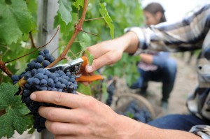
Landsat Thermal Data Provides Insight to Vintners
Landsat thermal bands allow for the measurement of water use and moisture status at the management scale.
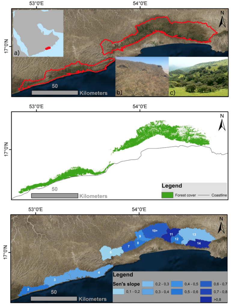
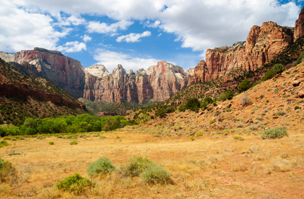
Getting to Know the Dhofar Cloud Forest
Learn more about this rather unusual seasonal and semi-arid cloud forest.
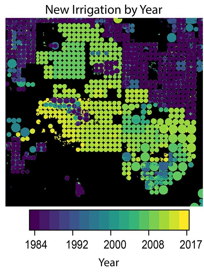
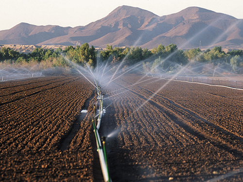
The Shifting Irrigation Patterns of the U.S. High Plains Aquifer
A new method to use the full Landsat archive to produce annual maps of irrigated area over the High Plains Aquifer in the central United States.
Determining Penguin Diet with Landsat (and Piles of Poo)
Scientists are now able to determine what penguins are eating from space.

Retrieving Secchi Depth with Landsat 8
Landsat 8 allows for the acquisition of spectral data for monitoring water quality from lakes and drinking water reservoirs across the United States.
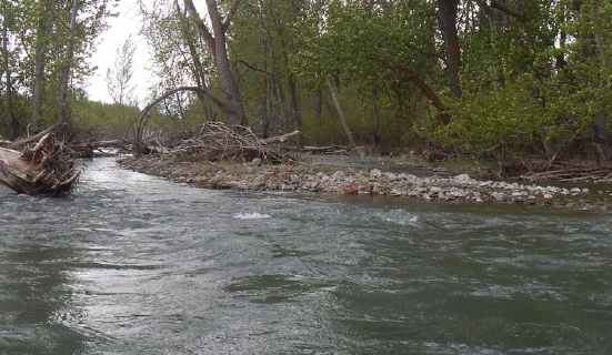
Watching River Islands Grow on the Brahmaputra
Stable river islands locally known as ‘chars’ are increasing in the Brahmaputra river.
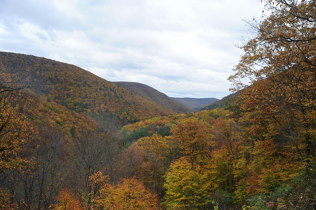
Monitoring Forest Health Amid Oil and Gas Extraction
Following changes in long-term forest health around oil and gas wells in the Pennsylvania State Forest.
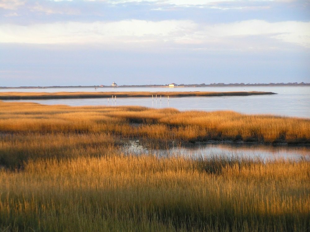
Mapping Long-term Salt Marsh Change with Landsat
This research identified the Delmarva as an area of significant salt marsh loss over the last three decades.
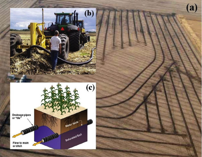
Improving Water Resource Management in the Great Plains
Making annual high-resolution agricultural subsurface drainage maps for the Northern Great Plains regions using multiple satellite and model datasets with Google Earth Engine.
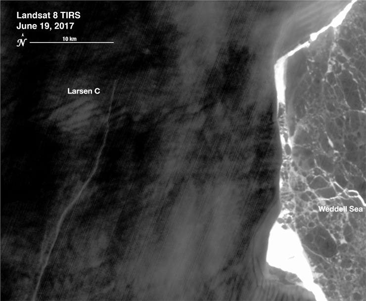
The Dynamic Nature of a Large Iceberg Calving Event
Iceberg A-68 calved from the Larsen C during a period of larger then average tidal cycles.
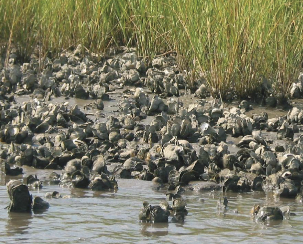
Investigating the Ecosystem Services Provided by Oysters
There is evidence of oyster reefs driving estuary-scale detention of freshwater in the Suwannee Sound.
Shrub and Grass Vegetation Declining Across Great Basin
Across the Great Basin from 1984-2016, shrub and grass vegetation are declining.
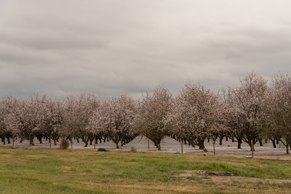
Towards Agricultural Sustainability of Fruit and Nut Trees in California’s Central Valley
A robust detection method to track crop cover dynamics and identify the planting year through Landsat time series data.
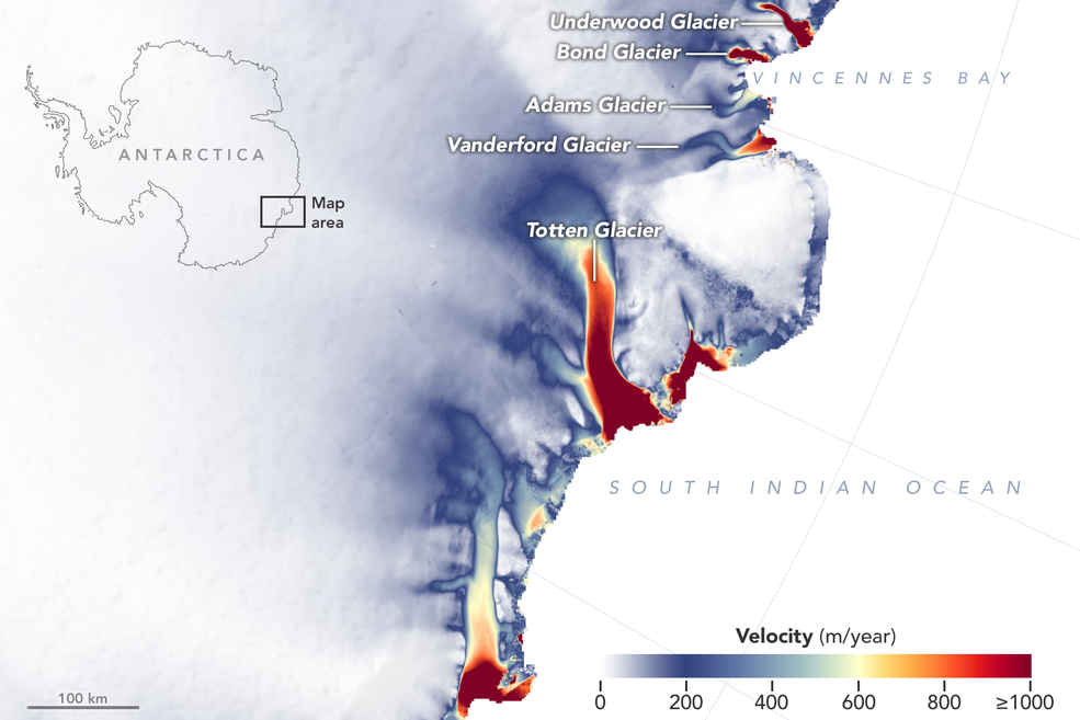
More Glaciers in East Antarctica Are Waking Up
New detailed NASA maps of ice velocity and elevation show that a group of glaciers spanning one-eighth of East Antarctica’s coast have begun to lose ice over the past decade, hinting at widespread changes in the ocean.
Watching River Islands Grow on the Brahmaputra
Stable river islands locally known as ‘chars’ are increasing in the Brahmaputra river.
Monitoring Forest Health Amid Oil and Gas Extraction
Following changes in long-term forest health around oil and gas wells in the Pennsylvania State Forest.
Mapping Long-term Salt Marsh Change with Landsat
This research identified the Delmarva as an area of significant salt marsh loss over the last three decades.
Improving Water Resource Management in the Great Plains
Making annual high-resolution agricultural subsurface drainage maps for the Northern Great Plains regions using multiple satellite and model datasets with Google Earth Engine.
The Dynamic Nature of a Large Iceberg Calving Event
Iceberg A-68 calved from the Larsen C during a period of larger then average tidal cycles.
Investigating the Ecosystem Services Provided by Oysters
There is evidence of oyster reefs driving estuary-scale detention of freshwater in the Suwannee Sound.
Shrub and Grass Vegetation Declining Across Great Basin
Across the Great Basin from 1984-2016, shrub and grass vegetation are declining.
Towards Agricultural Sustainability of Fruit and Nut Trees in California’s Central Valley
A robust detection method to track crop cover dynamics and identify the planting year through Landsat time series data.
More Glaciers in East Antarctica Are Waking Up
New detailed NASA maps of ice velocity and elevation show that a group of glaciers spanning one-eighth of East Antarctica’s coast have begun to lose ice over the past decade, hinting at widespread changes in the ocean.
