
How Landsat Data Led to a Breakthrough for Lake Erie Toxic Algal Blooms
With the growing frequency and magnitude of toxic freshwater algal blooms becoming an increasingly worrisome public health concern, Carnegie scientists Jeff Ho and Anna Michalak, along with colleagues, have made new advances in understanding the drivers behind Lake Erie blooms and their implications for lake restoration.
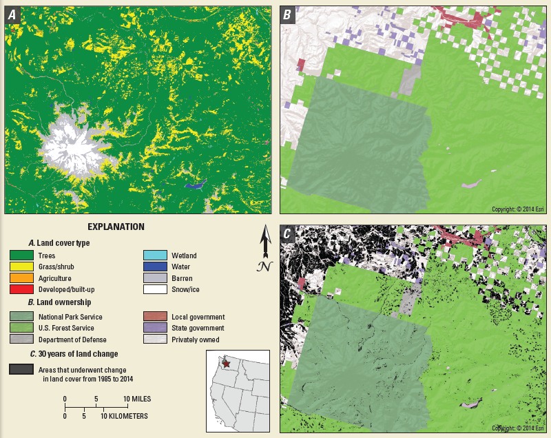
Revolutionizing Land Cover and Land Change Research
A new initiative called Land Change Monitoring, Assessment, and Projection provides definitive, timely information on how, why, and where the planet is changing.
Landsat Images Provided to the Disaster Charter, Apr. 2017
This month, 20 Landsat scenes were ingested by the USGS Hazard Data Distribution System to provide data for Charter activations.
Landsat365
Each day of 2017, a project called Landsat365 is sharing a stunning Landsat 8 image with the public.
UNOSAT Maps Flood Extent Near Lake Urmia with Landsat 8
A Landsat 8-based map showing regions south of Iran’s Lake Urmia that have been effected by recent flooding has been created for UN decision makers.
Canada’s Forests Return Following Disturbance
Tens-of-thousands of Landsat images representing billions of pixels, were used by White and co-authors to map forest wildfire and harvesting on an annual basis and to then characterize the return of forest vegetation following the disturbance.
Landsat Images Provided to the Disaster Charter, Mar. 2017
You can think of the Charter as a one-stop-shop for impact maps—an essential resource, since in many cases satellite data are the only practical method to assess current ground conditions after a disaster.
A Farewell to EO-1: Celebrating 17 Years of NASA’s ‘Little Earth Satellite That Could’
EO-1 was a technology validation mission for testing cutting-edge advancements that have been and are being implemented on current and future satellite missions.
Landsat Provides Global View of Speed of Ice
Scientists are providing a near-real-time view of every large glacier and ice sheet on Earth with Landsat 8.
Mapping Dissolved Organic Matter in Tropical Inland Waters with Landsat 8
Using Landsat 8 to map the colored dissolved organic matter of inland tropical waters.
Creating a Volcanic Plume Elevation Model
Using Landsat 8 to create three-dimensional maps of volcanic ash plumes.
Apalachicola's Disappearing Swamp
The hardwood swamp along the Apalachicola River is slowly replaced by bottomland hardwood forest.
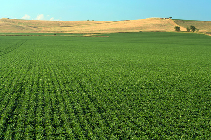
Mapping Croplands Over the U.S. High Plains Aquifer
Using Landsat to map croplands over the U.S. High Plains Aquifer.
Managing Water in Conflict-Torn Regions
Understanding the relationship between land use and river flows in the Yarmouk basin.
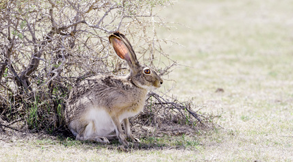
Managing Brush on Western Rangelands
An approach for evaluating brush management conservation.
Landsat Provides Global View of Speed of Ice
Scientists are providing a near-real-time view of every large glacier and ice sheet on Earth with Landsat 8.
Mapping Dissolved Organic Matter in Tropical Inland Waters with Landsat 8
Using Landsat 8 to map the colored dissolved organic matter of inland tropical waters.
Creating a Volcanic Plume Elevation Model
Using Landsat 8 to create three-dimensional maps of volcanic ash plumes.
Apalachicola's Disappearing Swamp
The hardwood swamp along the Apalachicola River is slowly replaced by bottomland hardwood forest.
Mapping Croplands Over the U.S. High Plains Aquifer
Using Landsat to map croplands over the U.S. High Plains Aquifer.
Managing Water in Conflict-Torn Regions
Understanding the relationship between land use and river flows in the Yarmouk basin.
Managing Brush on Western Rangelands
An approach for evaluating brush management conservation.
