The Landsat 9 ground system is designed around two main functions:
(1) command and control the Landsat 9 observatory in orbit
(2) manage the data transmitted from the observatory.
Ground System: Primary Components
The primary components of the Ground System are the Mission Operations Center (MOC), the Ground Network Element (GNE), and the Data Processing and Archive System (DPAS). These elements were developed by DOI/USGS.
The MOC defines the set of scenes to be collected by the Observatory on a daily basis. The MOC plans and schedules Observatory activities, commands and controls the Observatory, and monitors the Observatory and ground operating systems’ health and status.
The MOC is located at the NASA Goddard Space Flight Center (GSFC).
The GNE provides the hardware, software and networks to communicate Command and Telemetry data with the MOC and Mission Data to DPAS. The GNE includes a variety of Ground Stations that communicate with the Observatory for commanding and housekeeping data via the S-Band and receive Mission Data from the Observatory over the X-Band.
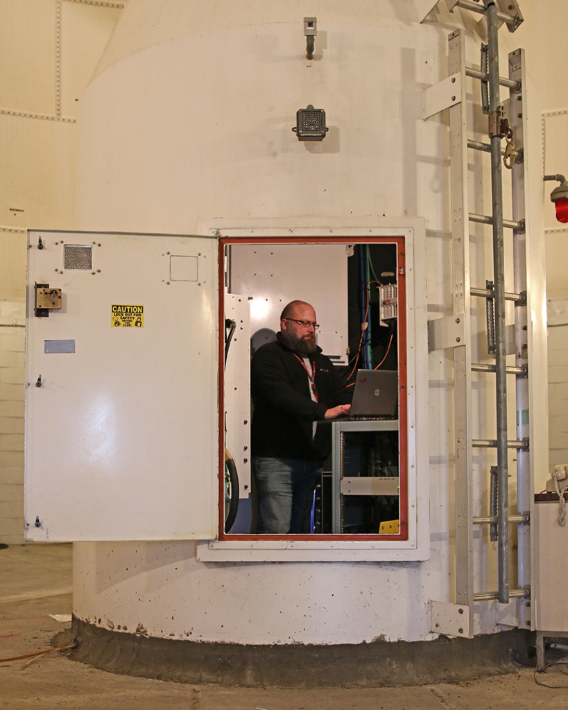
Within the large Radome at the U.S. Geological Survey’s Earth Resource Observation & Science Center, Aaron Hensley, a ground station technician, stands inside the pedestal of the 10-meter antenna to inspect communication components. The 10-meter antenna is the primary antenna for Landsat 7 and Landsat 8 communications in Sioux Falls, South Dakota. Photo Credit: USGS/EROS/Heidi Dornbusc
The DPAS will ingest, process, distribute, and archive all Landsat 9 Mission Data. It consists of four functionalities: Ingest, Storage and Archive, Image Processing, and Access and Distribution.
The Storage and Archive function performs near-term and long-term archiving.
Ingest performs preprocessing, scene framing, and ancillary data processing for the imagery.
Image Processing processes data to create L9 data products, and performs image assessments.
Access and Distribution will provide a capability for authorized users to request Landsat 9 image collections. Access and Distribution will also provide a capability for all users to access data products.