
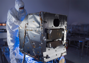
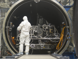
The Landsat 9 spacecraft
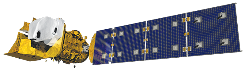
Northrop Grumman designed and fabricated the Landsat 9 spacecraft, integrated the mission’s two government-furnished instruments, and conducted satellite-level testing. After launch, Northrop Grumman aided in-orbit satellite checkout and mission operations support.
Landsat 9 is Essential for Informed Land Use Decisions
Landsat 9 extends our ability to measure changes on the global land surface at a scale where we can separate human and natural causes of change. When land use and resource availability issues arise, Landsat 9 can help decision makers make informed management decisions.
Landsat 9 contributes a critical component to the international strategy for monitoring the health and state of the Earth. Landsat users can now take advantage of more frequent observations (every 8 days using two satellites).
Applications such as weekly tropical deforestation alerts, water quality monitoring, and crop condition reports are now feasible with the constellation. With increased activity in international and commercial remote sensing, Landsat has emerged as a cornerstone of the global constellation of imagers.
The science quality of the Landsat archive, including careful calibration, allows it to serve as a “gold standard” for studies harmonizing multiple sources of satellite imagery.
Landsat 9 enables informed decision support for key areas such as:
+ Tropical deforestation and global forest dynamics: the Landsat archive provides an impartial and unbiased record of Earth’s forests for world governments and resource organizations to verify claims of environmental protection and carbon storage.
+ Urban expansion: the Landsat record helps us visualize the impact of humankind’s convergence on urban centers and to understand the environmental consequences.
+ Water use: Landsat 9 is an invaluable tool for managing water in areas such as the Western U.S. where water is scarce and water usage between agriculture, industry, and residential needs is very competitive.
+ Coral reef degradation: Landsat has helped enable global monitoring of Earth’s reefs.
+ Glacier and ice-shelf retreat: the Landsat archive chronicles changes to 98 percent of Earth’s glaciers, and Landsat 9 will monitoring them into the future.
+ Natural and man-made disasters: Landsat data are regularly used as part of the International Disaster Charter, mapping disaster impacts to save lives.
+ Climate change: Landsat data provide a direct view of how almost five decades of climate change have affected Earth’s surface and biology.
