Search
Close this search box.

Category: Carbon and Climate

News Archive

Despite Warming, Landsat Reveals Decadal Slowdowns on Greenland Ice Sheet

Ice sheets are in perpetual motion, making their way downslope like a river. If the amount of snow that an ice sheet accumulates does not keep pace with its loss to the sea, sea level will rise. As temperatures have climbed, positive feedback loops have led to an accelerated loss of ice sheet sections that touch the sea, but in an unexpected twist to the global warming saga, scientists have just discovered a negative feedback loop that is slowing down the Greenland Ice Sheet sections that end on land—a sliver of good news for sea-level rise.

Read More »

A forest by any other name? Semantics, carbon implications, and solutions

Using the world’s first global, Landsat-based 30-meter resolution map of tree cover, researchers found that ambiguity of the term “forest” has the potential to create 13 percent discrepancies in forest area maps. While ecologists have long understood the complexity comprised by the concept of “forest”, and while geographers have called for the term to be more uniformly defined across monitoring entities, no one had quantified the scope of the problem.

Read More »

New Global Data Finds Tropical Forests Declining in Overlooked Hotspots

The world lost more than 18 million hectares (45 million acres) of tree cover in 2014, an area twice the size of Portugal, according to new data from the University of Maryland (UMD) and Google released by Global Forest Watch. The data find that tropical forests are in the most trouble, losing 9.9 million hectares (24.5 million acres) of tree cover in 2014 – over half of the global total. A three-year-average shows tree cover loss is the highest it’s been since 2001.

Read More »

Lakes On A Glacier

How deep is that icy blue water on Greenland’s ice sheet? Dr. Allen Pope, of the National Snow and Ice Data Center, is using data from the NASA/USGS Landsat 8 satellite to find out. In this video, Dr. Pope shares what he sees when he looks at a Landsat image of the Greenland ice sheet just south of the Jakobshavn Glacier.

Read More »

Turkish Glaciers Shrink By Half

Researchers and citizens have known for some time that Turkey’s glaciers are shrinking. Now scientists have calculated the losses and found that more than half of the ice cover in this mountainous country has vanished since the 1970s.

Read More »

Landsat Shows Felling of Tropical Trees Has Soared

The rate at which tropical forests were cut, burned or otherwise lost from the 1990s through the 2000s accelerated by 62 percent, according to a new study which dramatically reverses a previous estimate of a 25 percent slowdown over the same period. That previous estimate, from the U.N.’s Food and Agriculture Organization’s (FAO) Forest Resource Assessment, was based on a collection of reports from dozens of countries. The new estimate, in contrast, is based on vast amounts of Landsat image data which directly record the changes to forests over 20 years.

Read More »

Landsat Goes Over The Top: A Long View of the Arctic

On February 11, 2013, the Landsat 8 satellite rocketed into space to extend a four-decade legacy of Earth observations. A few months after launch, we published a composite of images that spanned 9,000 kilometers of land from Russia to South Africa. In celebration of the satellite’s second anniversary, the mosaic concept returns with a chilly twist, this time featuring a slice of the Arctic Circle.

Read More »

Unleashing Climate Data and Innovation for more Resilient Ecosystems

Ecosystems provide vast services and benefits to humankind: food and water that is needed for survival; nutrients and other natural products that fuel farms and industries; natural controls on many pests and pathogens; storage of carbon safely out of the atmosphere; shared spaces for tourism and recreation; and sanctuaries that preserve biodiversity, natural beauty, and cultural history.

Read More »

Over 20 Million Landsat Scenes Downloaded

Since 2008, all Landsat data—archived and newly acquired—have been available for free download. On September 16, 2014, users worldwide downloaded over 14,000 scenes from the servers at the USGS Earth Resources Observation and Science (EROS) Center. These downloads brought the total number of Landsat data downloads to more than 20 million.

Read More »

Mapping South Asia's Mangroves

Along the sea’s edge in Bangladesh, India, Pakistan, and Sri Lanka, the dense coastal population lives largely in symbiosis with the region’s mangrove forests.
Mangroves—a vast network of intertidal trees and shrubs with their characteristic tangle of above ground roots—give safety, sustenance, and spectacle to coastal denizens in a multitude of ways. Namely, by stabilizing shorelines, safeguarding water quality, influencing stable microclimates, controlling flooding, and providing transportation, forest products, hunting and fishing grounds, and recreation and protecting people and property from storms.

Read More »
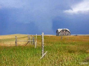
An abandoned farmstead in eastern Montana

Modeling a Changing American Landscape

Land change is a signature activity of human civilization. Since the dawn of history, people have purposefully converted natural landscapes to human-dominated areas. Typical motivations for land change are cultivation (e.g. slash-and-burn fields, rice paddies, modern farms); occupation (villages, cities, housing developments); and other cultural and economic pursuits (roads, schools, airports).

Read More »

Insights Provided by New Compendium of Land Cover Mapping Satellites

A compendium of civilian satellites with the potential to image global land surfaces has been compiled by Alan Belward and Jon Skøien from the Land Resource Management Unit of the European Commission’s Institute for Environment and Sustainability. Results of this work were published online on April 28, 2014 in the Journal of Photogrammetry and Remote Sensing.

Read More »

Glacier Monitoring in Nepal to Help Locals

A recently published report gives a comprehensive look at the glaciers of Nepal over the last three decades, at ten year increments (1980, 1990, 2000, and 2010). The information was derived from Landsat and Shuttle Radar Topography Mission (SRTM) data in order to provide a clear view of changing glacier dynamics in the region.

Read More »

Nearly 200,000 Glaciers Mapped for Better Sea Level Rise Estimates

An international team led by glaciologists from the University of Colorado Boulder and Trent University in Ontario, Canada has completed the first mapping of virtually all of the world’s glaciers—including their locations and sizes—allowing for calculations of their volumes and ongoing contributions to global sea rise as the world warms.

Read More »

Surveying Ice and Fire: The First Map of All of Iceland’s Glaciers and Subglacier Volcanic Calderas Released

For the first time, all of Iceland’s glaciers are shown on a single map, produced by the Icelandic Meteorological Office (IMO), in collaboration with the U. S. Geological Survey (USGS) and Iceland Geosurvey. The map is the first to incorporate historical data and coverage from aerial photographs and remote sensing satellites, such as Landsat and SPOT, to show the change in the areal extent of glaciers during the past century.

Read More »

Mapping the World with Landsat

Speeding around the Earth at 16,800 mph (27,000 kph), two Landsat satellites are quietly, expertly watching and recording changes in Earth’s lands from space. They are gathering data for people to make maps–all kinds of wonderful maps–of our cities growing, rivers flooding, lava flowing from volcanic eruptions, forests expanding or shrinking, crops greening through the growing season, and even of evidence of pollution.

Read More »

Landsat Revisits Old Flames in Fire Trends

The Wallow Fire burned over 500,000 acres, making it the largest fire in Arizona history, to date. It is one of many large fires that fire managers and researchers have seen scorch forests nationwide since the early 2000s.

Read More »

Meet Mauri Pelto, Glaciologist

At a small college in Dudley, Mass., a professor of Environmental Science is doing big things. Glaciologist Mauri Pelto is using Landsat imagery to monitor glaciers around the world from his office at Nichols College.

Read More »

After a Fire, Before a Flood

While the 138,000-acre Silver Fire still smoldered, forest restoration specialists were on the job. They analyzed maps created using Landsat satellite data to determine where the burn destroyed vegetation and exposed soil—and where to focus emergency restoration efforts.

Read More »

NASA 'Fire Towers' in Space Watch for Wildfires

The Black Forest wildfire this June was one of the most destructive in Colorado history, in terms of homes lost. It started close to houses and quickly spread through the ponderosa pine canopies on the rolling hills near Colorado Springs. The wildfire destroyed 500 homes in the first 48 hours and killed two people.

Read More »

Using Landsat 8 to Locate Fires in Indonesia

In June, air pollution over Singapore and Malaysia spiked as forests in neighboring Sumatra (Indonesia) burned. Using NASA’s daily fire alerts and official national maps, the fires were located in the vicinity of oil palm and acacia tree plantations. However, the coarse resolution of the fire alerts coupled with outdated national maps, made it hard to establish culpability.

Read More »

Using Landsat to Study Juneau Icefield

The Juneau Icefield Research Program (JIRP) has been examining the glaciers of the Juneau Icefield since 1946. Until the NASA Landsat program began, field measurements and aerial observations were the only means to observe the glaciers of the icefield. For more than 40 years it was Maynard Miller, U of Idaho, who led this expedition that has trained so many of today’s glaciologists. Today it is Jeff Kavanaugh, U of Alberta.

Read More »