
Tracking Elephants Across Namibia
In a new study, researchers used GPS tracking data and satellite imagery to map elephant movement in northwestern Namibia, looking for corridors of connectivity.

In a new study, researchers used GPS tracking data and satellite imagery to map elephant movement in northwestern Namibia, looking for corridors of connectivity.
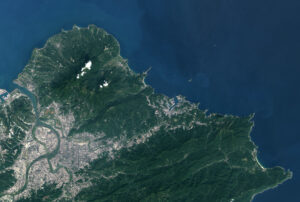
In Taiwan, earthquakes are linked to shallow stores of magma. New research explores this connection by linking land surface temperature with earthquakes.
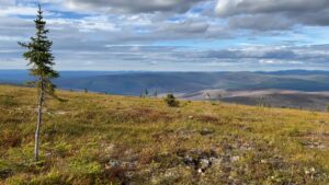
Warming global climate is changing the vegetation structure of forests in the far north. It’s a trend that will continue at least through the end of this century, according to NASA researchers.
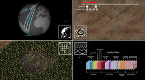
Ross Walter, from the Landsat Outreach Team, has turned a much used, but static, Landsat Spectral Band Comparison graphic into a dynamic, multifaceted tool that enables users to compare different sensors and output the comparison graphics they need.
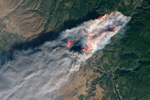
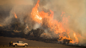
A new study tracks the shifting dynamics of wildfires in western North America. Using Landsat-derived datasets and active fire information from geostationary satellites, researchers found that fires are burning through the night more often—and drought is partially to blame.
A recent national report finds Landsat satellites to be a vital source of data to support U.S. agriculture and forest activities in the United States. The report also supports the continuation of the Landsat Satellite Program as essential to Americans in terms of the value and benefits Landsat delivers every year.
Anyone making innovative use of Landsat data to meet societal needs today and during coming decades is encouraged to submit and abstract for the upcoming “Emerging Science Applications of Landsat” session at AGU24.
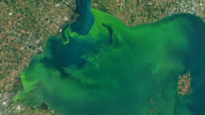
A combination of Landsat and Sentinel-2 imagery, NASA near real-time data, and machine learning provides near real-time access to high-resolution water quality maps.
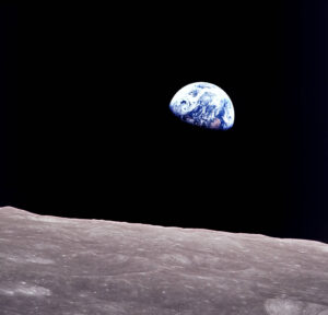
Anders, 90, the astronaut who captured the iconic Earthrise photograph, died on June 7, 2024, when the plane he was piloting crashed into the San Juan Channel.

NASA announced in a contract release that Raytheon Company will build the series of Landsat Next instruments. Landsat Next represents a quantum leap in measurement capabilities with improved temporal, spatial, and spectral resolutions.
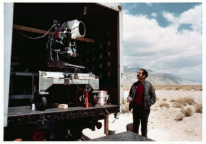
Two months before the launch of Landsat 1, the engineering model of the satellite’s multispectral scanner system went on a California road trip.

In the FY23 Aeronautics and Space Report released on May 23, 2024, a multitude of Federal agencies report work informed by Landsat data.
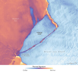
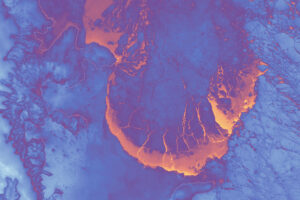
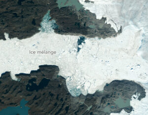
The Brunt Ice Shelf lost a large wedge of floating ice, the third sizeable iceberg to calve from the shelf in recent years. The TIRS instrument on Landsat 9 captured false-color images of the calving.
The Australian company Indji Systems uses a variety of satellite data to provide real-time hazard monitoring and alerts to utility and renewable energy companies across Australia, North America and Europe.
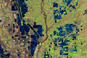
More water is taken from the Colorado River than it has to give. Better water use accounting made possible by Landsat provides needed guidance for difficult water use decisions.
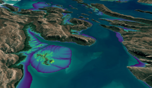
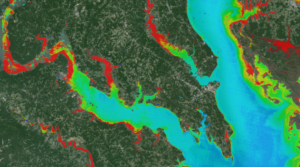
This month, the Digital Earth Australia (DEA) team released a new Landsat and Sentinel-2 based intertidal data product. The new data set characterizes the tidal shoreline zone of Australia in more detail than ever before.
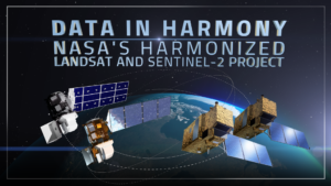
NASA’s Harmonized Landsat and Sentinel-2 (HLS) project is a groundbreaking initiative that combines data from Landsats 8 & 9 with the European Space Agency’s Sentinel-2A & 2B satellites.

The research teams who help sustain the largest freshwater reserve in the world are developing a new tool to promote more resilient farming systems in Brazil. The goal is to help farmers better handle changes in the water cycle, deal with droughts, and adapt to a changing climate.
Landsat satellites have begun regularly acquiring images of ice at the poles during the winter, with enlightening results.

Landsat 9’s OLI-2 instrument was characterized in unprecedented detail using a new laser-based method of in-band spectral response testing. A continuous relative spectral response dataset and pre-launch testing details have been published in a recent paper.
A new study using NASA satellite data reveals how drought affects the recovery of western ecosystems from fire, a result that could provide meaningful information for conservation efforts.
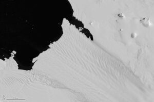
New research shows that while some Antarctic ice shelves have been thinning since at least the 1970s, widespread thinning accelerated in the 1990s.
A delve into Landsat-based studies revealing the environmental impact of river mining, the decline in global lake water levels, and the risks of rising sea levels on coastal habitats. Plus, a sneak peek at what the future of the Landsat program holds with the introduction of Landsat Next.
As the world looks for sustainable solutions, a system tapping into Landsat data for water management has passed a critical test.
A new, comprehensive analysis of satellite data finds that majority of glaciers on the landmass have retreated significantly.

In an Instagram Live event titled “Guided by Science,” Deb Haaland, U.S. Secretary of the Interior, spoke with USGS Director Dr. David Applegate. The Landsat portion of that discussion is shared here.
The Landsat 2030 International Partnership Initiative will enhance U.S. and partner governments’ ability to sustainably manage their land, surface water and resource use.

Using satellite data, including Landsat, Griffith University researchers found that less than 13 percent of the endangered greater gliders’ habitat in Queensland is protected.

A summary of the final activities of the 2018–2023 Landsat Science Team and a synopsis of the 2022 History of NASA and the Environment Symposium were among the topics covered in the most recent issue of NASA’s The Earth Observer.
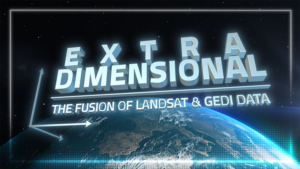
When Landsat’s vast decades-long archive is combined with data from other instruments it can provide amazing insight into how our world is evolving with us and around us. Here are some of the ways Landsat and GEDI data are being harnessed to help us better understand the complex relationship between humanity and nature.
At a recent Group on Earth Observations Ministerial Summit, DOI Assistant Secretary Cantor and USGS Director Applegate highlighted the Landsat program.
While floating algae, emergent aquatic vegetation, and historic surface scum can be tracked throughout the Landsat record, researchers warn data users that older Landsat sensors lack the precision needed to be used for water-column studies.
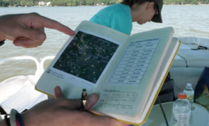
Safeguarding freshwater resources is crucial, and while scientists use a variety of ground-based techniques to gauge water quality, the Landsat program has provided water quality data from orbit for decades.
