By Laura E.P. Rocchio
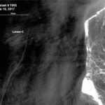
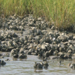
 At the 2018 AGU Fall Meeting, nearly 500 presentations will feature research conducted with the aid of Landsat data. The gamut of focus areas where you can find Landsat-related papers and posters attests to the wide scope and interdisciplinary nature of Landsat data. From oyster reef restoration planning to iceberg tracking, talks and posters on Landsat-aided research will be presented throughout the week.
This year we again had the opportunity to speak with a number of scientists, researchers, and students using Landsat in their studies. The resulting Q&A’s will be posted here throughout the week.
For other NASA-related AGU happenings, visit NASA at American Geophysical Union.
This year’s Landsat Q&As:
Visit the 2018 AGU Fall Meeting website for more details, including the scientific program and virtual options.
Further Information:
+ NASA at AGU 2018
+ USGS Landsat Update – AGU Edition
+ Landsat at AGU 2017
+ Landsat at AGU 2016
+ Landsat at AGU 2015
Anyone can freely download Landsat data from the USGS EarthExplorer or LandsatLook.

