
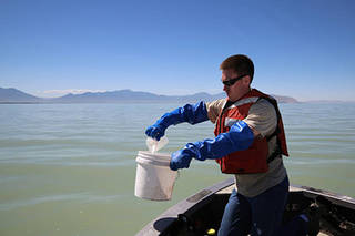
Early Detection of Algae ‘Blooms’ by Satellite Yields Healthcare Savings
The use of satellite data by environmental managers tracking harmful algal bloom outbreaks along lakefronts and coasts can result in earlier detections that yield significant savings on healthcare, lost work hours and other economic costs.
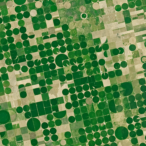
Agriculture: The View From Space
The Food and Agricultural Organization of the United Nations published an audio article about using geospatial data, including Landsat, to monitor would agriculture on soundcloud.
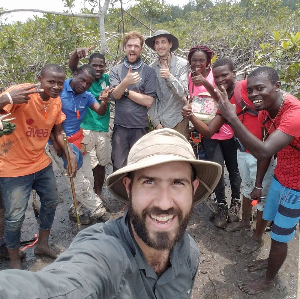
Meet Dr. David Lagomasino
Coastal ecosystems are some of Earth’s most biologically diverse environments, especially coastal mangrove forests. Dr. Lagomasino uses Earth observing data to study these vital biomes.

Landsat Helps Urban Planners Find Disparities in Access to Green Spaces
Study of two metro areas finds where parks, trees and other green spaces are located.
NASA Fosters Innovative Ways to Understand Biodiversity
NASA has funded four projects to create new, virtual portals to share a wealth of biodiversity information with land stewards around the world.

Meet Dr. Eric Bullock
Dr. Eric Bullock uses Earth observation data to explore the consequences of land use and land cover change in high biodiversity areas.
Sensing Invasive Species From Space
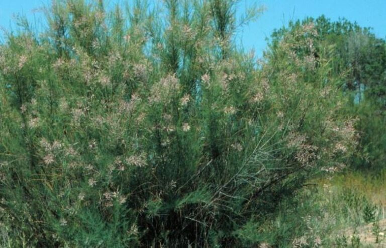
Invasive species cost the U.S. economy approximately $120 billion a year and disrupt the dynamics of ecosystems. Researchers are increasingly using remote sensing to map where invasive species are and where they could spread in order to minimize their damage.
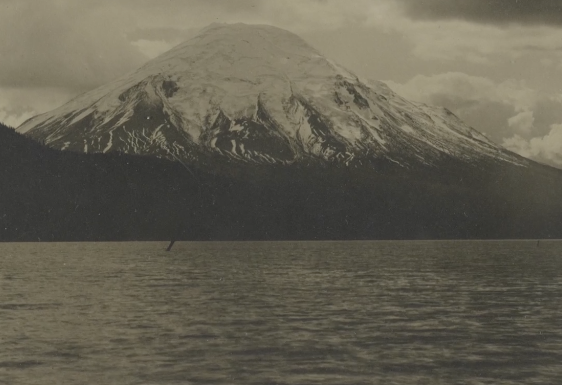
40 Years After Mount St. Helens’ Eruption, 40 Years of Forest Recovery
Landsat data (since 1972) is helping scientists Sean Healey and Zhiqiang Yang of the Rocky Mountain Research Station (U.S. Forest Service) study the long-term impact of the May 18, 1980, eruption of Mount St. Helens.
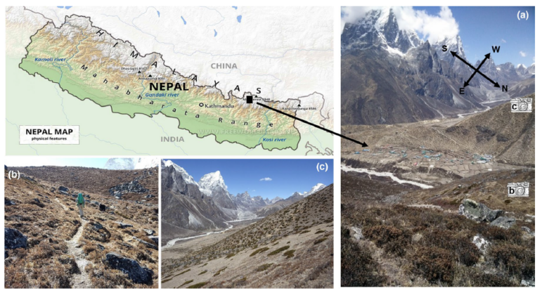
Landsat Reveals Expanding Plant Life in the Everest Region
Plant life is expanding in the area around Mount Everest, and across the Himalayan region, new research shows.

Landsat 9: The Pieces Come Together
Landsat 9’s two science instruments are now attached to the spacecraft.

Predicting Waterbird Habitat in California
Ecologists are using Landsat to locate waterbird habitat that may be vulnerable in dry years.

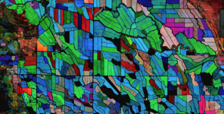
Understanding the Ecological and Environmental Impacts of Urbanization
Landsat-based urban extent and phenology indicators provide new information about urban environments.
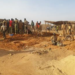
Assessing the Environmental Impacts of Artisanal Gold Mining
Landsat helps monitor changes in artisanal gold mining areas, enabling land managers to prevent and remedy environmental impacts.
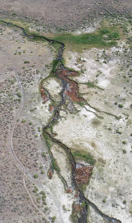
When a River Runs Through Drylands
There is a dance between the vegetation that thrives along a river’s edge and the availability of water; with Landsat, that relationship is now being understood in ways not previously possible.
Using NASA’s Harmonized Landsat Sentinel-2 Product to Give Farmers Real-Time Crop Health Information
IndigoAg is using HLS data to help fulfill its mission of making farms more profitable and sustainable.
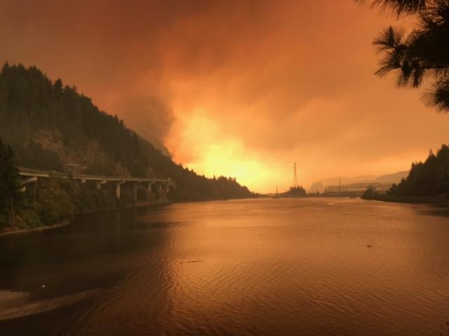
Fire & Water: How Wildfires Can Impact Drinking Water
Fires in forested watersheds that support drinking water supplies can introduce contaminants that overwhelm current treatment capabilities. Earth observation data are helping.
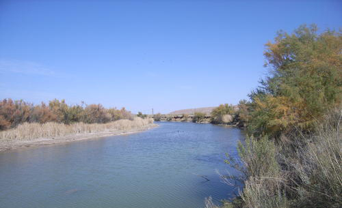
Improving Water Management in New Mexico with Landsat and ECOSTRESS
New Mexico is one of the most arid states in the US, and precise and accurate information on water use is of utmost importance.
Landsat Reveals Expanding Plant Life in the Everest Region
Plant life is expanding in the area around Mount Everest, and across the Himalayan region, new research shows.
Landsat 9: The Pieces Come Together
Landsat 9’s two science instruments are now attached to the spacecraft.
Predicting Waterbird Habitat in California
Ecologists are using Landsat to locate waterbird habitat that may be vulnerable in dry years.
Understanding the Ecological and Environmental Impacts of Urbanization
Landsat-based urban extent and phenology indicators provide new information about urban environments.
Assessing the Environmental Impacts of Artisanal Gold Mining
Landsat helps monitor changes in artisanal gold mining areas, enabling land managers to prevent and remedy environmental impacts.
When a River Runs Through Drylands
There is a dance between the vegetation that thrives along a river’s edge and the availability of water; with Landsat, that relationship is now being understood in ways not previously possible.
Using NASA’s Harmonized Landsat Sentinel-2 Product to Give Farmers Real-Time Crop Health Information
IndigoAg is using HLS data to help fulfill its mission of making farms more profitable and sustainable.
Fire & Water: How Wildfires Can Impact Drinking Water
Fires in forested watersheds that support drinking water supplies can introduce contaminants that overwhelm current treatment capabilities. Earth observation data are helping.
Improving Water Management in New Mexico with Landsat and ECOSTRESS
New Mexico is one of the most arid states in the US, and precise and accurate information on water use is of utmost importance.
