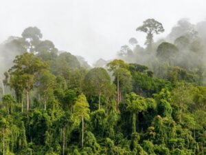
Alert System Shows Potential for Reducing Deforestation, Mitigating Climate Change
Landsat-based Global Forest Watch alerts seem to be helping slow down forest loss in Africa.

Landsat-based Global Forest Watch alerts seem to be helping slow down forest loss in Africa.

Landsat 9 Project Scientist Jeff Masek from NASA Goddard was interviewed for NOVA Now.
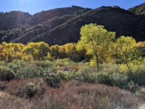
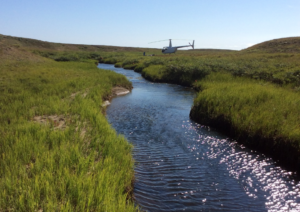
Using Landsat to keep an eye on the trees offers an effective way to monitor groundwater along river corridors in the Southwest.
The NASA-funded Navajo Nation Drought Project has built a cloud-based web application that uses Landsat and Sentinel-2 data, among others, to improve drought reporting and management in the Navajo Nation.
Landsat shows some of the ways in which COVID-19 is changing the environment.
This new four-part video series shares the history of Landsat, how Landsat 9 works, how Landsat data gets from the satellite to the ground, and how Landsat data can be used with other data to support a wide range of research and applications. Enjoy!
November 30, 2020 • This month, the world lost a giant in the world of quantitative remote sensing. David A. Landgrebe passed away on November 21,
Scientist and Landsat data user Africa Flores recently talked with Science Friday about her work.
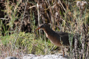
By Morgan Spehar, NASA’s Goddard Space Flight Center The Yuma Ridgway’s rail, a chicken-sized bird that looks like a cross between a duck and a crane,
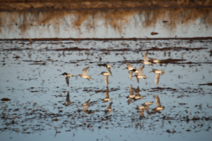
Earth observations and citizen science are informing a program called BirdReturns to help restore lost natural wetlands.
Landsat 9 Project Scientist Jeff Masek joined astronaut Jessica Meir and other researchers to discuss the role of space and aviation technologies in studying our changing world as part of the Smithsonian Conservation Commons’ Earth Optimism initiative.

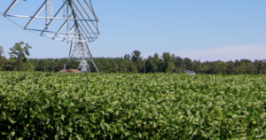
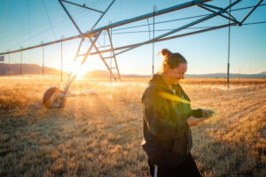
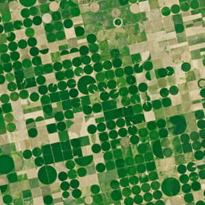
Farmers rely on the accuracy of a crucial NASA and USGS mission, Landsat, to make decisions about crops.
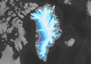
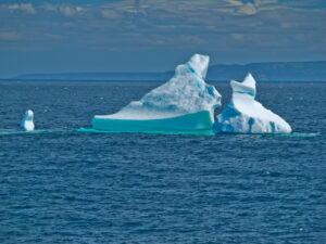
Many of the Greenland’s glaciers are retreating while also undergoing other physical changes.
Scientists are combining data from water samples containing fish DNA with satellite data to find native fish and identify their habitats.
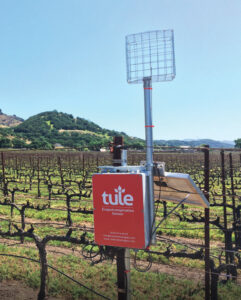
A young start-up is using satellite data to give California farmers better information about water, which can translate into water savings or bigger yield for the same input.
A number of new data products with information derived from Landsat inputs have become available recently.
Using satellite images to track global tundra ecosystems over decades, a new study found the region has become greener, as warmer air and soil temperatures lead to increased plant growth.
A new data set uses Landsat data to extend the Crop Data Layer back in time.
A new web-based platform called OpenET will soon be putting satellite data in the hands of farmers, water managers and conservation groups to accelerate improvements and innovations in water management.
A new study reports a net increase of 5.38 petagrams of forest biomass between 1984 and 2016; carbon-wise, that is equivalent to a train of loaded coal cars long enough to wrap itself around Earth nearly 34 times.
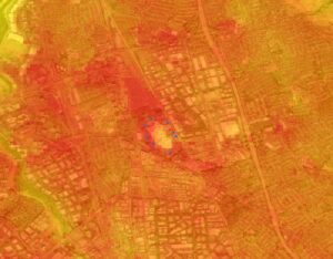
Satellite images are helping to reveal how COVID-19 lockdown measures are impacting food security, urban surface heat, water quality and aquatic ecosystems, and more in NASA-funded studies.
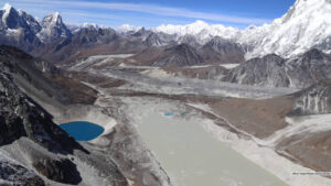
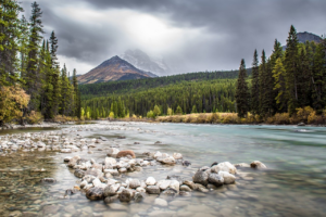
Using 30 years of Landsat data, researchers have found that the volume of glacial lakes worldwide has increased by about 50% since 1990.
Landsat and ICESat-2 satellite data have made it possible for scientists to develop maps showing the “quality” of tropical forests.
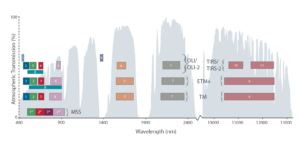
Learn more about the atmospheric transmission data used for our Landsat spectral band comparison graphic.
Using Landsat, researchers have created the first map of the causes of change in global mangrove habitats between 2000 and 2016—a valuable tool to aid conservation efforts for these vital coastline defenders.
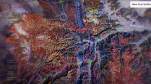
In Beck’s “Hyperlife” video, the abstract beauty of our planet morphs from geographic location-to-location with the flow of the etherial track.

We have Virginia Norwood to thank for the design and engineering that made the Landsat program a success and set the path for modern Earth observation.
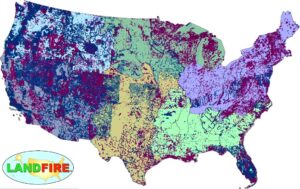
LANDFIRE has released its Remap dataset; new techniques and new data provide significant improvement.

Goldberg will launch Cloud to Classroom, an innovative project that uses satellite imagery to help K-12 classrooms understand global environmental change through remote sensing.
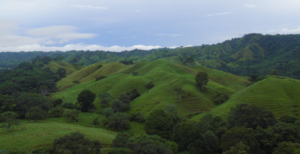
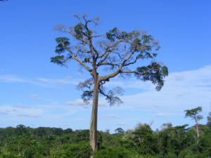
A team of Boise State researchers is helping forecast tropical forest recovery from deforestation using Landsat satellite data.

In August 1975, Jacques Cousteau and his divers helped determine if Landsat could measure the depth of shallow ocean waters.
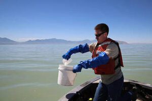
The use of satellite data by environmental managers tracking harmful algal bloom outbreaks along lakefronts and coasts can result in earlier detections that yield significant savings on healthcare, lost work hours and other economic costs.
The Food and Agricultural Organization of the United Nations published an audio article about using geospatial data, including Landsat, to monitor would agriculture on soundcloud.
